Old Maps of Mason County, Texas
Explore 43 old maps of Mason County, spanning from 1887 to today. These high-resolution historic maps reveal how streets, neighborhoods, landmarks, and natural features evolved over time — perfect for genealogy, metal detecting, research, and local history exploration.
What you can do with these maps:
- See how Mason County changed over time: Compare historical maps to modern-day views to trace roads, homesites, rail lines & more.
- View detailed metadata: Each map includes creators, publishers, year, scale, and archive source.
- Overlay maps with satellite & LiDAR: Visualize the past alongside modern tools to explore terrain & human change.
- Trusted historical sources: Maps sourced from the USGS, Library of Congress, and other archives.
- Access maps your way: View online, download high-res files, or order prints for personal or research use.
Start exploring old maps of Mason County to uncover forgotten places, hidden landmarks, and the deep history beneath your feet.
Mason County, TX maps
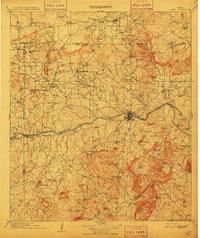
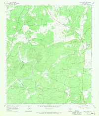
(43)- 1887 Map of Llano
 1887 Llano1887 Print · USGSCovers Mason County, including Llano, Baby Head, and other nearby areas
 - 1887 Map of Mason
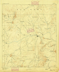
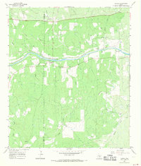
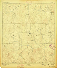 1887 Mason1887 Print · USGSCovers Mason County, including Mason, Koocksville, and other nearby areas
 - 1894 Map of Mason
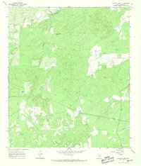
 1894 Mason1894 Print · USGSCovers Mason County, including Mason, Koocksville, and other nearby areas4 unique versions available
 - 1894 Map of Fredericksburg
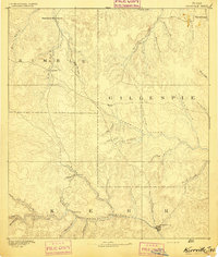
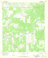
 1894 Fredericksburg1894 Print · USGSCovers Mason County, including Fredericksburg, Hye, and other nearby areas4 unique versions available
 - 1894 Map of Kerrville
 1894 Kerrville1894 Print · USGSCovers Mason County, including Kerrville, Ingram, and other nearby areas4 unique versions available
 - 1894 Map of Llano
 1894 Llano1894 Print · USGSCovers Mason County, including Llano, Baby Head, and other nearby areas
 - 1904 Map of Llano
 1904 Llano1904 Print · USGSCovers Mason County, including Llano, Baby Head, and other nearby areas
 - 1909 Map of Llano
 1909 Llano1909 Print · USGSCovers Mason County, including Llano, Baby Head, and other nearby areas3 unique versions available
 - 1918 Map of Llano
 1918 Llano1918 Print · USGSCovers Mason County, including Llano, Baby Head, and other nearby areas
 - 1954 Map of Llano, 1964 Print
 1954 Llano1964 Print · USGSCovers Mason County, including Kerrville, Lakeway, and other nearby areas2 unique versions available
 - 1955 Map of Llano
 1955 Llano1955 Print · USGSCovers Mason County, including Kerrville, Lakeway, and other nearby areas
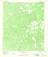
 - 1955 Map of Smoothingiron Mountain, 1956 Print
 1955 Smoothingiron Mountain1956 Print · USGSCovers Mason County, including Llano County, United States, and other nearby areas2 unique versions available
 - 1955 Map of Pontotoc, 1956 Print
 1955 Pontotoc1956 Print · USGSCovers Mason County, including Field Creek, Pontotoc, and other nearby areas2 unique versions available
 - 1955 Map of Valley Spring, 1957 Print
 1955 Valley Spring1957 Print · USGSCovers Mason County, including Field Creek, Pontotoc, and other nearby areas
 - 1956 Map of Llano, 1976 Print
 1956 Llano1976 Print · USGSCovers Mason County, including Kerrville, Lakeway, and other nearby areas
 - 1962 Map of Purdy Hill, 1964 Print
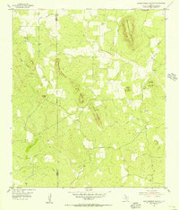
 1962 Purdy Hill1964 Print · USGSCovers Mason County, including Mason, United States, and other nearby areas2 unique versions available
 - 1962 Map of Fly Gap, 1965 Print
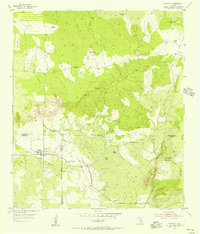
 1962 Fly Gap1965 Print · USGSCovers Mason County, including United States, Texas, and other nearby areas2 unique versions available
 - 1962 Map of Fredonia, 1965 Print
 1962 Fredonia1965 Print · USGSCovers Mason County, including Fredonia, McCulloch County, and other nearby areas2 unique versions available
 - 1963 Map of Spy Rock, 1964 Print
 1963 Spy Rock1964 Print · USGSCovers Mason County, including McCulloch County, United States, and other nearby areas2 unique versions available
 - 1967 Map of Cherry Mountain, 1969 Print
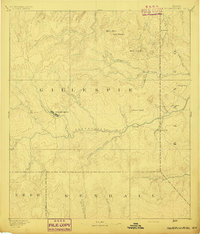
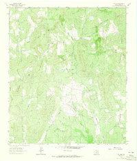
 1967 Cherry Mountain1969 Print · USGSCovers Mason County, including Cherry Mountain, Gillespie County, and other nearby areas
 - 1967 Map of Loyal Valley, 1969 Print
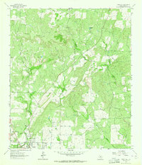
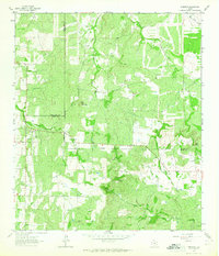
 1967 Loyal Valley1969 Print · USGSCovers Mason County, including Loyal Valley, Hilda, and other nearby areas2 unique versions available
 - 1967 Map of Castell, 1969 Print
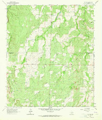
 1967 Castell1969 Print · USGSCovers Mason County, including Castell, Llano County, and other nearby areas2 unique versions available
 - 1967 Map of Panther Creek, 1969 Print
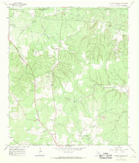
 1967 Panther Creek1969 Print · USGSCovers Mason County, including United States, Texas, and other nearby areas2 unique versions available
 - 1967 Map of Art, 1969 Print
 1967 Art1969 Print · USGSCovers Mason County, including Art, Hedwigs Hill, and other nearby areas2 unique versions available
 - 1967 Map of Doss, 1969 Print
 1967 Doss1969 Print · USGSCovers Mason County, including Doss, Gillespie County, and other nearby areas
Showing maps 1-25 of 43
Top cities of Mason County
Frequently asked questions
- What are the different types of historical maps available for Mason County?
- What is the oldest map of Mason County?
- Where can I purchase historical maps of Mason County for my home or office?
- Where can I download high-res historical maps of Mason County?
- Are there historical topographic maps available for Mason County?
- Is there historical aerial imagery available for Mason County?
- Where are historical maps of Mason County sourced from?