Old Maps of Medina County, Texas for Hiking & Exploration
Hike through history with 219 historic maps of Medina County. Explore old trails, ghost towns, and forgotten backroads — perfect for outdoor adventurers and local explorers.
- Rediscover forgotten places: Map out old mining camps, roads, and footpaths that no longer exist on modern maps.
- Layer with modern tools: Combine with LiDAR or satellite views to plan hikes through historical terrain.
- Made for exploration: Popular among hikers, overlanders, and local history lovers.
Use these maps to find adventure and explore the hidden past of Medina County.
Medina County, TX maps
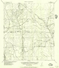
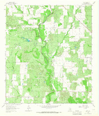
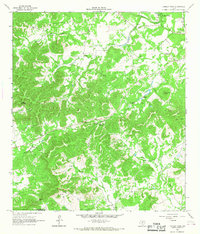
(219)- 1928 Map of Frio Town, 1956 Print
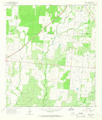
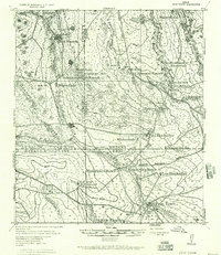 1928 Frio Town1956 Print · USGSThe ranchlands of South Texas are documented here in the late 1920s, showing a landscape shaped by water rights and family holdings. Genealogists and local historians can trace the bounds of the Schuddemagen Ranch and Woodward Ranch or locate the old Post Office at Frio Town.
 - 1942 Map of Natalia, 1956 Print
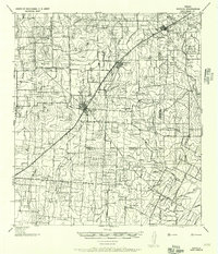 1942 Natalia1956 Print · USGSMedina and Atascosa Counties are captured here during the mid-century, showing the shift from traditional ranching to an oil and rail economy. Genealogists can trace family holdings and local landmarks such as Bear Creek School, the Sullivan Ranch, and the early settlement at Zig Zag.
 - 1954 Map of San Antonio, 1964 Print
 1954 San Antonio1964 Print · USGSSan Antonio and the Texas Hill Country are captured here in the mid-fifties, showing a landscape defined by massive military air bases and the rising Canyon Reservoir. Trace family ties through historic rail towns like D'Hanis and Castroville or explore the Cold War footprint of Lackland AFB and Randolph AFB.3 unique versions available
 - 1956 Map of Sabinal
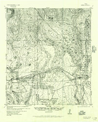 1956 Sabinal1956 Print · USGSRanching and rail transit define this South Texas landscape in the mid-1950s. Genealogists and historians can trace family holdings like the A Rothe Ranch, locate the industry of the Brick Yard, and follow the old Fort Clark-San Antonio Road past Sabinal.
 - 1956 Map of New Fountain
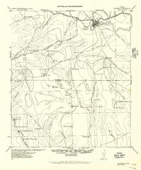
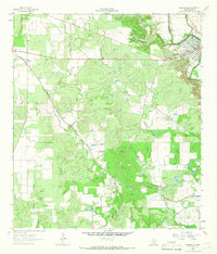
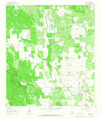
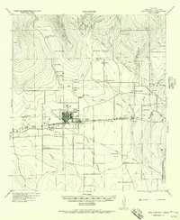 1956 New Fountain1956 Print · USGSMedina County comes into focus during the war years, showing a landscape defined by ranching and military training. Genealogy researchers can trace family lines through labeled homesteads like HJ Meyers and Lee Batot, or locate the Hondo Navigation School and Blue Waterhole.
 - 1956 Map of Tarpley
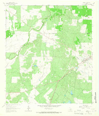
 1956 Tarpley1956 Print · USGSThe Texas Hill Country around Tarpley comes into focus in this mid-century survey, showing the transition from family ranches to early industrial infrastructure. Trace old property lines and landmarks like Old Montell Camp, the German Settlement, and the Humble Pipeline.
 - 1956 Map of Bandera
 1956 Bandera1956 Print · USGSThe Texas Hill Country comes alive in the mid-1950s as a landscape of remote ranches and critical waterholes. Genealogists and historians can trace family holdings like Hanson Ranch or locate unique landmarks such as the Line Walkers Shanty and Bat Cave.
 - 1956 Map of Medina Lake
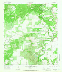
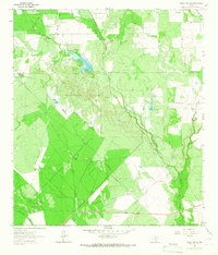
 1956 Medina Lake1956 Print · USGSMedina Lake and the surrounding Texas highlands are captured here in the 1920s and early 1930s. Genealogists and local historians can trace family properties like Kallison Ranch and the Granieri Hotel, or locate landmarks such as the Mico P.O. and Toll Gate.
 - 1957 Map of San Antonio
 1957 San Antonio1957 Print · USGSSan Antonio and the Texas Hill Country are shown here during the mid-fifties, capturing the region's expanding post-war military and transportation footprint. Genealogists and local historians can trace the early residential boundaries of Alamo Heights or locate rural landmarks like St Hedwig and Medina Lake.
 - 1958 Map of La Coste, 1961 Print
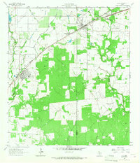
 1958 La Coste1961 Print · USGSMedina County during the late fifties shows a rural landscape shaped by the Medina River and the expanding irrigation systems of South Texas. Researchers can find long-standing landmarks like Our Lady of Grace Sch and the Castroville Air Force Auxiliary Field.3 unique versions available
 - 1958 Map of La Coste NE, 1961 Print
 1958 La Coste NE1961 Print · USGSMedina and Bexar Counties are captured in the late fifties, showcasing a transitional landscape of central Texas creek beds and rising hills. Local historians can trace the intricate drainages of Potranca Creek, Medio Creek, and the slopes of Loma Alta.2 unique versions available
 - 1964 Map of Ghost Hill, 1966 Print
 1964 Ghost Hill1966 Print · USGSSouthern Frio County comes to life in the mid-1960s, showing a landscape defined by the intersection of the cattle industry and the energy boom. Genealogists and historians can trace family land at Moore Cem or study the reach of the Big Foot Gas Field and the Missouri Pacific railroad.2 unique versions available
 - 1964 Map of Riomedina, 1966 Print
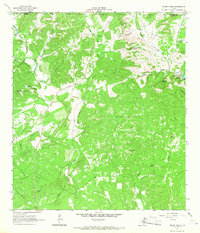
 1964 Riomedina1966 Print · USGSMedina County during the mid-1960s was a landscape of winding river valleys and quiet ranching communities. Genealogists and local historians can trace the early footprints of Riomedina and Quihi, and locate landmarks like Indian Hill and Gabe Lake.2 unique versions available
 - 1964 Map of Castroville, 1966 Print
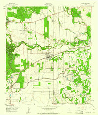
 1964 Castroville1966 Print · USGSThe Alsatian-settled landscape of Medina County is captured here in the mid-sixties, from the bends of the Medina River to the rail siding at Dunlay. Trace family history and land use through labels like Chacowalla Water Hole, Bader, and the Southern Pacific line.2 unique versions available
 - 1964 Map of Devine, 1966 Print
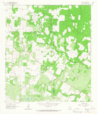
 1964 Devine1966 Print · USGSDevine and the surrounding Medina County countryside are captured here in the mid-1960s as a thriving rail and agricultural hub. Genealogists and researchers can locate family sites at Roberson Cem, trace the Missouri Pacific line, or find the Medina Lake State Fish Hatchery.2 unique versions available
 - 1964 Map of Moore, 1966 Print
 1964 Moore1966 Print · USGSMoore and the surrounding Frio County ranch lands are documented here during the mid-1960s. Genealogists and historians can trace the Missouri Pacific rail line and locate rural landmarks like Tehuacana Cem and Moore Hollow.2 unique versions available
 - 1964 Map of Wilson Ranch, 1966 Print
 1964 Wilson Ranch1966 Print · USGSRanching life on the Frio and Medina County line is captured here in the mid-1960s, showing a landscape defined by water rights and wide-open range. Researchers can trace historic land use through cattle-country landmarks like Wilson Ranch, Javelin Windmill, and Slaughter Windmill.
 - 1964 Map of Lytle, 1966 Print
 1964 Lytle1966 Print · USGSMid-century Atascosa and Medina Counties are shaped here by rail corridors and oil production. Trace the legacy of Lytle and Natalia along the Missouri Pacific near the Verna-Anacacho Oil Field.2 unique versions available
 - 1964 Map of Timber Creek, 1967 Print
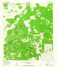
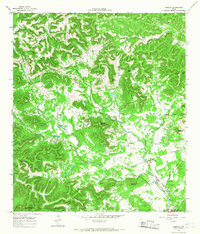
 1964 Timber Creek1967 Print · USGSThe Texas Hill Country at the edge of the Balcones Escarpment is mapped here during the 1960s. Genealogists and historians can trace old property boundaries near Medina Lake or locate remote landmarks like One Horn Mountain and Indian Spring.
 - 1964 Map of Bigfoot, 1967 Print
 1964 Bigfoot1967 Print · USGSSouth Texas ranching and oil production define this area during the mid-sixties. Genealogists and historians can trace family-named sites like Brummett Cem and Moore Cem near the Big Foot Oil Field.
 - 1964 Map of Biry, 1967 Print
 1964 Biry1967 Print · USGSMedina County ranching and petroleum production are captured here in the mid-sixties, showcasing a landscape of winding creeks and active oil extraction. Researchers can locate family landmarks like the Mussman Cem, the community of Biry, and the sprawling Taylor Ina Oil Field.
 - 1964 Map of Yancey, 1967 Print
 1964 Yancey1967 Print · USGSMedina County ranch lands and small-town life are preserved here during the mid-sixties. Researchers can trace family history at Yancey Cem and Butts Cem or locate the boundaries of the Taylor-Ina Oil Field.
 - 1964 Map of Medina Lake, 1968 Print
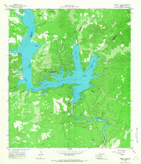 1964 Medina Lake1968 Print · USGSMedina Lake and its jagged limestone shoreline are captured here in the early sixties as recreational communities began to flourish. Researchers can trace family sites near Lake Hills, find the Medina Dam, or locate the St Victors Chapel.2 unique versions available
 - 1964 Map of Tarpley, 1968 Print
 1964 Tarpley1968 Print · USGSTarpley and the surrounding ranch lands of the Texas Hill Country are captured here in the mid-1960s. Genealogists and historians can trace old homesteads and landmarks like Garrison, Tarpley Gem Spring, and family-named features such as Winans Creek.2 unique versions available
 - 1964 Map of Tarpley Pass, 1968 Print
 1964 Tarpley Pass1968 Print · USGSBandera and Medina counties come together in the Texas Hill Country during the mid-1960s, showing a rugged landscape of ranching and riverfront. Researchers can trace historical water sources and landmarks like Pear Tree Spring, El Paraiso Ranch, and the Tarpley Pass.3 unique versions available
Showing maps 1-25 of 219
Top cities of Medina County
Frequently asked questions
- What are the different types of historical maps available for Medina County?
- What is the oldest map of Medina County?
- Where can I purchase historical maps of Medina County for my home or office?
- Where can I download high-res historical maps of Medina County?
- Are there historical topographic maps available for Medina County?
- Is there historical aerial imagery available for Medina County?
- Where are historical maps of Medina County sourced from?