1960s Maps of Medina County, Texas
Explore 22 historic maps of Medina County from the 1960s. These maps offer a rare glimpse into what life looked like during the 1960s — showing old roads, neighborhoods, homes, and landmarks that have changed or disappeared over time.
Whether you're researching your family's past, planning a metal detecting trip, or studying how Medina County's landscape evolved across the 1960s, these high-resolution maps are a powerful tool for exploring the history of this region.
- Focus on a specific era: All maps on this page are from the 1960s, giving you a focused view of this time period.
- See what’s changed: Compare century-old streets, trails, and buildings to today's modern landscape using overlays and satellite layers.
- Research with precision: Use these maps for genealogy, historical research, land use analysis, or educational projects.
- View, download, or print: Maps are fully viewable online in high resolution, and can be downloaded or printed for your own records.
Start exploring Medina County's history through authentic maps from the 1960s. This is your window into the past.
Medina County, TX maps
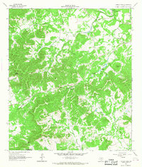
(22)- 1964 Map of Ghost Hill, 1966 Print
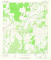 1964 Ghost Hill1966 Print · USGSSouthern Frio County comes to life in the mid-1960s, showing a landscape defined by the intersection of the cattle industry and the energy boom. Genealogists and historians can trace family land at Moore Cem or study the reach of the Big Foot Gas Field and the Missouri Pacific railroad.2 unique versions available
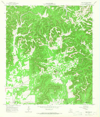
 - 1964 Map of Riomedina, 1966 Print
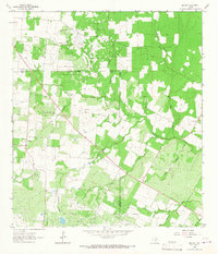
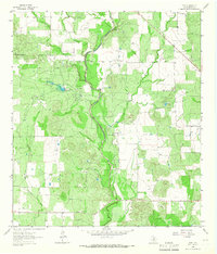
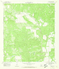
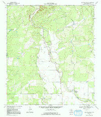
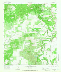 1964 Riomedina1966 Print · USGSMedina County during the mid-1960s was a landscape of winding river valleys and quiet ranching communities. Genealogists and local historians can trace the early footprints of Riomedina and Quihi, and locate landmarks like Indian Hill and Gabe Lake.2 unique versions available
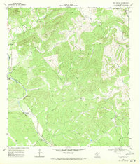
 - 1964 Map of Castroville, 1966 Print
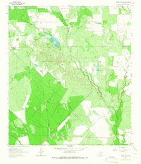
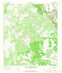 1964 Castroville1966 Print · USGSThe Alsatian-settled landscape of Medina County is captured here in the mid-sixties, from the bends of the Medina River to the rail siding at Dunlay. Trace family history and land use through labels like Chacowalla Water Hole, Bader, and the Southern Pacific line.2 unique versions available
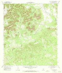
 - 1964 Map of Devine, 1966 Print
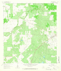
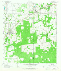
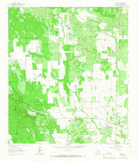
 1964 Devine1966 Print · USGSDevine and the surrounding Medina County countryside are captured here in the mid-1960s as a thriving rail and agricultural hub. Genealogists and researchers can locate family sites at Roberson Cem, trace the Missouri Pacific line, or find the Medina Lake State Fish Hatchery.2 unique versions available
 - 1964 Map of Moore, 1966 Print
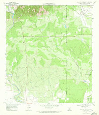
 1964 Moore1966 Print · USGSMoore and the surrounding Frio County ranch lands are documented here during the mid-1960s. Genealogists and historians can trace the Missouri Pacific rail line and locate rural landmarks like Tehuacana Cem and Moore Hollow.2 unique versions available
 - 1964 Map of Wilson Ranch, 1966 Print
 1964 Wilson Ranch1966 Print · USGSRanching life on the Frio and Medina County line is captured here in the mid-1960s, showing a landscape defined by water rights and wide-open range. Researchers can trace historic land use through cattle-country landmarks like Wilson Ranch, Javelin Windmill, and Slaughter Windmill.
 - 1964 Map of Lytle, 1966 Print
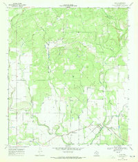
 1964 Lytle1966 Print · USGSMid-century Atascosa and Medina Counties are shaped here by rail corridors and oil production. Trace the legacy of Lytle and Natalia along the Missouri Pacific near the Verna-Anacacho Oil Field.2 unique versions available
 - 1964 Map of Timber Creek, 1967 Print
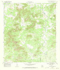
 1964 Timber Creek1967 Print · USGSThe Texas Hill Country at the edge of the Balcones Escarpment is mapped here during the 1960s. Genealogists and historians can trace old property boundaries near Medina Lake or locate remote landmarks like One Horn Mountain and Indian Spring.
 - 1964 Map of Bigfoot, 1967 Print
 1964 Bigfoot1967 Print · USGSSouth Texas ranching and oil production define this area during the mid-sixties. Genealogists and historians can trace family-named sites like Brummett Cem and Moore Cem near the Big Foot Oil Field.
 - 1964 Map of Biry, 1967 Print
 1964 Biry1967 Print · USGSMedina County ranching and petroleum production are captured here in the mid-sixties, showcasing a landscape of winding creeks and active oil extraction. Researchers can locate family landmarks like the Mussman Cem, the community of Biry, and the sprawling Taylor Ina Oil Field.
 - 1964 Map of Yancey, 1967 Print
 1964 Yancey1967 Print · USGSMedina County ranch lands and small-town life are preserved here during the mid-sixties. Researchers can trace family history at Yancey Cem and Butts Cem or locate the boundaries of the Taylor-Ina Oil Field.
 - 1964 Map of Medina Lake, 1968 Print
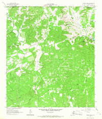
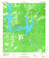 1964 Medina Lake1968 Print · USGSMedina Lake and its jagged limestone shoreline are captured here in the early sixties as recreational communities began to flourish. Researchers can trace family sites near Lake Hills, find the Medina Dam, or locate the St Victors Chapel.2 unique versions available
 - 1964 Map of Tarpley, 1968 Print
 1964 Tarpley1968 Print · USGSTarpley and the surrounding ranch lands of the Texas Hill Country are captured here in the mid-1960s. Genealogists and historians can trace old homesteads and landmarks like Garrison, Tarpley Gem Spring, and family-named features such as Winans Creek.2 unique versions available
 - 1964 Map of Tarpley Pass, 1968 Print
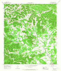
 1964 Tarpley Pass1968 Print · USGSBandera and Medina counties come together in the Texas Hill Country during the mid-1960s, showing a rugged landscape of ranching and riverfront. Researchers can trace historical water sources and landmarks like Pear Tree Spring, El Paraiso Ranch, and the Tarpley Pass.3 unique versions available
 - 1964 Map of Seco Pass, 1968 Print
 1964 Seco Pass1968 Print · USGSThe Bandera County highlands of the mid-sixties are captured here at the intersection with Uvalde and Medina Counties. Researchers can trace rural landmarks like Haby Cem, identify remote sites like Sutherland, and locate Sentry Mountain.
 - 1969 Map of Twin Hollow, 1971 Print
 1969 Twin Hollow1971 Print · USGSThe Texas Hill Country at the Bandera and Medina county line was a landscape of vital water sources and limestone ridges in the late sixties. Researchers can trace the path of Hondo Creek to find Two Pecan Waterhole and the notable Ney Cave.3 unique versions available
 - 1969 Map of Texas Mountain, 1972 Print
 1969 Texas Mountain1972 Print · USGSMedina County ranchlands and limestone ridges are captured here in the late sixties. Genealogists and historians can trace the terrain around Texas Mountain, locating Camp Mary Louise, the Blue Waterhole, and the original footprint of Valdina Farms.
 - 1969 Map of Sabinal NE, 1972 Print
 1969 Sabinal NE1972 Print · USGSMedina County ranchland meets early industrial innovation in the late sixties near the Edwards Plateau. Trace the evolution of the landscape from the Automotive Test Facility and Landing Field to the banks of Seco Creek.2 unique versions available
 - 1969 Map of Comanche Waterhole, 1972 Print
 1969 Comanche Waterhole1972 Print · USGSThe Uvalde and Medina County line area was a landscape of ranching and specialized industry in the late sixties. Researchers can trace land use through the K Bar Ranch and Valdina Farms, or locate the Automotive Test Facility and Comanche Waterhole.
 - 1969 Map of Quihi, 1972 Print
 1969 Quihi1972 Print · USGSMedina County settlements like Quihi and New Fountain are shown during the late sixties, surrounded by family-named landmarks and creeks. Genealogists can locate several historic burial sites, including St Johns Cem and Britsch Cem., alongside the sprawling Automotive Test Facility.2 unique versions available
 - 1969 Map of Flatrock Crossing, 1972 Print
 1969 Flatrock Crossing1972 Print · USGSThe Edwards Plateau breaks into the Hill Country of Uvalde and Medina counties during the late sixties, where ranching life follows the limestone creek beds. Researchers can locate remote family landmarks like Miller Cem, the Flatrock Crossing ford, and high points like Holy Mountain.2 unique versions available
 - 1969 Map of Mustang Valley, 1992 Print
 1969 Mustang Valley1992 Print · USGSMedina County ranch lands and river valleys are captured here in the late sixties as the local landscape was shaped by water management and mineral extraction. Researchers can trace rural fence lines and water sources like King Waterhole, Mustang Tank, and Hondo Creek.
End of results
Showing maps 1-22 of 22
Top cities of Medina County
Frequently asked questions
- What are the different types of historical maps available for Medina County?
- What is the oldest map of Medina County?
- Where can I purchase historical maps of Medina County for my home or office?
- Where can I download high-res historical maps of Medina County?
- Are there historical topographic maps available for Medina County?
- Is there historical aerial imagery available for Medina County?
- Where are historical maps of Medina County sourced from?