1900s (20th Century) Maps of Rockdale, Texas
Explore 6 historic maps of Rockdale from the 1900s (20th Century). These maps offer a rare glimpse into what life looked like during the 1900s — showing old roads, neighborhoods, homes, and landmarks that have changed or disappeared over time.
Whether you're researching your family's past, planning a metal detecting trip, or studying how Rockdale's landscape evolved across the 1900s, these high-resolution maps are a powerful tool for exploring the history of this region.
- Focus on a specific era: All maps on this page are from the 1900s, giving you a focused view of this time period.
- See what’s changed: Compare century-old streets, trails, and buildings to today's modern landscape using overlays and satellite layers.
- Research with precision: Use these maps for genealogy, historical research, land use analysis, or educational projects.
- View, download, or print: Maps are fully viewable online in high resolution, and can be downloaded or printed for your own records.
Start exploring Rockdale's history through authentic maps from the 1900s. This is your window into the past.
Rockdale, TX maps
(6)- 1954 Map of Austin, 1964 Print
 1954 Austin1964 Print · USGSCentral Texas is captured during a period of steady growth as the capital city and its neighboring farm towns began to modernize. Researchers can trace historic rail corridors like the Southern Pacific RR or locate landmarks such as Bergstrom Air Force Base and Pilot Knob.4 unique versions available
 - 1956 Map of Milano
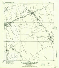 1956 Milano1956 Print · USGSRailroad junctions and rural post offices define this Milam County landscape during the early twentieth century. Genealogists and historians can locate family-named landmarks like Septimus) Olson or trace the early paths of the San Antonio and Aransas Pass Railway.
 - 1961 Map of Rockdale East, 1964 Print
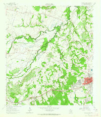
 1961 Rockdale East1964 Print · USGSThe eastern edge of Rockdale and the surrounding Milam County prairie are captured in the early sixties, showing a landscape defined by rail lines and rural community centers. Family historians can trace local landmarks like Aycock Sch, San Jose Cem, and Mt Zion Ch.3 unique versions available
 - 1962 Map of Rockdale West, 1964 Print
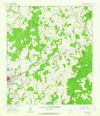
 1962 Rockdale West1964 Print · USGSMilam County in the early sixties shows the growth of Rockdale alongside traditional Texas river-bottom farming. Genealogists and historians can trace family locations through numerous sites like Hickory Grove Cem, Bushdale Cem, and Tracy.3 unique versions available
 - 1985 Map of Taylor, 1986 Print
 1985 Taylor1986 Print · USGSWilliamson and Bell counties in the mid-eighties reveal a landscape where the cattle and cotton economy met burgeoning rail infrastructure. Genealogists and historians can trace the paths of the Missouri Pacific railroad through unique hamlets like Ding Dong, Frame Switch, and Beyersville.2 unique versions available
 - 1993 Map of Bryan
 1993 Bryan1993 Print · USGSBrazos Valley life in the early nineties centered on the rapid growth of College Station and the agricultural heartbeat of the river bottomlands. Genealogists and historians can trace the paths of the Kings Highway, several rail lines, and local landmarks like City Cem and Texas A&M University.
End of results
Showing maps 1-6 of 6
Top cities near Rockdale
- Cameron historical maps
- Thorndale historical maps
- Lexington historical maps
- Buckholts historical maps
- Milano historical maps
Frequently asked questions
- What are the different types of historical maps available for Rockdale?
- What is the oldest map of Rockdale?
- Where can I purchase historical maps of Rockdale for my home or office?
- Where can I download high-res historical maps of Rockdale?
- Are there historical topographic maps available for Rockdale?
- Is there historical aerial imagery available for Rockdale?
- Where are historical maps of Rockdale sourced from?