2020s Maps of Corsicana, Texas
Explore 4 historic maps of Corsicana from the 2020s. These maps offer a rare glimpse into what life looked like during the 2020s — showing old roads, neighborhoods, homes, and landmarks that have changed or disappeared over time.
Whether you're researching your family's past, planning a metal detecting trip, or studying how Corsicana's landscape evolved across the 2020s, these high-resolution maps are a powerful tool for exploring the history of this region.
- Focus on a specific era: All maps on this page are from the 2020s, giving you a focused view of this time period.
- See what’s changed: Compare century-old streets, trails, and buildings to today's modern landscape using overlays and satellite layers.
- Research with precision: Use these maps for genealogy, historical research, land use analysis, or educational projects.
- View, download, or print: Maps are fully viewable online in high resolution, and can be downloaded or printed for your own records.
Start exploring Corsicana's history through authentic maps from the 2020s. This is your window into the past.
Corsicana, TX maps
(4)- 2022 Map of Corbet, 2022 Print
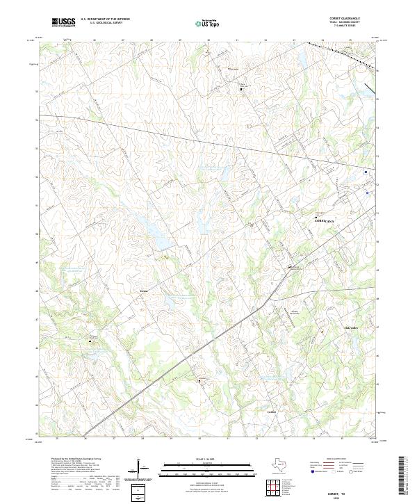 2022 Corbet2022 Print · USGSCorsicana and its Navarro County surroundings appear in the early 2020s as a landscape of agricultural reservoirs and historic family cemeteries. Researchers can locate Cunningham Cem, trace the waters of Briar Creek, and explore the rural settlements of Drane and Corbet.
 - 2022 Map of Corsicana, 2022 Print
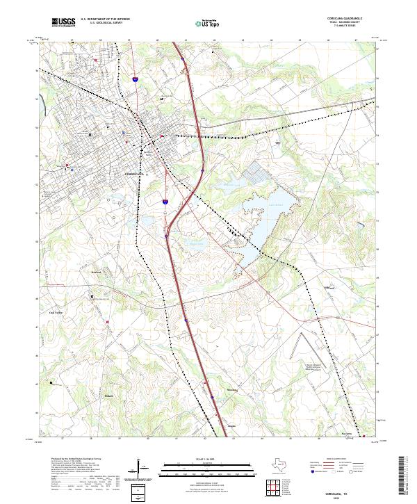 2022 Corsicana2022 Print · USGSCorsicana and its surrounding Navarro County ranch lands are shown here in the early twenty-first century as the city expands toward the south. Researchers can trace family sites from Oakwood Cem to Retreat and the Hamilton Beeman Cem.
 - 2022 Map of Chatfield, 2022 Print
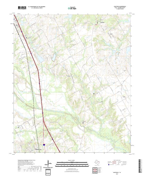 2022 Chatfield2022 Print · USGSNavarro County's rural landscape comes into focus in this contemporary record of the blackland prairie east of the Interstate. Genealogists and historians can trace family locations through numerous sites like Old Chatfield Cem, Hamilton-Bragg Cem, and Roane.
 - 2022 Map of Emhouse, 2022 Print
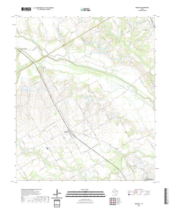 2022 Emhouse2022 Print · USGSThe prairie landscapes of Navarro County are mapped here in the early 2020s, showing the agricultural community of Emhouse and its surrounding farm-to-market roads. Researchers can locate the Pattison Cem and trace the meandering paths of Chambers Creek and Waxahachie Slough.
End of results
Showing maps 1-4 of 4
Top cities near Corsicana
- Ennis historical maps
- Kerens historical maps
- Rice historical maps
- Oak Valley historical maps
- Mildred historical maps
- Angus historical maps
See more
Frequently asked questions
- What are the different types of historical maps available for Corsicana?
- What is the oldest map of Corsicana?
- Where can I purchase historical maps of Corsicana for my home or office?
- Where can I download high-res historical maps of Corsicana?
- Are there historical topographic maps available for Corsicana?
- Is there historical aerial imagery available for Corsicana?
- Where are historical maps of Corsicana sourced from?