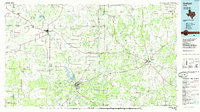
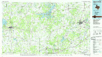
1980s Maps of Palo Pinto County, Texas
Explore 19 historic maps of Palo Pinto County from the 1980s. These maps offer a rare glimpse into what life looked like during the 1980s — showing old roads, neighborhoods, homes, and landmarks that have changed or disappeared over time.
Whether you're researching your family's past, planning a metal detecting trip, or studying how Palo Pinto County's landscape evolved across the 1980s, these high-resolution maps are a powerful tool for exploring the history of this region.
- Focus on a specific era: All maps on this page are from the 1980s, giving you a focused view of this time period.
- See what’s changed: Compare century-old streets, trails, and buildings to today's modern landscape using overlays and satellite layers.
- Research with precision: Use these maps for genealogy, historical research, land use analysis, or educational projects.
- View, download, or print: Maps are fully viewable online in high resolution, and can be downloaded or printed for your own records.
Start exploring Palo Pinto County's history through authentic maps from the 1980s. This is your window into the past.
Palo Pinto County, TX maps
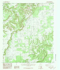
(19)- 1982 Map of Bartons Chapel
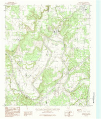
 1982 Bartons Chapel1982 Print · USGSThe rural landscapes of Jack County come into focus during the early eighties, showing a community built around creek forks and country churches. Researchers can locate family-named sites like Tettertiller Hill, Sparks Spring, and the grounds of Bartons Chapel.
 - 1984 Map of Palo Pinto
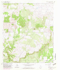
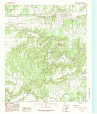
 1984 Palo Pinto1984 Print · USGSThe Palo Pinto County seat is documented in the mid-1980s, revealing the landscape of the Brazos River valley. Trace family history and land features near Palo Pinto or the winding river loops of Dalton Bend and Chick Bend.
 - 1984 Map of Santo
 1984 Santo1984 Print · USGSNorth-central Texas in the late seventies and early eighties shows a landscape of winding creeks and prominent peaks. Trace local history through the streets of Santo, find the settlement of Patillo to the south, or locate landmarks like Bugle Mountain.2 unique versions available
 - 1984 Map of Fortune Bend
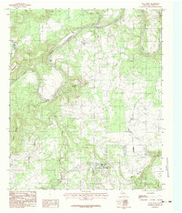
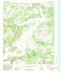
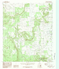
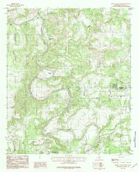
 1984 Fortune Bend1984 Print · USGSPalo Pinto County’s dramatic river bends and reservoir shoreline are captured here in the mid-eighties. Researchers can trace the rugged topography around Possum Kingdom Lake, locating landmarks like Morris Sheppard Dam, Hells Gate, and Schoolhouse Mountain.2 unique versions available
 - 1984 Map of Costello Island
 1984 Costello Island1984 Print · USGSThe Brazos River valley meets the waters of the Palo Pinto hills in the early 1980s. Historians and outdoor enthusiasts can trace the shoreline of Possum Kingdom Lake and locate landmarks like Mc Ginnis Point, Mc Adams Peak, and Costello Island.
 - 1984 Map of Brazos West
 1984 Brazos West1984 Print · USGSThe Brazos River dominates this Palo Pinto County landscape in the late 1970s, twisting through deep loops and named river bends. Researchers can trace family history through landmarks like John Hittson Bend, the community of Brazos, and Robinson Mountain.2 unique versions available
 - 1984 Map of Graford East
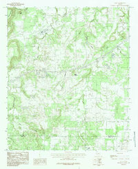
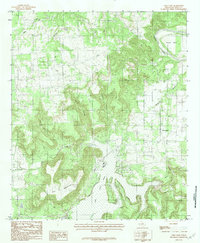
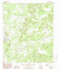
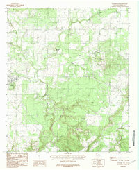 1984 Graford East1984 Print · USGSPalo Pinto County in the mid-1980s shows a landscape of winding creek forks and rural homesteads centered on the community of Oran. Genealogists and historians can trace local landmarks like Grindstone Mountain, Soda Springs Creek, and several rural Cem locations.
 - 1984 Map of Strawn East
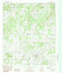
 1984 Strawn East1984 Print · USGSThe Texas coal country near the Palo Pinto and Erath county lines comes into focus in the early eighties. Genealogists and historians can trace the foundations of Strawn, Mingus, and the industrial sites at Coal Mine Mountain.
 - 1984 Map of Brazos East
 1984 Brazos East1984 Print · USGSThe Brazos River valley at the Parker and Palo Pinto county line is captured here in the early 1980s, showing a landscape defined by deep river bends and high overlooks. Genealogists and local historians can trace the topography of Millsap, the small community of Bennett, and landmarks like Inspiration Point.
 - 1984 Map of Graford West
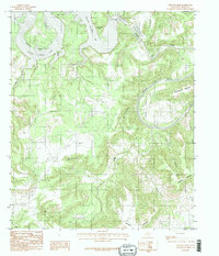
 1984 Graford West1984 Print · USGSPalo Pinto County at the start of the 1980s shows a landscape of winding river bends and prairie highlands. Researchers can trace family-named landmarks like B C Harris Bend, the small community at Flatrock, and the rugged slopes of Mc Clure Mountain.2 unique versions available
 - 1984 Map of Lone Camp
 1984 Lone Camp1984 Print · USGSThe community of Lone Camp and the winding Brazos River define this North Texas landscape during the early 1980s. Researchers can locate the local Cem and trace natural landmarks from Village Bend to the heights of Palo Pinto Mountain.
 - 1984 Map of Whitt
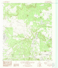
 1984 Whitt1984 Print · USGSThe ranchlands along the Palo Pinto and Parker County border are documented here in the early 1980s. Local researchers can trace the rural layout of Whitt, Peadenville, and Salesville, along with landmarks like Rock Crusher Lake and Turkey Creek.
 - 1984 Map of Metcalf Gap
 1984 Metcalf Gap1984 Print · USGSThe Palo Pinto hill country in the early eighties shows a landscape of dramatic breaks and high cattle country. Trace the rugged terrain through Metcalf Gap, the heights of Sugarloaf Mountain, and the drainages of Eagle Creek.
 - 1984 Map of Mineral Wells West
 1984 Mineral Wells West1984 Print · USGSThe western edges of Mineral Wells and the deep bends of the Brazos River are captured here in the late seventies and early eighties. Researchers can trace the river's winding path through Ballenger Bend or locate landmarks like Barber Mountain and Coronados Camp.2 unique versions available
 - 1984 Map of Gordon
 1984 Gordon1984 Print · USGSPalo Pinto County in the late seventies and early eighties shows a landscape of rail-connected settlements and prominent Texas peaks. Genealogists and historians can trace old homesteads and transport points from Coalville and Blue Flat to Judge Switch and Clayton Mountain.
 - 1984 Map of Lipan
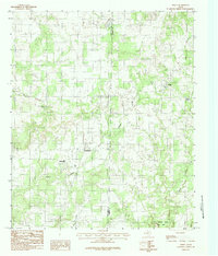
 1984 Lipan1984 Print · USGSNorth Central Texas in the early eighties shows a landscape of intersecting county lines and creek-fed valleys. Researchers can trace rural property patterns around Lipan or follow the waters of the Brazos River and Kickapoo Creek.
 - 1984 Map of Mineral Wells East, 1986 Print
 1984 Mineral Wells East1986 Print · USGSMineral Wells and its eastern neighbors are shown in the early 1980s as the region transitioned from military influence to recreation and education. Genealogists can trace family connections in Wolters Village, Sturdivant, or Millsap and locate landmarks like Weatherford College.
 - 1985 Map of Graham
 1985 Graham1985 Print · USGSNorth Texas in the mid-eighties shows a landscape of growing reservoirs and historic cattle country. Genealogists and historians can trace the foundations of Young County through the Belknap Mountains, Barton Chapel, and the grounds of Fort Richardson State Park.2 unique versions available
 - 1985 Map of Mineral Wells
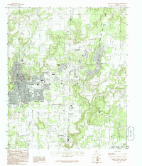
 1985 Mineral Wells1985 Print · USGSNorth-central Texas in the mid-eighties shows a landscape of deep river valleys and massive reservoirs. Genealogists and historians can trace the Missouri Pacific rail line and locate rural settlements like Thurber, Necessity, and Palo Pinto.2 unique versions available
End of results
Showing maps 1-19 of 19
Top cities of Palo Pinto County
- Strawn historical maps
- Graford historical maps
- Gordon historical maps
- Palo Pinto historical maps
- Mingus historical maps
Frequently asked questions
- What are the different types of historical maps available for Palo Pinto County?
- What is the oldest map of Palo Pinto County?
- Where can I purchase historical maps of Palo Pinto County for my home or office?
- Where can I download high-res historical maps of Palo Pinto County?
- Are there historical topographic maps available for Palo Pinto County?
- Is there historical aerial imagery available for Palo Pinto County?
- Where are historical maps of Palo Pinto County sourced from?