Old Maps of Palo Pinto County, Texas for Genealogy
Trace your family roots with 169 historic maps of Palo Pinto County. These high-res maps reveal old neighborhoods, homesites, landmarks, and streets — helping you uncover where your ancestors lived and how the area evolved over time.
- Explore historic neighborhoods: Identify where your relatives may have lived in the 1800s or 1900s.
- Compare maps over time: Trace the changes in streets, buildings, and landmarks for multi-generational research.
- Perfect for genealogy & ancestry research: Used by family historians and researchers to map out lineage and migration.
These maps are an incredible resource for exploring your personal connection to Palo Pinto County's past.
Palo Pinto County, TX maps
(169)- 1890 Map of Breckenridge
 1890 Breckenridge1890 Print · USGSStephens County was a landscape of budding settlements and cattle country in the late nineteenth century. Genealogists can trace early homesteads near Breckenridge or follow the Texas and Pacific R.R. past peaks like Steal Easy Mt. and Gunsight Mt..6 unique versions available
 - 1891 Map of Palo Pinto
 1891 Palo Pinto1891 Print · USGSNorth Texas in the late nineteenth century was a landscape of winding river bends and emerging coal towns. Genealogists and historians can trace early river crossings at Oaks Ferry, the path of the Texas and Pacific Railroad, and the Coal Mines at Coalville.7 unique versions available
 - 1918 Map of Palo Pinto
 1918 Palo Pinto1918 Print · USGSPalo Pinto County and the Brazos River valley appear here in the final year of the Great War, showing a landscape shaped by coal and steam. Genealogists and historians can locate defunct river crossings like Oaks Ferry, early rural education at Marsden School, and the extensive Coal Mines that once powered the regional economy.
 - 1924 Map of Breckenridge 1-a
 1924 Breckenridge 1-a1924 Print · USGSNorth Central Texas oil and ranching lands are captured here in the mid-1920s at the junction of three counties. Genealogists can locate family homesteads near Eliasville PO, Sorghum Flat School, or the petroleum derricks at Eubanks Derrick.
 - 1924 Map of Palo Pinto 2-b
 1924 Palo Pinto 2-b1924 Print · USGSThe Brazos River winds through Palo Pinto and Young counties in the mid-twenties, long before the creation of modern reservoirs. Researchers can locate the Pickwick settlement, several river transits like Wild Bend Crossing, and the McAdams Cem.
 - 1924 Map of Palo Pinto 2-a
 1924 Palo Pinto 2-a1924 Print · USGSPalo Pinto County at the mid-point of the twenties is captured here in an advance survey of its settlements and rugged bluffs. Genealogists and researchers can locate Grassy Ridge School or trace the early W. M. W. & N. W. rail line through Graford and Dalton.
 - 1924 Map of Palo Pinto 1-b
 1924 Palo Pinto 1-b1924 Print · USGSPalo Pinto County in the mid-1920s is captured here as a landscape of rural schools and emerging rail connections. Researchers can trace the path of the Weatherford and Mineral Wells Northwestern and find local hubs like Graford and the Union Hill School.
 - 1924 Map of Palo Pinto 2-c
 1924 Palo Pinto 2-c1924 Print · USGSThe Brazos River meanders through Palo Pinto County in the mid-1920s, showing the landscape before the creation of the reservoir. Genealogists and researchers can trace family-named river fords and landmarks like Belding Ranch, Fortune Bend School, and Johnson Crossing.
 - 1924 Map of Breckenridge 1-d
 1924 Breckenridge 1-d1924 Print · USGSThe borderlands of Stephens and Palo Pinto counties are captured here in the mid-1920s, showing a rugged landscape of winding creek beds and family-named hollows. Genealogists and researchers can locate old landmarks like Cedar Springs Church, Hayrick Mt, and Hog Bend.
 - 1925 Map of Palo Pinto 4-b
 1925 Palo Pinto 4-b1925 Print · USGSPalo Pinto County in the mid-twenties shows a landscape of sharp river bends and scattered rural schoolhouses. Genealogists and local historians can locate early educational landmarks like Progress School and New Hope School or trace the Texas and Pacific rail line.
 - 1927 Map of Pickwick
 1927 Pickwick1927 Print · USGSThe Brazos River loops through Palo Pinto and Young Counties in the mid-1920s, showing the river's path before the dams. Genealogists can trace family landmarks like Mc Adams Cem, Henry Chapel, and the isolated Belding Ranch.2 unique versions available
 - 1927 Map of Mineral Wells
 1927 Mineral Wells1927 Print · USGSThe Brazos River carves a winding path through Palo Pinto County in the mid-1920s, defining a landscape of deep hollows and sharp river bends. Researchers can trace early rural schools like Union Hill School and the route of the Weatherford Mineral Wells and Northwestern rail line.2 unique versions available
 - 1931 Map of Santo
 1931 Santo1931 Print · USGSPalo Pinto County in the mid-1920s was a land of winding river valleys and rural schoolhouse communities. Genealogists and historians can trace the early rail-and-river economy through the Texas and Pacific line and the Brazos River, while locating family homesteads near Village Bend Sch or New Hope Sch.3 unique versions available
 - 1931 Map of Ivan
 1931 Ivan1931 Print · USGSThe Brazos River loop and the rolling breaks of north-central Texas are captured here in the mid-1920s. Genealogists can locate family-named schoolhouses and small settlements like Duff Prairie Sch, South Bend, and Oil City.2 unique versions available
 - 1954 Map of Abilene, 1966 Print
 1954 Abilene1966 Print · USGSThe Texas Big Country comes into focus in the mid-1950s as petroleum and new water projects reshape the landscape. Local historians can trace the Butterfield Trail, find the Fort Phantom Hill Ruins, and locate numerous small communities along the Texas & Pacific line.2 unique versions available
 - 1954 Map of Wichita Falls, 1966 Print
 1954 Wichita Falls1966 Print · USGSNorth Texas in the mid-fifties is captured here as a landscape of expanding oil fields and vital rail corridors. Genealogists and historians can trace family roots through rural landmarks like Bacon Chapel and the rail-side growth of Seymour and Archer City.3 unique versions available
 - 1958 Map of Wichita Falls
 1958 Wichita Falls1958 Print · USGSNorth Texas during the late fifties reveals a landscape defined by the booming petroleum industry and established rail hubs. Researchers can trace the development of Wichita Falls and discover rural landmarks like Barton's Chapel or the Hull-Silk Oil Field.
 - 1958 Map of Abilene
 1958 Abilene1958 Print · USGSMid-century West Texas comes alive in this survey of the Abilene and Stephenville region during a period of steady oil expansion and military growth. Genealogists and local historians can trace the paths of the Texas & Pacific RR through historic towns, locate the Fort Griffin Ruins, and find smaller settlements like Desdemona and Lueders.
 - 1958 Map of Palo Pinto, 1960 Print
 1958 Palo Pinto1960 Print · USGSThe Palo Pinto Mountains and the winding Brazos River are captured here in the late fifties, just as Possum Kingdom Lake was maturing into a regional landmark. Researchers can trace family history at Mc Adams Cem, explore the Floyd Dalton Oil Field, or locate Palo Pinto and Graford.2 unique versions available
 - 1959 Map of Mineral Wells, 1960 Print
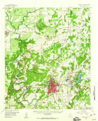 1959 Mineral Wells1960 Print · USGSMineral Wells and the surrounding Palo Pinto ranch lands are captured here during the height of the Cold War helicopter training era. Researchers can trace the massive footprint of Camp Wolters, the winding Brazos River bends, and local landmarks like Staggs Prairie Cem.2 unique versions available
 - 1959 Map of Lipan, 1960 Print
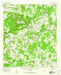 1959 Lipan1960 Print · USGSNear the intersection of four Texas counties in the late fifties, this survey captures the rural character and winding river bends of the Brazos valley. Researchers can locate family landmarks like Evergreen Cem, Dobbs Valley Ch, and the remote Progress Sch.3 unique versions available
 - 1959 Map of Gordon, 1960 Print
 1959 Gordon1960 Print · USGSThe Palo Pinto hills in the late fifties show a landscape defined by the Texas and Pacific railroad and active coal and oil extraction. Local researchers can trace the locations of family burial sites like Thurber Cem and landmarks like Metcalf Gap.2 unique versions available
 - 1961 Map of Bartons Chapel, 1962 Print
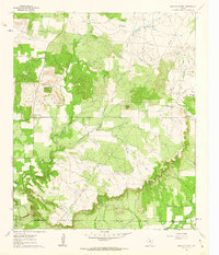 1961 Bartons Chapel1962 Print · USGSJack County ranch lands are documented here in the early sixties as the oil industry began to mark the landscape. Genealogists can trace family roots at Bartons Chapel Cem and Springdale Cem or locate the rural Sparks Spring Ch.
 - 1961 Map of Perrin, 1962 Print
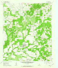 1961 Perrin1962 Print · USGSNorth Texas ranching and petroleum production meet in the early sixties near the intersection of Jack, Palo Pinto, and Parker Counties. Local historians can trace the Old Railroad Grade, locate the High Sch in Perrin, and explore the Rusmag Field oil operations.2 unique versions available
 - 1967 Map of Brad, 1970 Print
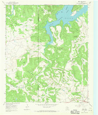 1967 Brad1970 Print · USGSThe Palo Pinto back-country in the late sixties reveals a landscape shaped by petroleum and the waters of the Brazos. Researchers can locate the small settlement of Brad, the Cedar Springs Ch, and the industrial footprint of the Les Oil Field.2 unique versions available
Showing maps 1-25 of 169
Top cities of Palo Pinto County
- Strawn historical maps
- Graford historical maps
- Gordon historical maps
- Palo Pinto historical maps
- Mingus historical maps
Frequently asked questions
- What are the different types of historical maps available for Palo Pinto County?
- What is the oldest map of Palo Pinto County?
- Where can I purchase historical maps of Palo Pinto County for my home or office?
- Where can I download high-res historical maps of Palo Pinto County?
- Are there historical topographic maps available for Palo Pinto County?
- Is there historical aerial imagery available for Palo Pinto County?
- Where are historical maps of Palo Pinto County sourced from?