Old Maps of Tin Top, Texas for Genealogy
Trace your family roots with 14 historic maps of Tin Top. These high-res maps reveal old neighborhoods, homesites, landmarks, and streets — helping you uncover where your ancestors lived and how the area evolved over time.
- Explore historic neighborhoods: Identify where your relatives may have lived in the 1800s or 1900s.
- Compare maps over time: Trace the changes in streets, buildings, and landmarks for multi-generational research.
- Perfect for genealogy & ancestry research: Used by family historians and researchers to map out lineage and migration.
These maps are an incredible resource for exploring your personal connection to Tin Top's past.
Tin Top, TX maps
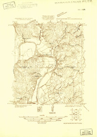
(14)- 1891 Map of Weatherford
 1891 Weatherford1891 Print · USGSParker County and the surrounding ranchlands are shown here in the 1890s as the rail network transformed the region. Researchers can trace early river transport at Powell Ferry or locate vanished sites like Veal Station, Center Mill, and the Bear Creek P.O.
 - 1893 Map of Weatherford
 1893 Weatherford1893 Print · USGSParker County was at a pivotal turning point in the late nineteenth century as railroads began to stitch together the North Texas cattle country. Genealogists and local historians can trace early crossings like Powell Ferry and landmarks like Center Mill or Veal Station.5 unique versions available
 - 1924 Map of Weatherford 3-d
 1924 Weatherford 3-d1924 Print · USGSParker and Hood counties are captured here in the mid-1920s as the river-cut landscape began to see early industrial infrastructure. Genealogists can trace early rural life through Walker School, the Hightower Bridge, and several family-named creek branches.
 - 1931 Map of Dennis
 1931 Dennis1931 Print · USGSThe Brazos River winds along the Parker and Hood County line in the 1920s, a landscape defined by riverside homesteads. Genealogists can trace family roots through rural landmarks like Walker Sch, Nightower Bridge, and the community of Robertson.
 - 1954 Map of Dallas, 1963 Print
 1954 Dallas1963 Print · USGSNorth Texas in the mid-fifties and early sixties reveals a landscape of rapid urban growth and water management. Genealogists and historians can trace the evolution of the metroplex through landmarks like Hensley Field, Boles Orphan Home, and the Texas & Pacific RR.4 unique versions available
 - 1958 Map of Dallas
 1958 Dallas1958 Print · USGSNorth Texas in the late fifties shows the dramatic expansion of the Metroplex as it absorbs surrounding farm towns. Genealogists and historians can trace old rail lines like the Missouri-Kansas-Texas and locate early lakefront developments at Eagle Mountain Lake and Lake Worth Village.
 - 1959 Map of Tin Top, 1960 Print
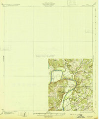
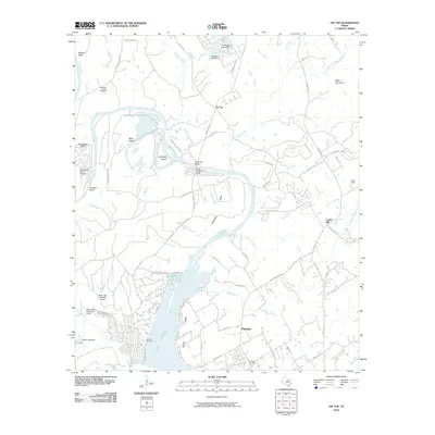
 1959 Tin Top1960 Print · USGSThe Brazos River loop defines this Parker and Hood County landscape in the late fifties, where rural life focused on tight-knit river valley communities. Genealogists can trace family footprints at Haring Cem, New Prospect Ch, and the settlement of Tin Top.4 unique versions available
 - 1959 Map of Dennis, 1960 Print
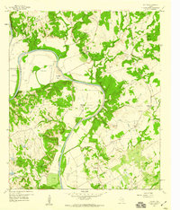
 1959 Dennis1960 Print · USGSParker and Hood Counties are shown in the late fifties as the Brazos River meanders through a landscape of historic crossings and valley settlements. Researchers can trace rural lineages through numerous sites like Tin Top Sch, Center Mill, and the Bethel Cem.
 - 1985 Map of Fort Worth
 1985 Fort Worth1985 Print · USGSMid-1980s Tarrant County and Parker County emerge from a transition between urban sprawl and rural cattle country. Researchers can trace the expansion of Fort Worth and Arlington alongside older landmarks like Nebo Mtn and Kikapoo Falls.2 unique versions available
 - 2010 Map of Tin Top, 2010 Print
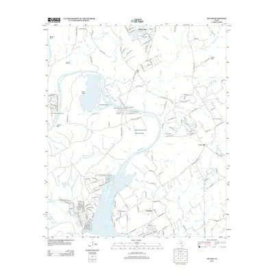
 2010 Tin Top2010 Print · USGSCovers Tin Top, including Center Mill, Fairview, and other nearby areas
 - 2012 Map of Tin Top, 2012 Print
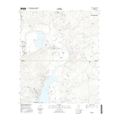
 2012 Tin Top2012 Print · USGSCovers Tin Top, including Center Mill, Fairview, and other nearby areas
 - 2016 Map of Tin Top, 2016 Print
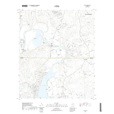
 2016 Tin Top2016 Print · USGSCovers Tin Top, including Center Mill, Fairview, and other nearby areas
 - 2019 Map of Tin Top, 2019 Print
 2019 Tin Top2019 Print · USGSCovers Tin Top, including Center Mill, Fairview, and other nearby areas
 - 2022 Map of Tin Top, 2022 Print
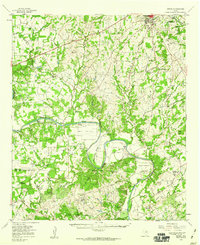
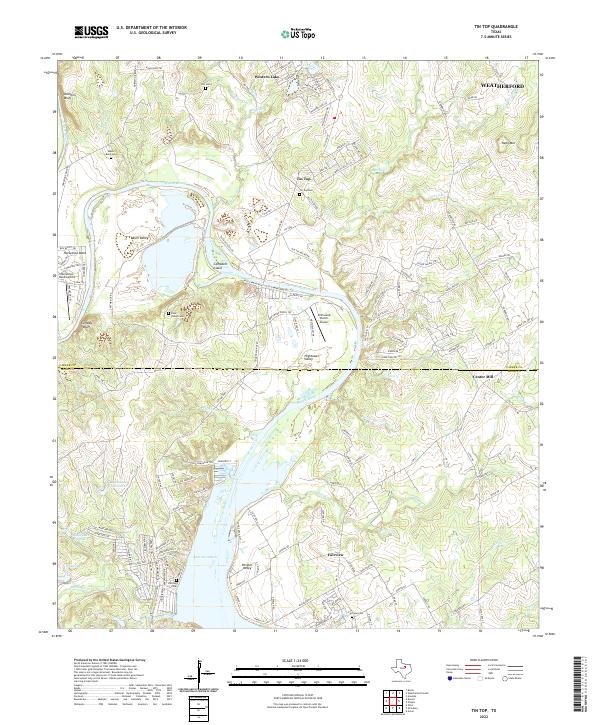 2022 Tin Top2022 Print · USGSThe Brazos River meanders through the Texas countryside between Parker and Hood Counties in the early 2020s. Researchers can locate several burial grounds like Irby Cem and Fairview Cem, alongside the industrial TXI Plant and the site of Center Mill.
End of results
Showing maps 1-14 of 14
Top cities near Tin Top
- Fort Worth historical maps
- Weatherford historical maps
- Mineral Wells historical maps
- Granbury historical maps
- Willow Park historical maps
- Aledo historical maps
See more
Frequently asked questions
- What are the different types of historical maps available for Tin Top?
- What is the oldest map of Tin Top?
- Where can I purchase historical maps of Tin Top for my home or office?
- Where can I download high-res historical maps of Tin Top?
- Are there historical topographic maps available for Tin Top?
- Is there historical aerial imagery available for Tin Top?
- Where are historical maps of Tin Top sourced from?