Old Maps of Polk County, Texas for Metal Detecting
Plan your next treasure hunt with 205 historic maps of Polk County. Find old homesites, ghost towns, trails, and gathering spots that may be lost to time — perfect for identifying promising metal detecting locations.
- Locate forgotten sites: Uncover places like long-lost settlements, abandoned rail lines, or gathering spots.
- Plan better hunts: Use map overlays combined with LiDAR or satellite views to narrow in on historically rich areas.
- Made for detectorists: Thousands of hobbyists use these maps to discover relics, coins, and hidden history.
Use these historic maps to boost your research and find new opportunities beneath the surface of Polk County.
Polk County, TX maps
(205)- 1927 Map of Lufkin 4-c
 1927 Lufkin 4-c1927 Print · USGSDeep in the Piney Woods during the late twenties, this survey documents the winding Neches River and the rural communities of Polk County. Researchers can locate the Pluck PO, Seaman Ridge Sch, and the path of the Beaumont Trinity and Sabine.
 - 1928 Map of Lufkin 4-d
 1928 Lufkin 4-d1928 Print · USGSDeep in the East Texas bottomlands during the late 1920s, the river systems dictate the shape of local life and county lines. Genealogists can trace family footprints near Lambert Chapel or the rural Crane Sch and Delview Sch.
 - 1932 Map of Manning
 1932 Manning1932 Print · USGSDeep in the Piney Woods during the early thirties, this area shows the intersection of three counties along the Neches River. Genealogists can trace family footprints at Havard Cem or follow the old Waco Beaumont Trinity and Sabine Railway to Pluck PO.3 unique versions available
 - 1943 Map of Liberty
 1943 Liberty1943 Print · USGSLiberty and the surrounding Big Thicket are documented here during the early twentieth-century boom in timber and oil. Researchers can locate vanished landmarks such as the Yellow School House, trace family lands like Mears Ranch, and follow the path of the Old Tram through the river bottomlands.
 - 1953 Map of Palestine, 1964 Print
 1953 Palestine1964 Print · USGSEast Texas was defined by its deep pine forests and burgeoning energy sector in the mid-1950s. Genealogists and historians can trace the rail-and-river economy through settlements like Tennessee Colony and Pollok or explore the early footprints of the Cayuga Oil Field and Davy Crockett National Forest.2 unique versions available
 - 1954 Map of Beaumont, 1964 Print
 1954 Beaumont1964 Print · USGSSoutheast Texas in the mid-fifties reveals a landscape of massive national forests, emerging reservoirs, and a booming oil economy. Genealogists and researchers can trace rural settlements like Dallardsville and Village Mills or locate early drilling sites at Sour Lake Oil Field.3 unique versions available
 - 1955 Map of Saratoga, 1956 Print
 1955 Saratoga1956 Print · USGSHardin County oil and timber industries are on full display in the mid-fifties, showing the region's dense baygalls and rail towns. Genealogists and historians can trace family sites at Mt Calvary Ch or the Saratoga Oil Field.4 unique versions available
 - 1955 Map of Camden, 1956 Print
 1955 Camden1956 Print · USGSThe deep piney woods of Polk and Tyler Counties are shown here during the mid-fifties, when timber industry rails still threaded the hills. Researchers can trace the layout of Camden and Chester or locate family sites like the Darden Palestine Sch Ch and Peach Tree Village Cem.2 unique versions available
 - 1955 Map of Rayburn, 1957 Print
 1955 Rayburn1957 Print · USGSDeep in East Texas during the mid-fifties, this survey reveals the intricate oxbows of the Trinity River and the rural communities of Tarkington Prairie. Genealogists can locate family landmarks like Concord Cem and the Tarkington Prairie Sch.2 unique versions available
 - 1955 Map of New Willard, 1957 Print
 1955 New Willard1957 Print · USGSPolk County at the height of the 1950s reveals a landscape of East Texas timber towns and essential rail corridors. Genealogists and historians can trace family roots through numerous rural sites like Bold Springs Ch, Seven Oaks, and the Leggett-Alexander Cem.3 unique versions available
 - 1957 Map of Beaumont
 1957 Beaumont1957 Print · USGSSoutheast Texas in the mid-fifties is defined by the timber-rich lands between the Trinity River and Beaumont. Trace the history of the Alabama and Coushatti Indian Reservation or locate early campus sites like Prairie View College.
 - 1957 Map of Palestine
 1957 Palestine1957 Print · USGSEast Texas in the mid-fifties reveals a landscape of deep pine forests and winding river valleys before the era of massive reservoir construction. Researchers can trace the legacy of the timber and rail industries through labels for the Missouri Pacific RR, Davy Crockett National Forest, and Nacogdoches.
 - 1958 Map of Livingston, 1960 Print
 1958 Livingston1960 Print · USGSThe Piney Woods of East Texas are captured here during a period of industrial expansion, centered on the Livingston rail and oil hub. Researchers can trace the path of the Texas and New Orleans RR or locate rural sites like Drews Landing and Mt Moriah Ch.2 unique versions available
 - 1958 Map of Segno, 1960 Print
 1958 Segno1960 Print · USGSDeep in the East Texas Piney Woods during the late fifties, this area shows the intersection of tribal lands and the burgeoning oil industry. Genealogists can locate family sites near Indian Village, Segno, and the Midway Cem.2 unique versions available
 - 1960 Map of Blanchard, 1961 Print
 1960 Blanchard1961 Print · USGSEast Texas river life is captured here in the early sixties along the winding Trinity River on the Polk County border. Genealogists and local historians can trace the Old Railroad Grade or locate family sites near Blanchard, Garner Chapel, and Tigerville.3 unique versions available
 - 1960 Map of Colita, 1961 Print
 1960 Colita1961 Print · USGSThe Trinity and Polk county line comes alive in the early sixties, showing a landscape defined by the winding Kickapoo Creek. Genealogists and local historians can locate the Bethel Cem and rural gathering places like Colita Ch and Bethel Ch.3 unique versions available
 - 1960 Map of Carlisle, 1962 Print
 1960 Carlisle1962 Print · USGSThe Trinity River valley at the start of the 1960s reveals a landscape of small churches, family cemeteries, and old transit corridors. Genealogists and local historians can locate the Patricks Ferry site, the Pointblank School, and family landmarks like Darby Hill.3 unique versions available
 - 1960 Map of Stephen Creek, 1962 Print
 1960 Stephen Creek1962 Print · USGSThe East Texas piney woods and Trinity River bottomlands are captured here at the start of the 1960s. Researchers can locate family landmarks like the Paul Horton Memorial Ch, Liberty Hill Cem, and the Willow Springs Lookout.3 unique versions available
 - 1960 Map of Camilla, 1962 Print
 1960 Camilla1962 Print · USGSSan Jacinto County in the early sixties remains a landscape of dense timber and river bottomlands within the Sam Houston National Forest. Genealogists and local historians can trace family locations at Sweet Home, search for ancestors at Gorman Cem, or locate the Old RR Grade in the woods.4 unique versions available
 - 1961 Map of Onalaska, 1962 Print
 1961 Onalaska1962 Print · USGSThe rural landscape of Polk County is documented here in the early sixties, showing the area's transition through established timber and creek-bottom communities. Genealogists and historians can locate family landmarks like Robinett Cem, trace the Old Railroad Grade, and find the Tin Top Ch meeting house.4 unique versions available
 - 1963 Map of Diboll, 1966 Print
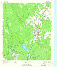 1963 Diboll1966 Print · USGSDiboll and the surrounding Angelina County timberlands are shown in the early sixties as the regional lumber industry flourished. Researchers can trace the junction of the Texas South-Eastern railroad, locate Clarks Ferry, or find family sites near McCarty Cem.2 unique versions available
 - 1963 Map of Trevat, 1966 Print
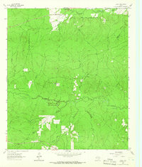 1963 Trevat1966 Print · USGSTrinity and Polk counties are shown in the early sixties as the timber industry and national forest management shaped the local landscape. Researchers can locate the Sulphur Springs Ch, trace the Old Railroad Grade, and find family sites like Abbott Springs Cem.3 unique versions available
 - 1963 Map of Wolf Hill, 1966 Print
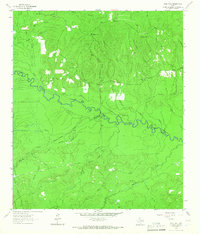 1963 Wolf Hill1966 Print · USGSDeep in the Piney Woods during the early sixties, the Neches River valley reveals a landscape of family-run cemeteries and old timber routes. Trace the Old Railroad Grade and find historic sites like Lambert Chapel or the Wolf Hill Lookout Tower.2 unique versions available
 - 1963 Map of Wakefield, 1966 Print
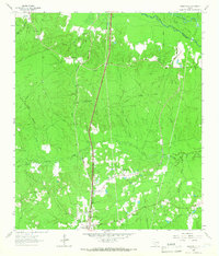 1963 Wakefield1966 Print · USGSPolk County timberlands and river bottoms are documented here in the early sixties, showing the transition from old rail corridors to modern transit. Researchers can find Wakefield family landmarks, Knox Cem, and the path of the Southern Pacific railroad.3 unique versions available
 - 1963 Map of Pluck, 1966 Print
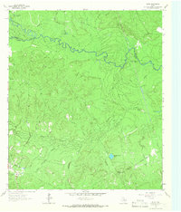 1963 Pluck1966 Print · USGSThe bottomlands of the Neches River are captured here in the early sixties, showing a landscape defined by timber-era infrastructure and rural outposts. Genealogists can locate Grimes Cem and Stryker Cem while tracing the Old Railroad Grade near Pluck.2 unique versions available
Showing maps 1-25 of 205
Top cities of Polk County
- Livingston historical maps
- Corrigan historical maps
- Onalaska historical maps
- Goodrich historical maps
- Seven Oaks historical maps
Frequently asked questions
- What are the different types of historical maps available for Polk County?
- What is the oldest map of Polk County?
- Where can I purchase historical maps of Polk County for my home or office?
- Where can I download high-res historical maps of Polk County?
- Are there historical topographic maps available for Polk County?
- Is there historical aerial imagery available for Polk County?
- Where are historical maps of Polk County sourced from?