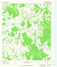
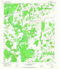
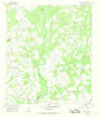
1960s Maps of Robertson County, Texas
Explore 26 historic maps of Robertson County from the 1960s. These maps offer a rare glimpse into what life looked like during the 1960s — showing old roads, neighborhoods, homes, and landmarks that have changed or disappeared over time.
Whether you're researching your family's past, planning a metal detecting trip, or studying how Robertson County's landscape evolved across the 1960s, these high-resolution maps are a powerful tool for exploring the history of this region.
- Focus on a specific era: All maps on this page are from the 1960s, giving you a focused view of this time period.
- See what’s changed: Compare century-old streets, trails, and buildings to today's modern landscape using overlays and satellite layers.
- Research with precision: Use these maps for genealogy, historical research, land use analysis, or educational projects.
- View, download, or print: Maps are fully viewable online in high resolution, and can be downloaded or printed for your own records.
Start exploring Robertson County's history through authentic maps from the 1960s. This is your window into the past.
Robertson County, TX maps
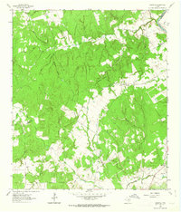
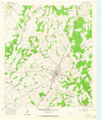
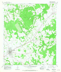
(26)- 1961 Map of Mumford, 1964 Print
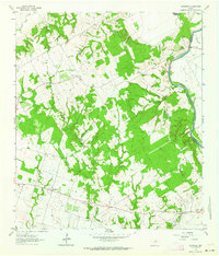
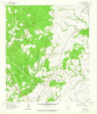
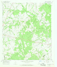
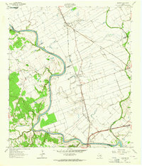 1961 Mumford1964 Print · USGSThe Brazos River valley in the early sixties is a landscape of rural junctions and historic outposts at the meeting point of four counties. Researchers can locate the Fort Tenoxtitlan (Site), the rail sidings at Mudville, and local landmarks like Smith Sch.3 unique versions available
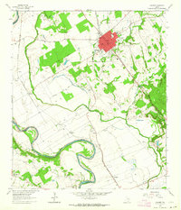
 - 1961 Map of Hearne North, 1964 Print
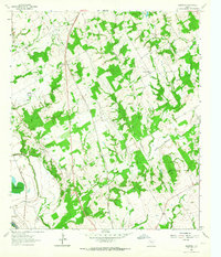
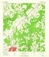 1961 Hearne North1964 Print · USGSHearne and the surrounding Robertson County prairies are captured in the early sixties as a bustling rail and transit hub. Genealogists can locate family landmarks like Hammond Colony, Blackshear High Sch, and the Norwood Cem among the creek breaks.2 unique versions available
 - 1961 Map of Baileyville, 1964 Print
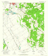
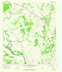
 1961 Baileyville1964 Print · USGSIn the early sixties, this rural intersection of Milam, Falls, and Robertson Counties was defined by its winding river bottomlands and family farmsteads. Researchers can locate family landmarks like Bozeman Cem, Morning Star Ch, and the Hooper Ranch.2 unique versions available
 - 1961 Map of Hearne South, 1964 Print
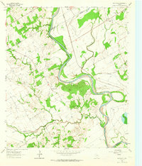
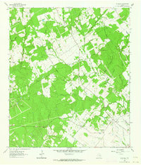
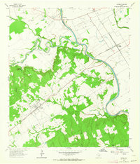
 1961 Hearne South1964 Print · USGSRailroad operations in the Brazos Valley defined the early 1960s landscape near the Milam and Robertson County line. Genealogists and local historians can trace the footprint of rural communities through sites like Tatsie Crossing, St Luke Cem, and the Blackshear High Sch.3 unique versions available
 - 1962 Map of Goodwill, 1963 Print
 1962 Goodwill1963 Print · USGSThe rural borderlands of Burleson and Milam counties are captured here in the early 1960s, centered on the community of Hix. Genealogists and local historians can trace the foundations of this area through St Mathews Ch, the Hix Cem, and family-named hollows like Bailey Hollow.2 unique versions available
 - 1962 Map of Edge, 1964 Print
 1962 Edge1964 Print · USGSRobertson and Brazos counties in the early sixties remain a landscape of small rural settlements and family cemeteries. Genealogy researchers can trace local roots at Edge, Shiloh Ch, and the historic Kings Highway that cuts through the region.2 unique versions available
 - 1962 Map of Calvert, 1964 Print
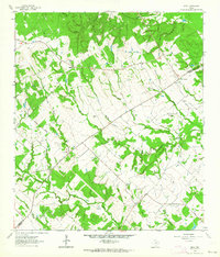
 1962 Calvert1964 Print · USGSCentral Robertson County's agricultural and rail heart is captured here in the early sixties. Researchers can trace family roots through the Calvert Cem, identify local schools like Spikes High Sch, and locate rural settlements near Marvin and Barton.3 unique versions available
 - 1962 Map of Wheelock, 1964 Print
 1962 Wheelock1964 Print · USGSIn the early 1960s, the Robertson and Brazos county line was a landscape of rural schoolhouse-era churches and family cemeteries. Researchers can find ancestral sites at Wheelock Cem, Cavit Cem, and the historic Henry Prairie Ch.3 unique versions available
 - 1962 Map of Maysfield, 1964 Print
 1962 Maysfield1964 Print · USGSMilam County farming communities and the Brazos River valley are captured here in the early sixties. Researchers can locate numerous family-history sites like Harlin Chapel Cem, the Maysfield Sch, and the riverside crossing at Black Bridge.2 unique versions available
 - 1962 Map of Hammond, 1964 Print
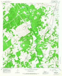
 1962 Hammond1964 Print · USGSThe rural Robertson County landscape comes alive in this early 1960s survey, showing a time when small communities were still centered around their country schools and churches. Genealogists and historians can trace family roots through landmarks like Hammond High Sch, Bethlehem Cem, and Mt Moriah Ch.3 unique versions available
 - 1962 Map of Reagan, 1964 Print
 1962 Reagan1964 Print · USGSThe Brazos River valley in the early sixties remains a landscape of rail-side settlements and rural congregations. Researchers can trace family history through Washington Cem, Bowman Chapel, and the communities of Highbank and Reagan.2 unique versions available
 - 1962 Map of Gause, 1964 Print
 1962 Gause1964 Print · USGSMilam and Robertson counties are captured here in the early sixties as the rail and river networks defined local life. Trace the old river port at Port Sullivan or locate ancestral sites like Nashville Cem and Stephen Chapel near the town of Gause.2 unique versions available
 - 1962 Map of Bremond, 1964 Print
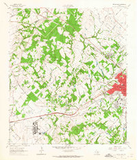
 1962 Bremond1964 Print · USGSBremond was a bustling railroad town in the early sixties, anchored by the Southern Pacific line and a tight-knit community of schools and churches. Genealogists can trace family names through several rural burial grounds including St Mary Cem and Cloverleaf Rest Cem.2 unique versions available
 - 1962 Map of Petteway, 1964 Print
 1962 Petteway1964 Print · USGSThe rural borderlands of Robertson and Limestone counties come into focus in the early sixties. Genealogists and local historians can trace family-named watercourses and community landmarks like Post Oak Sch, Petteway Ch, and the waters of Hurricane Creek.2 unique versions available
 - 1962 Map of Owensville, 1964 Print
 1962 Owensville1964 Print · USGSIn the heart of Robertson County during the early sixties, this map captures the dispersed settlements and family burial grounds of central Texas. Genealogists can locate Anderson Cem, Owensville Cem, and the rail corridor of the Missouri Pacific.2 unique versions available
 - 1962 Map of Bryan West, 1965 Print
 1962 Bryan West1965 Print · USGSBrazos County in the early sixties shows the westward expansion of Bryan toward the Little Brazos River. Trace family roots at Rest-Ever Memorial Cem or explore the rail-side life in Smetana and Benchley.4 unique versions available
 - 1963 Map of Dunn Creek, 1964 Print
 1963 Dunn Creek1964 Print · USGSRobertson and Brazos counties in the early sixties reveal a landscape of creek-side settlements and early frontier history. Researchers can trace family roots at Walker Settlement Cem and locate the historic Dunns Fort (Site) or the railroad stop at Alexander.2 unique versions available
 - 1964 Map of Hilltop Lakes, 1967 Print
 1964 Hilltop Lakes1967 Print · USGSMid-century development meets rural Texas tradition in this Leon County survey as the aviation-themed resort of Hilltop Lakes begins to take shape. Researchers can trace family roots through the Greer Cem and explore the older settlements of Wealthy and Normangee.2 unique versions available
 - 1965 Map of Marquez, 1967 Print
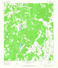
 1965 Marquez1967 Print · USGSLeon and Robertson counties are captured here in the mid-sixties, dominated by the winding path of the NAVASOTA RIVER. Genealogists can trace rural communities like Venetia and locate several burial sites including Holly Cem and Kaster Cem.2 unique versions available
 - 1965 Map of Camp Creek Lake, 1967 Print
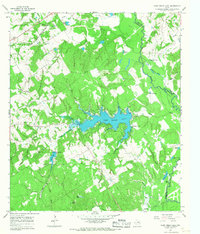 1965 Camp Creek Lake1967 Print · USGSRobertson County's wooded creek bottoms and newly impounded waters are captured here in the mid-sixties as the rural landscape adapted to new reservoirs. Genealogists and local historians can locate the community of Easterly, the Missouri Pacific rail line, and quiet landmarks like Hoxie Chapel Cem and Elm Grove Ch.2 unique versions available
 - 1965 Map of Franklin, 1968 Print
 1965 Franklin1968 Print · USGSRobertson County in the mid-sixties centers on the railroad economy of Franklin and its neighboring rural settlements. Genealogists and local historians can trace the foundations of New Baden and Easterly, or locate family sites at New Baden Cem and Mt Pleasant Ch.2 unique versions available
 - 1965 Map of Bald Prairie, 1968 Print
 1965 Bald Prairie1968 Print · USGSMid-century Robertson County is captured here during a period of quiet rural transition. Genealogists and local researchers can trace family roots at West Boone Prairie Ch, Wesley Chapel, and the East Boone Prairie Cem along the banks of Duck Creek.2 unique versions available
 - 1965 Map of Canary, 1968 Print
 1965 Canary1968 Print · USGSMadison and Leon counties are mapped here in the mid-sixties, showing a landscape of river bottoms and rural landings. Genealogists can locate family landmarks like Plainview Cem, Manning Ch, and the crossing at Bundy Crossing.2 unique versions available
 - 1966 Map of Round Prairie, 1968 Print
 1966 Round Prairie1968 Print · USGSThe tri-county borderlands of Leon, Limestone, and Robertson counties are captured here in the mid-1960s. Genealogists can trace family heritage through numerous burial sites like Seale-Round Prairie Cem and Grayson Cem near the Navasota River.3 unique versions available
 - 1966 Map of Kosse East, 1969 Print
 1966 Kosse East1969 Print · USGSThe community of Kosse and the Southern Pacific rail line define this central Texas landscape during the mid-1960s. Genealogists and local historians can trace numerous rural burial grounds and sanctuaries, including Eutaw Cem, Shady Grove Ch, and Buttrill Cem.2 unique versions available
Showing maps 1-25 of 26
Top cities of Robertson County
Frequently asked questions
- What are the different types of historical maps available for Robertson County?
- What is the oldest map of Robertson County?
- Where can I purchase historical maps of Robertson County for my home or office?
- Where can I download high-res historical maps of Robertson County?
- Are there historical topographic maps available for Robertson County?
- Is there historical aerial imagery available for Robertson County?
- Where are historical maps of Robertson County sourced from?