1900s (20th Century) Maps of Runnels County, Texas
Explore 49 historic maps of Runnels County from the 1900s (20th Century). These maps offer a rare glimpse into what life looked like during the 1900s — showing old roads, neighborhoods, homes, and landmarks that have changed or disappeared over time.
Whether you're researching your family's past, planning a metal detecting trip, or studying how Runnels County's landscape evolved across the 1900s, these high-resolution maps are a powerful tool for exploring the history of this region.
- Focus on a specific era: All maps on this page are from the 1900s, giving you a focused view of this time period.
- See what’s changed: Compare century-old streets, trails, and buildings to today's modern landscape using overlays and satellite layers.
- Research with precision: Use these maps for genealogy, historical research, land use analysis, or educational projects.
- View, download, or print: Maps are fully viewable online in high resolution, and can be downloaded or printed for your own records.
Start exploring Runnels County's history through authentic maps from the 1900s. This is your window into the past.
Runnels County, TX maps
(49)- 1921 Map of Baker Flat
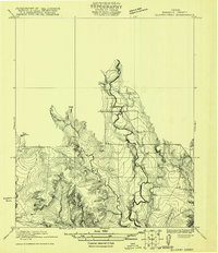
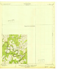
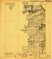 1921 Baker Flat1921 Print · USGSRunnels County ranch lands and rural school districts are captured in this early 1920s survey. Researchers can locate the Red Bank School and trace the drainage of Antelope Creek through the Baker Flat area.
 - 1921 Map of Hatchel
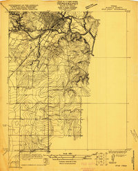
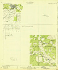
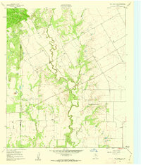
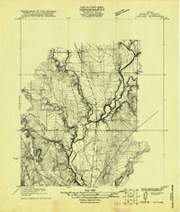 1921 Hatchel1921 Print · USGSRunnels County enters the early twenties as a landscape of creek-side schools and steam-era rail lines. Family historians can locate Eagle School, Runnels School, and the Runnels Cemetery along the Abilene and Southern route.
 - 1921 Map of Lowake
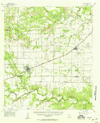
 1921 Lowake1921 Print · USGSLowake and the Concho County ranchlands are captured here in the early 1920s as the railroad drove local commerce. Genealogists and historians can trace the locations of rural schoolhouses like Sweet Home School and Green Wall School near the banks of Little Concho Creek.
 - 1921 Map of Maverick
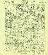
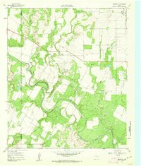
 1921 Maverick1921 Print · USGSThe rural landscape of Runnels and Coke County is captured here in the early 1920s, showing the early infrastructure of the Maverick area. Researchers can locate the Brookshire School and trace the original courses of Oak Creek and the Colorado River.
 - 1921 Map of Quarry Creek
 1921 Quarry Creek1921 Print · USGSRunnels County ranchlands are captured here in the early twenties, showing a landscape defined by deep drainages and rural schoolhouse hubs. Genealogists and researchers can locate family-named landmarks like Barner School, Hagan School, and the winding course of Valley Creek.
 - 1921 Map of Spur Creek
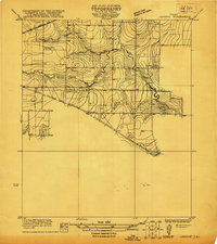
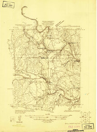
 1921 Spur Creek1921 Print · USGSBallinger and the surrounding Runnels County countryside are captured here in the early 1920s during a period of established riverfront settlement. Genealogists can locate old family-named sites and rural institutions like Big Rock School, Dry Ridge School, and the Gulf Colorado and Santa Fe rail line.
 - 1921 Map of Rowena
 1921 Rowena1921 Print · USGSRunnels County at the start of the 1920s is captured here as a landscape of rural schools and rail-side growth. Genealogists can locate family lands near Rowena and trace the paths to Cross Roads School or Valley Creek School.
 - 1925 Map of Ballinger 3-d
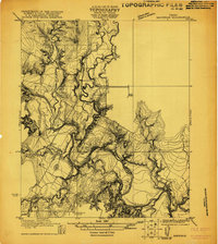
 1925 Ballinger 3-d1925 Print · USGSThe convergence of the Colorado and Concho Rivers is captured here in the mid-1920s as ranching life centered on the water. Local historians can locate river crossings like Hall Ford and rural educational sites such as Mapes School and Currie School.
 - 1925 Map of Ballinger 4-c
 1925 Ballinger 4-c1925 Print · USGSCentral West Texas river valleys are surveyed in the mid-1920s at the junction of three counties. Researchers can locate early rural landmarks like Liberty School and historic river crossings such as Coffee Ford and Trap Crossing.
 - 1932 Map of Voss
 1932 Voss1932 Print · USGSCentral Texas river life in the mid-1920s is documented here along the winding banks of the Concho River. Genealogists and local historians can trace the community of Leaday and several rural schoolhouses like Liberty Sch and Redwire Sch.2 unique versions available
 - 1932 Map of Paint Rock
 1932 Paint Rock1932 Print · USGSThe northern edge of the Edwards Plateau comes into focus in the early 1930s as the rail lines reached into Concho County. Genealogists and historians can trace the rural school districts of the day, including Dry Ridge Sch and Mapes Sch, or locate the family-named bluffs along the Concho River.2 unique versions available
 - 1954 Map of Brownwood, 1955 Print
 1954 Brownwood1955 Print · USGSCentral Texas in the early fifties shows a landscape of rail-linked cattle towns and winding river valleys before modern highway expansion. Genealogists and historians can trace family-named peaks and vanished rail stops like Trickham, Santa Anna, and the Brady Mountains.3 unique versions available
 - 1954 Map of Big Spring, 1965 Print
 1954 Big Spring1965 Print · USGSWest Texas in the mid-1950s shows a landscape of growing oil towns and vital rail links along the Texas and Pacific RR. Researchers can trace the development of Big Spring, find smaller settlements like Knott and Lomax, or locate landmarks such as Boyds Chapel and Signal Mountain.4 unique versions available
 - 1954 Map of Abilene, 1966 Print
 1954 Abilene1966 Print · USGSThe Texas Big Country comes into focus in the mid-1950s as petroleum and new water projects reshape the landscape. Local historians can trace the Butterfield Trail, find the Fort Phantom Hill Ruins, and locate numerous small communities along the Texas & Pacific line.2 unique versions available
 - 1954 Map of San Angelo, 1967 Print
 1954 San Angelo1967 Print · USGSThe Concho Valley and eastern Permian Basin transition from ranching to a burgeoning oil economy during the mid-twentieth century. Trace the expansion of San Angelo near Goodfellow AFB and locate old crossroads like Stiles, Texon, and Barnhart along the SANTA FE railroad.2 unique versions available
 - 1957 Map of Miles, 1958 Print
 1957 Miles1958 Print · USGSRunnels and Tom Green Counties are shown in the late fifties as the regional economy balanced between rail-side agriculture and a growing oil industry. Genealogists can locate several burial sites including Evergreen Cem and Protestant Cem, or trace early river crossings like 10 Mile Crossing.
 - 1958 Map of San Angelo
 1958 San Angelo1958 Print · USGSWest Texas in the late fifties centers on the growing hub of San Angelo and its vital river confluences. Genealogists and historians can trace the paths of the Santa Fe railroad to outposts like Fort Chadbourne, Big Lake, and the specialized community of Sanatorium.
 - 1958 Map of Big Spring
 1958 Big Spring1958 Print · USGSThe West Texas oil boom was in full swing during the late fifties, transforming the landscape around Howard and Mitchell counties. Genealogists and historians can trace the growth of Big Spring and Snyder alongside industrial landmarks like the Kelly-Snyder Oil Field and the Santa Fe rail lines.
 - 1958 Map of Abilene
 1958 Abilene1958 Print · USGSMid-century West Texas comes alive in this survey of the Abilene and Stephenville region during a period of steady oil expansion and military growth. Genealogists and local historians can trace the paths of the Texas & Pacific RR through historic towns, locate the Fort Griffin Ruins, and find smaller settlements like Desdemona and Lueders.
 - 1961 Map of Maverick, 1962 Print
 1961 Maverick1962 Print · USGSRunnels and Coke counties are captured here in the early sixties as the ranching and oil economies shaped the land. Genealogists can trace family sites at Maverick Cem, Norton Cem, and Brookshier Ch along the winding Colorado River.2 unique versions available
 - 1961 Map of Hog Mountain, 1962 Print
 1961 Hog Mountain1962 Print · USGSThe West Texas frontier meets the mid-century oil boom along the Coke and Runnels county line in the early sixties. Historians and genealogists can trace the site of Fort Chadbourne, the former settlement at Marie (Site), and the secluded Hall Cem.2 unique versions available
 - 1961 Map of Herring Ranch, 1962 Print
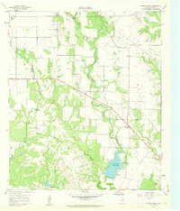 1961 Herring Ranch1962 Print · USGSRunnels County ranch lands and oil fields are captured here in the early sixties as the petroleum industry expanded across the West Texas prairie. Researchers can trace rural family sites like Herring Ranch and Nihues or locate the Valley View Ch near the shores of Ballinger City Lake.2 unique versions available
 - 1961 Map of Wilmeth, 1987 Print
 1961 Wilmeth1987 Print · USGSRunnels County ranching and early oil production are captured here at the dawn of the 1960s. Genealogists can trace family footprints near Wilmeth, Old Norton Ch, and Wilmeth Cem as the landscape began to show the mark of new pipelines.
 - 1965 Map of San Angelo
 1965 San Angelo1965 Print · USGSWest Texas in the mid-sixties reveals a landscape shaped by the petroleum industry and strategic water management. Genealogists and historians can trace the rail corridor through Texon and Big Lake, or locate military landmarks like Goodfellow AFB and Broome Air Force Auxiliary Airfield.
 - 1967 Map of Hatchel, 1969 Print
 1967 Hatchel1969 Print · USGSRunnels County in the late sixties shows the intersection of the Abilene and Southern rail line and a network of winding creeks. Researchers can locate the Old Runnels Cem and traces of local life at the Rodeo Ground or the Drive-in Theater.2 unique versions available
Showing maps 1-25 of 49
Top cities of Runnels County
Frequently asked questions
- What are the different types of historical maps available for Runnels County?
- What is the oldest map of Runnels County?
- Where can I purchase historical maps of Runnels County for my home or office?
- Where can I download high-res historical maps of Runnels County?
- Are there historical topographic maps available for Runnels County?
- Is there historical aerial imagery available for Runnels County?
- Where are historical maps of Runnels County sourced from?