1960s Maps of Runnels County, Texas
Explore 22 historic maps of Runnels County from the 1960s. These maps offer a rare glimpse into what life looked like during the 1960s — showing old roads, neighborhoods, homes, and landmarks that have changed or disappeared over time.
Whether you're researching your family's past, planning a metal detecting trip, or studying how Runnels County's landscape evolved across the 1960s, these high-resolution maps are a powerful tool for exploring the history of this region.
- Focus on a specific era: All maps on this page are from the 1960s, giving you a focused view of this time period.
- See what’s changed: Compare century-old streets, trails, and buildings to today's modern landscape using overlays and satellite layers.
- Research with precision: Use these maps for genealogy, historical research, land use analysis, or educational projects.
- View, download, or print: Maps are fully viewable online in high resolution, and can be downloaded or printed for your own records.
Start exploring Runnels County's history through authentic maps from the 1960s. This is your window into the past.
Runnels County, TX maps
(22)- 1961 Map of Maverick, 1962 Print
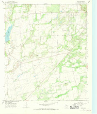
 1961 Maverick1962 Print · USGSRunnels and Coke counties are captured here in the early sixties as the ranching and oil economies shaped the land. Genealogists can trace family sites at Maverick Cem, Norton Cem, and Brookshier Ch along the winding Colorado River.2 unique versions available
 - 1961 Map of Hog Mountain, 1962 Print
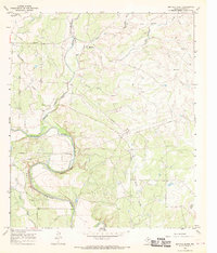
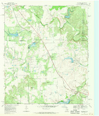
 1961 Hog Mountain1962 Print · USGSThe West Texas frontier meets the mid-century oil boom along the Coke and Runnels county line in the early sixties. Historians and genealogists can trace the site of Fort Chadbourne, the former settlement at Marie (Site), and the secluded Hall Cem.2 unique versions available
 - 1961 Map of Herring Ranch, 1962 Print
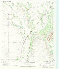
 1961 Herring Ranch1962 Print · USGSRunnels County ranch lands and oil fields are captured here in the early sixties as the petroleum industry expanded across the West Texas prairie. Researchers can trace rural family sites like Herring Ranch and Nihues or locate the Valley View Ch near the shores of Ballinger City Lake.2 unique versions available
 - 1961 Map of Wilmeth, 1987 Print
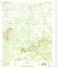
 1961 Wilmeth1987 Print · USGSRunnels County ranching and early oil production are captured here at the dawn of the 1960s. Genealogists can trace family footprints near Wilmeth, Old Norton Ch, and Wilmeth Cem as the landscape began to show the mark of new pipelines.
 - 1965 Map of San Angelo
 1965 San Angelo1965 Print · USGSWest Texas in the mid-sixties reveals a landscape shaped by the petroleum industry and strategic water management. Genealogists and historians can trace the rail corridor through Texon and Big Lake, or locate military landmarks like Goodfellow AFB and Broome Air Force Auxiliary Airfield.
 - 1967 Map of Hatchel, 1969 Print
 1967 Hatchel1969 Print · USGSRunnels County in the late sixties shows the intersection of the Abilene and Southern rail line and a network of winding creeks. Researchers can locate the Old Runnels Cem and traces of local life at the Rodeo Ground or the Drive-in Theater.2 unique versions available
 - 1967 Map of Talpa, 1969 Print
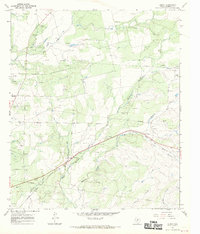
 1967 Talpa1969 Print · USGSColeman County saw a landscape defined by ranching and the oil industry in the late sixties. Genealogists and historians can trace the Atchison Topeka and Santa Fe rail line through Talpa and locate family plots at Herring Cem or Glen Cove Cem.2 unique versions available
 - 1967 Map of Concho, 1969 Print
 1967 Concho1969 Print · USGSThe Texas ranchlands at the Concho and Colorado River confluence appear in high detail during the late sixties. Local researchers can trace the rural settlement of Concho, locate the community Cem, and explore the riverfront near Deadmans Bluff and Fuzzy.3 unique versions available
 - 1967 Map of Novice West, 1969 Print
 1967 Novice West1969 Print · USGSThe West Texas ranchlands and oil fields of Coleman and Runnels Counties are captured here in the late sixties. Genealogists can trace family names and local landmarks through sites like Atoka Cem, Crews Cem, and the railroad town of Novice.2 unique versions available
 - 1967 Map of Church Peak, 1969 Print
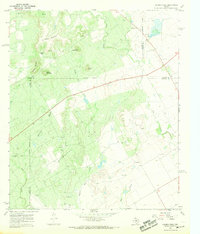 1967 Church Peak1969 Print · USGSWest Texas ranching and oil production meet at the borders of Runnels and Coke counties during the late sixties. Genealogists and historians can locate the Fort Chadbourne (Site) and trace industrial activity at Fort Chadbourne Field and the Refinery.2 unique versions available
 - 1967 Map of Little Grape Creek, 1969 Print
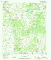
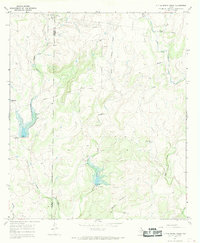 1967 Little Grape Creek1969 Print · USGSThe border of Runnels and Coleman counties in the late sixties reveals a landscape of ranching and early energy development. Researchers can trace the industrial footprint of Oil Wells and Gas Wells alongside local water features like Little Grape Creek and Elm Creek.3 unique versions available
 - 1967 Map of Leaday, 1969 Print
 1967 Leaday1969 Print · USGSThe convergence of the Colorado and Concho Rivers defines this Central Texas landscape in the late sixties. Genealogists can locate family burial sites at Gann Cem and Leaday Cem, or trace the winding course of Little Grape Creek.2 unique versions available
 - 1967 Map of Wingate, 1969 Print
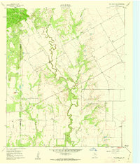
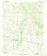
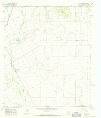 1967 Wingate1969 Print · USGSWingate and the surrounding West Texas oil fields are captured here in the late 1960s. Researchers can trace the rural communities of Pumphrey and Sliger, locate family graves at Pumphrey Cem, and follow the winding course of Valley Creek.
 - 1967 Map of Paint Rock, 1969 Print
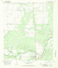 1967 Paint Rock1969 Print · USGSThe Concho River valley in the late sixties reveals a landscape of ancient history and mid-century utility at the county line. Researchers can trace the layout of Paint Rock and Olfen, or locate landmarks like the Indian Pictographs and St Boniface Ch.2 unique versions available
 - 1967 Map of Buffalo Bluff, 1969 Print
 1967 Buffalo Bluff1969 Print · USGSRunnels County as it appeared in the late sixties reveals a landscape shaped by the winding Colorado River and local resource extraction. Researchers can locate the Hoffman Cem and trace the path of the AT & SF railroad near Mustang Creek.3 unique versions available
 - 1967 Map of Benoit, 1970 Print
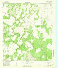
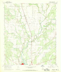
 1967 Benoit1970 Print · USGSIn the late 1960s, this area of Runnels County was a hub of railroad activity and petroleum extraction. Genealogists and researchers can trace the Atchison Topeka and Santa Fe line as it passes through Benoit or locate family sites near Norwood Cem.
 - 1967 Map of Ballinger, 1970 Print
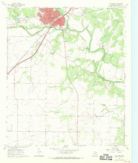 1967 Ballinger1970 Print · USGSBallinger and the surrounding Texas plains are captured here in the late sixties as the local economy balanced rail transport and oil production. Researchers can trace the legacy of the Atchison Topeka and Santa Fe and locate family landmarks like Evergreen Cem and Carver Sch.2 unique versions available
 - 1967 Map of Winters, 1970 Print
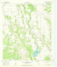
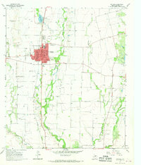 1967 Winters1970 Print · USGSMid-century Runnels County comes to life in this detailed record of Winters, showing the town's growth alongside the Abilene and Southern rail line. Genealogists and local historians can locate several burial grounds like Northview Cem or trace the development of Old Lake Winters.2 unique versions available
 - 1967 Map of Crews, 1970 Print
 1967 Crews1970 Print · USGSRunnels County in the late sixties shows a landscape balancing cattle ranching with a maturing petroleum industry. Genealogists and historians can trace local landmarks like Harmony Ch, the community of Crews, and the sprawling Sykes Oil Field.2 unique versions available
 - 1967 Map of Goldsboro, 1970 Print
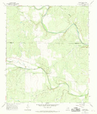
 1967 Goldsboro1970 Print · USGSCentral Texas ranching and oil country come into focus in the late sixties as petroleum development reshaped the quad-county borderlands. Genealogists and historians can trace family-named peaks, the Midway Cem, and old stops like Goldsboro or Tokeen (Content).
 - 1967 Map of Bradshaw, 1971 Print
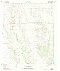
 1967 Bradshaw1971 Print · USGSRunnels and Taylor Counties are captured here in the late sixties as the local economy balanced ranching with oil exploration. Genealogists and researchers can trace the Abilene and Southern rail line past Bradshaw and Drasco, locating old Oil Wells and a rural Cem.
 - 1967 Map of Bald Knob, 1979 Print
 1967 Bald Knob1979 Print · USGSRunnels and Taylor Counties are captured here in the late sixties during a period of active petroleum production and ranching. Researchers can locate remote burial sites at Dewey Cem and Counts Cem or trace the Abilene & Southern rail line.
End of results
Showing maps 1-22 of 22
Top cities of Runnels County
Frequently asked questions
- What are the different types of historical maps available for Runnels County?
- What is the oldest map of Runnels County?
- Where can I purchase historical maps of Runnels County for my home or office?
- Where can I download high-res historical maps of Runnels County?
- Are there historical topographic maps available for Runnels County?
- Is there historical aerial imagery available for Runnels County?
- Where are historical maps of Runnels County sourced from?