Old Maps of San Jacinto County, Texas for Metal Detecting
Plan your next treasure hunt with 59 historic maps of San Jacinto County. Find old homesites, ghost towns, trails, and gathering spots that may be lost to time — perfect for identifying promising metal detecting locations.
- Locate forgotten sites: Uncover places like long-lost settlements, abandoned rail lines, or gathering spots.
- Plan better hunts: Use map overlays combined with LiDAR or satellite views to narrow in on historically rich areas.
- Made for detectorists: Thousands of hobbyists use these maps to discover relics, coins, and hidden history.
Use these historic maps to boost your research and find new opportunities beneath the surface of San Jacinto County.
San Jacinto County, TX maps
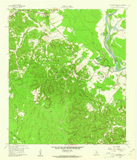
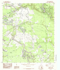
(59)- 1943 Map of Liberty
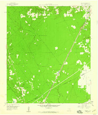
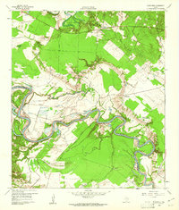
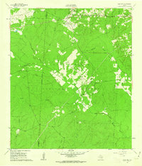
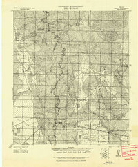 1943 Liberty1943 Print · USGSLiberty and the surrounding Big Thicket are documented here during the early twentieth-century boom in timber and oil. Researchers can locate vanished landmarks such as the Yellow School House, trace family lands like Mears Ranch, and follow the path of the Old Tram through the river bottomlands.
 - 1954 Map of Beaumont, 1964 Print
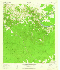
 1954 Beaumont1964 Print · USGSSoutheast Texas in the mid-fifties reveals a landscape of massive national forests, emerging reservoirs, and a booming oil economy. Genealogists and researchers can trace rural settlements like Dallardsville and Village Mills or locate early drilling sites at Sour Lake Oil Field.3 unique versions available
 - 1955 Map of Rayburn, 1957 Print
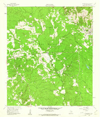
 1955 Rayburn1957 Print · USGSDeep in East Texas during the mid-fifties, this survey reveals the intricate oxbows of the Trinity River and the rural communities of Tarkington Prairie. Genealogists can locate family landmarks like Concord Cem and the Tarkington Prairie Sch.2 unique versions available
 - 1957 Map of Beaumont
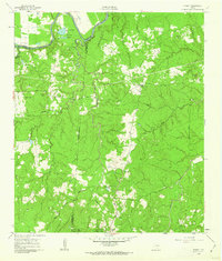
 1957 Beaumont1957 Print · USGSSoutheast Texas in the mid-fifties is defined by the timber-rich lands between the Trinity River and Beaumont. Trace the history of the Alabama and Coushatti Indian Reservation or locate early campus sites like Prairie View College.
 - 1958 Map of Fostoria, 1959 Print
 1958 Fostoria1959 Print · USGSThe timber country of southeast Texas is captured here in the late fifties, centered on the mill town of Fostoria. Researchers can trace old family landmarks and rural life at Pin Oak Cem, Pilgrim Rest Ch, and the logging stops along the Gulf Colorado and Santa Fe railroad.3 unique versions available
 - 1958 Map of Cleveland, 1959 Print
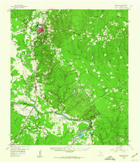
 1958 Cleveland1959 Print · USGSCleveland emerged as a bustling rail and timber crossroads in the late fifties, where major lines met at the edge of the national forest. Genealogists and historians can trace old community anchors like Pin Oak Cem, New Salem Ch, and the outlying settlement of Fostoria.2 unique versions available
 - 1958 Map of Westcott, 1959 Print
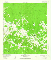
 1958 Westcott1959 Print · USGSThe Piney Woods of San Jacinto County meet the open grasslands in the late fifties, as rail lines drove the local timber economy. Researchers can locate family landmarks like Lovett Cem, the Big Creek Missionary Ch, and the rural school at Dixon High Sch.3 unique versions available
 - 1958 Map of Livingston, 1960 Print
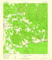
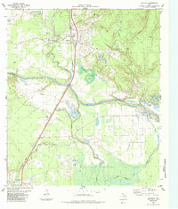
 1958 Livingston1960 Print · USGSThe Piney Woods of East Texas are captured here during a period of industrial expansion, centered on the Livingston rail and oil hub. Researchers can trace the path of the Texas and New Orleans RR or locate rural sites like Drews Landing and Mt Moriah Ch.2 unique versions available
 - 1958 Map of Bear Creek, 1960 Print
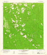 1958 Bear Creek1960 Print · USGSSan Jacinto County in the late fifties was a landscape of dense woodland and emerging oil fields. Researchers can locate family landmarks like Oak Grove, Purkerson Cem, and Montague Ch within the Sam Houston National Forest.3 unique versions available
 - 1959 Map of Conroe NE, 1960 Print
 1959 Conroe NE1960 Print · USGSThe timberlands of East Texas are captured here in the late fifties, showing the deep woods of the Sam Houston National Forest. Researchers can trace the Old Railroad Grade and locate rural landmarks like Hickory Grove Cem and China Grove Ch.3 unique versions available
 - 1960 Map of Blanchard, 1961 Print
 1960 Blanchard1961 Print · USGSEast Texas river life is captured here in the early sixties along the winding Trinity River on the Polk County border. Genealogists and local historians can trace the Old Railroad Grade or locate family sites near Blanchard, Garner Chapel, and Tigerville.3 unique versions available
 - 1960 Map of Maynard, 1962 Print
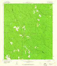
 1960 Maynard1962 Print · USGSSan Jacinto County in the early sixties remains a landscape of dense woods and quiet creek bottoms within the Sam Houston National Forest. Genealogists and historians can trace the foundations of Old Waverly and locate local landmarks like the Old Railroad Grade and Hargrove Cem.3 unique versions available
 - 1960 Map of Trinity East, 1962 Print
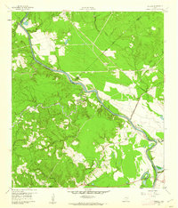
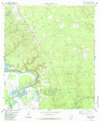
 1960 Trinity East1962 Print · USGSThe community of Trinity and its riverfront surroundings are captured in the early 1960s, showing the intersection of rail and river life. Researchers can trace the Missouri Pacific line or follow the Old Railroad Grade past Skaines Lake and the settlement of Sebastopol.3 unique versions available
 - 1960 Map of Carlisle, 1962 Print
 1960 Carlisle1962 Print · USGSThe Trinity River valley at the start of the 1960s reveals a landscape of small churches, family cemeteries, and old transit corridors. Genealogists and local historians can locate the Patricks Ferry site, the Pointblank School, and family landmarks like Darby Hill.3 unique versions available
 - 1960 Map of Stephen Creek, 1962 Print
 1960 Stephen Creek1962 Print · USGSThe East Texas piney woods and Trinity River bottomlands are captured here at the start of the 1960s. Researchers can locate family landmarks like the Paul Horton Memorial Ch, Liberty Hill Cem, and the Willow Springs Lookout.3 unique versions available
 - 1960 Map of Camilla, 1962 Print
 1960 Camilla1962 Print · USGSSan Jacinto County in the early sixties remains a landscape of dense timber and river bottomlands within the Sam Houston National Forest. Genealogists and local historians can trace family locations at Sweet Home, search for ancestors at Gorman Cem, or locate the Old RR Grade in the woods.4 unique versions available
 - 1960 Map of Coldspring, 1962 Print
 1960 Coldspring1962 Print · USGSColdspring and the surrounding timberlands of San Jacinto County are captured here in the early sixties. Genealogists can trace family roots through numerous remote burial sites like Evergreen Cem and Youngblood Cem, or locate the Coline Oil Field and the Old Railroad Grade.3 unique versions available
 - 1961 Map of Staley, 1962 Print
 1961 Staley1962 Print · USGSDeep in the Piney Woods of the early sixties, this survey shows the rugged creek drainages and forest boundaries along the San Jacinto and Walker county lines. Trace family history through local landmarks like Gospel Hill Sch, Staley (Embryfield), and Community Relief Cem.2 unique versions available
 - 1961 Map of Oakhurst, 1962 Print
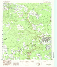
 1961 Oakhurst1962 Print · USGSSan Jacinto and Walker Counties appear here in the early sixties, centered on the interface of the deep woods and rural homesteads. Genealogists can trace family landmarks like White Hill Missionary Ch, the Hoby Cem, and the Old Railroad Grade.3 unique versions available
 - 1984 Map of Beaumont
 1984 Beaumont1984 Print · USGSSoutheast Texas in the late seventies and early eighties shows a landscape of expanding reservoirs and deep timber industry. Researchers can trace the development of the Sam Houston National Forest or locate regional landmarks like Grabbs Prairie and the Wynne State Prison Farm.3 unique versions available
 - 1984 Map of Goodrich
 1984 Goodrich1984 Print · USGSThe Trinity River valley and the Southern Pacific rail corridor are captured here during the mid-1980s. Researchers can locate family landmarks like Lake Pool Cem, rural congregations at Shiloh Ch, and the industrial footprint of the Goodrich Oil Field.
 - 1984 Map of Schwab City
 1984 Schwab City1984 Print · USGSDeep in the Piney Woods during the mid-eighties, this area shows a landscape defined by the Trinity River and the local petroleum industry. Genealogists and historians can trace the community life of Schwab City and Ace through landmarks like Blue Water Cem and Menard Ch.
 - 1984 Map of Rayburn, 1985 Print
 1984 Rayburn1985 Print · USGSLiberty and San Jacinto Counties in the mid-1980s show a landscape of rural settlements and winding bayous along the Trinity River. Researchers can trace family sites near Shepherd, locate the Lookout Tower, and find old Cemeteries near Hightower and Dolen.
 - 1984 Map of Romayor, 1985 Print
 1984 Romayor1985 Print · USGSThe Trinity River bottomlands of East Texas come alive in the mid-eighties, showing the intersection of Liberty, San Jacinto, and Polk counties. Genealogists and local historians can trace family-named sites like Mc Anally Break or locate the Fields Landing Strip and Horn Crossing.
 - 1985 Map of Conroe
 1985 Conroe1985 Print · USGSSoutheast Texas in the mid-eighties shows a landscape of timberlands and new lakeside developments. Researchers can trace the legacy of rail lines like the Southern Pacific RR or locate rural communities such as Plantersville, Yarboro, and Hufsmith.2 unique versions available
Showing maps 1-25 of 59
Top cities of San Jacinto County
Frequently asked questions
- What are the different types of historical maps available for San Jacinto County?
- What is the oldest map of San Jacinto County?
- Where can I purchase historical maps of San Jacinto County for my home or office?
- Where can I download high-res historical maps of San Jacinto County?
- Are there historical topographic maps available for San Jacinto County?
- Is there historical aerial imagery available for San Jacinto County?
- Where are historical maps of San Jacinto County sourced from?