1930s Maps of San Saba County, Texas
Explore 3 historic maps of San Saba County from the 1930s. These maps offer a rare glimpse into what life looked like during the 1930s — showing old roads, neighborhoods, homes, and landmarks that have changed or disappeared over time.
Whether you're researching your family's past, planning a metal detecting trip, or studying how San Saba County's landscape evolved across the 1930s, these high-resolution maps are a powerful tool for exploring the history of this region.
- Focus on a specific era: All maps on this page are from the 1930s, giving you a focused view of this time period.
- See what’s changed: Compare century-old streets, trails, and buildings to today's modern landscape using overlays and satellite layers.
- Research with precision: Use these maps for genealogy, historical research, land use analysis, or educational projects.
- View, download, or print: Maps are fully viewable online in high resolution, and can be downloaded or printed for your own records.
Start exploring San Saba County's history through authentic maps from the 1930s. This is your window into the past.
San Saba County, TX maps
(3)- 1930 Map of Richland Springs
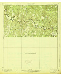 1930 Richland Springs1930 Print · USGSThe Colorado River divides Mills and San Saba counties in the late 1920s, a period defined by small-town farming and ranching. You can trace early family sites through several river crossings and community hubs like Hanna Valley Cem and the Jones Valley Sch.
 - 1931 Map of Bend
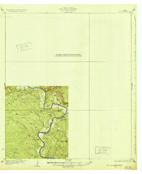
 1931 Bend1931 Print · USGSThe confluence of the Colorado and San Saba rivers in the mid-1920s reveals a rural Texas landscape of river crossings and country schools. Genealogists can trace early homesteads near Bend, the Bend Cem, and several local schoolhouses like Colony Sch.2 unique versions available
 - 1932 Map of Tow
 1932 Tow1932 Print · USGSThe Colorado River valley along the Llano and Burnet county line is captured here in the mid-1920s, before the landscape was altered by dams. Researchers can locate the settlement of Bluffton, the Bluffton Sch, and the river crossing at Saltworks Ford.2 unique versions available
End of results
Showing maps 1-3 of 3
Top cities of San Saba County
Frequently asked questions
- What are the different types of historical maps available for San Saba County?
- What is the oldest map of San Saba County?
- Where can I purchase historical maps of San Saba County for my home or office?
- Where can I download high-res historical maps of San Saba County?
- Are there historical topographic maps available for San Saba County?
- Is there historical aerial imagery available for San Saba County?
- Where are historical maps of San Saba County sourced from?