1980s Maps of San Saba County, Texas
Explore 9 historic maps of San Saba County from the 1980s. These maps offer a rare glimpse into what life looked like during the 1980s — showing old roads, neighborhoods, homes, and landmarks that have changed or disappeared over time.
Whether you're researching your family's past, planning a metal detecting trip, or studying how San Saba County's landscape evolved across the 1980s, these high-resolution maps are a powerful tool for exploring the history of this region.
- Focus on a specific era: All maps on this page are from the 1980s, giving you a focused view of this time period.
- See what’s changed: Compare century-old streets, trails, and buildings to today's modern landscape using overlays and satellite layers.
- Research with precision: Use these maps for genealogy, historical research, land use analysis, or educational projects.
- View, download, or print: Maps are fully viewable online in high resolution, and can be downloaded or printed for your own records.
Start exploring San Saba County's history through authentic maps from the 1980s. This is your window into the past.
San Saba County, TX maps
(9)- 1980 Map of Big Valley North
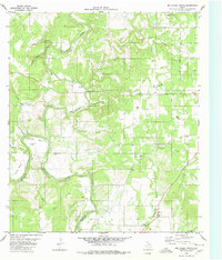 1980 Big Valley North1980 Print · USGSThe Colorado River and Pecan Bayou come together along the Mills and San Saba county line during the late 1970s. Genealogists can trace deep local roots at rural sites like Big Valley Cem, Estep Cem, and the Big Valley Ch.2 unique versions available
 - 1980 Map of Bowser
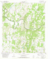 1980 Bowser1980 Print · USGSThe Colorado River corridor near the San Saba and Mills County line comes to life in this mid-1970s study. Genealogists and local historians can trace family ties at Vargy Chapel, Oakland Church, and the Bowser Cemetery near the old Bowser settlement.
 - 1980 Map of Blucher Mountain
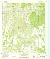 1980 Blucher Mountain1980 Print · USGSThe ranching country of San Saba County is documented here during the late seventies, showing a landscape defined by scattered settlements and seasonal creeks. Genealogists can locate family landmarks like Old Algerita Cem or trace the environs of Bethel and Fairview.
 - 1980 Map of Regency
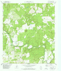 1980 Regency1980 Print · USGSThe Colorado River marks the county line in this central Texas landscape during the late seventies. Researchers can locate rural landmarks like Regency, the Ridge Community Hall, and family sites at Hollis Cem or Mesquite Cem.
 - 1980 Map of San Saba Peak
 1980 San Saba Peak1980 Print · USGSThe Colorado River marks the county lines of San Saba and Mills in the late 1970s, framing a landscape of isolated peaks and river bends. Researchers can locate family landmarks such as Nabors Creek Cem and Shaw Bend Cem near the slopes of San Saba Peak.
 - 1985 Map of Brady
 1985 Brady1985 Print · USGSMcCulloch and Concho counties during the mid-1980s show a landscape of small ranching communities tied together by the Atchison Topeka and Santa Fe rail line. Researchers can trace rural developments like West Sweden, Pear Valley, and the waters of the Brady Reservoir.2 unique versions available
 - 1985 Map of San Saba
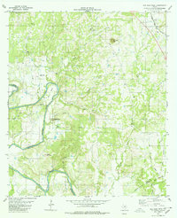
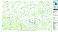
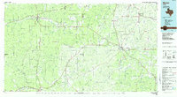
 1985 San Saba1985 Print · USGSCentral Texas in the mid-eighties was a landscape of river-valley ranching and quiet railroad towns. Researchers can trace family history through sites like San Saba Cem, follow the Atchison Topeka and Santa Fe line, or explore landmarks near Pecan Bayou.2 unique versions available
 - 1985 Map of Mason
 1985 Mason1985 Print · USGSMason and Menard counties in the 1980s showcase a landscape defined by the rugged Mason Mountains and the winding San Saba River. Researchers can trace old community lines and landmarks from the County Airport to the rural outposts of London and Fredonia.2 unique versions available
 - 1985 Map of Llano
 1985 Llano1985 Print · USGSThe Texas Hill Country and Highland Lakes come into focus in the mid-1980s, showcasing the intersection of traditional ranching and modern lakeside growth. Researchers can locate vanished schoolhouses and family burial sites like Valley Spring Sch, Babyhead Cem, and the rural community of Oatmeal.
End of results
Showing maps 1-9 of 9
Top cities of San Saba County
Frequently asked questions
- What are the different types of historical maps available for San Saba County?
- What is the oldest map of San Saba County?
- Where can I purchase historical maps of San Saba County for my home or office?
- Where can I download high-res historical maps of San Saba County?
- Are there historical topographic maps available for San Saba County?
- Is there historical aerial imagery available for San Saba County?
- Where are historical maps of San Saba County sourced from?