Old Maps of San Saba County, Texas for Academic Research
Study the evolution of San Saba County with 203 high-resolution historic maps. Whether you're teaching, researching, or modeling changes in land use, these maps provide essential visual documentation of urban, environmental, and geographic change.
- Analyze long-term change: Track patterns in development, transportation, and natural features.
- Ideal for environmental or urban studies: Support academic projects with primary historical map data.
- Use in the classroom or lab: Educators and researchers rely on these maps to bring historical context to life.
These maps are a powerful tool for teaching, research, and visualizing how San Saba County has changed over the decades.
San Saba County, TX maps
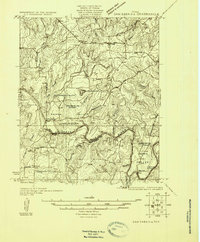
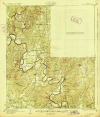
(203)- 1885 Map of San Saba
 1885 San Saba1885 Print · USGSCentral Texas in the late nineteenth century comes alive through this survey of the river valleys and high knobs. Genealogists and researchers can trace the early foundations of San Saba and Goldthwaite, or find forgotten locations like Regency and Bendy.
 - 1887 Map of Llano
 1887 Llano1887 Print · USGSThe Texas Hill Country emerges as a frontier of granite peaks and river valleys in the mid-1880s. Researchers can locate early settlements like Castell and Baby Head, or trace the rugged topography of Enchanted Rock and Pack Saddle Mountain.
 - 1887 Map of Lampasas
 1887 Lampasas1887 Print · USGSThe Lampasas region in the late 1880s shows the arrival of the Gulf Colorado and Santa Fe Railroad alongside early frontier settlements. Local historians can trace old post offices and milling sites like Townsen Mills, Wayback, and Senterfitt among the numerous gaps and peaks of the Hill Country.
 - 1887 Map of Mason
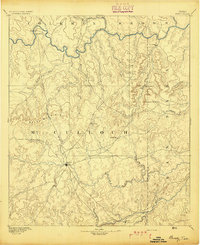
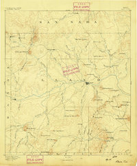
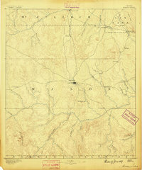 1887 Mason1887 Print · USGSThe Texas Hill Country comes into focus during the late frontier era, centering on the vital cattle and trade crossroads of Mason. Researchers can trace early German-Texan settlements and rural post offices including Loyal Valley, Hoersterville, and Fredonia.
 - 1887 Map of Burnet
 1887 Burnet1887 Print · USGSCentral Texas in the late nineteenth century is defined here by the arrival of the rail line and the wild course of the Colorado River. Genealogists and historians can trace early settlements and transit points like Tiger Mill, Bluffton, and Wolf Crossing.
 - 1893 Map of Burnet
 1893 Burnet1893 Print · USGSThe Texas Hill Country comes alive in this late nineteenth-century survey, showcasing a landscape of river crossings and early rail expansion. Researchers can locate vanished communities and rural landmarks like Tiger Mill, Wolf Crossing, and the old depot at Bertram.
 - 1894 Map of Brady
 1894 Brady1894 Print · USGSCentral Texas ranching country comes to life in the late nineteenth century as regional hubs begin to take shape. Genealogists and researchers can trace early settlements and river crossings like Waldrip, Milburn, and the hilltop landmark of Lookout Mountain.5 unique versions available
 - 1894 Map of Mason
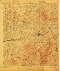
 1894 Mason1894 Print · USGSTexas Hill Country ranching and frontier life are captured here in the 1890s, centered on the growing county seat. Genealogists can trace family-named settlements like Bodeville and Hoersterville or remote outposts like Camp San Saba.4 unique versions available
 - 1894 Map of Lampasas
 1894 Lampasas1894 Print · USGSLampasas and the surrounding hill country are shown in the years following the arrival of the rail. Genealogists can trace family-named landmarks like Kinchelo Peak and old post offices at Senterfitt, Nix, and Wayback.4 unique versions available
 - 1894 Map of San Saba
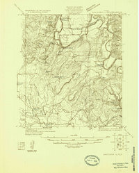
 1894 San Saba1894 Print · USGSCentral Texas in the late nineteenth century is defined here by the meeting of the San Saba River and the Colorado River. Researchers can trace the path of the Gulf Colorado and Santa Fe Railroad near Goldthwaite or locate early settlements like Richland Springs and Red Bluff.4 unique versions available
 - 1894 Map of Llano
 1894 Llano1894 Print · USGSThe Llano Uplift of Central Texas is captured here in the late nineteenth century as a landscape of remote ranching outposts and granite peaks. Genealogists and historians can trace the early layouts of Llano, Castell, and the community of Baby Head.
 - 1903 Map of Burnet
 1903 Burnet1903 Print · USGSThe Texas Hill Country at the turn of the century shows a landscape of river-side industry and early rail expansion. Trace the historic Houston and Texas Central Railroad line through Burnet and Bertram or locate long-standing landmarks like Morman Mill and Tanyard Crossing.
 - 1904 Map of Llano
 1904 Llano1904 Print · USGSThe Texas Hill Country around the turn of the century centered on the rail hub of Llano and the winding Llano River. Genealogists can trace early homesteads like Kuykendall's Ranch and locate remote landmarks such as Hesterville Church and the Iron Mine.
 - 1909 Map of Llano
 1909 Llano1909 Print · USGSCentral Texas at the first decade of the new century shows a landscape of cattle ranches and growing rail towns. Genealogists can locate family landmarks such as Atkinson's Ranch, Oxford, and rural social centers like Kennedy School or Wooten Church.3 unique versions available
 - 1909 Map of Burnet
 1909 Burnet1909 Print · USGSThe Texas Hill Country at the turn of the century shows a landscape of river crossings and rail towns before the creation of the Highland Lakes. Genealogists can locate family-named landmarks like Morman Mill, Tumlinson, and rural schoolhouses such as Berry School or Sunny Lane.3 unique versions available
 - 1918 Map of Llano
 1918 Llano1918 Print · USGSThe Llano River country during the Great War era reveals a landscape of isolated cattle ranches and early mining efforts. Genealogists can trace family landmarks like Atkinson's Ranch and Taylorville or locate long-gone community centers like Kennedy School and Wooten Church.
 - 1925 Map of San Saba 4-a
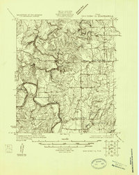
 1925 San Saba 4-a1925 Print · USGSTexas river life in the mid-twenties is defined by the winding paths of the Colorado and San Saba rivers as they meet near San Saba County. Genealogists can trace early rural communities through Bend Cem and a network of country schools including Colony School and Harmony Ridge School.
 - 1925 Map of San Saba 2-a
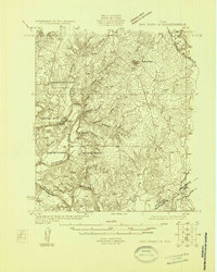
 1925 San Saba 2-a1925 Print · USGSMills and San Saba counties are shown in the mid-1920s as rural ranching communities centered on the Colorado River. Genealogists and historians can trace family roots through the Hanna Valley Cem, Ratler, and the Mesquite Church.
 - 1925 Map of Brady 1-a
 1925 Brady 1-a1925 Print · USGSCentral Texas river country and ranchland are captured in the mid-1920s as early highway networks began to reach remote crossings. Researchers can locate early rural landmarks like Elm Grove Church, Holt School, and the settlement of Milburn.
 - 1925 Map of San Saba 1-c
 1925 San Saba 1-c1925 Print · USGSThe Colorado River valley at the border of Mills and San Saba Counties comes alive in this 1920s survey. Genealogists and local historians can trace the rural school districts of Big Valley School and Liveoak School or locate old river fords like Ogilby Crossing.
 - 1925 Map of San Saba 1-b
 1925 San Saba 1-b1925 Print · USGSMills and San Saba counties are shown during the mid-1920s as the Colorado River winds through a landscape of rural schools and crossings. Researchers can trace early community hubs like Big Valley Church, Ebony School, and the remote Goughenor Crossing.
 - 1925 Map of San Saba 2-b
 1925 San Saba 2-b1925 Print · USGSCentral Texas river life in the mid-twenties is centered here on the winding COLORADO RIVER. You can trace rural family roots at Bowser Cemetery and locate vanished schools like Indian Cr School and Oakland School.
 - 1925 Map of San Saba 1-d
 1925 San Saba 1-d1925 Print · USGSThe Colorado River corridor between Mills and San Saba counties is captured here in the mid-1920s. Genealogists can locate rural community hubs like Nabors Creek School and Shaw Bend School or trace the early Santa Fe rail line.
 - 1928 Map of Mercury
 1928 Mercury1928 Print · USGSCentral Texas river country comes to life in the late 1920s as the railroad connects small cattle towns near the four-county junction. Trace family roots at Mercury and Winchell, or locate old landmarks like Elm Grove Church and Holt School.
 - 1928 Map of Goldthwaite
 1928 Goldthwaite1928 Print · USGSThe Colorado River snakes through the Mills and San Saba county line during the mid-twenties, a time of small schoolhouses and river fords. Genealogists can trace family landmarks like San Saba Peak, Big Valley Church, and the Rock Spring School.
Showing maps 1-25 of 203
Top cities of San Saba County
Frequently asked questions
- What are the different types of historical maps available for San Saba County?
- What is the oldest map of San Saba County?
- Where can I purchase historical maps of San Saba County for my home or office?
- Where can I download high-res historical maps of San Saba County?
- Are there historical topographic maps available for San Saba County?
- Is there historical aerial imagery available for San Saba County?
- Where are historical maps of San Saba County sourced from?