1980s Maps of Shelby County, Texas
Explore 25 historic maps of Shelby County from the 1980s. These maps offer a rare glimpse into what life looked like during the 1980s — showing old roads, neighborhoods, homes, and landmarks that have changed or disappeared over time.
Whether you're researching your family's past, planning a metal detecting trip, or studying how Shelby County's landscape evolved across the 1980s, these high-resolution maps are a powerful tool for exploring the history of this region.
- Focus on a specific era: All maps on this page are from the 1980s, giving you a focused view of this time period.
- See what’s changed: Compare century-old streets, trails, and buildings to today's modern landscape using overlays and satellite layers.
- Research with precision: Use these maps for genealogy, historical research, land use analysis, or educational projects.
- View, download, or print: Maps are fully viewable online in high resolution, and can be downloaded or printed for your own records.
Start exploring Shelby County's history through authentic maps from the 1980s. This is your window into the past.
Shelby County, TX maps
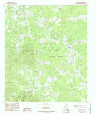
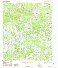
(25)- 1984 Map of Union Springs
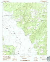 1984 Union Springs1984 Print · USGSThe Louisiana-Texas borderlands are defined by the rising waters of the Toledo Bend Reservoir in this mid-eighties survey. Family historians can trace colonial property lines in the Las Ormigas Grant and locate the settlement of Union Springs.
 - 1984 Map of Brushy Creek
 1984 Brushy Creek1984 Print · USGSThe Sabine River and Toledo Bend Reservoir define this 1980s borderland between Texas and Louisiana. Genealogists and historians can trace old property lines within the Sabine National Forest and locate the historic Las Ormigas Grant Lot No 1.
 - 1984 Map of East Hamilton
 1984 East Hamilton1984 Print · USGSThe Texas-Louisiana borderlands appear in the mid-eighties as the forest meets the massive waters of the Toledo Bend Reservoir. Researchers can trace old family sites near East Hamilton and Isla or locate cemeteries along the Patroon Bayou.
 - 1984 Map of Huxley
 1984 Huxley1984 Print · USGSThe Texas-Louisiana borderlands in the early 1980s are defined here by the intersection of the Sabine National Forest and the Toledo Bend Reservoir. Genealogists and local historians can trace the corporate limits of Huxley and locate family-named landmarks like Mason Lake and Star Spring.
 - 1984 Map of Logansport East
 1984 Logansport East1984 Print · USGSThe Louisiana-Texas borderlands in the early eighties were defined by the rising waters of the Toledo Bend Reservoir. Local historians can trace the creek-side settlements of Stanley and Logansport or locate family-named landmarks like Cawthorn Lake and Southerland Bottom.
 - 1984 Map of Palestine
 1984 Palestine1984 Print · USGSEast Texas in the mid-eighties reveals a landscape of massive reservoirs and protected timberlands between Palestine and Nacogdoches. Researchers can trace old routes like the Missouri Pacific RR and locate rural communities such as Tennessee Colony, Latexo, and Etoile.3 unique versions available
 - 1984 Map of Logansport West
 1984 Logansport West1984 Print · USGSThe borderlands along the Sabine River in the mid-1980s show a region shaped by timber and the Toledo Bend Reservoir. Local researchers can trace family lands near Joaquin, Logansport, and the rural community of Fellowship.
 - 1984 Map of Center, 1985 Print
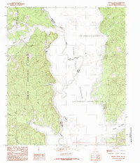
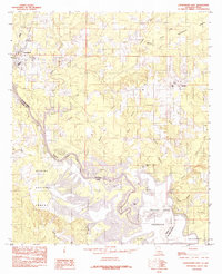
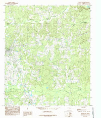
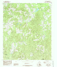
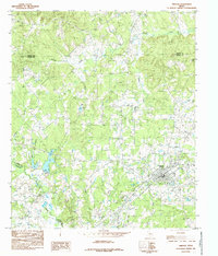
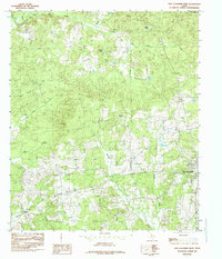
 1984 Center1985 Print · USGSShelby County's seat is shown during a period of steady growth in the mid-eighties, balancing its rural roots with modern infrastructure. Local historians can trace the town's footprint from the Municipal Airport to landmarks like the Drive-In Theater and Rodeo Ground.
 - 1984 Map of San Augustine East, 1985 Print
 1984 San Augustine East1985 Print · USGSSan Augustine and the surrounding timberlands are captured here in the early 1980s as the town grew toward the forest edge. Researchers can trace rural lineages through local place names like Black Ankle, Lanetown, and White Rock.
 - 1984 Map of Hurstown, 1985 Print
 1984 Hurstown1985 Print · USGSShelby County in the mid-1980s is shown here as a landscape of deep timber and winding bayous. Genealogists and local historians can trace the rural communities of Hurstown and East Liberty, or locate landmarks like Doggett Spring and Big Hill.
 - 1984 Map of Tenaha East, 1985 Print
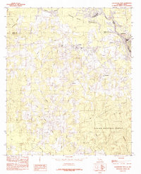
 1984 Tenaha East1985 Print · USGSShelby County near the Sabine River valley comes into focus during the mid-1980s, showing a landscape defined by timber and transit. Researchers can trace the rail-side growth of Tenaha and Paxton or locate family-named landmarks like Woods Ch and Mc Faddin.
 - 1984 Map of Garrison East, 1985 Print
 1984 Garrison East1985 Print · USGSEast Texas ranching and timber country is well-defined in the 1980s as the borders of Rusk and Shelby counties meet. Researchers can trace rural settlement patterns at Garrison, locate old homesteads near Silas, and find family landmarks along the Attoyac River.
 - 1984 Map of Shelbyville, 1985 Print
 1984 Shelbyville1985 Print · USGSShelby County, Texas, is captured in the mid-1980s, showcasing the rural communities and forest lands surrounding Shelbyville. Researchers can trace the layout of old settlements and local landmarks like Antioch Ch, Plum, and the winding Tenaha Creek.
 - 1984 Map of Neuville, 1985 Print
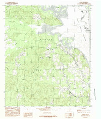
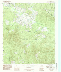
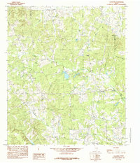
 1984 Neuville1985 Print · USGSShelby County in the mid-1980s reveals a landscape of dispersed settlements and winding creek branches during a period of steady rural character. Genealogists and local historians can locate early communities like Neuville, Choice, and Short, or trace the banks of Lake Center.
 - 1984 Map of Timpson, 1985 Print
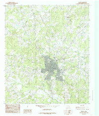
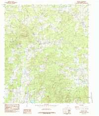
 1984 Timpson1985 Print · USGSTimpson and the surrounding East Texas timberlands are captured here in the mid-1980s, showcasing the area's complex river systems. Researchers can trace the winding Attoyac River or locate local landmarks like Rose Hill, a Gravel Pit, and various Cem sites.
 - 1984 Map of Mount Herman, 1985 Print
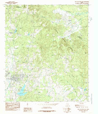
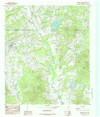
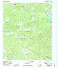
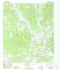
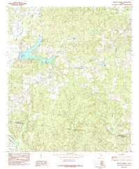 1984 Mount Herman1985 Print · USGSShelby County in the early eighties shows a landscape of winding creeks and new infrastructure. Genealogists and local historians can trace the early footprint of Pinkston Reservoir and locate the small settlements of Mount Herman and Aiken.
 - 1984 Map of Patroon South, 1985 Print
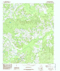
 1984 Patroon South1985 Print · USGSEast Texas timberlands and local bayous define the landscape during the mid-1980s as the regional economy centers on the forest. Researchers can locate family landmarks in Patroon, trace the drainage of Patroon Bayou, and explore the wooded heights of the Matlock Hills.
 - 1984 Map of Tenaha West, 1985 Print
 1984 Tenaha West1985 Print · USGSEast Texas ranching and timber country is captured here in the 1980s as it spans the border of Panola and Shelby Counties. Genealogists and local historians can trace family-named sites like Porter Hill, the Tennessee Cem, and the rural community of Bobo.
 - 1984 Map of Patroon North, 1985 Print
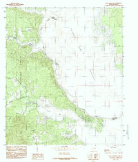
 1984 Patroon North1985 Print · USGSThe East Texas piney woods and the shoreline of the Toledo Bend Reservoir define this mid-1980s landscape. Researchers can locate small communities like Dreka and Patroon or trace family sites near Goober Hill and several local Cem plots.
 - 1984 Map of Arcadia, 1985 Print
 1984 Arcadia1985 Print · USGSShelby County in the early eighties shows a landscape defined by timber and the winding tributaries of the Sabine River basin. Researchers can trace rural cemetery sites and old local centers like Arcadia, Huber, and the forest Lookout Tower.
 - 1984 Map of Caledonia, 1985 Print
 1984 Caledonia1985 Print · USGSEast Texas rural life in the early eighties is centered around the confluence of the Attoyac River and the borders of Rusk, Panola, and Shelby counties. Genealogists can trace small settlements like Caledonia, Concord, and Arlam alongside old cemeteries and local Gravel Pits.
 - 1984 Map of San Augustine West, 1985 Print
 1984 San Augustine West1985 Print · USGSSan Augustine County in the early eighties remains a landscape of dense woods and small rural outposts. Genealogists can trace family roots through the scattered sites of Ironosa, Denning, and Union Ch along the banks of Big Iron Ore Creek.
 - 1984 Map of Martinsville, 1985 Print
 1984 Martinsville1985 Print · USGSNacogdoches County in the mid-1980s was a landscape of dense creek bottoms and small upland settlements where three East Texas counties meet. Local researchers can trace old family land near Martinsville, locate rural Cem sites, and follow the winding Attoyac River.
 - 1986 Map of Natchitoches
 1986 Natchitoches1986 Print · USGSNorthwestern Louisiana during the mid-eighties shows a landscape shaped by major water projects and timberlands. Researchers can trace historic routes like the Old Spanish Trail or locate rural communities such as Fort Jesup, Fairview Alpha, and Grappes Bluff.2 unique versions available
 - 1986 Map of Nacogdoches
 1986 Nacogdoches1986 Print · USGSDeep in the East Texas Piney Woods during the mid-eighties, this landscape centers on Nacogdoches and the sprawling Toledo Bend Reservoir. Genealogists can trace family footprints at Sulphur Springs Cem, Oak Grove Ch, and the many small settlements like Reklaw and Sacul.
End of results
Showing maps 1-25 of 25
Top cities of Shelby County
- Center historical maps
- Timpson historical maps
- Tenaha historical maps
- Joaquin historical maps
- Huxley historical maps
Frequently asked questions
- What are the different types of historical maps available for Shelby County?
- What is the oldest map of Shelby County?
- Where can I purchase historical maps of Shelby County for my home or office?
- Where can I download high-res historical maps of Shelby County?
- Are there historical topographic maps available for Shelby County?
- Is there historical aerial imagery available for Shelby County?
- Where are historical maps of Shelby County sourced from?