1950s Maps of Starr County, Texas
Explore 6 historic maps of Starr County from the 1950s. These maps offer a rare glimpse into what life looked like during the 1950s — showing old roads, neighborhoods, homes, and landmarks that have changed or disappeared over time.
Whether you're researching your family's past, planning a metal detecting trip, or studying how Starr County's landscape evolved across the 1950s, these high-resolution maps are a powerful tool for exploring the history of this region.
- Focus on a specific era: All maps on this page are from the 1950s, giving you a focused view of this time period.
- See what’s changed: Compare century-old streets, trails, and buildings to today's modern landscape using overlays and satellite layers.
- Research with precision: Use these maps for genealogy, historical research, land use analysis, or educational projects.
- View, download, or print: Maps are fully viewable online in high resolution, and can be downloaded or printed for your own records.
Start exploring Starr County's history through authentic maps from the 1950s. This is your window into the past.
Starr County, TX maps
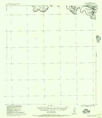
(6)- 1954 Map of McAllen
 1954 McAllen1954 Print · USGSCovers Starr County, including Reynosa, McAllen, and other nearby areas
 - 1956 Map of Garcias
 1956 Garcias1956 Print · USGSThe Rio Grande borderlands of South Texas are captured here during the mid-twentieth century as the regional ranching economy flourished. Researchers can trace ancestral family lands like the Stephen Garcia Ranch or locate vanished sites including the Brick Yard and La Grulla Sta.
 - 1956 Map of Los Ebanos
 1956 Los Ebanos1956 Print · USGSThe Rio Grande borderlands of South Texas are captured here as they appeared between the world wars. Genealogists and local historians can trace family-named sites like Antonio de la Banco and early river settlements including Los Ebanos and Havana.
 - 1956 Map of Escobares
 1956 Escobares1956 Print · USGSThe Texas borderlands along the Rio Grande appear here during the transition to the mid-century, dominated by historic ranching estates. Researchers can trace family legacies at Escobares Ranch or Villareales and locate the grounds of Fort Ringgold.
 - 1956 Map of Roma
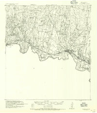
 1956 Roma1956 Print · USGSLife along the Rio Grande in South Texas comes into focus in this mid-century reprint of late 1920s army surveys. Researchers can trace family-named properties like Ramon Montalvo or locate the historic Los Arrieros Ford and the Old Army Camp near Roma.
 - 1957 Map of Mc Allen, 1962 Print
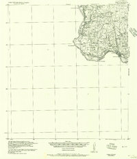
 1957 Mc Allen1962 Print · USGSThe South Texas borderlands emerge in the late fifties as a hub of energy production and military activity. Researchers can trace the river economy through Rio Grande City, find the Brewster School, and locate the Moore Air Force Base.2 unique versions available
End of results
Showing maps 1-6 of 6
Top cities of Starr County
- Rio Grande City historical maps
- Roma historical maps
- La Grulla historical maps
- San Isidro historical maps
Frequently asked questions
- What are the different types of historical maps available for Starr County?
- What is the oldest map of Starr County?
- Where can I purchase historical maps of Starr County for my home or office?
- Where can I download high-res historical maps of Starr County?
- Are there historical topographic maps available for Starr County?
- Is there historical aerial imagery available for Starr County?
- Where are historical maps of Starr County sourced from?