Old Maps of Starr County, Texas for Metal Detecting
Plan your next treasure hunt with 219 historic maps of Starr County. Find old homesites, ghost towns, trails, and gathering spots that may be lost to time — perfect for identifying promising metal detecting locations.
- Locate forgotten sites: Uncover places like long-lost settlements, abandoned rail lines, or gathering spots.
- Plan better hunts: Use map overlays combined with LiDAR or satellite views to narrow in on historically rich areas.
- Made for detectorists: Thousands of hobbyists use these maps to discover relics, coins, and hidden history.
Use these historic maps to boost your research and find new opportunities beneath the surface of Starr County.
Starr County, TX maps
(219)- 1938 Map of Falcon, 1956 Print
 1938 Falcon1956 Print · USGSThe Rio Grande valley of South Texas appears here in the decades before the creation of Falcon Lake, revealing a landscape of historic river crossings and family ranches. Genealogists can trace ancestral sites like Falcon (Ramireño), Salineño, and Lopeño, or locate river landmarks such as Las Piedras Island.
 - 1938 Map of El Sauz, 1958 Print
 1938 El Sauz1958 Print · USGSSouth Texas ranching territory in the late thirties is defined by a dense network of family-held estates and cattle outposts. Local historians and genealogists can trace ancestral holdings through landmarks like La Presurosa Store, Las Escobas Ranch, and Agua Dulce Ranch.
 - 1938 Map of Agua Nueva, 1959 Print
 1938 Agua Nueva1959 Print · USGSThe ranching country of South Texas is captured here in the late 1930s before modern development altered these family lands. Researchers can locate specific ancestral sites and livestock holdings like Agua Nueva, Palangana Ranch, and Rancho Viejo.
 - 1938 Map of Sal Colorada, 1959 Print
 1938 Sal Colorada1959 Print · USGSStarr County ranching life in the late 1930s is captured here through a dense network of family-owned landholdings and early oil exploration. Genealogists can trace specific homesteads such as Gran Jenito Ranch, Santanita Ranch, and the Sal Colorada School.
 - 1938 Map of Cuevitas, 1959 Print
 1938 Cuevitas1959 Print · USGSSouth Texas ranching and the nascent oil industry define this borderlands region in the late nineteen-thirties. Researchers can trace ancestral family lands through dozens of named sites like San Antonio Viejo Ranch, Cuevitas, and the Sun Oil Co Camp.
 - 1939 Map of La Reforma, 1959 Print
 1939 La Reforma1959 Print · USGSThe ranching country of South Texas comes alive in the late 1930s, showing the intersection of cattle territory and the budding oil industry. Genealogists can trace family holdings and local landmarks like the Sam Lane School, Arkansas City, and La Reforma.
 - 1939 Map of Encantada, 1959 Print
 1939 Encantada1959 Print · USGSBrooks and Starr counties are shown in the late 1930s as a landscape of established cattle ranches and emerging oil fields. Genealogists and researchers can locate family landmarks such as Guerra, Encantada Ranch, and La Particion Ranch.
 - 1940 Map of Monte Christo
 1940 Monte Christo1940 Print · USGSHidalgo County ranching and irrigation systems are shown here in the 1930s and 40s as a structured agricultural grid takes shape. Researchers can trace family homesteads like Tanquecillas Ranch or locate the site of the Wimobasis Club and early railroad stops on the St L B & M Ry.2 unique versions available
 - 1949 Map of Mc Allen, 1954 Print
 1949 Mc Allen1954 Print · USGSThe Rio Grande Valley at mid-century reveals a bustling international corridor of citrus groves, rail lines, and growing border towns. Genealogists and historians can trace the Missouri Pacific RR through McAllen or locate rural landmarks like the Santa Fe School and Arkansas City.
 - 1954 Map of McAllen
 1954 McAllen1954 Print · USGSThe Lower Rio Grande Valley in the mid-fifties is captured here as a burgeoning hub of agriculture, oil, and international trade. Researchers can trace the extensive rail lines of the St Louis Brownsville and Mexico or locate rural landmarks like Tacubaya School and Clay Dusting Service.
 - 1956 Map of Garcias
 1956 Garcias1956 Print · USGSThe Rio Grande borderlands of South Texas are captured here during the mid-twentieth century as the regional ranching economy flourished. Researchers can trace ancestral family lands like the Stephen Garcia Ranch or locate vanished sites including the Brick Yard and La Grulla Sta.
 - 1956 Map of Los Ebanos
 1956 Los Ebanos1956 Print · USGSThe Rio Grande borderlands of South Texas are captured here as they appeared between the world wars. Genealogists and local historians can trace family-named sites like Antonio de la Banco and early river settlements including Los Ebanos and Havana.
 - 1956 Map of Escobares
 1956 Escobares1956 Print · USGSThe Texas borderlands along the Rio Grande appear here during the transition to the mid-century, dominated by historic ranching estates. Researchers can trace family legacies at Escobares Ranch or Villareales and locate the grounds of Fort Ringgold.
 - 1956 Map of Roma
 1956 Roma1956 Print · USGSLife along the Rio Grande in South Texas comes into focus in this mid-century reprint of late 1920s army surveys. Researchers can trace family-named properties like Ramon Montalvo or locate the historic Los Arrieros Ford and the Old Army Camp near Roma.
 - 1957 Map of Mc Allen, 1962 Print
 1957 Mc Allen1962 Print · USGSThe South Texas borderlands emerge in the late fifties as a hub of energy production and military activity. Researchers can trace the river economy through Rio Grande City, find the Brewster School, and locate the Moore Air Force Base.2 unique versions available
 - 1962 Map of McAllen
 1962 McAllen1962 Print · USGSThe Lower Rio Grande Valley in the mid-twentieth century shows a complex landscape of irrigation, oil production, and border commerce. Genealogists and historians can trace family roots through riverside towns like Zapata, Roma-Los Saenz, and Hidalgo, or locate landmarks like Santa Elena Ch and Moore Air Force Base.
 - 1963 Map of McCook, 1965 Print
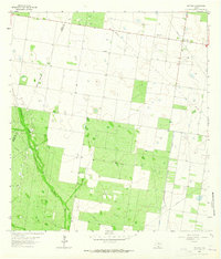 1963 McCook1965 Print · USGSHidalgo County's ranchlands and early energy fields come into focus during the early sixties as the regional landscape transitioned. Local researchers can trace family landmarks like the Immaculate Conception Cem and follow the industry footprint of the Javelina Gas Field.
 - 1965 Map of Rio Grande City South
 1965 Rio Grande City South1965 Print · USGSAlong the international border in the mid-sixties, this area of southern Starr County shows a landscape of river-bend settlements and early oil exploration. Genealogists can locate family landmarks like Santa Cruz and El Refugio or trace the Missouri Pacific rail line.2 unique versions available
 - 1965 Map of Los Garzas, 1968 Print
 1965 Los Garzas1968 Print · USGSThe Texas-Mexico borderlands in the mid-1960s are captured here during a period of shifting river boundaries. Researchers can pinpoint the rural settlement of Los Garzas, its associated Los Garzas Cem, and local landmarks like Casa Banco No 90.2 unique versions available
 - 1965 Map of La Grulla, 1968 Print
 1965 La Grulla1968 Print · USGSThe Rio Grande borderlands of South Texas are captured here in the mid-sixties, showing the intricate network of river bancos and agricultural settlements. Genealogists can locate family landmarks like Solizes Cem, San Vicente Cem, and San Ignacio de Loyola.2 unique versions available
 - 1965 Map of Salineno, 1968 Print
 1965 Salineno1968 Print · USGSThe Texas-Mexico borderlands come into focus in the mid-1960s, showing the early infrastructure surrounding the river and the reservoir. Genealogists can trace family sites at Salineño and Los Arrierous Cem or locate old ranching outposts like Margo.2 unique versions available
 - 1965 Map of Sullivan City, 1968 Print
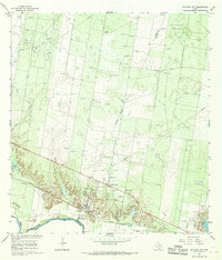 1965 Sullivan City1968 Print · USGSSullivan City and the Rio Grande borderlands come alive in the mid-sixties, showing a landscape defined by the river and the oil industry. Genealogists and historians can trace the foundations of Sullivan City and Cuevitas, or locate landmarks like San Guillermo Ch and El Faro Sch.2 unique versions available
 - 1965 Map of Camp Garcia, 1968 Print
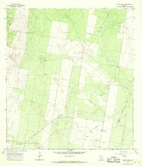 1965 Camp Garcia1968 Print · USGSStarr County in the mid-1960s was a landscape shaped by the intensive growth of the Texas petroleum industry. Genealogists and historians can trace family-named sites like Samano Ranch and Camp Garcia alongside industrial landmarks like the Davenport Oil Field.3 unique versions available
 - 1965 Map of Los Ebanos, 1968 Print
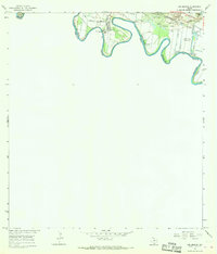 1965 Los Ebanos1968 Print · USGSThe Rio Grande Valley borderlands appear here in the mid-1960s, a landscape defined by the river's winding course and the busy gravel and gas industries. You can trace the historic International Ferry at Los Ebanos and locate rail-dependent sites like Sam Fordyce and Crow.
 - 1965 Map of Falcon Village, 1968 Print
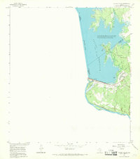 1965 Falcon Village1968 Print · USGSThe mid-sixties Rio Grande borderlands are defined here by the waters of Falcon Reservoir and the rise of Falcon Village. Researchers can trace the international boundary and locate features like Chapeno Cem and the Falcon Dam.
Showing maps 1-25 of 219
Top cities of Starr County
- Rio Grande City historical maps
- Roma historical maps
- La Grulla historical maps
- San Isidro historical maps
Frequently asked questions
- What are the different types of historical maps available for Starr County?
- What is the oldest map of Starr County?
- Where can I purchase historical maps of Starr County for my home or office?
- Where can I download high-res historical maps of Starr County?
- Are there historical topographic maps available for Starr County?
- Is there historical aerial imagery available for Starr County?
- Where are historical maps of Starr County sourced from?