1970s Maps of Starr County, Texas
Explore 17 historic maps of Starr County from the 1970s. These maps offer a rare glimpse into what life looked like during the 1970s — showing old roads, neighborhoods, homes, and landmarks that have changed or disappeared over time.
Whether you're researching your family's past, planning a metal detecting trip, or studying how Starr County's landscape evolved across the 1970s, these high-resolution maps are a powerful tool for exploring the history of this region.
- Focus on a specific era: All maps on this page are from the 1970s, giving you a focused view of this time period.
- See what’s changed: Compare century-old streets, trails, and buildings to today's modern landscape using overlays and satellite layers.
- Research with precision: Use these maps for genealogy, historical research, land use analysis, or educational projects.
- View, download, or print: Maps are fully viewable online in high resolution, and can be downloaded or printed for your own records.
Start exploring Starr County's history through authentic maps from the 1970s. This is your window into the past.
Starr County, TX maps
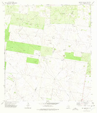
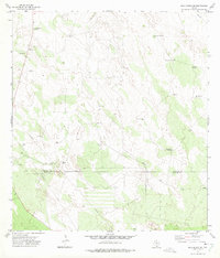
(17)- 1972 Map of Santa Elena SE, 1975 Print
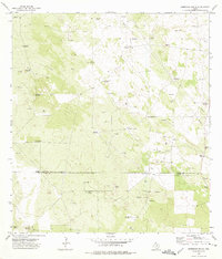
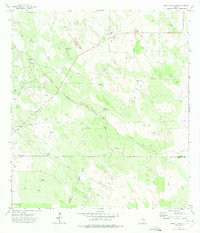 1972 Santa Elena SE1975 Print · USGSThe Texas brush country at the tri-county corner of Brooks, Starr, and Hidalgo is shown in the early seventies during a period of active energy development. Researchers can trace historic water sources like Juarez Well alongside the growing industrial footprint of Oil Wells and the Gas Plant.2 unique versions available
 - 1972 Map of Cuevitas, 1975 Print
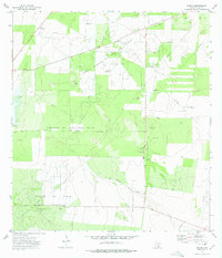
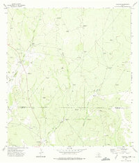 1972 Cuevitas1975 Print · USGSDeep South Texas ranching country comes to life in this early 1970s survey of the borderlands between Jim Hogg and Starr counties. Genealogists can trace family landmarks and rural outposts at Cuevitas and San Roman, or locate remote ranch infrastructure like Filipino Windmill and the Ebanito Windmills.2 unique versions available
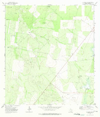
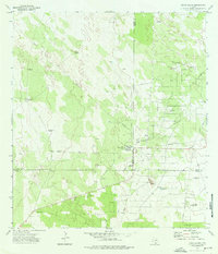
 - 1972 Map of San Isidro, 1975 Print
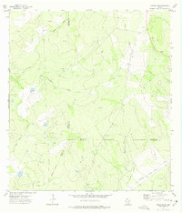
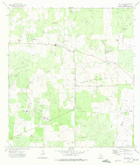 1972 San Isidro1975 Print · USGSThe ranching and petroleum lands of Starr County are captured here during the early seventies, showing a landscape defined by oil fields and family legacies. Genealogists can locate numerous small burial sites like Soledad Cem, Olivares Cem, and Naranjo Cem among the drilling rigs.2 unique versions available
 - 1972 Map of Viboras, 1975 Print
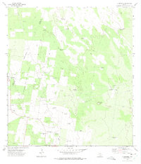
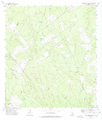
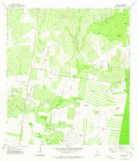 1972 Viboras1975 Print · USGSStarr County ranching and energy operations are captured here in the early 1970s, showing a landscape reliant on deep-well infrastructure. Genealogists and historians can locate rural landmarks like Viboras, San Carlos, and family-named sites such as Tia Ramona Windmill.2 unique versions available
 - 1972 Map of Bentsen Ranch, 1975 Print
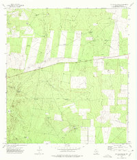
 1972 Bentsen Ranch1975 Print · USGSSouth Texas ranching and oil exploration intersect in the early 1970s along the Starr and Hidalgo county line. Genealogists and historians can locate remote landmarks like Bentsen Ranch, the Landing Field, and numerous named water sources like Guagial Windmill.2 unique versions available
 - 1972 Map of La Gloria SW, 1975 Print
 1972 La Gloria SW1975 Print · USGSThe ranchlands of Starr County are captured here in the early seventies, showing a landscape shaped by water scarcity and emerging energy production. Researchers can trace family-named sites like El Negro Ranch and isolated landmarks such as Borrachito Windmill or Garcias Creek.2 unique versions available
 - 1972 Map of La Reforma, 1975 Print
 1972 La Reforma1975 Print · USGSSouth Texas ranching and oil exploration meet in the early 1970s along the Hidalgo and Starr county line. Trace local family history through Santa Monica Cem and find remote landmarks like Guadalupe Toreros Church and La Rosita Windmill.2 unique versions available
 - 1972 Map of Las Islas Ranch, 1975 Print
 1972 Las Islas Ranch1975 Print · USGSStarr County ranching life in the early seventies is defined by the vital water infrastructure scattered across this South Texas landscape. Genealogists and historians can trace named landmarks like Las Islas Ranch, La Pita Well, and the Borrego Windmill.2 unique versions available
 - 1972 Map of El Sauz, 1975 Print
 1972 El Sauz1975 Print · USGSThe brush country of Starr County is shown in the early seventies as a landscape of cattle ranching and energy extraction. Genealogists and historians can trace family-named outposts like El Negro Ranch and survey the infrastructure of the Sixto Oil and Gas Field.
 - 1972 Map of El Chapote Creek, 1975 Print
 1972 El Chapote Creek1975 Print · USGSStarr County in the early seventies shows a landscape of brush country ranching and active oil and gas exploration. Genealogists and local historians can locate family landmarks like Elizondo Cem, Garcia Cem, and the small settlement of Chinges.
 - 1972 Map of Borregos Ranch, 1975 Print
 1972 Borregos Ranch1975 Print · USGSThe ranchlands of South Texas are captured here during the 1970s, showcasing the intersection of the Jim Hogg and Starr County lines. Genealogists and researchers can trace a terrain of family-named landmarks and infrastructure, from Borregos Ranch to the Cemeteries and Sacatones Windmill.2 unique versions available
 - 1972 Map of Rincon, 1975 Print
 1972 Rincon1975 Print · USGSStarr County in the early 1970s shows a landscape transformed by the Texas energy boom and local ranching. Researchers can trace the industrial footprint of the Rincon Oil Field, locate the Cem, and identify family-named landmarks like the Pablito Windmill.2 unique versions available
 - 1972 Map of Cuevitas SW, 1975 Print
 1972 Cuevitas SW1975 Print · USGSSouth Texas ranch and oil country is frozen in time during the early 1970s at the intersection of Jim Hogg, Starr, and Zapata counties. Genealogists and researchers can trace local landmarks like Guerra Windmill, the El Javali Oil Field, and isolated Cem sites.
 - 1972 Map of Las Escobas Ranch, 1975 Print
 1972 Las Escobas Ranch1975 Print · USGSRanching and oil production define the borderlands of Zapata and Starr counties during the early seventies. Genealogists can locate family landmarks such as Buena Vista Cem and Uña de Gato Cem alongside the historic Las Escobas Ranch.2 unique versions available
 - 1972 Map of Agua Nueva SE, 1975 Print
 1972 Agua Nueva SE1975 Print · USGSThe ranchlands along the border of Jim Hogg and Starr counties are captured here in the early 1970s. Trace the distribution of remote outposts and water sources like Ramirito Ranch, Brazil Windmill, and Particion.2 unique versions available
 - 1972 Map of Santa Elena, 1976 Print
 1972 Santa Elena1976 Print · USGSThe ranchlands of South Texas appear in the early 1970s at the junction of three counties. Researchers can trace rural life and industry through family-named landmarks like Estrella Windmill, the Santa Elena settlement, and the local Oil Field.2 unique versions available
 - 1972 Map of La Gloria, 1993 Print
 1972 La Gloria1993 Print · USGSStarr County ranching and energy production intersect in the early 1970s as oil fields expand across the South Texas brush. Researchers can trace rural lineages through the Diamond O Ranch and family-named sites like Santa Catarina or the Tangue Allegre Cem.
End of results
Showing maps 1-17 of 17
Top cities of Starr County
- Rio Grande City historical maps
- Roma historical maps
- La Grulla historical maps
- San Isidro historical maps
Frequently asked questions
- What are the different types of historical maps available for Starr County?
- What is the oldest map of Starr County?
- Where can I purchase historical maps of Starr County for my home or office?
- Where can I download high-res historical maps of Starr County?
- Are there historical topographic maps available for Starr County?
- Is there historical aerial imagery available for Starr County?
- Where are historical maps of Starr County sourced from?