1960s Maps of Terrell County, Texas
Explore 30 historic maps of Terrell County from the 1960s. These maps offer a rare glimpse into what life looked like during the 1960s — showing old roads, neighborhoods, homes, and landmarks that have changed or disappeared over time.
Whether you're researching your family's past, planning a metal detecting trip, or studying how Terrell County's landscape evolved across the 1960s, these high-resolution maps are a powerful tool for exploring the history of this region.
- Focus on a specific era: All maps on this page are from the 1960s, giving you a focused view of this time period.
- See what’s changed: Compare century-old streets, trails, and buildings to today's modern landscape using overlays and satellite layers.
- Research with precision: Use these maps for genealogy, historical research, land use analysis, or educational projects.
- View, download, or print: Maps are fully viewable online in high resolution, and can be downloaded or printed for your own records.
Start exploring Terrell County's history through authentic maps from the 1960s. This is your window into the past.
Terrell County, TX maps
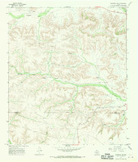
(30)- 1964 Map of Del Rio
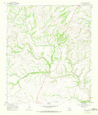
 1964 Del Rio1964 Print · USGSAlong the Mexican border during the mid-sixties, this area centered on the confluence of the Rio Grande and Devils River. Researchers can trace the Southern Pacific line through isolated stops like Pumpville or locate military and industrial sites such as Laughlin Air Force Base and the mines at Blewett.
 - 1965 Map of Emory Peak
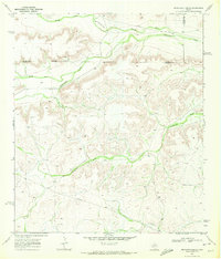
 1965 Emory Peak1965 Print · USGSThe Big Bend backcountry in the mid-1960s reveals a desert landscape of remote ranches and mercury mining. Trace the historic boundary along the Rio Grande and locate landmarks like the Fresno Mine and Panther Spring.
 - 1967 Map of Sheffield NW, 1970 Print
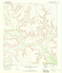
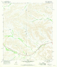
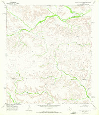
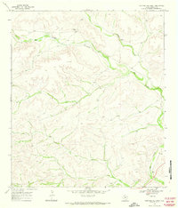
 1967 Sheffield NW1970 Print · USGSThe Pecos and Terrell county border country comes to life in this late 1960s study of the West Texas landscape. Genealogists and historians can trace the established Cannon Ranch, Slaughter Ranch, and the Perkins Windmill across the draws.2 unique versions available
 - 1967 Map of Horsehead Canyon, 1970 Print
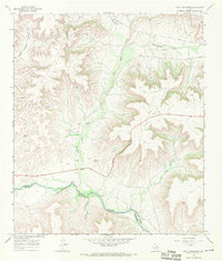
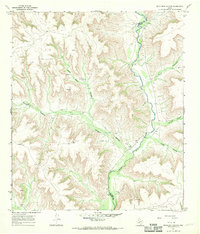
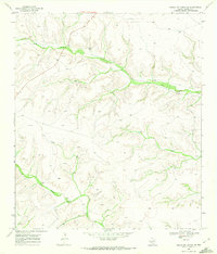
 1967 Horsehead Canyon1970 Print · USGSTerrell County during the late 1960s is defined by a deep-cut canyon system and the growing reach of energy infrastructure. Researchers can trace the path of Independence Creek and identify industrial landmarks like the Pumping Sta and scattered Gas Wells.
 - 1967 Map of Fort Lancaster, 1970 Print
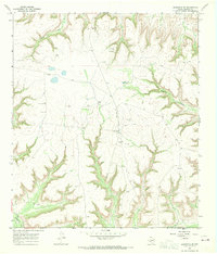
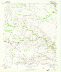
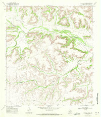
 1967 Fort Lancaster1970 Print · USGSThe West Texas frontier meets the mid-century oil industry in this late 1960s survey of the Pecos River valley. Historians and researchers can locate the site of Fort Lancaster (Ruins) and trace the industrial footprint of Oil Wells across COX HILL.
 - 1967 Map of Sheffield SE, 1970 Print
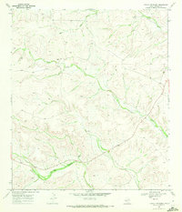
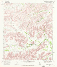
 1967 Sheffield SE1970 Print · USGSThe rugged Trans-Pecos terrain of Terrell County is captured here in the late sixties, showing a landscape defined by deep draws and remote ranching outposts. Researchers can trace the livestock operations of the Allison Ranch and locate specific water landmarks like East Martin Windmill and Independence Creek.
 - 1967 Map of Dead Man Canyon, 1970 Print
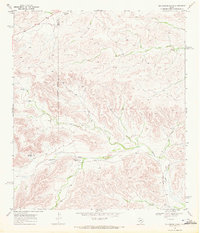
 1967 Dead Man Canyon1970 Print · USGSThe West Texas frontier along the Pecos River is captured here in the late sixties, a time of isolated ranching and early petroleum exploration. Genealogists and historians can locate the Dead Man Windmill Grave and trace early crossings like the Ford near Reagan Canyon.
 - 1967 Map of Sheffield, 1970 Print
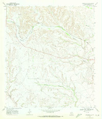
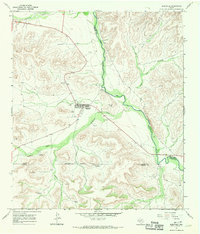 1967 Sheffield1970 Print · USGSSheffield and the Pecos River valley are captured in the late sixties, showing a landscape defined by ranching and oil. Researchers can trace family sites at Sheffield Cem and locate remote landmarks like Greer Airfield or Squaw Peak.
 - 1968 Map of Big Brindle Canyon, 1971 Print
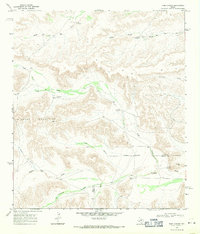
 1968 Big Brindle Canyon1971 Print · USGSWest Texas ranching life in the late sixties centers on isolated homesteads and vital water sources among the deep draws of the Trans-Pecos. Researchers can trace the boundaries of the Brown Ranch, Murrah Ranch, and the southern Ranchito near Maxon Creek.
 - 1968 Map of Toms Canyon, 1971 Print
 1968 Toms Canyon1971 Print · USGSThe arid ranchlands of the Trans-Pecos come into focus in the late 1960s, showing the vital water systems of the Wildcat Mountains. Researchers can locate historic family holdings and landmarks like Downie Ranch, Standifer Gap, and Cliett Windmills.2 unique versions available
 - 1968 Map of Ninemile Ranch, 1971 Print
 1968 Ninemile Ranch1971 Print · USGSRanching life and rail transport define this Terrell County landscape in the late sixties. Researchers can trace the Southern Pacific line through Sanderson Canyon and locate remote landmarks like Ninemile Ranch, Emerson, and Jackson Tank.2 unique versions available
 - 1968 Map of Dryden, 1972 Print
 1968 Dryden1972 Print · USGSTerrell County ranching and rail life are documented here during the late sixties. Researchers can trace the Southern Pacific line through Dryden and locate family landmarks like the Goodwin Ranch amidst the winding Thurston Canyon.
 - 1969 Map of Sanderson SE, 1972 Print
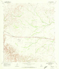
 1969 Sanderson SE1972 Print · USGSTerrell County ranching and rail transport are captured here in the late sixties as the high desert landscape remained sparsely settled. Genealogists and historians can trace family operations at Harrell Ranch and Carruthers Ranch along the Southern Pacific line.
 - 1969 Map of Circle Dot Ranch, 1972 Print
 1969 Circle Dot Ranch1972 Print · USGSTerrell County ranching life is preserved here as it appeared in the late sixties. Researchers can locate remote family operations like Circle Dot Ranch and Dry Creek Ranch or trace the path of Big Canyon.
 - 1969 Map of Smoky Mountain Ranch, 1972 Print
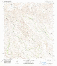
 1969 Smoky Mountain Ranch1972 Print · USGSThe Pecos and Terrell County line runs through this West Texas ranching country as it appeared in the late sixties. Researchers can trace the isolated outposts of Smoky Mountain Ranch, an active Oil Field, and the steep winding path of Surveyor Canyon.
 - 1969 Map of Sanderson, 1972 Print
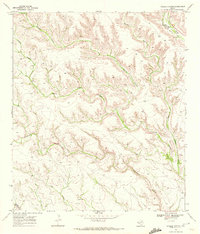
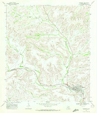 1969 Sanderson1972 Print · USGSSanderson and the surrounding West Texas ranchlands are shown in detail during the late sixties. Researchers can trace the SOUTHERN PACIFIC line and locate family sites like Deaton Ranch or the Cedar Grove Cem.2 unique versions available
 - 1969 Map of Big Canyon Ranch, 1972 Print
 1969 Big Canyon Ranch1972 Print · USGSThe arid canyons of West Texas are captured here in the late sixties, showing a landscape defined by the Pecos Co Terrell Co line. Researchers can trace the isolated outposts of the ranching frontier at Big Canyon Ranch, Hagelslein Ranch, and Russell.
 - 1969 Map of Mofeta, 1972 Print
 1969 Mofeta1972 Print · USGSTerrell County ranching and rail life are preserved here in the late sixties. Genealogists and researchers can trace the Southern Pacific corridor through Mofeta or locate the Dryden Airfield and Rule Ranch.
 - 1969 Map of Continental Ranch, 1972 Print
 1969 Continental Ranch1972 Print · USGSTerrell County ranching country is captured here during the late sixties, showing a landscape defined by isolation and deep drainage basins. Genealogists and historians can trace the remote Continental Ranch and Riggs Ranch or locate the Landing Strip and Big Canyon.
 - 1969 Map of Circle Dot Ranch NE, 1972 Print
 1969 Circle Dot Ranch NE1972 Print · USGSTerrell County ranch lands are captured here in the late sixties, showing the remote intersection of West Texas mineral extraction and livestock territory. Trace the path of McKay Creek and find legacy landmarks like Mitchell Ranch and the local Gas Well.2 unique versions available
 - 1969 Map of Mitchell Draw, 1972 Print
 1969 Mitchell Draw1972 Print · USGSThe arid canyons of West Texas appear in detail in the late sixties, showing the remote ranching lands of Terrell County. Researchers can trace the winding paths of Independence Creek and Mitchell Draw or locate specific industrial markers like the Pipeline.
 - 1969 Map of Big Canyon Ranch SW, 1972 Print
 1969 Big Canyon Ranch SW1972 Print · USGSPecos and Terrell Counties appear here in the late sixties, showing a ranching landscape defined by intermittent watercourses. Trace the isolated Mitchell Ranch and the winding paths of Fortyone Draw and Downie Draw.
 - 1969 Map of Seventeen Ranch, 1972 Print
 1969 Seventeen Ranch1972 Print · USGSThe West Texas ranchlands along the Terrell and Pecos county line are captured here in the late sixties. Genealogists and historians can trace family landholdings at Seventeen Ranch and Mitchell Ranch or locate the remote Landing Strip.
 - 1969 Map of Dryden NE, 1972 Print
 1969 Dryden NE1972 Print · USGSTerrell County ranch lands in the late sixties were defined by isolated homesteads and deep canyon drainages. Researchers can trace the boundaries of the James Ranch and Bell Ranch or follow the paths of Meyers Canyon and Downie Draw.
 - 1969 Map of Hagler Canyon, 1972 Print
 1969 Hagler Canyon1972 Print · USGSWest Texas ranching and rail corridors are captured here at the end of the 1960s. Trace the path of the Southern Pacific through the rugged drainages of Hagler Canyon and Isinglass Canyon along the Terrell and Brewster county line.2 unique versions available
Showing maps 1-25 of 30
Top cities of Terrell County
Frequently asked questions
- What are the different types of historical maps available for Terrell County?
- What is the oldest map of Terrell County?
- Where can I purchase historical maps of Terrell County for my home or office?
- Where can I download high-res historical maps of Terrell County?
- Are there historical topographic maps available for Terrell County?
- Is there historical aerial imagery available for Terrell County?
- Where are historical maps of Terrell County sourced from?