1970s Maps of Terrell County, Texas
Explore 7 historic maps of Terrell County from the 1970s. These maps offer a rare glimpse into what life looked like during the 1970s — showing old roads, neighborhoods, homes, and landmarks that have changed or disappeared over time.
Whether you're researching your family's past, planning a metal detecting trip, or studying how Terrell County's landscape evolved across the 1970s, these high-resolution maps are a powerful tool for exploring the history of this region.
- Focus on a specific era: All maps on this page are from the 1970s, giving you a focused view of this time period.
- See what’s changed: Compare century-old streets, trails, and buildings to today's modern landscape using overlays and satellite layers.
- Research with precision: Use these maps for genealogy, historical research, land use analysis, or educational projects.
- View, download, or print: Maps are fully viewable online in high resolution, and can be downloaded or printed for your own records.
Start exploring Terrell County's history through authentic maps from the 1970s. This is your window into the past.
Terrell County, TX maps
(7)- 1973 Map of Fort Stockton, 1974 Print
 1973 Fort Stockton1974 Print · USGSThe Trans-Pecos region of West Texas comes alive in the early seventies, from the desert flats of the Stockton Plateau to the heights of the Davis Mountains. Researchers can trace the legacy of frontier outposts and rail lines through Fort Davis Nat Hist Site, Alpine, and the Southern Pacific RR.
 - 1973 Map of Post Canyon, 1976 Print
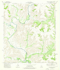
 1973 Post Canyon1976 Print · USGSThe winding Pecos River marks the intersection of three counties in the early 1970s. Trace the isolated network of Jeep Trails and Private roads connecting remote Gas Wells and a river Ford through Post Canyon.
 - 1973 Map of Sixshooter Canyon, 1976 Print
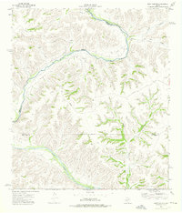
 1973 Sixshooter Canyon1976 Print · USGSThe Pecos River canyonlands of Terrell and Crockett Counties are captured here in the early 1970s. Trace old ranching life at Dunlap Ranch or locate remote water sources like Wolf Spring and Independence Creek.
 - 1979 Map of Cook Creek North
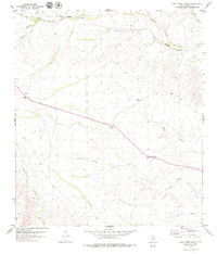 1979 Cook Creek North1979 Print · USGSTerrell County ranching and rail infrastructure are captured here in the late seventies. Family historians and researchers can trace the Old Railroad Grade and Southern Pacific line past Cedar Station and the Rock House Ranch.
 - 1979 Map of Lozier Canyon North
 1979 Lozier Canyon North1979 Print · USGSThe West Texas desert landscape is revealed in the late seventies as a maze of deep canyons and railroad infrastructure near the Val Verde county line. Researchers can trace the path of the Southern Pacific and find local landmarks like Lozier Cem and Malvado.
 - 1979 Map of Cook Creek South
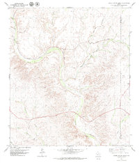
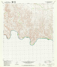 1979 Cook Creek South1979 Print · USGSThe Texas-Mexico borderlands in Terrell County come into focus during the late seventies, showing the winding Rio Grande frontier. Researchers can trace remote ranching life at Watts Ranch and Casa de Piedras while navigating the terrain via a lone Jeep Trail.
 - 1979 Map of Lozier Canyon South, 1980 Print
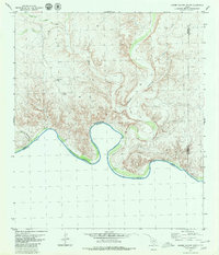 1979 Lozier Canyon South1980 Print · USGSThe Texas-Mexico borderlands come into sharp focus in the late 1970s as the Rio Grande carves through the desert. Local historians can trace remote outposts like Cinco de Mayo Ranch and the winding Lozier Canyon drainage system.
End of results
Showing maps 1-7 of 7
Top cities of Terrell County
Frequently asked questions
- What are the different types of historical maps available for Terrell County?
- What is the oldest map of Terrell County?
- Where can I purchase historical maps of Terrell County for my home or office?
- Where can I download high-res historical maps of Terrell County?
- Are there historical topographic maps available for Terrell County?
- Is there historical aerial imagery available for Terrell County?
- Where are historical maps of Terrell County sourced from?