1950s Maps of Trinity County, Texas
Explore 11 historic maps of Trinity County from the 1950s. These maps offer a rare glimpse into what life looked like during the 1950s — showing old roads, neighborhoods, homes, and landmarks that have changed or disappeared over time.
Whether you're researching your family's past, planning a metal detecting trip, or studying how Trinity County's landscape evolved across the 1950s, these high-resolution maps are a powerful tool for exploring the history of this region.
- Focus on a specific era: All maps on this page are from the 1950s, giving you a focused view of this time period.
- See what’s changed: Compare century-old streets, trails, and buildings to today's modern landscape using overlays and satellite layers.
- Research with precision: Use these maps for genealogy, historical research, land use analysis, or educational projects.
- View, download, or print: Maps are fully viewable online in high resolution, and can be downloaded or printed for your own records.
Start exploring Trinity County's history through authentic maps from the 1950s. This is your window into the past.
Trinity County, TX maps
(11)- 1950 Map of Keltys
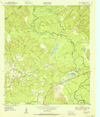
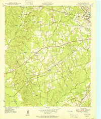 1950 Keltys1950 Print · USGSAngelina County saw significant growth in the early post-war years as the rail lines connected rural timberlands and towns. Genealogists can trace family names at Wallace Cem, Hudson Sch, and New Hope Ch.
 - 1950 Map of Centralia, 1977 Print
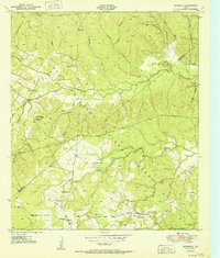
 1950 Centralia1977 Print · USGSThe Piney Woods of Trinity and Houston Counties are revealed here at mid-century as a landscape defined by timber and tight-knit rural communities. You can trace the Logging Railroad networks and find family landmarks like Rice Cem, Nogalus, and Old Ivy Ch.
 - 1951 Map of Kennard
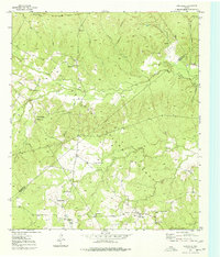
 1951 Kennard1951 Print · USGSDeep in the East Texas piney woods in the early fifties, this area shows the intersection of the Davy Crockett National Forest and local timber life. Genealogists can trace early landmarks like Antioch Cem, Nogalus Lookout Tower, and rural congregations including Mt Olive Ch.
 - 1951 Map of Wells
 1951 Wells1951 Print · USGSCherokee County at mid-century shows a landscape shaped by timber and rail as the Piney Woods met the Neches River. Researchers can locate family landmarks like Simpson Cem, the rural center of Redtown, and the St Louis Southwestern Railroad line.3 unique versions available
 - 1951 Map of Wells SW
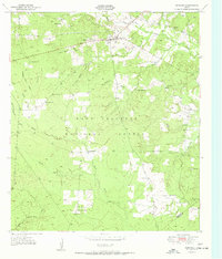
 1951 Wells SW1951 Print · USGSDeep East Texas timberlands come alive in this mid-century survey of the Neches River bottomlands at the edge of the Davy Crockett National Forest. Genealogists and historians can trace old transit lines like the Old Logging Railroad Grade or locate rural landmarks such as Raville Siding and Vair.3 unique versions available
 - 1951 Map of Centralia
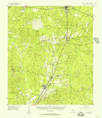
 1951 Centralia1951 Print · USGSEast Texas timber country comes alive in the early fifties, showing the intersections of the Davy Crockett National Forest and local homesteads. Researchers can locate remote community hubs like Nogalus, Old Ivy Ch, and the defunct Logging Railroad Grade.
 - 1953 Map of Palestine, 1964 Print
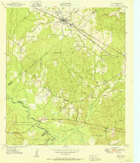
 1953 Palestine1964 Print · USGSEast Texas was defined by its deep pine forests and burgeoning energy sector in the mid-1950s. Genealogists and historians can trace the rail-and-river economy through settlements like Tennessee Colony and Pollok or explore the early footprints of the Cayuga Oil Field and Davy Crockett National Forest.2 unique versions available
 - 1954 Map of Beaumont, 1964 Print
 1954 Beaumont1964 Print · USGSSoutheast Texas in the mid-fifties reveals a landscape of massive national forests, emerging reservoirs, and a booming oil economy. Genealogists and researchers can trace rural settlements like Dallardsville and Village Mills or locate early drilling sites at Sour Lake Oil Field.3 unique versions available
 - 1955 Map of New Willard, 1957 Print
 1955 New Willard1957 Print · USGSPolk County at the height of the 1950s reveals a landscape of East Texas timber towns and essential rail corridors. Genealogists and historians can trace family roots through numerous rural sites like Bold Springs Ch, Seven Oaks, and the Leggett-Alexander Cem.3 unique versions available
 - 1957 Map of Beaumont
 1957 Beaumont1957 Print · USGSSoutheast Texas in the mid-fifties is defined by the timber-rich lands between the Trinity River and Beaumont. Trace the history of the Alabama and Coushatti Indian Reservation or locate early campus sites like Prairie View College.
 - 1957 Map of Palestine
 1957 Palestine1957 Print · USGSEast Texas in the mid-fifties reveals a landscape of deep pine forests and winding river valleys before the era of massive reservoir construction. Researchers can trace the legacy of the timber and rail industries through labels for the Missouri Pacific RR, Davy Crockett National Forest, and Nacogdoches.
End of results
Showing maps 1-11 of 11
Top cities of Trinity County
Frequently asked questions
- What are the different types of historical maps available for Trinity County?
- What is the oldest map of Trinity County?
- Where can I purchase historical maps of Trinity County for my home or office?
- Where can I download high-res historical maps of Trinity County?
- Are there historical topographic maps available for Trinity County?
- Is there historical aerial imagery available for Trinity County?
- Where are historical maps of Trinity County sourced from?