2020s Maps of Trinity County, Texas
Explore 24 historic maps of Trinity County from the 2020s. These maps offer a rare glimpse into what life looked like during the 2020s — showing old roads, neighborhoods, homes, and landmarks that have changed or disappeared over time.
Whether you're researching your family's past, planning a metal detecting trip, or studying how Trinity County's landscape evolved across the 2020s, these high-resolution maps are a powerful tool for exploring the history of this region.
- Focus on a specific era: All maps on this page are from the 2020s, giving you a focused view of this time period.
- See what’s changed: Compare century-old streets, trails, and buildings to today's modern landscape using overlays and satellite layers.
- Research with precision: Use these maps for genealogy, historical research, land use analysis, or educational projects.
- View, download, or print: Maps are fully viewable online in high resolution, and can be downloaded or printed for your own records.
Start exploring Trinity County's history through authentic maps from the 2020s. This is your window into the past.
Trinity County, TX maps
(24)- 2022 Map of Trinity East, 2022 Print
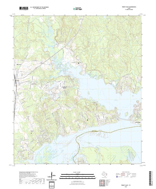 2022 Trinity East2022 Print · USGSTrinity and the shores of Lake Livingston are captured in the early 2020s, showing a landscape defined by water and residential growth. Researchers can trace family sites at French Memorial Cem and Skains Cem or explore the waterfront layouts of Westwood Shores and Sebastopol.
 - 2022 Map of Carmona, 2022 Print
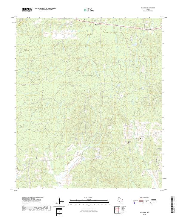 2022 Carmona2022 Print · USGSThe rural landscape of Polk County is mapped here in the early twenty-first century, showing the persistent patterns of East Texas creek-bottom settlement. Genealogists can locate family burial sites like Rowe - Dunham Family Cem and Holhausen - Darby Cem near the waters of Meadow Cr.
 - 2022 Map of Colita, 2022 Print
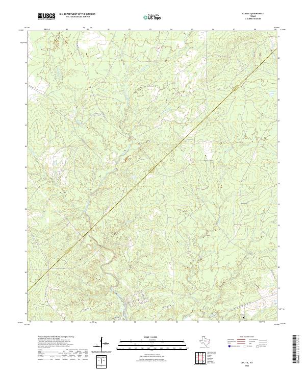 2022 Colita2022 Print · USGSThe Trinity and Polk County borderlands come into focus in this contemporary survey of the East Texas woods. Genealogists and local historians can trace family-named routes and landmarks like Bethel Cem, Carmona Lake, and Lumbermans Rd.
 - 2022 Map of Apple Springs, 2022 Print
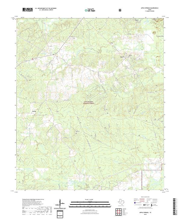 2022 Apple Springs2022 Print · USGSTrinity County's timberlands and rural communities are preserved in this recent survey of the East Texas Piney Woods. Researchers can trace family roots through landmarks like Mount Zion Cem, the settlement of Nigton, and roads such as Delbert Greer Rd.
 - 2022 Map of Trevat, 2022 Print
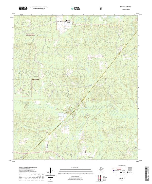 2022 Trevat2022 Print · USGSThe Trinity and Polk County line runs through this East Texas timberland in the early 2020s, centered on the community of Trevat. Genealogists can locate family landmarks like Trevat Cem and Wagner Hill Cem among the branches of Alabama Cr.
 - 2022 Map of Glendale, 2022 Print
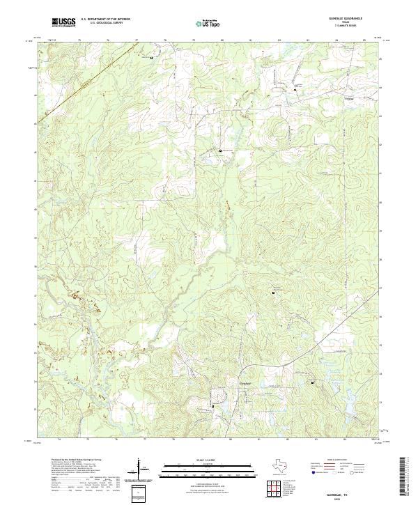 2022 Glendale2022 Print · USGSTrinity County in the early 2020s preserves a traditional East Texas landscape of timbered creek bottoms and quiet rural crossroads. Genealogists can trace family footprints across numerous sites like Zion Hill Cem, Friday, and the Anderson-Ellis Cem.
 - 2022 Map of Centralia, 2022 Print
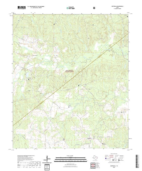 2022 Centralia2022 Print · USGSCentralia and the surrounding piney woods are captured in this 2022 survey as the landscape straddles the Houston and Trinity County line. Family historians can trace local roots through numerous rural burial grounds like Enon Cem, Calvary Cem, and Pisgah Cem nestled within the Davy Crockett National Forest.
 - 2022 Map of Groveton East, 2022 Print
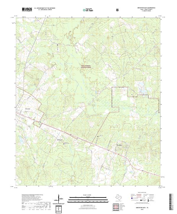 2022 Groveton East2022 Print · USGSTrinity County's timber-rich corridor comes to life in this survey of the Groveton and Woodlake areas. Historians can trace early settlement patterns through Lacy Cem, the industrial roots of Josserand, and the winding course of Kickapoo Creek as it feeds into the forest.
 - 2022 Map of Lovelady South, 2022 Print
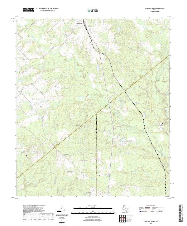 2022 Lovelady South2022 Print · USGSHouston and Trinity counties meet in this 2020s landscape near Lovelady, where small-scale ranching and timber define the terrain. Genealogists can trace local roots across several burial grounds including New Zion Cem and White Rock Cem.
 - 2022 Map of Trinity West, 2022 Print
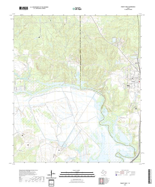 2022 Trinity West2022 Print · USGSThe Trinity River valley in the early twenty-first century reveals a landscape shaped by water and memory at the Walker and Trinity county line. Researchers can trace numerous local burial sites including Cedar Grove Cem, Trinity Black Cem - East, and Chalk Cem.
 - 2022 Map of Pennington, 2022 Print
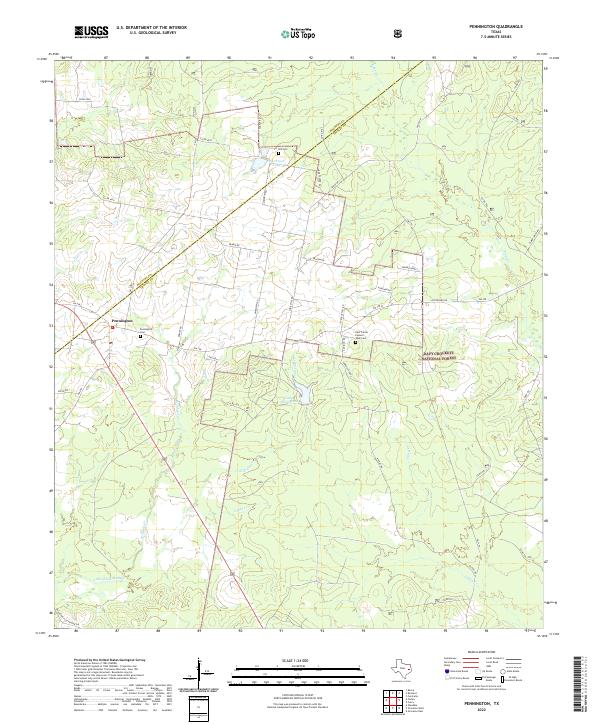 2022 Pennington2022 Print · USGSPennington and the surrounding Piney Woods are captured here in the early twenty-first century as the woodland meets the Groveton Flat Prairie. Genealogists can locate family landmarks like the Hill Cem and East Prairie Possum Walk Cem near the Davy Crockett National Forest border.
 - 2022 Map of Wakefield, 2022 Print
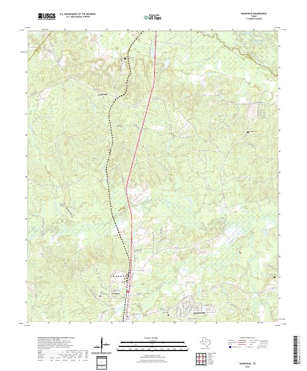 2022 Wakefield2022 Print · USGSThe Piney Woods of Polk County are documented here in the early 2020s, showing the intersection of river bottomlands and rural settlements. Researchers can locate family landmarks like Wheeler Cem, trace the Dollorhide Cutoff near the Neches River, or study the layout of Corrigan and Wakefield.
 - 2022 Map of Crecy, 2022 Print
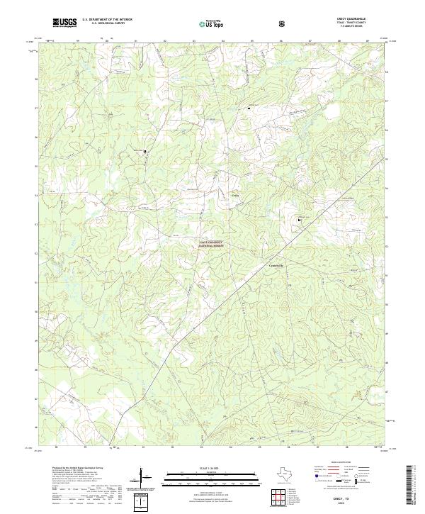 2022 Crecy2022 Print · USGSTrinity County timberlands and rural communities are preserved here in the early twenty-first century. Family history researchers can trace locations like Moore Cem and McLain Cem near the settlements of Crecy and Centerville.
 - 2022 Map of Groveton West, 2022 Print
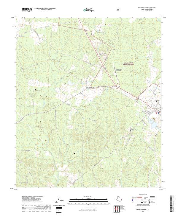 2022 Groveton West2022 Print · USGSTrinity County timberlands and rural settlements are documented in this recent survey of the East Texas forest. Genealogists can locate several local burial sites, including Ellis Prairie Cem, Boontown Cem, and Dean Cem.
 - 2022 Map of Wells SW, 2022 Print
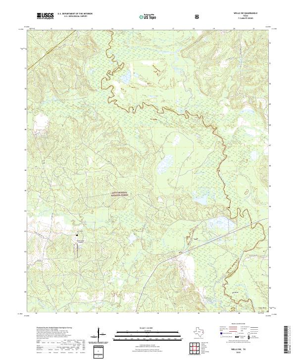 2022 Wells SW2022 Print · USGSDeep in the Piney Woods during the early 2020s, this map captures the winding river boundaries and forest settlements of East Texas. Trace family sites near New Church Cem or explore the river bottomlands of Vair and the Neches River.
 - 2022 Map of Staley, 2022 Print
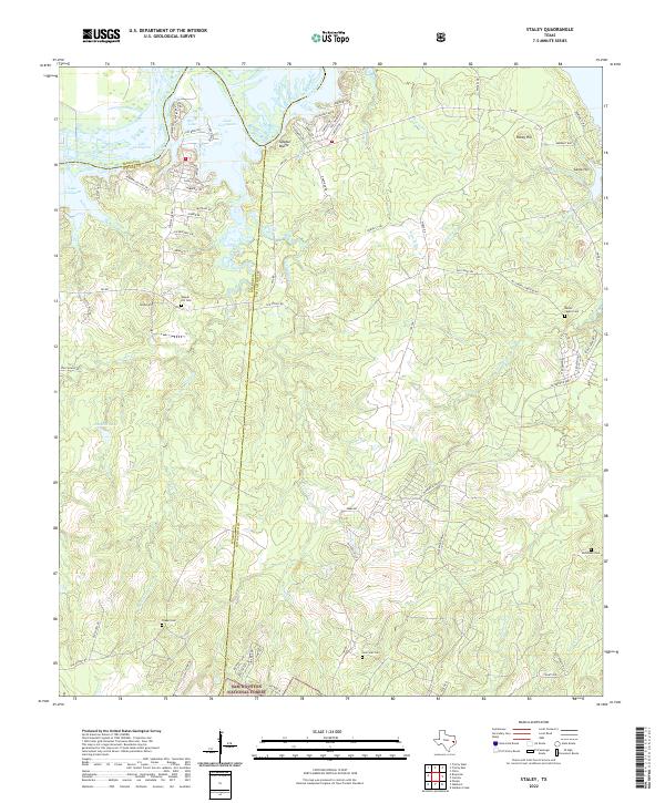 2022 Staley2022 Print · USGSThe northern reaches of the reservoir meet the deep timberlands of San Jacinto and Walker counties in the early 2020s. Trace family roots at Gospel Hill Cem and Lone Star Cem or explore the trails of the Sam Houston National Forest.
 - 2022 Map of Chita, 2022 Print
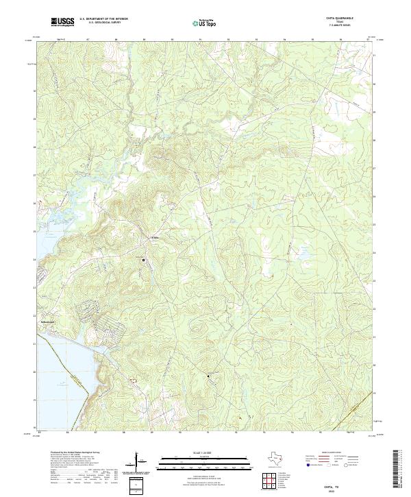 2022 Chita2022 Print · USGSEastern Texas near the Trinity River basin comes into focus in the early 2020s, showing a landscape defined by local creeks and lakeside growth. Trace family sites at Chita Cem and Hickman Cem, or explore the winding roads near Chita and Sebastopol.
 - 2022 Map of Fodice, 2022 Print
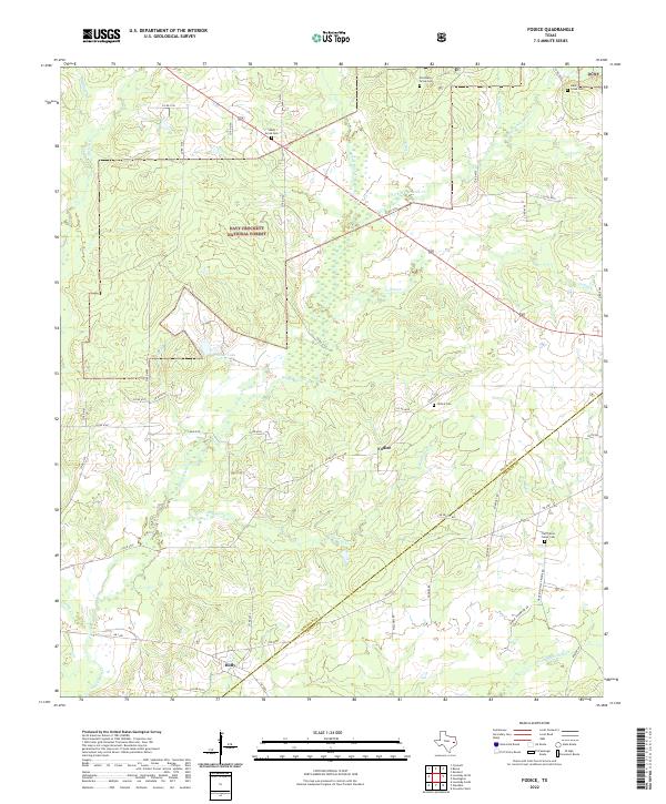 2022 Fodice2022 Print · USGSEast Texas forest lands and rural Houston County communities come into focus in this recent survey. Local historians can trace the legacy of Fodice and Holly, while genealogists can locate several remote burial sites like Old Shady Grove Cemetery and Lake Creek Cemetery.
 - 2022 Map of Kennard, 2022 Print
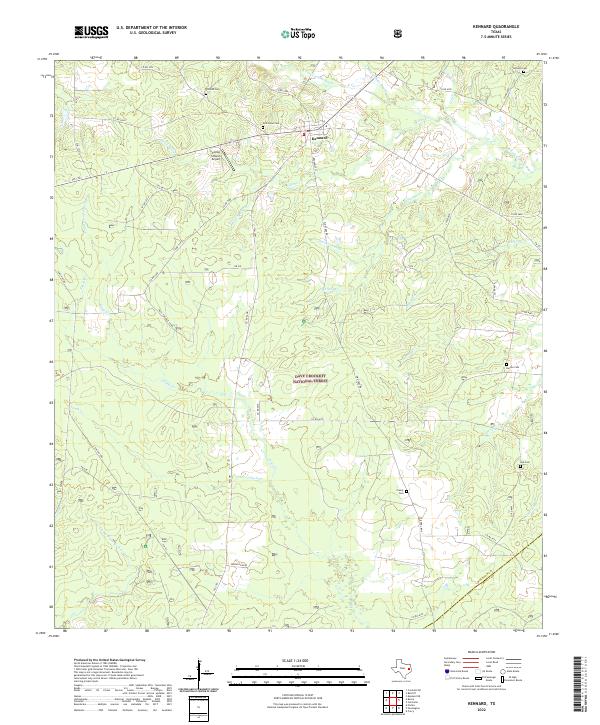 2022 Kennard2022 Print · USGSKennard and the surrounding timberlands of the Piney Woods are captured here in the early 2020s. Researchers can locate several historic burial grounds including New Hope Cem and Creasy Cem, or trace the winding course of Elm Cr.
 - 2022 Map of Riverside, 2022 Print
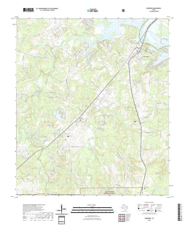 2022 Riverside2022 Print · USGSRiverside and the surrounding Walker County woodlands are documented here in the early twenty-first century as the landscape meets the waters of Lake Livingston. Family historians can locate several local burial grounds including Broyles Chapel Cem and the Riverside Pioneer Cem.
 - 2022 Map of Carlisle, 2022 Print
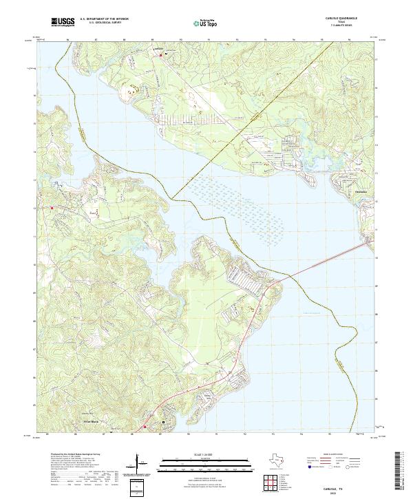 2022 Carlisle2022 Print · USGSThe shorelines of San Jacinto and Polk counties are captured in this recent survey of the Lake Livingston area. Researchers can trace local landmarks from Carlisle and Onalaska to quiet rural spots like Darby Hill and Foster Cem.
 - 2022 Map of Wells, 2022 Print
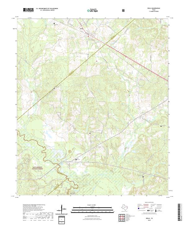 2022 Wells2022 Print · USGSThe community of Wells is captured here at the threshold of the Davy Crockett National Forest. Genealogists can trace family landmarks across the countryside, from Simpson Cem and Durham Cem to the tracks of the A & N RR.
 - 2022 Map of Diboll, 2022 Print
 2022 Diboll2022 Print · USGSAngelina County at the heart of the East Texas timber belt is documented here in the early twenty-first century. Researchers can locate several family and community burial sites, including Old Emporia Cem and McCarty Cem, alongside the oxbows of the Neches River.
 - 2022 Map of Keltys, 2022 Print
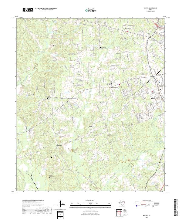 2022 Keltys2022 Print · USGSThe northern outskirts of Lufkin and surrounding rural Angelina County are captured in this modern survey. Genealogists can trace family burial sites at Old Union Cem, Narraway Cem, or the small settlements of Peavy and Keltys.
End of results
Showing maps 1-24 of 24
Top cities of Trinity County
Frequently asked questions
- What are the different types of historical maps available for Trinity County?
- What is the oldest map of Trinity County?
- Where can I purchase historical maps of Trinity County for my home or office?
- Where can I download high-res historical maps of Trinity County?
- Are there historical topographic maps available for Trinity County?
- Is there historical aerial imagery available for Trinity County?
- Where are historical maps of Trinity County sourced from?