1960s Maps of Trinity County, Texas
Explore 17 historic maps of Trinity County from the 1960s. These maps offer a rare glimpse into what life looked like during the 1960s — showing old roads, neighborhoods, homes, and landmarks that have changed or disappeared over time.
Whether you're researching your family's past, planning a metal detecting trip, or studying how Trinity County's landscape evolved across the 1960s, these high-resolution maps are a powerful tool for exploring the history of this region.
- Focus on a specific era: All maps on this page are from the 1960s, giving you a focused view of this time period.
- See what’s changed: Compare century-old streets, trails, and buildings to today's modern landscape using overlays and satellite layers.
- Research with precision: Use these maps for genealogy, historical research, land use analysis, or educational projects.
- View, download, or print: Maps are fully viewable online in high resolution, and can be downloaded or printed for your own records.
Start exploring Trinity County's history through authentic maps from the 1960s. This is your window into the past.
Trinity County, TX maps
(17)- 1960 Map of Colita, 1961 Print
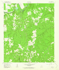
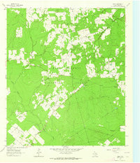
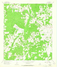
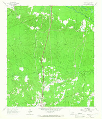
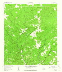 1960 Colita1961 Print · USGSThe Trinity and Polk county line comes alive in the early sixties, showing a landscape defined by the winding Kickapoo Creek. Genealogists and local historians can locate the Bethel Cem and rural gathering places like Colita Ch and Bethel Ch.3 unique versions available
 - 1960 Map of Trinity West, 1962 Print
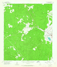
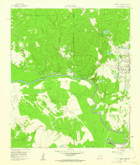 1960 Trinity West1962 Print · USGSThe Trinity River bottomlands south of the town of Trinity come into focus in the early 1960s as a landscape of railroads and institutional farms. Researchers can trace the path of the Waco Beaumont Trinity and Sabine rail line or locate the grounds of the Smither Prison Farm and Mt Olive Ch.3 unique versions available
 - 1960 Map of Trinity East, 1962 Print
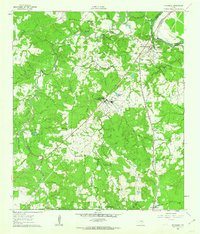
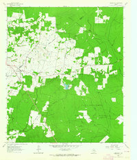
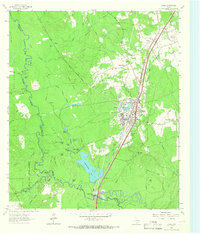
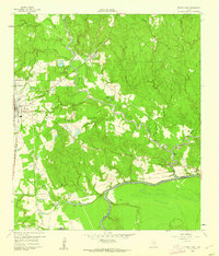 1960 Trinity East1962 Print · USGSThe community of Trinity and its riverfront surroundings are captured in the early 1960s, showing the intersection of rail and river life. Researchers can trace the Missouri Pacific line or follow the Old Railroad Grade past Skaines Lake and the settlement of Sebastopol.3 unique versions available
 - 1960 Map of Carlisle, 1962 Print
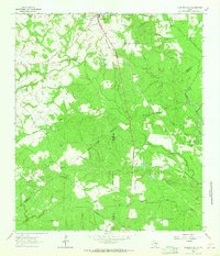
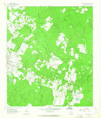
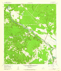 1960 Carlisle1962 Print · USGSThe Trinity River valley at the start of the 1960s reveals a landscape of small churches, family cemeteries, and old transit corridors. Genealogists and local historians can locate the Patricks Ferry site, the Pointblank School, and family landmarks like Darby Hill.3 unique versions available
 - 1961 Map of Staley, 1962 Print
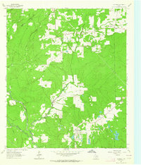
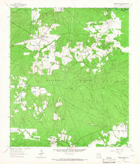
 1961 Staley1962 Print · USGSDeep in the Piney Woods of the early sixties, this survey shows the rugged creek drainages and forest boundaries along the San Jacinto and Walker county lines. Trace family history through local landmarks like Gospel Hill Sch, Staley (Embryfield), and Community Relief Cem.2 unique versions available
 - 1961 Map of Riverside, 1962 Print
 1961 Riverside1962 Print · USGSEastern Walker County in the early sixties is characterized by small rural communities and the presence of the Sam Houston State Teachers College. Trace family roots at Dodge Cem or locate the old Riverside Jr High Sch and Holmes Chapel.3 unique versions available
 - 1962 Map of Lovelady South, 1964 Print
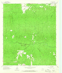
 1962 Lovelady South1964 Print · USGSThe woodlands of East Texas are captured here in the early 1960s as a landscape of timber, oil, and rail. Genealogists can locate family landmarks like Prairie Pt Cem, White Rock Ch, and the workings of the Trinity Oil Field.
 - 1962 Map of Glendale, 1964 Print
 1962 Glendale1964 Print · USGSDeep in East Texas during the early sixties, this area shows the rural life of Trinity and Houston Counties. Genealogists can trace family names at Holly Cem, Thompson Sch, and Zion Hill Ch, or follow the Old Railroad Grade past Glendale.2 unique versions available
 - 1963 Map of Crecy, 1964 Print
 1963 Crecy1964 Print · USGSDeep in the Piney Woods during the early sixties, this area shows the enduring footprints of timber and rural life. Trace family roots at McLain Cem or follow the Old Railroad Grade through the Davy Crockett National Forest.
 - 1963 Map of Groveton West, 1964 Print
 1963 Groveton West1964 Print · USGSTrinity County timber country comes into focus in the early sixties as the national forest boundary meets the growing outskirts of Groveton. Researchers can trace the Old Railroad Grade and locate old family burial sites like Ellis Prairie Cem and Boontown Cem.2 unique versions available
 - 1963 Map of Pennington, 1964 Print
 1963 Pennington1964 Print · USGSPennington and the surrounding Piney Woods are captured in the early sixties as rural life centered on the local timberlands and country churches. Genealogists can locate family burial sites at Pennington Cem and Possum Walk Cem or trace the old paths near Friendship.2 unique versions available
 - 1963 Map of Groveton East, 1964 Print
 1963 Groveton East1964 Print · USGSTrinity County's timber country is captured here in the early sixties, showing the transition from old logging ways to modern forest management. Genealogists can locate family landmarks like Sumpter Cem or trace rural church sites such as Mt Olive Ch and New Hope Ch.2 unique versions available
 - 1963 Map of Fodice, 1965 Print
 1963 Fodice1965 Print · USGSThe piney woods and crossroads of East Texas appear in the early sixties, showing a landscape defined by timber and agriculture. Trace old family sites and rural landmarks like Fodice Cem, White Rock Ch, and the settlement of Shady Grove.2 unique versions available
 - 1963 Map of Apple Springs, 1966 Print
 1963 Apple Springs1966 Print · USGSTrinity County timberlands and rural communities are captured here in the early 1960s. Researchers can locate family sites and landmarks like Mt Zion Cem, the settlement of Nigton, and the Mt Zion Lookout within the Davy Crockett National Forest.2 unique versions available
 - 1963 Map of Diboll, 1966 Print
 1963 Diboll1966 Print · USGSDiboll and the surrounding Angelina County timberlands are shown in the early sixties as the regional lumber industry flourished. Researchers can trace the junction of the Texas South-Eastern railroad, locate Clarks Ferry, or find family sites near McCarty Cem.2 unique versions available
 - 1963 Map of Trevat, 1966 Print
 1963 Trevat1966 Print · USGSTrinity and Polk counties are shown in the early sixties as the timber industry and national forest management shaped the local landscape. Researchers can locate the Sulphur Springs Ch, trace the Old Railroad Grade, and find family sites like Abbott Springs Cem.3 unique versions available
 - 1963 Map of Wakefield, 1966 Print
 1963 Wakefield1966 Print · USGSPolk County timberlands and river bottoms are documented here in the early sixties, showing the transition from old rail corridors to modern transit. Researchers can find Wakefield family landmarks, Knox Cem, and the path of the Southern Pacific railroad.3 unique versions available
End of results
Showing maps 1-17 of 17
Top cities of Trinity County
Frequently asked questions
- What are the different types of historical maps available for Trinity County?
- What is the oldest map of Trinity County?
- Where can I purchase historical maps of Trinity County for my home or office?
- Where can I download high-res historical maps of Trinity County?
- Are there historical topographic maps available for Trinity County?
- Is there historical aerial imagery available for Trinity County?
- Where are historical maps of Trinity County sourced from?