Old Maps of Upshur County, Texas for Genealogy
Trace your family roots with 119 historic maps of Upshur County. These high-res maps reveal old neighborhoods, homesites, landmarks, and streets — helping you uncover where your ancestors lived and how the area evolved over time.
- Explore historic neighborhoods: Identify where your relatives may have lived in the 1800s or 1900s.
- Compare maps over time: Trace the changes in streets, buildings, and landmarks for multi-generational research.
- Perfect for genealogy & ancestry research: Used by family historians and researchers to map out lineage and migration.
These maps are an incredible resource for exploring your personal connection to Upshur County's past.
Upshur County, TX maps
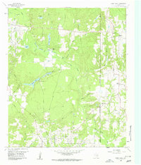
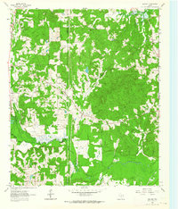
(119)- 1956 Map of Tyler
 1956 Tyler1956 Print · USGSEast Texas was a powerhouse of oil production and rail transport during the mid-fifties, centered on the sprawling East Texas Oil Field. Researchers can trace the heritage of industrial hubs like Kilgore, military sites such as the Longhorn Ordnance Works, and many rural landmarks like Mount Enterprise.5 unique versions available
 - 1960 Map of Shady Grove, 1961 Print
 1960 Shady Grove1961 Print · USGSWood County was a landscape of petroleum and pine in the early sixties, with oil wells and rural churches scattered across the creeks. Genealogists can locate family sites near Shady Grove or trace landmarks like Maple Springs Ch and the Hawkins Oil Field.3 unique versions available
 - 1960 Map of Hawkins, 1961 Print
 1960 Hawkins1961 Print · USGSHawkins and the Sabine River valley are shown here during the peak of the local oil boom in the early sixties. Researchers can trace family sites near Jarvis Christian College, find old burials at Liberty Cem, or locate the Hawkins Oil Field wells.3 unique versions available
 - 1960 Map of Big Sandy, 1961 Print
 1960 Big Sandy1961 Print · USGSIn the early 1960s, this East Texas corridor was defined by the confluence of major rail lines and the Sabine River. Genealogists can trace family names and rural communities through Union Grove Ch, Chilton Cem, and the old settlement at Waters Bluff.3 unique versions available
 - 1960 Map of Pritchett, 1961 Print
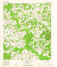
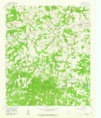
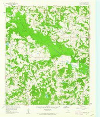
 1960 Pritchett1961 Print · USGSUpshur County settlements and rural churches thrive in the 1960s as a rail-connected agricultural community. Genealogists can locate Kelsey Cem and numerous country churches like Hopewell Ch and Pleasant Grove Ch.3 unique versions available
 - 1960 Map of Bettie, 1962 Print
 1960 Bettie1962 Print · USGSThe area around Bettie in the early 1960s was a landscape of timbered hills and rail-side settlements. Genealogists can trace family roots at Bethlehem Ch, Zion Hill Cem, and the old rail stop at Smith Siding.2 unique versions available
 - 1960 Map of White Oak, 1962 Print
 1960 White Oak1962 Print · USGSMid-century East Texas reveals an economy driven by petroleum and the Texas and Pacific rail line. Researchers can trace company outposts like Amerada Camp or locate community centers like Sherman Chapel and Pine Tree Sch.3 unique versions available
 - 1960 Map of Gilmer, 1962 Print
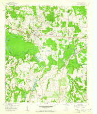
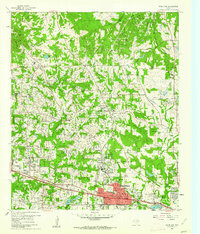
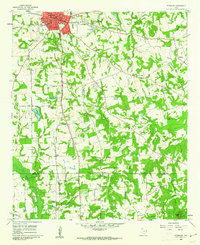
 1960 Gilmer1962 Print · USGSUpshur County in the early sixties centers on the town of Gilmer during a period of steady community growth. Researchers can trace local heritage through numerous rural landmarks like Mings Chapel, Morris Cem, and the St Louis Southwestern Railroad Grade.2 unique versions available
 - 1960 Map of Thomas, 1962 Print
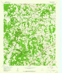
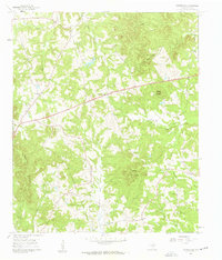
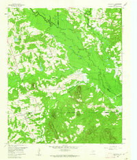
 1960 Thomas1962 Print · USGSUpshur County is seen here in the early sixties, characterized by small timber-and-farm communities and winding creek bottoms. Researchers can trace local heritage through landmarks like Simpsonville Cem, the old Cherokee Trace road, and Harmony Sch.3 unique versions available
 - 1960 Map of Newsome, 1962 Print
 1960 Newsome1962 Print · USGSWood and Franklin Counties in the early sixties show a rural landscape shaped by the Louisiana & Arkansas (KCS) rail line and local industry. Genealogists can locate family landmarks like Morris Chapel, Clearwater Cem, and the Newsome Oil Field.3 unique versions available
 - 1960 Map of Leesburg, 1962 Print
 1960 Leesburg1962 Print · USGSEast Texas at the dawn of the sixties shows a landscape of oil fields and rail-side settlements. Genealogists can trace family roots through numerous local landmarks like Oak Grove Cem, Leesburg, and the rural pews of Myrtle Springs Ch.2 unique versions available
 - 1960 Map of Rhonesboro, 1962 Print
 1960 Rhonesboro1962 Print · USGSWood and Upshur counties are shown at the dawn of the sixties, a landscape of creek-bottoms and rural settlements. Researchers can trace the Old Railroad Grade or find local landmarks like Little Hope Ch and Perryville.4 unique versions available
 - 1960 Map of Coffeeville, 1962 Print
 1960 Coffeeville1962 Print · USGSUpshur County in the early sixties was a landscape of small timber-belt settlements and quiet country churches. Genealogists and local historians can trace family roots through the Coffeeville Cem, New Mountain Cem, and landmarks like Holly Springs Ch or the crossroads at Stamps.2 unique versions available
 - 1960 Map of Glenwood, 1962 Print
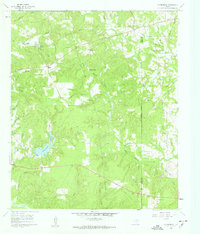
 1960 Glenwood1962 Print · USGSEastern Upshur County is captured here at the height of its mid-century oil production. Researchers can trace rural lineages through family landmarks like Mattox Cem or locate community centers such as Valley View Sch and the Lake Providence Ch.2 unique versions available
 - 1960 Map of La Fayette, 1962 Print
 1960 La Fayette1962 Print · USGSUpper East Texas is shown here at the dawn of the sixties, just as the rising waters of the newly formed Lake O' the Pines began to reshape the Big Cypress Creek basin. Researchers can pinpoint rural life at LaFayette and Holly Springs, or trace family sites like Pleasant Grove Cem and Slaton Cem.2 unique versions available
 - 1960 Map of Pittsburg, 1962 Print
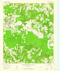
 1960 Pittsburg1962 Print · USGSNorthwest of the Piney Woods in the early sixties, Pittsburg appears as a bustling railroad junction where two major lines meet. Genealogists can trace rural family life through numerous landmarks like Smart Cem, Union Chapel, and St Merner Ch.2 unique versions available
 - 1960 Map of Gladewater, 1962 Print
 1960 Gladewater1962 Print · USGSEast Texas at the start of the 1960s reveals a landscape of oil production and rural communities centered on the Sabine River. Researchers can trace the Texas and Pacific rail line through Gladewater and locate local landmarks like the Edwards Cem and Warren City.2 unique versions available
 - 1962 Map of Ashland, 1964 Print
 1962 Ashland1964 Print · USGSNortheast Texas in the early sixties shows a landscape of timber and rising industry as new reservoirs took shape. Genealogists and historians can locate rural hubs like Ashland and Old Diana, along with several family landmarks including Jones Cem and Shady Grove Ch.2 unique versions available
 - 1962 Map of Ore City, 1964 Print
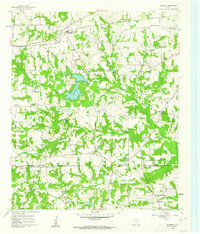
 1962 Ore City1964 Print · USGSThe development of East Texas lakefront culture is in full swing during the early sixties as Lake O' the Pines reshapes the landscape near Ore City. Genealogists and historians can trace community roots at Cedar Grove Cem or locate old landmarks like the Mims Chapel Lookout Tower.3 unique versions available
 - 1962 Map of Lone Star, 1964 Print
 1962 Lone Star1964 Print · USGSMorris County in the early sixties was a hub of East Texas industry and rural life, from the growing town of Lone Star to the heavy iron works. Researchers can trace the massive Steel Plant, local landmarks like Hospital in the Pines, and old family burial grounds including South Union Cem.2 unique versions available
 - 1984 Map of Tyler
 1984 Tyler1984 Print · USGSEast Texas at the peak of its reservoir-building era shows a landscape defined by new lakes and established rail corridors. Trace the path of the St Louis Southwestern RR or locate industrial sites like the Longhorn Ordnance Works.3 unique versions available
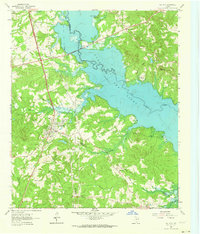
 - 1985 Map of Mineola
 1985 Mineola1985 Print · USGSUpper East Texas in the mid-eighties shows a region shaped by the Sabine River and large-scale water projects. Researchers can trace the rail heritage of the Missouri Pacific RR and locate rural landmarks like Ambassador College Res or the Oil Field.
 - 1986 Map of Marshall
 1986 Marshall1986 Print · USGSEast Texas and the Louisiana borderlands are shown in the mid-1980s during a period of sustained industrial and energy production. Researchers can trace family roots through settlements like Ebenezer or study the impact of the Longhorn Army Ammunition Plant and Rodessa Oil Field.2 unique versions available
 - 1991 Map of Mineola
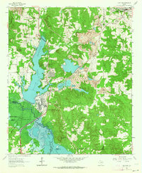
 1991 Mineola1991 Print · USGSEast Texas in the early nineties reveals a landscape shaped by large-scale water reservoirs and the enduring footprint of the oil industry. Genealogists and historians can trace rail-town development in Mineola or explore smaller settlements like Bright Star and Garden Valley.
 - 2010 Map of Big Sandy, 2010 Print
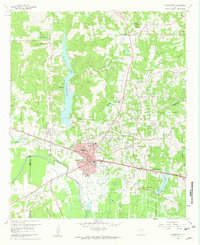
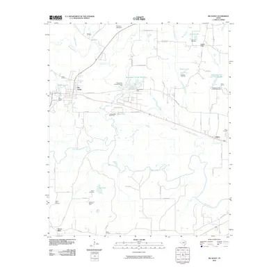 2010 Big Sandy2010 Print · USGSCovers Upshur County, including Big Sandy, Waters Bluff, and other nearby areas
Showing maps 1-25 of 119
Top cities of Upshur County
- Gilmer historical maps
- Big Sandy historical maps
- Ore City historical maps
- East Mountain historical maps
- Union Grove historical maps
- Union Grove historical maps
Frequently asked questions
- What are the different types of historical maps available for Upshur County?
- What is the oldest map of Upshur County?
- Where can I purchase historical maps of Upshur County for my home or office?
- Where can I download high-res historical maps of Upshur County?
- Are there historical topographic maps available for Upshur County?
- Is there historical aerial imagery available for Upshur County?
- Where are historical maps of Upshur County sourced from?