Old Maps of Waller County, Texas for Metal Detecting
Plan your next treasure hunt with 126 historic maps of Waller County. Find old homesites, ghost towns, trails, and gathering spots that may be lost to time — perfect for identifying promising metal detecting locations.
- Locate forgotten sites: Uncover places like long-lost settlements, abandoned rail lines, or gathering spots.
- Plan better hunts: Use map overlays combined with LiDAR or satellite views to narrow in on historically rich areas.
- Made for detectorists: Thousands of hobbyists use these maps to discover relics, coins, and hidden history.
Use these historic maps to boost your research and find new opportunities beneath the surface of Waller County.
Waller County, TX maps
(126)- 1915 Map of Katy
 1915 Katy1915 Print · USGSKaty was a budding rail settlement on the Texas prairie during the early twentieth century. Genealogists and local historians can trace the early town site along the Missouri Kansas and Texas tracks and locate the South Mayde School.3 unique versions available
 - 1916 Map of Hockley
 1916 Hockley1916 Print · USGSUpper Harris County during the First World War shows a landscape defined by timber mills and early railroad junctions. Genealogists can locate family-named landmarks like Bauers Store and Hegar School, or trace the old Houston and Texas Central Road.
 - 1916 Map of Swanson, 1961 Print
 1916 Swanson1961 Print · USGSTexas ranching and rail history come together in this 1910s survey of western Harris County. Researchers can trace early family landholdings like Warren Ranch or locate the original path of the Southern Pacific System near Wolf Hill.
 - 1919 Map of Swanson
 1919 Swanson1919 Print · USGSHarris and Waller counties appear here at the end of the Great War, showing the transition from open ranch land to a rail-connected economy. Genealogists and researchers can trace family-named landmarks like Warren Ranch, Lake Peter Donley, and Freemans Dam.2 unique versions available
 - 1920 Map of Hockley
 1920 Hockley1920 Print · USGSHarris County at the edge of the prairie reveals a landscape of early rail and timber industry just after the First World War. Trace local roots at Hockley and the Hegar School or locate the old Bauers Sawmill near Spring Creek.3 unique versions available
 - 1920 Map of Waller
 1920 Waller1920 Print · USGSThe Waller and Harris county line area comes into focus in this 1920s-era survey, detailing the early rail-and-road network. Genealogists and local historians can trace family sites like Badke Ranch, the Binford School, and the early layout of Waller.2 unique versions available
 - 1950 Map of Houston, 1953 Print
 1950 Houston1953 Print · USGSCoastal Texas in the early fifties reveals a landscape of massive civil engineering and industrial transit. Genealogists and researchers can trace the growth of the Houston suburbs and the maritime infrastructure of Galveston Bay, including the Gulf Freeway and the Texas City Dike.
 - 1953 Map of Seguin, 1965 Print
 1953 Seguin1965 Print · USGSSouth Texas in the early fifties shows a thriving river-and-rail economy across the Guadalupe and Colorado basins. Genealogists and historians can trace rail routes like the Southern Pacific through Seguin, locate oil wells, or find the Gary AAF near San Marcos.4 unique versions available
 - 1954 Map of Beaumont, 1964 Print
 1954 Beaumont1964 Print · USGSSoutheast Texas in the mid-fifties reveals a landscape of massive national forests, emerging reservoirs, and a booming oil economy. Genealogists and researchers can trace rural settlements like Dallardsville and Village Mills or locate early drilling sites at Sour Lake Oil Field.3 unique versions available
 - 1954 Map of Austin, 1964 Print
 1954 Austin1964 Print · USGSCentral Texas is captured during a period of steady growth as the capital city and its neighboring farm towns began to modernize. Researchers can trace historic rail corridors like the Southern Pacific RR or locate landmarks such as Bergstrom Air Force Base and Pilot Knob.4 unique versions available
 - 1955 Map of Brookshire, 1957 Print
 1955 Brookshire1957 Print · USGSThe growing railroad towns of Waller and Harris Counties are shown in the mid-fifties as the local energy economy takes hold. Genealogists and historians can locate family landmarks like Curry Chapel, Magnolia Cem, and the old Salt Mine at Hockley Mound.
 - 1955 Map of Richmond, 1958 Print
 1955 Richmond1958 Print · USGSFort Bend County during the mid-fifties is captured here as a landscape of meandering rivers and burgeoning rail hubs. Genealogists can trace family names through rural sites like Little Prayer Cem or follow the Old Spanish Trail through Rosenberg.
 - 1956 Map of Sealy
 1956 Sealy1956 Print · USGSThe Brazos River valley between Austin and Waller counties is shown here as it transitioned through the early twentieth century. Researchers can locate early post offices at Burleigh PO and Browntown, trace ferry crossings, or find the Cotton Gin and Wesley Chapel.
 - 1956 Map of Hempstead
 1956 Hempstead1956 Print · USGSSoutheast Texas river country comes alive in this survey of the Brazos valley at the dawn of the motorized age. Genealogists and historians can trace the foundations of local society through schools like Pauls School, post offices at Howth P.O., and the path of the Houston and Texas Central Railroad.
 - 1956 Map of Wallis
 1956 Wallis1956 Print · USGSThe Brazos and San Bernard rivers dominate this coastal prairie landscape during the early twentieth century. Trace family roots and vanished rail stops through Wallis, Chesterville, and Lissie along the Gulf Colorado and Santa Fe Railway.
 - 1956 Map of Houston, 1963 Print
 1956 Houston1963 Print · USGSSoutheast Texas in the mid-fifties is captured here as a powerhouse of oil and maritime trade. Genealogists and historians can trace the foundations of Houston and its ports, alongside landmarks like the Rice Institute and the Spindletop Oil Field.2 unique versions available
 - 1957 Map of Beaumont
 1957 Beaumont1957 Print · USGSSoutheast Texas in the mid-fifties is defined by the timber-rich lands between the Trinity River and Beaumont. Trace the history of the Alabama and Coushatti Indian Reservation or locate early campus sites like Prairie View College.
 - 1958 Map of Seguin
 1958 Seguin1958 Print · USGSSouth Texas in the late fifties was a network of river-valley settlements and active oilfields tied together by major rail lines. Genealogists and historians can trace family-named sites across Rabb Prairie, locate the Behring Store, or follow the Southern Pacific through Schulenburg.
 - 1960 Map of Waller, 1961 Print
 1960 Waller1961 Print · USGSThe Waller and Prairie View area at the dawn of the 1960s reveals a landscape of growing educational institutions and vital rail corridors. Researchers can trace the boundaries of Prairie View A & M College and locate family history at Waller Cem or Mathis Cem.4 unique versions available
 - 1960 Map of Wallis, 1961 Print
 1960 Wallis1961 Print · USGSThe Brazos River bottomlands in the early sixties reveal a landscape shaped by rail junctions and small farming communities. Genealogists can trace family roots through sites like Hartville Cem, Mount Olive Ch, and the intersection of two major railroads in Wallis.3 unique versions available
 - 1960 Map of San Felipe, 1961 Print
 1960 San Felipe1961 Print · USGSThe Brazos River valley in the early 1960s reveals a landscape of colonial heritage and oil-era industry. Genealogists can trace family names through numerous rural sites like Rosses Cem, Wesley Chapel, and the community of Frydek.5 unique versions available
 - 1960 Map of Sunny Side, 1961 Print
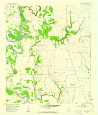 1960 Sunny Side1961 Print · USGSWaller County's riverfront landscape is shown here in the early sixties, defined by the winding Brazos and the local oil industry. Genealogists and researchers can locate family landmarks like Harper Cem, Mt Zion Ch, and the Sunny Side PO.3 unique versions available
 - 1960 Map of Waller NW, 1962 Print
 1960 Waller NW1962 Print · USGSThe rural borderlands of Waller and Harris counties are captured here in the early sixties, showing a landscape of family farms and creek bottoms. You can trace the community heart of the era through sites like Community Hall, Reida Prairie Ch, and Rosenau Cem.2 unique versions available
 - 1961 Map of Burleigh, 1962 Print
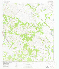 1961 Burleigh1962 Print · USGSThe Austin County countryside in the early sixties is captured here, centered on the community of Burleigh. Researchers can trace family sites like Coshatte Cem, the Coshatte Agricultural Society Hall, and several local rural schools.2 unique versions available
 - 1961 Map of Hempstead, 1963 Print
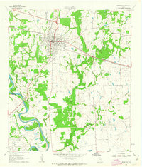 1961 Hempstead1963 Print · USGSHempstead and the surrounding Waller County prairie are captured here in the early sixties as a center of rail commerce and petroleum production. Genealogists can locate family landmarks such as Greater Wyatt Chapel, the Brenham Cem, and the Raccoon Bend Oil Field.4 unique versions available
Showing maps 1-25 of 126
Top cities of Waller County
- Prairie View historical maps
- Hempstead historical maps
- Brookshire historical maps
- Pine Island historical maps
- Pattison historical maps
Frequently asked questions
- What are the different types of historical maps available for Waller County?
- What is the oldest map of Waller County?
- Where can I purchase historical maps of Waller County for my home or office?
- Where can I download high-res historical maps of Waller County?
- Are there historical topographic maps available for Waller County?
- Is there historical aerial imagery available for Waller County?
- Where are historical maps of Waller County sourced from?