Old Maps of Laredo, Texas
Explore 16 old maps of Laredo, spanning from 1933 to today. These high-resolution historic maps reveal how streets, neighborhoods, landmarks, and natural features evolved over time — perfect for genealogy, metal detecting, research, and local history exploration.
What you can do with these maps:
- See how Laredo changed over time: Compare historical maps to modern-day views to trace roads, homesites, rail lines & more.
- View detailed metadata: Each map includes creators, publishers, year, scale, and archive source.
- Overlay maps with satellite & LiDAR: Visualize the past alongside modern tools to explore terrain & human change.
- Trusted historical sources: Maps sourced from the USGS, Library of Congress, and other archives.
- Access maps your way: View online, download high-res files, or order prints for personal or research use.
Start exploring old maps of Laredo to uncover forgotten places, hidden landmarks, and the deep history beneath your feet.
Laredo, TX maps
(16)- 1933 Map of Becerra Creek, 1956 Print
 1933 Becerra Creek1956 Print · USGSCovers Laredo, including Rio Bravo, El Cenizo, and other nearby areas
 - 1956 Map of Islitas
 1956 Islitas1956 Print · USGSCovers Laredo, including Colombia, La Cruz, and other nearby areas
 - 1956 Map of Laredo East
 1956 Laredo East1956 Print · USGSCovers Laredo, including Pescadito, Orvil, and other nearby areas
 - 1956 Map of Laredo, 1960 Print
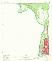
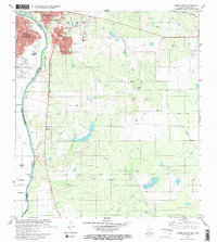
 1956 Laredo1960 Print · USGSCovers Laredo, including Nuevo Laredo, Alice, and other nearby areas3 unique versions available
 - 1965 Map of Laredo West, 1967 Print
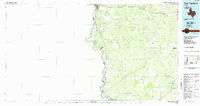
 1965 Laredo West1967 Print · USGSCovers Laredo, including La Cruz, Miguel Alemán (El Carrizo), and other nearby areas3 unique versions available
 - 1965 Map of Orvil, 1967 Print
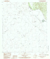
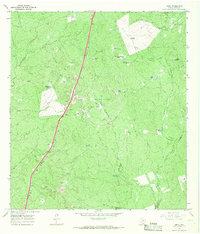 1965 Orvil1967 Print · USGSCovers Laredo, including Orvil, Webb County, and other nearby areas3 unique versions available
 - 1965 Map of Cuervo Creek, 1967 Print
 1965 Cuervo Creek1967 Print · USGSCovers Laredo, including Ranchos Penitas West Colonia, Ranchos Penitas West, and other nearby areas
 - 1965 Map of Dolores Ranch, 1967 Print
 1965 Dolores Ranch1967 Print · USGSCovers Laredo, including Colombia, Islitas, and other nearby areas2 unique versions available
 - 1965 Map of Laredo East, 1967 Print
 1965 Laredo East1967 Print · USGSCovers Laredo, including Webb County, United States, and other nearby areas2 unique versions available
 - 1979 Map of Isla Mesteno
 1979 Isla Mesteno1979 Print · USGSCovers Laredo, including Rio Bravo, El Cenizo, and other nearby areas
 - 1979 Map of Laredo South, 1980 Print
 1979 Laredo South1980 Print · USGSCovers Laredo, including La Presa, Tanquecitos South Acres Colonia, and other nearby areas2 unique versions available
 - 1979 Map of O'Keefe Lake, 1981 Print
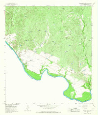
 1979 O'Keefe Lake1981 Print · USGSCovers Laredo, including Rio Bravo, El Cenizo, and other nearby areas
 - 1980 Map of Blancas Creek North
 1980 Blancas Creek North1980 Print · USGSCovers Laredo, including Laredo Ranchettes Colonia, Las Blancas Colonia, and other nearby areas
 - 1983 Map of Fort McIntosh 3 NE
 1983 Fort McIntosh 3 NE1983 Print · USGSCovers Laredo, including Colombia, Minera, and other nearby areas2 unique versions available
 - 1985 Map of Laredo
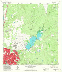
 1985 Laredo1985 Print · USGSCovers Laredo, including Hidalgo, Colombia, and other nearby areas3 unique versions available
 - 1985 Map of San Ygnacio
 1985 San Ygnacio1985 Print · USGSCovers Laredo, including Nuevo Laredo, Rio Bravo, and other nearby areas3 unique versions available
End of results
Showing maps 1-16 of 16
Top cities near Laredo
- Rio Bravo historical maps
- El Cenizo historical maps
- La Presa historical maps
- Los Veteranos II historical maps
Top neighborhoods of Laredo
- One River Place Colonia historical maps
- D-5 Acres Colonia historical maps
- Orvil historical maps
- Larga Vista historical maps
- Larga Vista Colonia historical maps
- Las Blancas Colonia historical maps
See more
Frequently asked questions
- What are the different types of historical maps available for Laredo?
- What is the oldest map of Laredo?
- Where can I purchase historical maps of Laredo for my home or office?
- Where can I download high-res historical maps of Laredo?
- Are there historical topographic maps available for Laredo?
- Is there historical aerial imagery available for Laredo?
- Where are historical maps of Laredo sourced from?