Old Maps of Layton, Utah for Genealogy
Trace your family roots with 25 historic maps of Layton. These high-res maps reveal old neighborhoods, homesites, landmarks, and streets — helping you uncover where your ancestors lived and how the area evolved over time.
- Explore historic neighborhoods: Identify where your relatives may have lived in the 1800s or 1900s.
- Compare maps over time: Trace the changes in streets, buildings, and landmarks for multi-generational research.
- Perfect for genealogy & ancestry research: Used by family historians and researchers to map out lineage and migration.
These maps are an incredible resource for exploring your personal connection to Layton's past.
Layton, UT maps
(25)- 1954 Map of Ogden, 1967 Print
 1954 Ogden1967 Print · USGSThe northern Utah corridor and Wyoming borderlands are captured here in the mid-1950s, showing the region's transition from mountain wilderness to settled valleys. Researchers can trace historic institutions like Utah State University or locate vanished points like Church Butte Station and the Trappist Monastery.3 unique versions available
 - 1954 Map of Brigham City, 1968 Print
 1954 Brigham City1968 Print · USGSNorthern Utah and the edges of the Great Salt Lake are captured here during the mid-fifties, showing the region's transition from pioneer rail hubs to modern military ranges. Researchers can find old sidings like Lemay Siding, the Golden Spike Monument, and settlements like Washakie.4 unique versions available
 - 1955 Map of Clearfield, 1956 Print
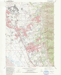
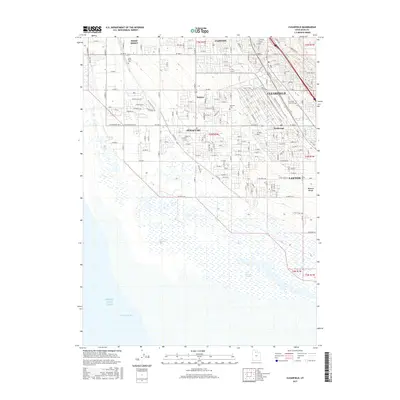
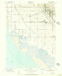 1955 Clearfield1956 Print · USGSCoastal Davis County is shown in the mid-fifties as the military and rail hub of the region expands toward the Great Salt Lake. Genealogists can trace family plots at West Point Cemetery or locate old school sites like Wasatch Sch and settlements at Laytona.
 - 1955 Map of Kaysville, 1956 Print
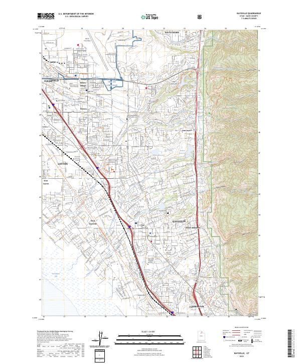
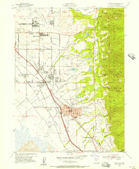 1955 Kaysville1956 Print · USGSDavis County transitioned from an agrarian valley to a strategic defense hub during the mid-fifties as the suburbs began to expand. You can trace the path of the electric Bamberger Railroad and locate civic landmarks like Sahara Village and the County High School.4 unique versions available
 - 1958 Map of Ogden
 1958 Ogden1958 Print · USGSNorthern Utah and southwestern Wyoming are captured here during a period of steady growth and military expansion. You can trace the Union Pacific rail lines and early road networks connecting Ogden and Logan to Bear Lake and Evanston.
 - 1958 Map of Brigham City
 1958 Brigham City1958 Print · USGSNorthern Utah in the late fifties shows a landscape of extremes, from the salt flats to the bustling Bear River Valley. Trace historical routes like the Old Immigrant Trail and locate local landmarks such as the Brigham Sugar Mill and Booth Valley School.
 - 1960 Map of Ogden
 1960 Ogden1960 Print · USGSIn the mid-1950s, this region of the American West balanced military expansion with frontier history along the Union Pacific RR. Genealogists and historians can trace old settlements like Fort Bridger, the residential growth of Washington Terrace, and industrial sites from the Hill AFB complex to the coal mines of Kemmerer.
 - 1962 Map of Brigham City
 1962 Brigham City1962 Print · USGSNorthern Utah in the early sixties reveals a landscape of vast salt flats and growing towns along the Wasatch Front. Researchers can trace the Southern Pacific line past the Golden Spike Monument or locate landmarks like Indian Cave and Donner-Reed Pass.
 - 1972 Map of Clearfield, 1974 Print
 1972 Clearfield1974 Print · USGSClearfield and Syracuse are shown at a peak of military and industrial activity in the early seventies, between the Great Salt Lake and the mountains. Researchers can trace the layout of Hill Air Force Base, local landmarks like Syracuse Cem, and the massive Freeport Center rail complex.
 - 1986 Map of Ogden, 1987 Print
 1986 Ogden1987 Print · USGSThe Wasatch Front was undergoing significant development in the mid-eighties as the urban corridor stretched from Ogden toward the Great Salt Lake. Researchers can trace the legacy of regional transport and defense via Hill Air Force Base, the Union Pacific line, and mountain passes near Snow Basin.
 - 1987 Map of Promontory Point
 1987 Promontory Point1987 Print · USGSThe Wasatch Front meets the great salt desert in the late eighties, showing the rapid growth of towns from Brigham City to Layton. Follow the Southern Pacific (Lucin Cutoff) across the water and explore the remote terrain of Antelope Island and Promontory Point.
 - 1991 Map of Clearfield
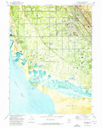
 1991 Clearfield1991 Print · USGSDavis County's shoreline meets industrial expansion in the early nineties, showing a landscape defined by water management and military presence. Researchers can trace the sprawling Freeport Center, family roots at West Point Cemetery, and the intricate path of the Hooper Aqueduct.2 unique versions available
 - 1992 Map of Kaysville
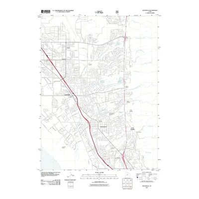
 1992 Kaysville1992 Print · USGSThe Wasatch Front underwent significant suburban expansion in the early nineties, centered on the military and agricultural hubs of Davis County. Researchers can trace local development through landmarks like Hill Air Force Base, Layton Sta, and Lakeview Cemetery.2 unique versions available
 - 1998 Map of Kaysville, 2001 Print
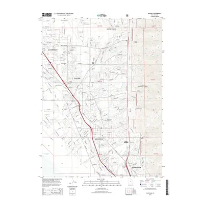
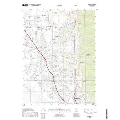
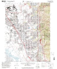 1998 Kaysville2001 Print · USGSDavis County underwent rapid suburban transformation in the late nineties as residential neighborhoods filled the benchlands below the Wasatch Front. Genealogists and local historians can trace the development of Clearfield, Layton, and Kaysville alongside landmarks like Lakeview Cemetery and the Hill Air Force Base.
 - 1999 Map of Clearfield, 2001 Print
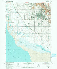
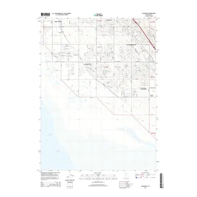
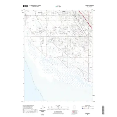
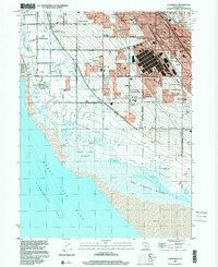 1999 Clearfield2001 Print · USGSThe eastern shore of the Great Salt Lake comes into focus in the late nineties as residential growth meets major industrial hubs. Researchers can trace the massive Freeport Center, the borders of Hill Air Force Base, and the West Point Cemetery.
 - 2011 Map of Clearfield, 2011 Print
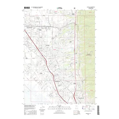
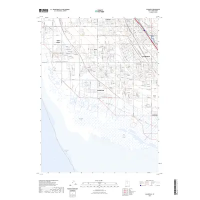
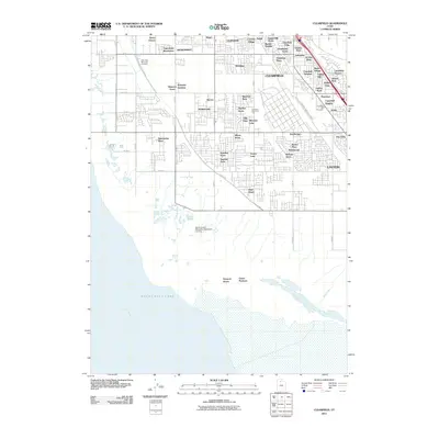 2011 Clearfield2011 Print · USGSCovers Layton, including Syracuse, Clearfield, and other nearby areas
 - 2011 Map of Kaysville, 2011 Print
 2011 Kaysville2011 Print · USGSCovers Layton, including Kaysville, Clearfield, and other nearby areas
 - 2014 Map of Kaysville, 2014 Print
 2014 Kaysville2014 Print · USGSCovers Layton, including Kaysville, Clearfield, and other nearby areas
 - 2014 Map of Clearfield, 2014 Print
 2014 Clearfield2014 Print · USGSCovers Layton, including Syracuse, Clearfield, and other nearby areas
 - 2017 Map of Kaysville, 2017 Print
 2017 Kaysville2017 Print · USGSCovers Layton, including Kaysville, Clearfield, and other nearby areas
 - 2017 Map of Clearfield, 2017 Print
 2017 Clearfield2017 Print · USGSCovers Layton, including Syracuse, Clearfield, and other nearby areas
 - 2020 Map of Kaysville, 2020 Print
 2020 Kaysville2020 Print · USGSCovers Layton, including Kaysville, Clearfield, and other nearby areas
 - 2020 Map of Clearfield, 2020 Print
 2020 Clearfield2020 Print · USGSCovers Layton, including Syracuse, Clearfield, and other nearby areas
 - 2023 Map of Clearfield, 2023 Print
 2023 Clearfield2023 Print · USGSSyracuse and Clearfield meet the Great Salt Lake shoreline in the early 2020s, showing a landscape of suburban growth and military infrastructure. Trace local history through the West Point Cem or follow the Hooper Canal toward Farmington Bay.
 - 2023 Map of Kaysville, 2023 Print
 2023 Kaysville2023 Print · USGSDavis County's suburban corridor and the towering Wasatch front are captured in this recent survey, showcasing the area's dense development and military footprint. Researchers can trace local landmarks like Hill Air Force Base, Kaysville City Cem, and the Davis County Court House Layton District Court.
End of results
Showing maps 1-25 of 25
Top cities near Layton
- Salt Lake City historical maps
- Ogden historical maps
- Bountiful historical maps
- Roy historical maps
- Kaysville historical maps
- Syracuse historical maps
See more
Top neighborhoods of Layton
- Chapel Hill historical maps
- Diamond Hills historical maps
- Victorian Oaks historical maps
- Snow Canyon historical maps
- Parkdale historical maps
- Indian Oaks historical maps
See more
Frequently asked questions
- What are the different types of historical maps available for Layton?
- What is the oldest map of Layton?
- Where can I purchase historical maps of Layton for my home or office?
- Where can I download high-res historical maps of Layton?
- Are there historical topographic maps available for Layton?
- Is there historical aerial imagery available for Layton?
- Where are historical maps of Layton sourced from?