1960s Maps of Juab County, Utah
Explore 27 historic maps of Juab County from the 1960s. These maps offer a rare glimpse into what life looked like during the 1960s — showing old roads, neighborhoods, homes, and landmarks that have changed or disappeared over time.
Whether you're researching your family's past, planning a metal detecting trip, or studying how Juab County's landscape evolved across the 1960s, these high-resolution maps are a powerful tool for exploring the history of this region.
- Focus on a specific era: All maps on this page are from the 1960s, giving you a focused view of this time period.
- See what’s changed: Compare century-old streets, trails, and buildings to today's modern landscape using overlays and satellite layers.
- Research with precision: Use these maps for genealogy, historical research, land use analysis, or educational projects.
- View, download, or print: Maps are fully viewable online in high resolution, and can be downloaded or printed for your own records.
Start exploring Juab County's history through authentic maps from the 1960s. This is your window into the past.
Juab County, UT maps
(27)- 1960 Map of Price
 1960 Price1960 Print · USGSCentral Utah in the late fifties was a landscape of coal-hauling railroads and high plateau settlements. Genealogists and local historians can trace the rail-to-river economy from Price to the mountain mining camps of Hiawatha, Dragerton, and Sunnyside.2 unique versions available
 - 1960 Map of Granite Mountain, 1962 Print
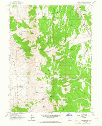
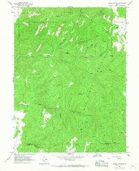
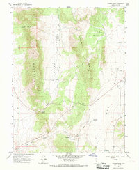
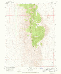
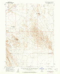 1960 Granite Mountain1962 Print · USGSJuab and Millard Counties are shown here during the early sixties, a period of remote ranching and rugged desert navigation. Genealogists and historians can trace the foundations of Granite Ranch and locate water sources like Hole-in-the-Wall Reservoir.
 - 1961 Map of Trout Creek, 1963 Print
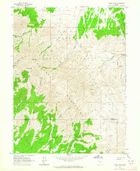
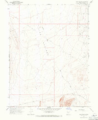
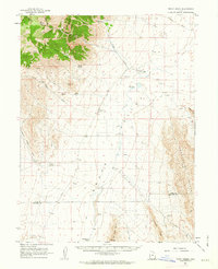 1961 Trout Creek1963 Print · USGSJuab County’s remote desert basins and mountain ranges are documented here in the early 1960s, showing a landscape shaped by scarce water and isolation. Researchers can trace the layout of Partoun and Trout Creek or locate vital desert water sources like Coyote Spring and Salt Marsh Lake.
 - 1962 Map of Price
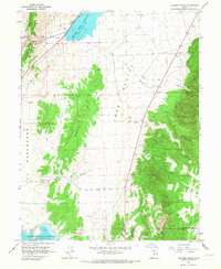
 1962 Price1962 Print · USGSCentral Utah during the early sixties shows a landscape balancing high-mountain forestry with valley agriculture and coal mining. Genealogists and historians can trace the Denver and Rio Grande Western rail lines through industrial hubs like Price or locate formerly active sites like Coal City (abandoned).
 - 1962 Map of Delta
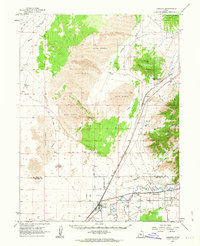
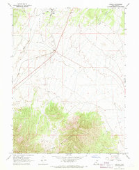
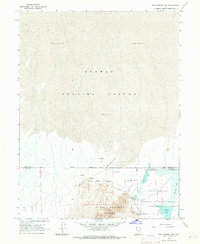
 1962 Delta1962 Print · USGSWest Central Utah in the early sixties reveals a landscape of desert agriculture and military testing grounds. Researchers can trace the Union Pacific line through Delta or locate historic sites like the Pony Express Monument and Silver City.
 - 1962 Map of Lynndyl, 1963 Print
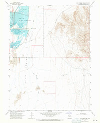
 1962 Lynndyl1963 Print · USGSThe high desert of Juab and Millard Counties comes into focus during the early sixties, centered on the railroad hub of Lynndyl. Local historians can trace the Union Pacific line, the remote Arrowhead Mine, and the irrigation network of the Utah Central Canal.2 unique versions available
 - 1963 Map of Ely
 1963 Ely1963 Print · USGSEastern Nevada's high basins and mountain ranges are captured here in the early sixties, showing a landscape defined by mining and ranching. Trace family roots at the Thompson Ranch or follow the Nevada Northern Railroad through Steptoe Valley.
 - 1963 Map of Maple Peak, 1964 Print
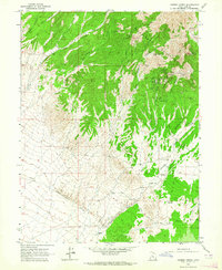
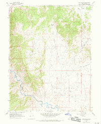
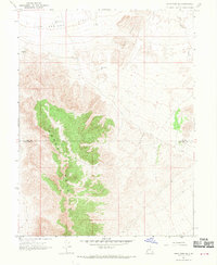
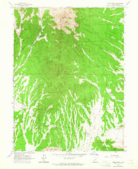 1963 Maple Peak1964 Print · USGSJuab County’s high desert and mountain peaks are captured here in the early sixties, showing a landscape defined by ranching and remote mining. Researchers can trace the layout of Hassel Ranch, locate several mountain mines, and follow old routes like the Telephone Road.
 - 1963 Map of Sabie Mountain, 1964 Print
 1963 Sabie Mountain1964 Print · USGSThe high desert of the Tooele and Juab county border is captured here during the early 1960s. Researchers can trace historic water sources like Boulter Springs and Keg Spring, or locate seasonal outposts such as Summer Ranch and Dry Farm.2 unique versions available
 - 1963 Map of Dutch Peak, 1964 Print
 1963 Dutch Peak1964 Print · USGSThe Sheeprock Mountains at the Tooele and Juab County line are captured here in the early 1960s. Researchers can locate remote mining sites and prospects near Dutch Peak or trace seasonal water sources like Chokecherry Spring and Indian Springs.3 unique versions available
 - 1963 Map of Cherry Creek, 1964 Print
 1963 Cherry Creek1964 Print · USGSJuab County ranching and silver-lead mining are preserved here in the early sixties. Researchers can trace the layout of mountain claims like the Scotia Mine and Bates Shaft, or locate early valley outposts at Rockwell Ranch.
 - 1965 Map of Hells Kitchen Canyon SW, 1967 Print
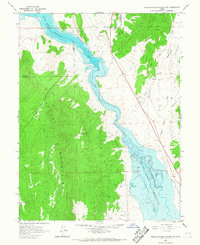 1965 Hells Kitchen Canyon SW1967 Print · USGSThe Sevier River valley in the 1960s was a landscape defined by the Sevier Bridge Reservoir and the surrounding high country. Local historians can trace family-named landmarks like Dick & Dalton Flat or examine early industrial sites including a Prospect and Gravel Pits.
 - 1965 Map of Chriss Canyon, 1967 Print
 1965 Chriss Canyon1967 Print · USGSThe high Sanpitch Mountains of central Utah are captured here in the mid-sixties, showing the rugged Uinta National Forest before modern development. Researchers can trace historic access routes like the Pack Trail and Jeep Trail past landmarks such as Big Baldy and Sage Flat.2 unique versions available
 - 1965 Map of Skinner Peaks, 1967 Print
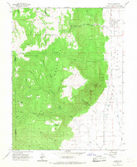
 1965 Skinner Peaks1967 Print · USGSJuab Valley in the mid-1960s is shown here as a landscape of high desert water management and historic transportation routes. Researchers can trace the path of the Union Pacific railroad and find evidence of early rural transit along the Old Botham Road.2 unique versions available
 - 1965 Map of Wales, 1967 Print
 1965 Wales1967 Print · USGSThe small community of Wales and the surrounding Sanpete Valley are shown in the mid-1960s as the local economy balanced valley farming with mountain resources. You can trace the rugged transition into the Uinta National Forest via Axhandle Canyon and locate early extraction sites like the Mine and Coal Canyon.2 unique versions available
 - 1967 Map of Champlin Peak, 1969 Print
 1967 Champlin Peak1969 Print · USGSThe Sevier River corridor in the late 1960s reveals a landscape defined by the intersection of water, rail, and industry. Researchers can trace the Union Pacific line through Leamington Canyon to find early sites like Soma, Uisco, and the Leamington Canal.2 unique versions available
 - 1967 Map of Furner Ridge, 1969 Print
 1967 Furner Ridge1969 Print · USGSJuab County’s high desert landscape comes into focus during the mid-sixties, highlighting the vital water systems and transit routes between the mountain ridges. Researchers can trace historic water sources like Tidwell Spring and navigate the paths through Furner Pass or along the Dog Valley Wash.
 - 1967 Map of Sage Valley, 1969 Print
 1967 Sage Valley1969 Print · USGSJuab County’s high valley landscapes are captured in the late sixties, showing the vital transit corridor where the Union Pacific follows the Sevier River. Researchers can trace old mountain routes like the Jeep Trail and locate early mining activity at several Prospects or the local Quarry.
 - 1967 Map of Jericho, 1969 Print
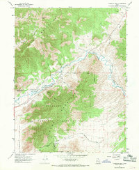
 1967 Jericho1969 Print · USGSThe Tintic Valley and Gilson Mountains appear in the late 1960s as a landscape defined by rail transit and ranching. Trace the Union Pacific line to Jericho or locate the remote Corral and Prospect site.
 - 1967 Map of Sand Pass, 1970 Print
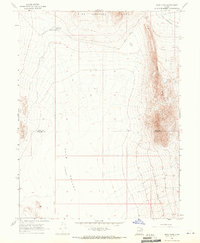 1967 Sand Pass1970 Print · USGSThe high desert of western Utah is captured here in the late sixties, where the ridges of Swasey Mountain overlook the Tule Valley. Researchers can trace the path of Sand Pass Road and locate the remote Roadside Reservoir near Sand Pass.4 unique versions available
 - 1967 Map of Sand Pass NW, 1970 Print
 1967 Sand Pass NW1970 Print · USGSJuab County in the late sixties remains a landscape of high desert peaks and wide basins. Researchers can trace the rugged topography of the Fish Springs Range and follow the route of Sand Pass Road across the Fish Springs Flat.2 unique versions available
 - 1967 Map of Sand Pass SE, 1970 Print
 1967 Sand Pass SE1970 Print · USGSJuab and Millard counties appear in the late sixties as a high-altitude expanse of mountain ridges and desert flats. Geologists and local historians can trace critical water infrastructure like Swasey Point Res and the lone Well on Fish Springs Flat.2 unique versions available
 - 1967 Map of Fish Springs NW, 1971 Print
 1967 Fish Springs NW1971 Print · USGSTooele County’s high desert meets managed wetlands in the late sixties, tracing the historic corridor of the Pony Express Road. Researchers can locate desert water sources like Wilson Health Springs and Deadman Spring or explore the Fish Springs National Wildlife Refuge.2 unique versions available
 - 1967 Map of Fish Springs SE, 1971 Print
 1967 Fish Springs SE1971 Print · USGSJuab County in the late 1960s reveals a unique intersection of migratory bird habitat and frontier history. Researchers can trace the path of the Pony Express Road as it passes Egret Pool and the Black Rock Hills.4 unique versions available
 - 1967 Map of Sand Pass NE, 1971 Print
 1967 Sand Pass NE1971 Print · USGSJuab County’s desert basin was a site of quiet exploration and remote transit during the late 1960s. Mineral prospectors and pilots can trace old sites like the Topaz Landing Strip, several Prospect mines, and the winding Sand Pass Road.2 unique versions available
Showing maps 1-25 of 27
Top cities of Juab County
- Nephi historical maps
- Mona historical maps
- Rocky Ridge historical maps
- Levan historical maps
- Eureka historical maps
Frequently asked questions
- What are the different types of historical maps available for Juab County?
- What is the oldest map of Juab County?
- Where can I purchase historical maps of Juab County for my home or office?
- Where can I download high-res historical maps of Juab County?
- Are there historical topographic maps available for Juab County?
- Is there historical aerial imagery available for Juab County?
- Where are historical maps of Juab County sourced from?