1950s Maps of Juab County, Utah
Explore 24 historic maps of Juab County from the 1950s. These maps offer a rare glimpse into what life looked like during the 1950s — showing old roads, neighborhoods, homes, and landmarks that have changed or disappeared over time.
Whether you're researching your family's past, planning a metal detecting trip, or studying how Juab County's landscape evolved across the 1950s, these high-resolution maps are a powerful tool for exploring the history of this region.
- Focus on a specific era: All maps on this page are from the 1950s, giving you a focused view of this time period.
- See what’s changed: Compare century-old streets, trails, and buildings to today's modern landscape using overlays and satellite layers.
- Research with precision: Use these maps for genealogy, historical research, land use analysis, or educational projects.
- View, download, or print: Maps are fully viewable online in high resolution, and can be downloaded or printed for your own records.
Start exploring Juab County's history through authentic maps from the 1950s. This is your window into the past.
Juab County, UT maps
(24)- 1951 Map of Moroni, 1953 Print
 1951 Moroni1953 Print · USGSThe Sanpete Valley's agricultural heart is captured here in the early fifties, showing the vital irrigation systems supporting local life. Genealogists and historians can trace family-named sites and vanished features from Fountain Green to Moroni, including the Fish Hatchery and Freedom.2 unique versions available
 - 1951 Map of Santaquin, 1953 Print
 1951 Santaquin1953 Print · USGSThe orchards and rail junctions of central Utah appear here in the early fifties, from the grid of Santaquin to the valley farms of Mona. Researchers can trace the legacy of the Privateer Mine and family landmarks like Lunt-Lattimer Spring and Burriston Ponds.3 unique versions available
 - 1951 Map of Nephi, 1953 Print
 1951 Nephi1953 Print · USGSJuab County in the early 1950s is defined by the mountain-to-valley economy of Nephi and Levan. Local historians can trace the paths of the Union Pacific railroad or locate family landmarks like Vine Bluff Cem and the Gypsum Mill.4 unique versions available
 - 1952 Map of Scipio North, 1954 Print
 1952 Scipio North1954 Print · USGSIn the early 1950s, the desert borderlands of Millard and Juab Counties were defined by the Sevier River's path and the rise of the high mountains. Trace the old Union Pacific corridor through Mills or locate family sites near Scipio and Dick & Dalton Flat.3 unique versions available
 - 1952 Map of Santaquin Peak, 1954 Print
 1952 Santaquin Peak1954 Print · USGSThe high peaks and forest canyons of central Utah are mapped here in the early fifties, showing the mountain corridor before modern development. Researchers can find old rail routes along Thistle Creek, the Wimmer Ranch homestead, and the remote Payson Guard Station.3 unique versions available
 - 1953 Map of Dugway Range NE, 1955 Print
 1953 Dugway Range NE1955 Print · USGSThe high desert of western Utah is documented here in the early fifties, showing the dramatic elevations of the Dugway Range. Researchers can locate remote water sources like Fandangle Well and Monument Reservoir along a network of old jeep trails.
 - 1953 Map of Dugway Pass, 1955 Print
 1953 Dugway Pass1955 Print · USGSJuab County in the early fifties remains a stark landscape defined by the legendary Pony Express Route. Historians and explorers can trace the precise location of the Dugway Pony Express Sta and water sources like Simpson Springs.3 unique versions available
 - 1953 Map of Dugway Range, 1955 Print
 1953 Dugway Range1955 Print · USGSJuab County in the early 1950s is a rugged landscape of mining prospects and historic trail corridors. Researchers can trace the original Pony Express Route past the Dugway Pony Express Sta and locate remote operations like the Rainbow Mines and Four Metal Mine.3 unique versions available
 - 1953 Map of Topaz Mtn, 1955 Print
 1953 Topaz Mtn1955 Print · USGSThe West Desert of Utah in the early fifties reveals a landscape shaped by mining and the search for water. Researchers can trace the routes between the Willden Mine, Freighters Well, and the high peaks of Lady Laird Peak.4 unique versions available
 - 1953 Map of Dugway Range NW, 1955 Print
 1953 Dugway Range NW1955 Print · USGSThe western Utah desert at the mid-century reveals a landscape of industrial extraction and high-altitude terrain. Metal detectorists and researchers can trace the locations of the Rainbow Mines, Four Metal Mine, and several prospect sites.2 unique versions available
 - 1953 Map of Tooele, 1968 Print
 1953 Tooele1968 Print · USGSTooele County is shown here in the 1950s, a vast landscape transitioning between the industrial growth of the Salt Lake Valley and isolated military testing grounds. Researchers can trace the routes of the Western Pacific railroad and locate historic outposts like Iosepa Ranch and St John Station.3 unique versions available
 - 1953 Map of Delta, 1969 Print
 1953 Delta1969 Print · USGSWest-central Utah in the early fifties shows a landscape of vast desert playas and rising mountain ranges. Genealogists and historians can trace rail sidings like Champlin Siding, local industry at the Tungsten Mill, and historic outposts such as Fort Deseret.3 unique versions available
 - 1954 Map of Mc Intyre, 1955 Print
 1954 Mc Intyre1955 Print · USGSJuab County ranching and railroading are captured here in the mid-1950s as the high desert landscape transitioned toward modern infrastructure. Genealogists and historians can trace the rail sidings and cattle outposts at McIntyre, Jericho, and Tintic Ranch.3 unique versions available
 - 1954 Map of Tintic Mountain, 1956 Print
 1954 Tintic Mountain1956 Print · USGSThe Tintic Mountains in the mid-1950s reveal a high-desert landscape defined by remote mining claims and isolated ranching. Researchers can trace historic operations like the Evelyn Mine or locate landmarks such as Hancock Ranch and the geological curiosity Paul Bunyans Woodpile.3 unique versions available
 - 1954 Map of Tintic Junction, 1956 Print
 1954 Tintic Junction1956 Print · USGSJuab County’s mining heartland comes into focus during the mid-1950s, showing a landscape shaped by mineral extraction and the railroad. Researchers can trace the lineage of the Tintic district through the many listed mines, Eureka Cem, and family outposts like Snell Ranch.3 unique versions available
 - 1954 Map of Eureka, 1957 Print
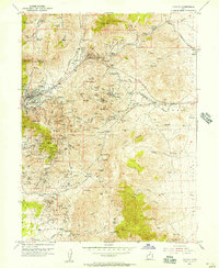 1954 Eureka1957 Print · USGSThe Tintic mining district remains a hive of industrial activity in the mid-fifties, dominated by rail lines and deep-shaft operations. Genealogists and researchers can locate family sites near Eureka, the Cem, and the historic Diamond (Site) or trace the path of the Union Pacific through these mineral-rich peaks.2 unique versions available
 - 1955 Map of Indian Springs, 1956 Print
 1955 Indian Springs1956 Print · USGSTooele and Juab counties meet in this mid-century survey of the rugged Simpson Mountains, where remote canyon geography and scarce water sources defined the landscape. You can trace early mining attempts at the Bar X Mine or locate historic watering spots like Indian Springs and Antelope Springs.3 unique versions available
 - 1955 Map of Table Mountain, 1957 Print
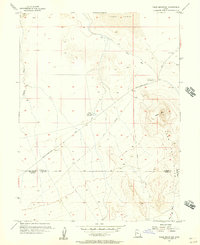 1955 Table Mountain1957 Print · USGSThe high desert of western Utah was still traversed by historical overland trails in the mid-1950s. You can trace the Pony Express Route past the Site of Riverbed Pony Express Sta and through the Slow Elk Hills.2 unique versions available
 - 1955 Map of Coyote Springs, 1957 Print
 1955 Coyote Springs1957 Print · USGSThe high desert of Tooele and Juab counties comes into focus in the mid-1950s, highlighting the critical water sources and transit routes of the Great Basin. Local history researchers can trace the legendary Pony Express Route and locate desert landmarks like Simpson Springs and Warehouse Rock.
 - 1955 Map of Tooele, 1958 Print
 1955 Tooele1958 Print · USGSTooele County and the Great Salt Lake are captured here during the mid-fifties, an era of burgeoning military testing and industrial mining. Researchers can trace the rail sidings at Salduro Station, the grounds of the Deseret Chemical Corps Depot, and the International Smelting Co facilities.3 unique versions available
 - 1956 Map of Price, 1968 Print
 1956 Price1968 Print · USGSCentral Utah in the mid-fifties showcases a landscape shaped by coal mining and mountain-fed irrigation. Trace the rail-and-river economy through the Geneva Coal Mine, the Union Pacific line, and settlements like Price and Ephraim.3 unique versions available
 - 1956 Map of Ely, 1968 Print
 1956 Ely1968 Print · USGSEastern Nevada in the mid-fifties is a land of massive mountain ranges and silver-boom history. Trace the legacy of mining ruins at Hamilton and Treasure City or follow the path of the Nevada Northern RR through Ely.5 unique versions available
 - 1958 Map of Delta
 1958 Delta1958 Print · USGSThe West Desert of Utah comes into sharp focus during the late 1950s, showing the intersection of military ranges, irrigation projects, and historical transit. You can trace the proximity of the Topaz Camp to Delta, or locate the Pony Express Monument and the ruins of Fort Deseret.
 - 1959 Map of Ely
 1959 Ely1959 Print · USGSEastern Nevada's high desert reveals its mining heart and pioneer ranching outposts during the late fifties. Genealogists and historians can trace family-named outposts like Goicoechea Ranch or explore the ruins of former silver-mining hubs like Hamilton and Treasure City.2 unique versions available
End of results
Showing maps 1-24 of 24
Top cities of Juab County
- Nephi historical maps
- Mona historical maps
- Rocky Ridge historical maps
- Levan historical maps
- Eureka historical maps
Frequently asked questions
- What are the different types of historical maps available for Juab County?
- What is the oldest map of Juab County?
- Where can I purchase historical maps of Juab County for my home or office?
- Where can I download high-res historical maps of Juab County?
- Are there historical topographic maps available for Juab County?
- Is there historical aerial imagery available for Juab County?
- Where are historical maps of Juab County sourced from?