1990s Maps of Juab County, Utah
Explore 26 historic maps of Juab County from the 1990s. These maps offer a rare glimpse into what life looked like during the 1990s — showing old roads, neighborhoods, homes, and landmarks that have changed or disappeared over time.
Whether you're researching your family's past, planning a metal detecting trip, or studying how Juab County's landscape evolved across the 1990s, these high-resolution maps are a powerful tool for exploring the history of this region.
- Focus on a specific era: All maps on this page are from the 1990s, giving you a focused view of this time period.
- See what’s changed: Compare century-old streets, trails, and buildings to today's modern landscape using overlays and satellite layers.
- Research with precision: Use these maps for genealogy, historical research, land use analysis, or educational projects.
- View, download, or print: Maps are fully viewable online in high resolution, and can be downloaded or printed for your own records.
Start exploring Juab County's history through authentic maps from the 1990s. This is your window into the past.
Juab County, UT maps
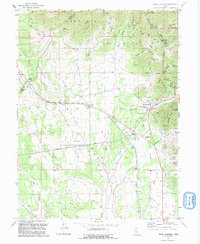
(26)- 1991 Map of Hole-in-the-Wall Reservoir
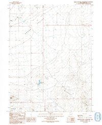 1991 Hole-in-the-Wall Reservoir1991 Print · USGSSnake Valley in the early nineties remains a study in isolation and resource management in the Utah desert. Researchers can locate remote sites like Granite Ranch, the Hole-in-the-Wall Reservoir, and a high-elevation Prospect in the Middle Range.
 - 1991 Map of Trout Creek SW
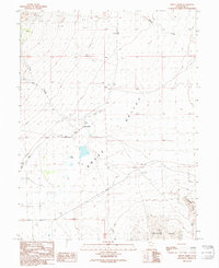
 1991 Trout Creek SW1991 Print · USGSJuab and Millard Counties are shown during the early nineties at the junction of mountain peaks and desert basins. Researchers can trace the desert mining legacy near Tungstonia through local prospects and find old routes like the Gandy Road.
 - 1991 Map of Trout Creek
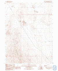
 1991 Trout Creek1991 Print · USGSSnake Valley and the northern reaches of the Confusion Range appear here as they were surveyed in the late twentieth century. Genealogists and local historians can locate the small settlement of Trout Creek, follow the path of Gandy Road, and identify old Mine Shafts.
 - 1991 Map of Middle Range North
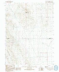
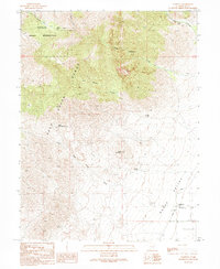
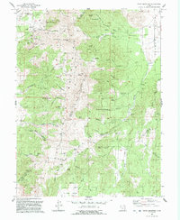
 1991 Middle Range North1991 Print · USGSJuab County in the early 1990s reveals a high-desert landscape defined by the prominent Middle Range. Researchers can trace old mining efforts at several Prospects or follow the route of the Weiss Highway past The Honeycombs.
 - 1991 Map of Granite Mountain
 1991 Granite Mountain1991 Print · USGSThe West Desert of Utah is captured here in the early 1990s at the intersection of Juab and Millard counties. Researchers can trace remote desert routes and topographical landmarks like Granite Mountain, the Confusion Range, and the aptly named Disappointment Hills.
 - 1991 Map of Partoun
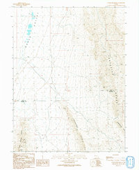
 1991 Partoun1991 Print · USGSSettlement in the remote Snake Valley is captured here in the early nineties, centered on the community of Partoun. Local researchers can trace the West Desert Sch and water sources like Lime Spring along the foot of Lime Mountain.
 - 1991 Map of Middle Range South
 1991 Middle Range South1991 Print · USGSJuab and Millard counties meet in this high desert landscape during the early nineties, where the Middle Range overlooks the deep Tule Valley. You can trace remote tracks and historical markers like a lone Well and a mountain Mine.
 - 1991 Map of Cockscomb Ridge
 1991 Cockscomb Ridge1991 Print · USGSThe high desert basins of western Utah are documented here in the early nineties, centered on the stark divide between Juab and Millard counties. Geologists and surveyors can trace the remote network of 4WD tracks connecting landmarks like the Radio Facility and Cockscomb Ridge.
 - 1992 Map of Eureka
 1992 Eureka1992 Print · USGSThe Tintic Mining District is shown here in the early nineties, revealing a landscape transformed by decades of hard-rock mining. Genealogists and historians can trace former town sites like Knightville and Dividend alongside major shafts including the Mammoth Shaft and Chief No 1.2 unique versions available
 - 1992 Map of Tintic Junction
 1992 Tintic Junction1992 Print · USGSThe Tintic Mining District is shown in the late twentieth century as it transitioned from an industrial powerhouse to a quieter rural landscape. Researchers can trace the heritage of local families and the ore economy through Silver City, Mammoth, and the Victoria Gold Mine.
 - 1992 Map of Tintic Mountain
 1992 Tintic Mountain1992 Print · USGSThe Tintic Mountains in the early nineties show a rugged landscape shaped by Utah's mining history. Researchers can trace historic extraction sites like the Rising Sun Mine and Buckeye Mine or locate the Dennis (Site) and the geological Paul Bunyans Woodpile.
 - 1992 Map of Mc Intyre
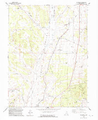 1992 Mc Intyre1992 Print · USGSThe high desert of Juab County in the early nineties reveals a landscape of ranching, mining, and old rail routes. Historians can trace the Old Railroad Grade through the valley or locate early sites like McIntyre and Jericho.
 - 1993 Map of Boulter Peak
 1993 Boulter Peak1993 Print · USGSThe East Tintic Mountains at the triple junction of Tooele, Utah, and Juab counties show a landscape defined by decades of mining. Researchers can trace historic industrial sites like the Scranton Mine, New Bullion Mine, and the high summit of Boulter Peak.
 - 1993 Map of Fish Springs NW, 1996 Print
 1993 Fish Springs NW1996 Print · USGSThe West Desert of Utah in the early 1990s reveals a landscape of vital springs and historic trails. Trace the legacy of the western frontier along the Pony Express Road or explore the wetlands of the Fish Springs National Wildlife Refuge, including North Springs and Deadman Spring.
 - 1993 Map of Callao, 1996 Print
 1993 Callao1996 Print · USGSSnake Valley settlement and desert transit are captured here in the 1990s. Researchers can trace the path of the Pony Express Overland Stage Route and locate historic water sources like Willow Springs Station and Big Spring.
 - 1993 Map of Dugway Range NW, 1996 Print
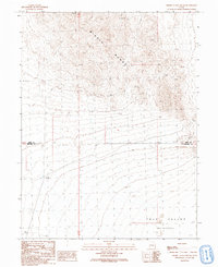
 1993 Dugway Range NW1996 Print · USGSThe high desert of western Utah was still a landscape of active prospecting and military exclusion in the 1990s. Researchers can trace the layout of the Rainbow Mines, locate the isolated Well No 28, and see the extent of the Dugway Proving Ground Boundary.
 - 1993 Map of Dugway Range NE, 1996 Print
 1993 Dugway Range NE1996 Print · USGSThe eastern Dugway Range comes into focus during the mid-1990s, revealing a landscape of high-desert ridges and critical water points. Researchers can trace remote 4WD trails to Dugway Topaz Well, Monument Reservoir, and the peak of Pyramid Peak.
 - 1993 Map of Fish Springs NE, 1996 Print
 1993 Fish Springs NE1996 Print · USGSThe high desert of western Utah in the 1990s reveals a unique intersection of military history and conservation. Trace the path of the Pony Express Road to the Black Rock Pony Express Station Historical Monument or explore the wetlands of the Fish Springs National Wildlife Refuge.
 - 1993 Map of Callao NE, 1996 Print
 1993 Callao NE1996 Print · USGSSnake Valley's remote desert floor appears in the early 1990s as a landscape of military testing and historical trails. Trace the path of the Pony Express Route and the edges of the Dugway Proving Ground through vast Sand Dunes.
 - 1998 Map of Santaquin, 2002 Print
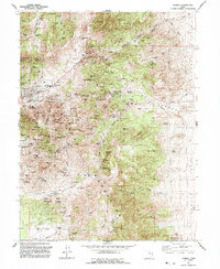
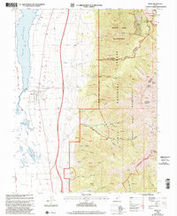
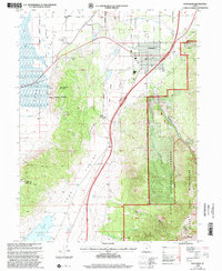 1998 Santaquin2002 Print · USGSThe foothills of the Wasatch Range meet the agricultural fields of Utah and Juab Counties in the late nineties. Local researchers can trace water rights along the Strawberry Highline Canal or explore old mining sites and cemeteries near Santaquin and Genola.
 - 1998 Map of Indian Springs, 2002 Print
 1998 Indian Springs2002 Print · USGSHigh in the Simpson Mountains at the end of the twentieth century, this survey tracks the rugged border between Tooele and Juab counties. Researchers can locate remote mining sites like the Bar X Mine and prospects alongside numerous water sources including Antelope Springs and Cherry Springs.
 - 1998 Map of Mona, 2002 Print
 1998 Mona2002 Print · USGSThe Juab Valley and the foothills of the Uinta National Forest are captured here in the late nineties as the town of Mona sits at the foot of the mountain front. Genealogists and local historians can locate the Mona Cem, the high-altitude Privateer Mine, and the vanished settlement at Starr.
 - 1998 Map of Dutch Peak, 2002 Print
 1998 Dutch Peak2002 Print · USGSThe Sheeprock and Tintic Mountains meet in this late 1990s survey of the Tooele and Juab county border. Researchers can trace historic mining activity near Dutch Peak and find water sources like Vernon Reservoir and Chokecherry Spring.
 - 1998 Map of Erickson Knoll, 2002 Print
 1998 Erickson Knoll2002 Print · USGSThe Sheeprock Mountains and the Tooele-Juab county line are documented here in the late nineties. Researchers can locate remote ranching outposts like Ekker Ranch and historic mining claims including the Utah Mine and Flying Dutchman Mine.
 - 1998 Map of Sabie Mountain, 2002 Print
 1998 Sabie Mountain2002 Print · USGSThe high desert ranges of Tooele and Juab counties are captured here in the late 1990s as the landscape remained a mix of federal forest land and mining prospects. Researchers can locate remote outposts like Dry Farm and Sumner Ranch or trace the 4WD trails leading to Devils Gate.
Showing maps 1-25 of 26
Top cities of Juab County
- Nephi historical maps
- Mona historical maps
- Rocky Ridge historical maps
- Levan historical maps
- Eureka historical maps
Frequently asked questions
- What are the different types of historical maps available for Juab County?
- What is the oldest map of Juab County?
- Where can I purchase historical maps of Juab County for my home or office?
- Where can I download high-res historical maps of Juab County?
- Are there historical topographic maps available for Juab County?
- Is there historical aerial imagery available for Juab County?
- Where are historical maps of Juab County sourced from?