Old Maps of Juab County, Utah for Hiking & Exploration
Hike through history with 255 historic maps of Juab County. Explore old trails, ghost towns, and forgotten backroads — perfect for outdoor adventurers and local explorers.
- Rediscover forgotten places: Map out old mining camps, roads, and footpaths that no longer exist on modern maps.
- Layer with modern tools: Combine with LiDAR or satellite views to plan hikes through historical terrain.
- Made for exploration: Popular among hikers, overlanders, and local history lovers.
Use these maps to find adventure and explore the hidden past of Juab County.
Juab County, UT maps
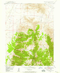
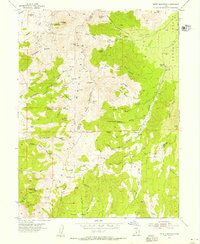
(255)- 1885 Map of Manti
 1885 Manti1885 Print · USGSCentral Utah during the mid-1880s reveals a growing network of agricultural towns and vital rail lines through the high desert. Researchers can trace early family settlements along the San Pete River and locate historic depots like Pleasant Valley Junction or the early township of Nephi.4 unique versions available
 - 1885 Map of Sevier Desert
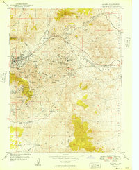
 1885 Sevier Desert1885 Print · USGSMining districts and desert outposts across central Utah come to life in the mid-1880s as the railroad pushes through the canyon. Researchers can trace early industrial footprints at Silver City, locate the riverside settlement of Deseret, and follow the original Central Pacific Railroad line.5 unique versions available
 - 1885 Map of Tooele Valley
 1885 Tooele Valley1885 Print · USGSThe valleys and ranges west of the Wasatch are captured here in the mid-1880s, showcasing the early mining and rail infrastructure of the region. Genealogists can trace early settlements like Grantsville, Ophir, and Stockton, or the route of the Utah and Nevada R. R.6 unique versions available
 - 1895 Map of Manti, 1921 Print
 1895 Manti1921 Print · USGSSanpete County and the high plateaus of central Utah are captured in the late nineteenth century as irrigation and railroads transformed the valley floor. Genealogists and historians can trace the early layout of Manti, Ephraim, and Nephi, alongside smaller outposts like Fountain Green and Mayfield.
 - 1908 Map of Fish Springs
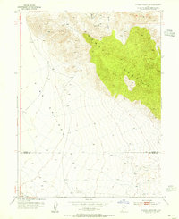
 1908 Fish Springs1908 Print · USGSWestern Utah at the turn of the century is a land of remote mining camps and desert outposts. Trace family history and early industry at Utah Mine, Joy P.O., and the isolated Butson's Ranch near the Confusion Range.
 - 1910 Map of Fish Springs
 1910 Fish Springs1910 Print · USGSWestern Utah's high desert and isolated mining districts are mapped here in the early twentieth century, showing a landscape of remote ranching and rugged mineral claims. Local historians can trace family-named outposts like Meecham's Ranch and Thomas' Ranch or locate the Queen of Sheba Mine and Fish Springs.6 unique versions available
 - 1947 Map of Fivemile Pass, 1953 Print
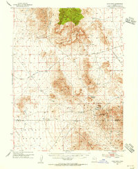
 1947 Fivemile Pass1953 Print · USGSUtah's high desert reveals its mining and transit legacy in the late 1940s as the East Tintic Mountains hum with mineral extraction. Trace the storied Pony Express Route or locate historic operations like the Lehi Tintic Mine and the settlement of Topliff.
 - 1947 Map of Boulter Peak, 1958 Print
 1947 Boulter Peak1958 Print · USGSThe East Tintic Mountains meet the desert basins of Tooele and Juab counties in the late 1940s. Researchers can trace historical mining claims and rugged transportation routes like the Scranton Mine, Twelvemile Pass, and Silver Dollar Mine.2 unique versions available
 - 1949 Map of Eureka
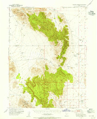
 1949 Eureka1949 Print · USGSThe Tintic mining district was at the height of its industrial reach in the late 1940s, marking a landscape defined by deep shafts and rail lines. You can trace the exact locations of historic operations like Mammoth, the Iron King No 1 Shaft, and the camps at Knightville.
 - 1951 Map of Moroni, 1953 Print
 1951 Moroni1953 Print · USGSThe Sanpete Valley's agricultural heart is captured here in the early fifties, showing the vital irrigation systems supporting local life. Genealogists and historians can trace family-named sites and vanished features from Fountain Green to Moroni, including the Fish Hatchery and Freedom.2 unique versions available
 - 1951 Map of Santaquin, 1953 Print
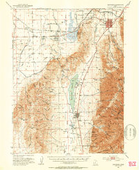 1951 Santaquin1953 Print · USGSThe orchards and rail junctions of central Utah appear here in the early fifties, from the grid of Santaquin to the valley farms of Mona. Researchers can trace the legacy of the Privateer Mine and family landmarks like Lunt-Lattimer Spring and Burriston Ponds.3 unique versions available
 - 1951 Map of Nephi, 1953 Print
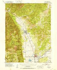
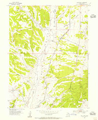
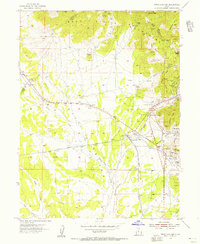
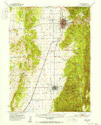 1951 Nephi1953 Print · USGSJuab County in the early 1950s is defined by the mountain-to-valley economy of Nephi and Levan. Local historians can trace the paths of the Union Pacific railroad or locate family landmarks like Vine Bluff Cem and the Gypsum Mill.4 unique versions available
 - 1952 Map of Scipio North, 1954 Print
 1952 Scipio North1954 Print · USGSIn the early 1950s, the desert borderlands of Millard and Juab Counties were defined by the Sevier River's path and the rise of the high mountains. Trace the old Union Pacific corridor through Mills or locate family sites near Scipio and Dick & Dalton Flat.3 unique versions available
 - 1952 Map of Santaquin Peak, 1954 Print
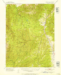 1952 Santaquin Peak1954 Print · USGSThe high peaks and forest canyons of central Utah are mapped here in the early fifties, showing the mountain corridor before modern development. Researchers can find old rail routes along Thistle Creek, the Wimmer Ranch homestead, and the remote Payson Guard Station.3 unique versions available
 - 1953 Map of Dugway Range NE, 1955 Print
 1953 Dugway Range NE1955 Print · USGSThe high desert of western Utah is documented here in the early fifties, showing the dramatic elevations of the Dugway Range. Researchers can locate remote water sources like Fandangle Well and Monument Reservoir along a network of old jeep trails.
 - 1953 Map of Dugway Pass, 1955 Print
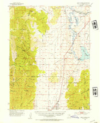
 1953 Dugway Pass1955 Print · USGSJuab County in the early fifties remains a stark landscape defined by the legendary Pony Express Route. Historians and explorers can trace the precise location of the Dugway Pony Express Sta and water sources like Simpson Springs.3 unique versions available
 - 1953 Map of Dugway Range, 1955 Print
 1953 Dugway Range1955 Print · USGSJuab County in the early 1950s is a rugged landscape of mining prospects and historic trail corridors. Researchers can trace the original Pony Express Route past the Dugway Pony Express Sta and locate remote operations like the Rainbow Mines and Four Metal Mine.3 unique versions available
 - 1953 Map of Topaz Mtn, 1955 Print
 1953 Topaz Mtn1955 Print · USGSThe West Desert of Utah in the early fifties reveals a landscape shaped by mining and the search for water. Researchers can trace the routes between the Willden Mine, Freighters Well, and the high peaks of Lady Laird Peak.4 unique versions available
 - 1953 Map of Dugway Range NW, 1955 Print
 1953 Dugway Range NW1955 Print · USGSThe western Utah desert at the mid-century reveals a landscape of industrial extraction and high-altitude terrain. Metal detectorists and researchers can trace the locations of the Rainbow Mines, Four Metal Mine, and several prospect sites.2 unique versions available
 - 1953 Map of Tooele, 1968 Print
 1953 Tooele1968 Print · USGSTooele County is shown here in the 1950s, a vast landscape transitioning between the industrial growth of the Salt Lake Valley and isolated military testing grounds. Researchers can trace the routes of the Western Pacific railroad and locate historic outposts like Iosepa Ranch and St John Station.3 unique versions available
 - 1953 Map of Delta, 1969 Print
 1953 Delta1969 Print · USGSWest-central Utah in the early fifties shows a landscape of vast desert playas and rising mountain ranges. Genealogists and historians can trace rail sidings like Champlin Siding, local industry at the Tungsten Mill, and historic outposts such as Fort Deseret.3 unique versions available
 - 1954 Map of Mc Intyre, 1955 Print
 1954 Mc Intyre1955 Print · USGSJuab County ranching and railroading are captured here in the mid-1950s as the high desert landscape transitioned toward modern infrastructure. Genealogists and historians can trace the rail sidings and cattle outposts at McIntyre, Jericho, and Tintic Ranch.3 unique versions available
 - 1954 Map of Tintic Mountain, 1956 Print
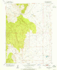
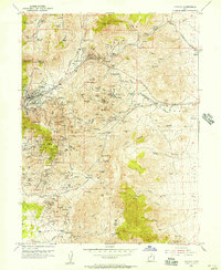
 1954 Tintic Mountain1956 Print · USGSThe Tintic Mountains in the mid-1950s reveal a high-desert landscape defined by remote mining claims and isolated ranching. Researchers can trace historic operations like the Evelyn Mine or locate landmarks such as Hancock Ranch and the geological curiosity Paul Bunyans Woodpile.3 unique versions available
 - 1954 Map of Tintic Junction, 1956 Print
 1954 Tintic Junction1956 Print · USGSJuab County’s mining heartland comes into focus during the mid-1950s, showing a landscape shaped by mineral extraction and the railroad. Researchers can trace the lineage of the Tintic district through the many listed mines, Eureka Cem, and family outposts like Snell Ranch.3 unique versions available
 - 1954 Map of Eureka, 1957 Print
 1954 Eureka1957 Print · USGSThe Tintic mining district remains a hive of industrial activity in the mid-fifties, dominated by rail lines and deep-shaft operations. Genealogists and researchers can locate family sites near Eureka, the Cem, and the historic Diamond (Site) or trace the path of the Union Pacific through these mineral-rich peaks.2 unique versions available
Showing maps 1-25 of 255
Top cities of Juab County
- Nephi historical maps
- Mona historical maps
- Rocky Ridge historical maps
- Levan historical maps
- Eureka historical maps
Frequently asked questions
- What are the different types of historical maps available for Juab County?
- What is the oldest map of Juab County?
- Where can I purchase historical maps of Juab County for my home or office?
- Where can I download high-res historical maps of Juab County?
- Are there historical topographic maps available for Juab County?
- Is there historical aerial imagery available for Juab County?
- Where are historical maps of Juab County sourced from?