1980s Maps of Juab County, Utah
Explore 28 historic maps of Juab County from the 1980s. These maps offer a rare glimpse into what life looked like during the 1980s — showing old roads, neighborhoods, homes, and landmarks that have changed or disappeared over time.
Whether you're researching your family's past, planning a metal detecting trip, or studying how Juab County's landscape evolved across the 1980s, these high-resolution maps are a powerful tool for exploring the history of this region.
- Focus on a specific era: All maps on this page are from the 1980s, giving you a focused view of this time period.
- See what’s changed: Compare century-old streets, trails, and buildings to today's modern landscape using overlays and satellite layers.
- Research with precision: Use these maps for genealogy, historical research, land use analysis, or educational projects.
- View, download, or print: Maps are fully viewable online in high resolution, and can be downloaded or printed for your own records.
Start exploring Juab County's history through authentic maps from the 1980s. This is your window into the past.
Juab County, UT maps
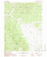
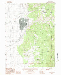
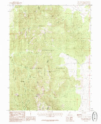
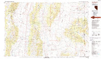
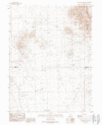
(28)- 1981 Map of Nephi
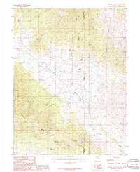
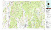 1981 Nephi1981 Print · USGSThe Juab and Sanpete valleys of central Utah are captured here in the early 1980s, during a period of established mountain settlement and rail-based commerce. Researchers can trace the routes of the Union Pacific and visit traditional communities like Nephi, Mount Pleasant, and Scofield.3 unique versions available
 - 1981 Map of Manti
 1981 Manti1981 Print · USGSCentral Utah in the early eighties shows a landscape of mountain-fed valleys and high plateau coal mines. Trace the rail lines of the Denver and Rio Grande Western or locate family roots in Gunnison, Orangeville, or Castle Dale.2 unique versions available
 - 1981 Map of Georgetta Ranch
 1981 Georgetta Ranch1981 Print · USGSThe Nevada-Utah borderlands are captured in the early eighties as a landscape of remote ranching and desert transit. Genealogists and historians can trace the foundations of Georgetta Ranch, the route of Whiskey Road, and the extent of the Goshute Indian Reservation.
 - 1981 Map of Weaver Canyon
 1981 Weaver Canyon1981 Print · USGSThe Nevada-Utah borderlands are captured here in the early eighties, where the Goshute lands meet the Great Basin high country. Family researchers and historians can trace the remote Thomas Place ranch and old mineral claims like the Lucky Strike Mine.
 - 1983 Map of Fountain Green North
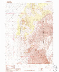
 1983 Fountain Green North1983 Print · USGSThe transition from the Sanpete Valley into the Uinta National Forest is captured here in the early eighties. Genealogists and local historians can trace the grid of Fountain Green and find landmark water sources like Big Springs, Holman Spring, and Bradley Springs.
 - 1983 Map of Levan
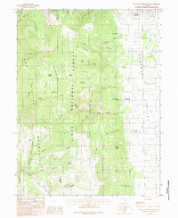
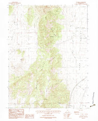
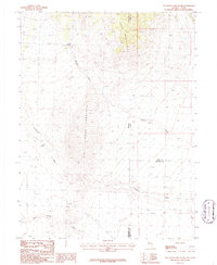
 1983 Levan1983 Print · USGSIn the early 1980s, the community of Levan remained a vital hub where the valley floor met the high peaks of the Uinta National Forest. Local researchers can trace the town layout including the Cem and Gravel Pits, or explore the canyon networks of Pigeon Creek and Chicken Hollow.
 - 1983 Map of Fountain Green South
 1983 Fountain Green South1983 Print · USGSSanpete County in the early 1980s reveals a rural landscape where mountain canyons meet the valley floor. Researchers can locate the small communities of Freedom and Jerusalem, as well as local landmarks like the Cemetery and Hamburger Lake.2 unique versions available
 - 1983 Map of Juab
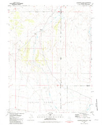
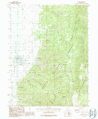
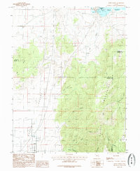
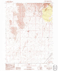
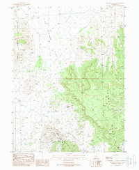
 1983 Juab1983 Print · USGSJuab and the surrounding basin floor are captured in the early eighties as they sit at the edge of the high desert peaks. Researchers can trace the drainage of Chicken Creek and the transit route through Sage Valley Pass between the West Hills and Juab Valley.
 - 1983 Map of Nephi
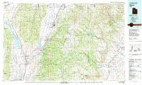
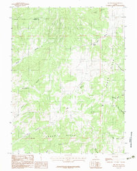
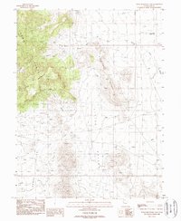
 1983 Nephi1983 Print · USGSJuab Valley life in the early eighties is centered around the growing hub of Nephi and the mountain-flanked village of Levan. Genealogists and researchers can trace the local landscape through the Cem, resource sites like Quarries, and named springs including Old Pinery Springs.2 unique versions available
 - 1983 Map of Big Hollow
 1983 Big Hollow1983 Print · USGSSanpete County high-desert terrain is documented here during the early eighties, showing the remote canyonlands along the Juab County line. Researchers can trace vital water sources and landmarks like Whitaker Springs, Pollys Peak, and the winding Big Hollow.2 unique versions available
 - 1983 Map of Sugarloaf
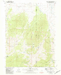
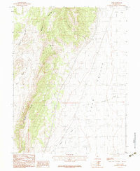
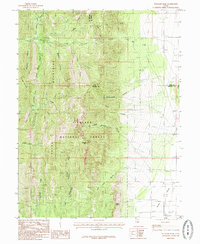
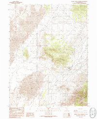
 1983 Sugarloaf1983 Print · USGSJuab County in the early 1980s is defined here by the sharp transition between the West Hills and the fertile Juab Valley. Genealogists and historians can trace old routes and water sources like Government Spring, Orme Spring, and Fourmile Creek.2 unique versions available
 - 1985 Map of Williams Peak
 1985 Williams Peak1985 Print · USGSThe high ridges of Millard County are captured in this mid-eighties survey during a period of steady land management. Researchers can trace remote water sources like John Williams Spring or follow the descent of Eightmile Creek into the Scipio Valley.
 - 1985 Map of Fool Creek Peak
 1985 Fool Creek Peak1985 Print · USGSThe high Canyon Mountains in the mid-eighties mark a landscape of sharp ridges and vital water sources on the Juab-Millard county line. Researchers can trace remote 4WD routes leading to Mourning Dove Spring and family-named landmarks like Charley Johnson Canyon.
 - 1985 Map of Mills
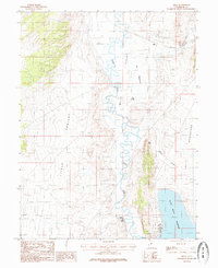 1985 Mills1985 Print · USGSJuab and Utah County geography in the early 1980s is defined by the winding Sevier River and the small rail-side settlement of Mills. Researchers can trace the Union Pacific line as it skirts The Meadows or explore the early layout of Yuba Lake State Recreation Area.
 - 1985 Map of Scipio North
 1985 Scipio North1985 Print · USGSThe high desert of central Utah comes into focus in the mid-1980s, centered on the settlement of Scipio. Researchers can trace local landmarks like the Cem and the vast Sevier Bridge Reservoir or explore family-named terrain like Dick and Dalton Flat.
 - 1986 Map of Lynndyl East
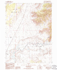 1986 Lynndyl East1986 Print · USGSJuab and Millard counties are captured in the mid-eighties as a landscape of desert dunes and irrigated river valleys. Researchers can trace the Union Pacific rail corridor through Lynndyl and Leamington or follow the path of the Central Utah Canal.
 - 1986 Map of Lynndyl West
 1986 Lynndyl West1986 Print · USGSThe high desert of western Utah is captured here in the mid-1980s, highlighting the transition from rugged dunes to the rail-side settlement of Lynndyl. Trace the Union Pacific tracks and the vast borders of the Little Sahara National Recreation Area.
 - 1986 Map of Tanner Creek Narrows
 1986 Tanner Creek Narrows1986 Print · USGSJuab County in the mid-1980s reveals a landscape defined by the shifting sands of the Little Sahara National Recreation Area. Genealogists and historians can trace the geography around Jericho and Champlin, or locate the Tanner Creek Narrows amidst the Black Mountains.
 - 1986 Map of Lynndyl NW
 1986 Lynndyl NW1986 Print · USGSThe high-desert dunes of Juab County are captured in the mid-1980s just as recreational management was taking shape. Outdoorsmen and geologists can trace the relief of Sand Mountain and the Sand Hills within the Little Sahara National Recreation Area.
 - 1986 Map of Tin Springs Mountain
 1986 Tin Springs Mountain1986 Print · USGSThe high desert border between Nevada and Utah is captured in the mid-1980s as it spans three different counties. Researchers can trace the drainage of Tungstonia Wash and locate vital water sources like Tin Spring and Sulphur Spring.
 - 1986 Map of Skinner Canyon, 1988 Print
 1986 Skinner Canyon1988 Print · USGSThe high-desert border of Nevada and Utah is captured here in the 1980s, centered on the rugged transition between Pleasant Valley and the Kern Mountains. Trace the isolated water sources essential for life in the Great Basin, from Cane Spring to a lonely Mine Shaft high in the hills.
 - 1988 Map of Kern Mountains
 1988 Kern Mountains1988 Print · USGSThe high-desert basins of the Nevada-Utah border are captured here in the late eighties, documenting a remote landscape of mining and ranching. Researchers can trace historic travel routes through Schellbourne Pass or locate the site of Cherry Creek Station and Stonehouse.2 unique versions available
 - 1988 Map of Dugway Range SW, 1989 Print
 1988 Dugway Range SW1989 Print · USGSJuab County, Utah, is shown in the late 1980s as a high-desert landscape defined by intense mineral exploration. Researchers can locate specific mining operations like the Lost Sheep Mine, Oversight Mine, and Thursday Mine among the slopes of Spor Mountain.
 - 1988 Map of Topaz Mountain East, 1989 Print
 1988 Topaz Mountain East1989 Print · USGSJuab County’s high desert mining landscape is captured in the late 1980s as mineral exploration shaped the remote terrain. Prospectors and geologists can trace numerous Prospects near Topaz Mountain and the distinctive Pismire Knolls.
 - 1988 Map of Topaz Mountain SW, 1989 Print
 1988 Topaz Mountain SW1989 Print · USGSThe high desert basins of Juab and Millard Counties are captured in the late eighties, documenting a landscape of intermittent washes and remote springs. Researchers can trace historic water sources like Swasey Springs and the drainage of Swasey Wash into the Whirlwind Valley.
Showing maps 1-25 of 28
Top cities of Juab County
- Nephi historical maps
- Mona historical maps
- Rocky Ridge historical maps
- Levan historical maps
- Eureka historical maps
Frequently asked questions
- What are the different types of historical maps available for Juab County?
- What is the oldest map of Juab County?
- Where can I purchase historical maps of Juab County for my home or office?
- Where can I download high-res historical maps of Juab County?
- Are there historical topographic maps available for Juab County?
- Is there historical aerial imagery available for Juab County?
- Where are historical maps of Juab County sourced from?