1930s Maps of Piute County, Utah
Explore 3 historic maps of Piute County from the 1930s. These maps offer a rare glimpse into what life looked like during the 1930s — showing old roads, neighborhoods, homes, and landmarks that have changed or disappeared over time.
Whether you're researching your family's past, planning a metal detecting trip, or studying how Piute County's landscape evolved across the 1930s, these high-resolution maps are a powerful tool for exploring the history of this region.
- Focus on a specific era: All maps on this page are from the 1930s, giving you a focused view of this time period.
- See what’s changed: Compare century-old streets, trails, and buildings to today's modern landscape using overlays and satellite layers.
- Research with precision: Use these maps for genealogy, historical research, land use analysis, or educational projects.
- View, download, or print: Maps are fully viewable online in high resolution, and can be downloaded or printed for your own records.
Start exploring Piute County's history through authentic maps from the 1930s. This is your window into the past.
Piute County, UT maps
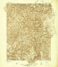
(3)- 1932 Map of Sevier, 1975 Print
 1932 Sevier1975 Print · USGSThe high plateau country of central Utah comes into focus in the early 1930s, showing a landscape defined by the Denver & Rio Grande Western railroad and remote mountain peaks. Genealogists and local historians can trace family-named landmarks like Parker Ranch or locate early forest service outposts at Rockwood Ranger Sta.
 - 1935 Map of Sevier
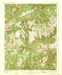 1935 Sevier1935 Print · USGSThe high country of Sevier and Millard Counties is captured here in the mid-1930s, documenting the early forest management and transit routes of the era. Genealogists and historians can trace old homesteads like Parker Ranch and find remote outposts such as Rockwood Ranger Sta and Pavant Ranger Sta.3 unique versions available
 - 1937 Map of Delano Peak
 1937 Delano Peak1937 Print · USGSThe Tushar Mountains are seen here during a peak era of mineral extraction in the late 1930s. Researchers can trace the layout of mining camps like Upper Kimberly or locate historical claims such as the Annie Laurie Mine and Bully Boy Mine.2 unique versions available
End of results
Showing maps 1-3 of 3
Top cities of Piute County
- Circleville historical maps
- Marysvale historical maps
- Junction historical maps
- Kingston historical maps
Frequently asked questions
- What are the different types of historical maps available for Piute County?
- What is the oldest map of Piute County?
- Where can I purchase historical maps of Piute County for my home or office?
- Where can I download high-res historical maps of Piute County?
- Are there historical topographic maps available for Piute County?
- Is there historical aerial imagery available for Piute County?
- Where are historical maps of Piute County sourced from?