1960s Maps of Piute County, Utah
Explore 12 historic maps of Piute County from the 1960s. These maps offer a rare glimpse into what life looked like during the 1960s — showing old roads, neighborhoods, homes, and landmarks that have changed or disappeared over time.
Whether you're researching your family's past, planning a metal detecting trip, or studying how Piute County's landscape evolved across the 1960s, these high-resolution maps are a powerful tool for exploring the history of this region.
- Focus on a specific era: All maps on this page are from the 1960s, giving you a focused view of this time period.
- See what’s changed: Compare century-old streets, trails, and buildings to today's modern landscape using overlays and satellite layers.
- Research with precision: Use these maps for genealogy, historical research, land use analysis, or educational projects.
- View, download, or print: Maps are fully viewable online in high resolution, and can be downloaded or printed for your own records.
Start exploring Piute County's history through authentic maps from the 1960s. This is your window into the past.
Piute County, UT maps
(12)- 1960 Map of Salina
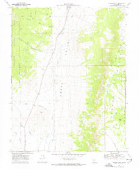
 1960 Salina1960 Print · USGSThe high plateaus and canyonlands of south-central Utah appear in the early sixties as a region of remote ranching towns and developing parklands. Researchers can trace historic settlements like Fruita and Loa or locate the uranium mines and the tracks of the Denver and Rio Grande Western RR.2 unique versions available
 - 1962 Map of Salina
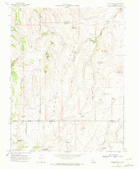
 1962 Salina1962 Print · USGSSevier County and the surrounding desert wilderness appear here in the early sixties as a network of isolated river valley towns and high-altitude forests. Researchers can locate remote landmarks like Fruita, trace the Denver & Rio Grande Western RR, and find backcountry sites like the Aquarius Ranger Station.
 - 1962 Map of Cove Fort, 1964 Print
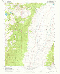
 1962 Cove Fort1964 Print · USGSCentral Utah in the early sixties reveals a high-desert landscape defined by historic waypoints and volcanic terrain. Genealogists and historians can trace routes through Cove Fort and Sulphurdale, or locate landmarks like Cinder Crater and Cedar Grove.
 - 1966 Map of Circleville, 1968 Print
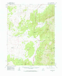
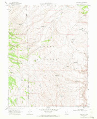
 1966 Circleville1968 Print · USGSThe Mormon village of Circleville is captured in the mid-sixties as it serves the surrounding high-desert ranching and farming operations. Researchers can trace irrigation networks like the Lost Creek Canal and find family-named landmarks such as Betenson Flat and Lums Creek.
 - 1966 Map of Junction, 1968 Print
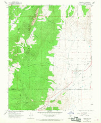
 1966 Junction1968 Print · USGSThe high desert valley of Junction and Kingston is captured here in the mid-sixties, showing a landscape defined by the Sevier River and complex irrigation. Researchers can trace historic water routes like the Kingston Canal or locate local landmarks such as Piute High Sch and several Prospects in the foothills.3 unique versions available
 - 1968 Map of Koosharem, 1972 Print
 1968 Koosharem1972 Print · USGSGrass Valley and the high plateaus of Sevier County come into focus in the late sixties, showing the rural community of Koosharem and its surrounding water infrastructure. Researchers can locate the Koosharem Cemetery and trace remote mountain trails leading to landmarks like Magleby Reservoir and Milos Kitchen.2 unique versions available
 - 1968 Map of Burrville, 1972 Print
 1968 Burrville1972 Print · USGSGrass Valley and the high plateaus of central Utah are captured in the late sixties as agricultural and forest lands intersected. Researchers can locate the Burrville Cem and trace historic routes like the Old Bamberger Road and the Aqueduct.
 - 1969 Map of Parker Knoll, 1972 Print
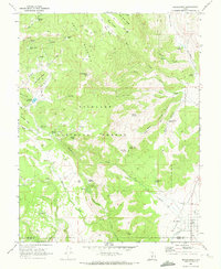
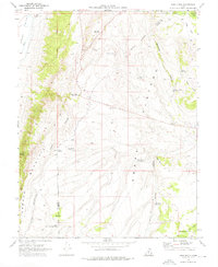
 1969 Parker Knoll1972 Print · USGSGrass Valley and the surrounding Piute County uplands are captured here in the late sixties as a network of trails and creek drainages. Researchers can trace the elevation changes from the Fishlake National Forest down to Otter Creek and up the Parker Mountain Awapa Plateau.2 unique versions available
 - 1969 Map of Flossie Knoll, 1972 Print
 1969 Flossie Knoll1972 Print · USGSThe high plateau of the Dixie National Forest is captured here in the late sixties, showing a landscape defined by grazing and water management. Researchers can trace remote landmarks like Flossie Lake, the string of The Buttes, and Gripe Reservoir.2 unique versions available
 - 1969 Map of Greenwich, 1972 Print
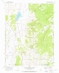
 1969 Greenwich1972 Print · USGSThe high ranching country of Grass Valley and the Fish Lake National Forest are captured here in the late sixties. Researchers can trace remote water sources like Shaffers Springs, irrigation via the Canal, and the small community of Greenwich.2 unique versions available
 - 1969 Map of Jakes Knoll, 1972 Print
 1969 Jakes Knoll1972 Print · USGSThe high Awapa Plateau comes into focus in the late sixties, showing the complex ranching and water infrastructure of Wayne and Piute counties. Genealogists and historians can trace essential upland water sources like Cyclone Co-op Reservoir, Parker Lake, and the local jeep trails.2 unique versions available
 - 1969 Map of Abes Knoll, 1976 Print
 1969 Abes Knoll1976 Print · USGSHigh-country ranching and water management define the Wayne County highlands during the late 1960s. Researchers can trace land use patterns and remote settlements like Cedar Grove alongside named landmarks like Abes Knoll and Eightmile Reservoir.
End of results
Showing maps 1-12 of 12
Top cities of Piute County
- Circleville historical maps
- Marysvale historical maps
- Junction historical maps
- Kingston historical maps
Frequently asked questions
- What are the different types of historical maps available for Piute County?
- What is the oldest map of Piute County?
- Where can I purchase historical maps of Piute County for my home or office?
- Where can I download high-res historical maps of Piute County?
- Are there historical topographic maps available for Piute County?
- Is there historical aerial imagery available for Piute County?
- Where are historical maps of Piute County sourced from?