1980s Maps of Piute County, Utah
Explore 18 historic maps of Piute County from the 1980s. These maps offer a rare glimpse into what life looked like during the 1980s — showing old roads, neighborhoods, homes, and landmarks that have changed or disappeared over time.
Whether you're researching your family's past, planning a metal detecting trip, or studying how Piute County's landscape evolved across the 1980s, these high-resolution maps are a powerful tool for exploring the history of this region.
- Focus on a specific era: All maps on this page are from the 1980s, giving you a focused view of this time period.
- See what’s changed: Compare century-old streets, trails, and buildings to today's modern landscape using overlays and satellite layers.
- Research with precision: Use these maps for genealogy, historical research, land use analysis, or educational projects.
- View, download, or print: Maps are fully viewable online in high resolution, and can be downloaded or printed for your own records.
Start exploring Piute County's history through authentic maps from the 1980s. This is your window into the past.
Piute County, UT maps
(18)- 1980 Map of Loa
 1980 Loa1980 Print · USGSCentral Utah's high plateaus and the Fremont River corridor are captured here during the 1980s, showcasing a landscape of high-elevation reservoirs and remote ranching outposts. Genealogists can trace family names and early settlements from Loa and Teasdale to the orchards of Fruita.2 unique versions available
 - 1980 Map of Antelope Range, 1981 Print
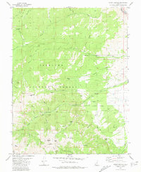
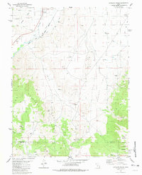 1980 Antelope Range1981 Print · USGSThe Sevier River valley in the early 1980s shows a landscape of rail-fed settlements and mountain mining. Trace family roots in Joseph and Sevier, or locate historic workings like the Antelope Mine and the irrigation network of Bertlesen Ditch.2 unique versions available
 - 1980 Map of Mahustan Peak, 1981 Print
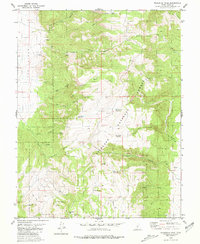 1980 Mahustan Peak1981 Print · USGSThe high ridges of Piute County are captured here in the early 1980s, showcasing a network of upland reservoirs and ranching landmarks. Researchers can trace land use through prospects and water features like Hell Hole Reservoir, Sevy Spring, and Dead Horse Reservoir.2 unique versions available
 - 1980 Map of Beaver, 1981 Print
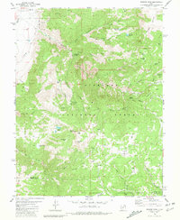
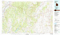
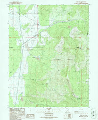
 1980 Beaver1981 Print · USGSSouthern Utah at the start of the 1980s reveals a rugged landscape of high mountain plateaus and essential desert irrigation networks. Researchers can trace the path of the Denver and Rio Grande Western through Marysvale or locate local landmarks like the Deer Trail Mine and Puffer Lake.2 unique versions available
 - 1980 Map of Monroe Peak, 1981 Print
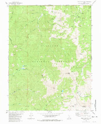
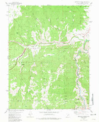
 1980 Monroe Peak1981 Print · USGSThe high country of the Sevier-Piute border is captured here in the early 1980s, where high-altitude meadows meet essential irrigation infrastructure. Researchers can trace remote mountain trails and land use around Monroe Peak, Monrovian Park Campground, and Monroe Meadows.2 unique versions available
 - 1980 Map of Mount Belknap, 1981 Print
 1980 Mount Belknap1981 Print · USGSThe Tushar Mountains of Piute and Beaver Counties are shown in the early 1980s during a period of high-altitude resource management. Researchers can trace historic mining locations like Lower Kimberly and the Grasshopper Mine near Mount Belknap.
 - 1980 Map of Mount Brigham, 1981 Print
 1980 Mount Brigham1981 Print · USGSThe Tushar Mountains of central Utah are captured in the early 1980s, documenting a high-country landscape of mining claims and rugged peaks. Researchers can locate specific operations like the Silver King Mine, trace the D & R G W railroad, or find landmarks like Bullion Falls.2 unique versions available
 - 1980 Map of Salina, 1981 Print
 1980 Salina1981 Print · USGSCentral Utah in the late twentieth century reveals a landscape of high plateaus and transit corridors. Trace the Denver and Rio Grande Western RR past Salina or locate remote sites like Browning Mine and Fish Lake.2 unique versions available
 - 1980 Map of Richfield, 1987 Print
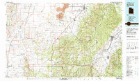 1980 Richfield1987 Print · USGSCentral Utah in the early eighties shows a landscape of volcanic fields and high mountain forests. Genealogists can trace family roots through the Sevier River valley in Richfield, Fillmore, and Monroe, or follow the Union Pacific rail lines.2 unique versions available
 - 1981 Map of Marysvale Canyon
 1981 Marysvale Canyon1981 Print · USGSThe Sevier River canyon in the early eighties shows a landscape shaped by industrial mining and heavy rail transport. You can trace the Denver and Rio Grande Western line past Big Rock Candy Mountain or locate high-altitude workings like the Yellow Cougar Mine.2 unique versions available
 - 1981 Map of Piute Reservoir
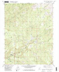
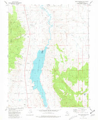 1981 Piute Reservoir1981 Print · USGSCentral Utah's water and mining history come into focus in the early 1980s. Trace local landmarks like Howes Cem, the Spillway 5971 at Piute Reservoir, and the Junction Airport near the town boundary.
 - 1981 Map of Delano Peak
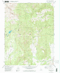 1981 Delano Peak1981 Print · USGSThe high Tushar Mountains of Piute and Beaver counties are shown in detail during the early eighties. Researchers can trace alpine mining history near Alunite Ridge, locate remote water features like Blainies Dam, and follow the old Pack Trails around Delano Peak.2 unique versions available
 - 1981 Map of Marysvale
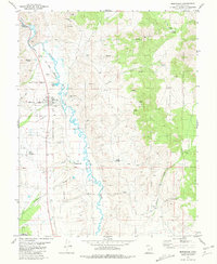 1981 Marysvale1981 Print · USGSMarysvale and the Sevier River valley in the early 1980s show a landscape shaped by mining, rail, and community life. Genealogists can locate several local burial grounds including Mountain View Cem and Murrays Cem, while historians can trace the Denver and Rio Grande Western line.
 - 1981 Map of Marysvale Peak
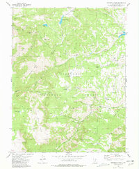 1981 Marysvale Peak1981 Print · USGSThe high plateaus of the Utah backcountry are captured here in the early eighties, showing a landscape defined by water management and mountain mining. Researchers can locate the Blackbird Mine, the Dry Creek Guard Station, and high-altitude water sources like Barney Lake.
 - 1981 Map of Shelly Baldy Peak
 1981 Shelly Baldy Peak1981 Print · USGSThe Tushar Mountains in the early eighties were a hub of water engineering and recreation. Genealogists and historians can trace the Fort Cameron Military Reservation Boundary or locate landmarks like Robbers Roost and Mount Holly Ski Area.2 unique versions available
 - 1981 Map of Trail Mountain
 1981 Trail Mountain1981 Print · USGSSevier County's high country is captured in the early eighties as modern infrastructure began to bisect the wilderness. Researchers can trace historical resource sites like the Mine and Sawmill Bench alongside the construction of the interstate and The Airstrip.2 unique versions available
 - 1986 Map of Cove Fort
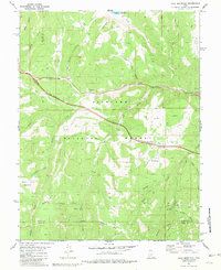
 1986 Cove Fort1986 Print · USGSBeaver County is captured in the mid-eighties at the historic junction of pioneer defenses and mining industry. Researchers can locate the iconic Old Cove Fort, trace mineral Prospect sites near Sulphurdale, and find remote water sources like Dead Cow Spring.
 - 1987 Map of Pole Mountain
 1987 Pole Mountain1987 Print · USGSThe Tushar Mountains in the late eighties reveal a landscape shaped by mineral extraction and high-country irrigation. Researchers can trace the footprint of mining at the Bob Roy Mine and follow water management through the Manderfield Old Levee.
End of results
Showing maps 1-18 of 18
Top cities of Piute County
- Circleville historical maps
- Marysvale historical maps
- Junction historical maps
- Kingston historical maps
Frequently asked questions
- What are the different types of historical maps available for Piute County?
- What is the oldest map of Piute County?
- Where can I purchase historical maps of Piute County for my home or office?
- Where can I download high-res historical maps of Piute County?
- Are there historical topographic maps available for Piute County?
- Is there historical aerial imagery available for Piute County?
- Where are historical maps of Piute County sourced from?