Old Maps of Piute County, Utah for Academic Research
Study the evolution of Piute County with 204 high-resolution historic maps. Whether you're teaching, researching, or modeling changes in land use, these maps provide essential visual documentation of urban, environmental, and geographic change.
- Analyze long-term change: Track patterns in development, transportation, and natural features.
- Ideal for environmental or urban studies: Support academic projects with primary historical map data.
- Use in the classroom or lab: Educators and researchers rely on these maps to bring historical context to life.
These maps are a powerful tool for teaching, research, and visualizing how Piute County has changed over the decades.
Piute County, UT maps
(204)- 1885 Map of Beaver
 1885 Beaver1885 Print · USGSSouth-central Utah in the 1880s was a landscape of high plateaus and valley settlements tied to the lifelines of the Sevier River and Beaver Creek. Family researchers can trace early town layouts in Beaver and Fillmore or locate rural outposts like Minersville and Kanosh.5 unique versions available
 - 1885 Map of Fish Lake
 1885 Fish Lake1885 Print · USGSThe high plateaus and early canyon settlements of central Utah are documented here in the mid-1880s, shortly after the Powell Survey. Genealogists and historians can trace early families in Salina, Antimony, and Cousharem, or locate remote sites like Bean Spring.
 - 1896 Map of Fish Lake, 1899 Print
 1896 Fish Lake1899 Print · USGSSouthern Utah in the late nineteenth century is a land of high plateaus and isolated river settlements. Trace early pioneer outposts like Thurber, Teardale, and Antimony alongside geological marvels such as Fish Lake and the Water Pocket Flexure.4 unique versions available
 - 1932 Map of Sevier, 1975 Print
 1932 Sevier1975 Print · USGSThe high plateau country of central Utah comes into focus in the early 1930s, showing a landscape defined by the Denver & Rio Grande Western railroad and remote mountain peaks. Genealogists and local historians can trace family-named landmarks like Parker Ranch or locate early forest service outposts at Rockwood Ranger Sta.
 - 1935 Map of Sevier
 1935 Sevier1935 Print · USGSThe high country of Sevier and Millard Counties is captured here in the mid-1930s, documenting the early forest management and transit routes of the era. Genealogists and historians can trace old homesteads like Parker Ranch and find remote outposts such as Rockwood Ranger Sta and Pavant Ranger Sta.3 unique versions available
 - 1937 Map of Delano Peak
 1937 Delano Peak1937 Print · USGSThe Tushar Mountains are seen here during a peak era of mineral extraction in the late 1930s. Researchers can trace the layout of mining camps like Upper Kimberly or locate historical claims such as the Annie Laurie Mine and Bully Boy Mine.2 unique versions available
 - 1940 Map of Monroe, 1957 Print
 1940 Monroe1957 Print · USGSThe Sevier River valley was a thriving corridor of rail and irrigation just before the mid-century. Researchers can trace the path of the Denver and Rio Grande Western Railroad through Monroe or locate the Antelope Mine and Poverty Flat Ranch.2 unique versions available
 - 1943 Map of Delano Peak
 1943 Delano Peak1943 Print · USGSThe Tushar Mountains of Piute and Sevier counties appear here during the mid-twentieth century peak of forest management and mining. Researchers can trace historic extraction sites like the Sevier Mine and Copper Belt Mine or locate early outposts such as the Delano Ranger Station.2 unique versions available
 - 1944 Map of Monroe
 1944 Monroe1944 Print · USGSThe Sevier River Valley thrived as a hub of irrigation and rail transport in the mid-twentieth century. Genealogists and historians can trace the foundations of Monroe, Elsinore, and Annabella alongside the ANTELOPE MINE and Poverty Flat Ranch.
 - 1945 Map of Marysvale, 1956 Print
 1945 Marysvale1956 Print · USGSPiute County at mid-century reveals a landscape defined by the Sevier River and the mining industry. Trace the Denver & Rio Grande Western rail line through Marysvale to industrial sites like Alunite and the remote Whitehorse Mine.3 unique versions available
 - 1947 Map of Marysvale
 1947 Marysvale1947 Print · USGSPiute County is shown here during the post-war era as a center for mining, rail, and reservoir management. Researchers can locate the Rio Grande Western RR terminus at Marysvale, the Whitehorse Mine, and the southern community of Junction.3 unique versions available
 - 1953 Map of Richfield, 1963 Print
 1953 Richfield1963 Print · USGSCentral Utah in the early fifties reveals a complex geography of high plateaus and desert basins tied together by the Union Pacific rail lines. Genealogists and historians can trace family roots in Richfield or Kanosh and locate remote operations like the Blue Star Mine or Newhouse.3 unique versions available
 - 1954 Map of Beaver NE, 1955 Print
 1954 Beaver NE1955 Print · USGSThe high country of the Utah-Piute county line is documented here in the mid-1950s during a period of active mountain mining and water engineering. Historians and mineral hunters can trace routes to the Bob Roy Mine, Sheepskin Mine, and the length of the Old Manderfield Ditch Road.
 - 1956 Map of Salina
 1956 Salina1956 Print · USGSCentral Utah in the mid-fifties reveals a landscape of high plateaus and desert basins before the modern highway era. Researchers can trace the ranching and mining roots of Hanksville and Loa or locate the Lucky Strike Mine near the San Rafael Swell.5 unique versions available
 - 1958 Map of Richfield
 1958 Richfield1958 Print · USGSCentral Utah in the late fifties shows a landscape of mountain forests and desert basins connected by the Union Pacific Railroad. Genealogists and historians can trace rail stops at Nada Station, mines like the Blue Star Mine, and tribal lands of the Paiute Indian Reservation.2 unique versions available
 - 1958 Map of Beaver, 1960 Print
 1958 Beaver1960 Print · USGSBeaver and the surrounding high desert valleys are documented here in the late fifties as the town grew along the historic corridor of the Utah state roads. Genealogists and local historians can locate civic landmarks like Belknap Sch and Mtn View Cemetery or trace old mining claims such as the Rob Roy Mine.2 unique versions available
 - 1960 Map of Salina
 1960 Salina1960 Print · USGSThe high plateaus and canyonlands of south-central Utah appear in the early sixties as a region of remote ranching towns and developing parklands. Researchers can trace historic settlements like Fruita and Loa or locate the uranium mines and the tracks of the Denver and Rio Grande Western RR.2 unique versions available
 - 1962 Map of Salina
 1962 Salina1962 Print · USGSSevier County and the surrounding desert wilderness appear here in the early sixties as a network of isolated river valley towns and high-altitude forests. Researchers can locate remote landmarks like Fruita, trace the Denver & Rio Grande Western RR, and find backcountry sites like the Aquarius Ranger Station.
 - 1962 Map of Cove Fort, 1964 Print
 1962 Cove Fort1964 Print · USGSCentral Utah in the early sixties reveals a high-desert landscape defined by historic waypoints and volcanic terrain. Genealogists and historians can trace routes through Cove Fort and Sulphurdale, or locate landmarks like Cinder Crater and Cedar Grove.
 - 1966 Map of Circleville, 1968 Print
 1966 Circleville1968 Print · USGSThe Mormon village of Circleville is captured in the mid-sixties as it serves the surrounding high-desert ranching and farming operations. Researchers can trace irrigation networks like the Lost Creek Canal and find family-named landmarks such as Betenson Flat and Lums Creek.
 - 1966 Map of Junction, 1968 Print
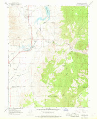 1966 Junction1968 Print · USGSThe high desert valley of Junction and Kingston is captured here in the mid-sixties, showing a landscape defined by the Sevier River and complex irrigation. Researchers can trace historic water routes like the Kingston Canal or locate local landmarks such as Piute High Sch and several Prospects in the foothills.3 unique versions available
 - 1968 Map of Koosharem, 1972 Print
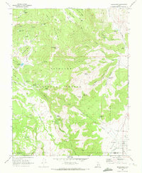 1968 Koosharem1972 Print · USGSGrass Valley and the high plateaus of Sevier County come into focus in the late sixties, showing the rural community of Koosharem and its surrounding water infrastructure. Researchers can locate the Koosharem Cemetery and trace remote mountain trails leading to landmarks like Magleby Reservoir and Milos Kitchen.2 unique versions available
 - 1968 Map of Burrville, 1972 Print
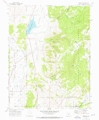 1968 Burrville1972 Print · USGSGrass Valley and the high plateaus of central Utah are captured in the late sixties as agricultural and forest lands intersected. Researchers can locate the Burrville Cem and trace historic routes like the Old Bamberger Road and the Aqueduct.
 - 1969 Map of Parker Knoll, 1972 Print
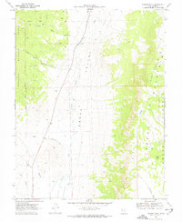 1969 Parker Knoll1972 Print · USGSGrass Valley and the surrounding Piute County uplands are captured here in the late sixties as a network of trails and creek drainages. Researchers can trace the elevation changes from the Fishlake National Forest down to Otter Creek and up the Parker Mountain Awapa Plateau.2 unique versions available
 - 1969 Map of Flossie Knoll, 1972 Print
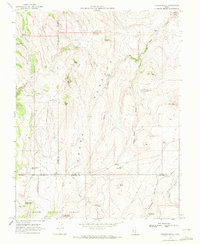 1969 Flossie Knoll1972 Print · USGSThe high plateau of the Dixie National Forest is captured here in the late sixties, showing a landscape defined by grazing and water management. Researchers can trace remote landmarks like Flossie Lake, the string of The Buttes, and Gripe Reservoir.2 unique versions available
Showing maps 1-25 of 204
Top cities of Piute County
- Circleville historical maps
- Marysvale historical maps
- Junction historical maps
- Kingston historical maps
Frequently asked questions
- What are the different types of historical maps available for Piute County?
- What is the oldest map of Piute County?
- Where can I purchase historical maps of Piute County for my home or office?
- Where can I download high-res historical maps of Piute County?
- Are there historical topographic maps available for Piute County?
- Is there historical aerial imagery available for Piute County?
- Where are historical maps of Piute County sourced from?