Old Maps of Sanpete County, Utah for Genealogy
Trace your family roots with 312 historic maps of Sanpete County. These high-res maps reveal old neighborhoods, homesites, landmarks, and streets — helping you uncover where your ancestors lived and how the area evolved over time.
- Explore historic neighborhoods: Identify where your relatives may have lived in the 1800s or 1900s.
- Compare maps over time: Trace the changes in streets, buildings, and landmarks for multi-generational research.
- Perfect for genealogy & ancestry research: Used by family historians and researchers to map out lineage and migration.
These maps are an incredible resource for exploring your personal connection to Sanpete County's past.
Sanpete County, UT maps
(312)- 1885 Map of Manti
 1885 Manti1885 Print · USGSCentral Utah during the mid-1880s reveals a growing network of agricultural towns and vital rail lines through the high desert. Researchers can trace early family settlements along the San Pete River and locate historic depots like Pleasant Valley Junction or the early township of Nephi.4 unique versions available
 - 1885 Map of Sevier Desert
 1885 Sevier Desert1885 Print · USGSMining districts and desert outposts across central Utah come to life in the mid-1880s as the railroad pushes through the canyon. Researchers can trace early industrial footprints at Silver City, locate the riverside settlement of Deseret, and follow the original Central Pacific Railroad line.5 unique versions available
 - 1895 Map of Manti, 1921 Print
 1895 Manti1921 Print · USGSSanpete County and the high plateaus of central Utah are captured in the late nineteenth century as irrigation and railroads transformed the valley floor. Genealogists and historians can trace the early layout of Manti, Ephraim, and Nephi, alongside smaller outposts like Fountain Green and Mayfield.
 - 1922 Map of Wasatch
 1922 Wasatch1922 Print · USGSThe high-elevation grazing lands of Sanpete and Emery County are captured in the early 1920s as a landscape of isolated ridges and ranch outposts. Genealogists and historians can trace family-named landmarks like Larsen Ranch and Hansen Ranch near Lower Joes Valley.
 - 1923 Map of Scofield, 1957 Print
 1923 Scofield1957 Print · USGSThe high-country coal camps of Carbon and Emery counties are shown in detail during the early twenties as the mining industry boomed. Trace the historic Denver & Rio Grande Western RR line between Scofield and Clear Creek or locate remote sites like the Wattis Mine.2 unique versions available
 - 1923 Map of Hiawatha, 1958 Print
 1923 Hiawatha1958 Print · USGSThe coal mining districts of Emery and Carbon counties are at their industrial peak during the 1920s. Genealogists and historians can trace the rail-linked company towns of Hiawatha and Mohrland and locate remote landmarks like Swaseys Ranch or the Huntington Mine.4 unique versions available
 - 1925 Map of Scofield
 1925 Scofield1925 Print · USGSCoal mining and mountain ranching dominate the Wasatch Plateau in the 1920s as the rail line pushes deep into the canyons. Genealogists and historians can trace the footprint of early industrial camps like Clear Creek and Wattis, or locate family landmarks such as Seeley Ranch and the Gibson Mine.2 unique versions available
 - 1925 Map of Hiawatha
 1925 Hiawatha1925 Print · USGSThe Wasatch Plateau’s coal mining frontier comes to life in this mid-1920s survey of the canyon lands. Researchers can trace early industrial footprints at the Hiawatha Mine and Mohrland, or locate remote family holdings like Swaseys Ranch.
 - 1939 Map of Soldier Summit, 1958 Print
 1939 Soldier Summit1958 Print · USGSCentral Utah’s mountain passes and railroad corridors are captured here during the 1920s and 30s. Genealogists and historians can trace the high-altitude tracks of the Denver and Rio Grande Western Railroad and locate remote sites like Pondtown Mine, Colton, and Soldier Summit.3 unique versions available
 - 1942 Map of Soldier Summit
 1942 Soldier Summit1942 Print · USGSHigh mountain passes and the rail-driven economy of the Wasatch Range come alive in this early 1940s survey. Genealogists and historians can trace the steep grades of the Denver and Rio Grande Western through old stations at Soldier Summit and Colton.2 unique versions available
 - 1951 Map of Moroni, 1953 Print
 1951 Moroni1953 Print · USGSThe Sanpete Valley's agricultural heart is captured here in the early fifties, showing the vital irrigation systems supporting local life. Genealogists and historians can trace family-named sites and vanished features from Fountain Green to Moroni, including the Fish Hatchery and Freedom.2 unique versions available
 - 1952 Map of Scipio North, 1954 Print
 1952 Scipio North1954 Print · USGSIn the early 1950s, the desert borderlands of Millard and Juab Counties were defined by the Sevier River's path and the rise of the high mountains. Trace the old Union Pacific corridor through Mills or locate family sites near Scipio and Dick & Dalton Flat.3 unique versions available
 - 1952 Map of Santaquin Peak, 1954 Print
 1952 Santaquin Peak1954 Print · USGSThe high peaks and forest canyons of central Utah are mapped here in the early fifties, showing the mountain corridor before modern development. Researchers can find old rail routes along Thistle Creek, the Wimmer Ranch homestead, and the remote Payson Guard Station.3 unique versions available
 - 1953 Map of Delta, 1969 Print
 1953 Delta1969 Print · USGSWest-central Utah in the early fifties shows a landscape of vast desert playas and rising mountain ranges. Genealogists and historians can trace rail sidings like Champlin Siding, local industry at the Tungsten Mill, and historic outposts such as Fort Deseret.3 unique versions available
 - 1956 Map of Price, 1968 Print
 1956 Price1968 Print · USGSCentral Utah in the mid-fifties showcases a landscape shaped by coal mining and mountain-fed irrigation. Trace the rail-and-river economy through the Geneva Coal Mine, the Union Pacific line, and settlements like Price and Ephraim.3 unique versions available
 - 1958 Map of Delta
 1958 Delta1958 Print · USGSThe West Desert of Utah comes into sharp focus during the late 1950s, showing the intersection of military ranges, irrigation projects, and historical transit. You can trace the proximity of the Topaz Camp to Delta, or locate the Pony Express Monument and the ruins of Fort Deseret.
 - 1960 Map of Price
 1960 Price1960 Print · USGSCentral Utah in the late fifties was a landscape of coal-hauling railroads and high plateau settlements. Genealogists and local historians can trace the rail-to-river economy from Price to the mountain mining camps of Hiawatha, Dragerton, and Sunnyside.2 unique versions available
 - 1962 Map of Price
 1962 Price1962 Print · USGSCentral Utah during the early sixties shows a landscape balancing high-mountain forestry with valley agriculture and coal mining. Genealogists and historians can trace the Denver and Rio Grande Western rail lines through industrial hubs like Price or locate formerly active sites like Coal City (abandoned).
 - 1962 Map of Delta
 1962 Delta1962 Print · USGSWest Central Utah in the early sixties reveals a landscape of desert agriculture and military testing grounds. Researchers can trace the Union Pacific line through Delta or locate historic sites like the Pony Express Monument and Silver City.
 - 1965 Map of Hells Kitchen Canyon SW, 1967 Print
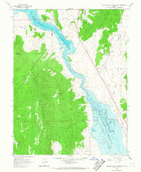 1965 Hells Kitchen Canyon SW1967 Print · USGSThe Sevier River valley in the 1960s was a landscape defined by the Sevier Bridge Reservoir and the surrounding high country. Local historians can trace family-named landmarks like Dick & Dalton Flat or examine early industrial sites including a Prospect and Gravel Pits.
 - 1965 Map of Woods Lake, 1967 Print
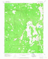 1965 Woods Lake1967 Print · USGSSanpete and Sevier counties meet in this high Utah wilderness during the mid-sixties, a landscape of national forest peaks and high-country camps. Researchers can locate remote landmarks like Whitlock Cabin, Marys Nipple, and the WPA Ponds near Deep Lake.2 unique versions available
 - 1965 Map of Chriss Canyon, 1967 Print
 1965 Chriss Canyon1967 Print · USGSThe high Sanpitch Mountains of central Utah are captured here in the mid-sixties, showing the rugged Uinta National Forest before modern development. Researchers can trace historic access routes like the Pack Trail and Jeep Trail past landmarks such as Big Baldy and Sage Flat.2 unique versions available
 - 1965 Map of Hells Kitchen Canyon SE, 1967 Print
 1965 Hells Kitchen Canyon SE1967 Print · USGSThe Sanpete County wilderness in the mid-1960s is defined by the high peaks of the San Pitch Mountains and early water management. Researchers can trace the path of the Gunnison Fayette Canal or explore remote landmarks like Axhandle and Hells Kitchen Canyon.
 - 1965 Map of Skinner Peaks, 1967 Print
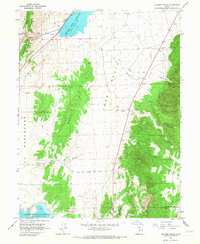 1965 Skinner Peaks1967 Print · USGSJuab Valley in the mid-1960s is shown here as a landscape of high desert water management and historic transportation routes. Researchers can trace the path of the Union Pacific railroad and find evidence of early rural transit along the Old Botham Road.2 unique versions available
 - 1965 Map of Mayfield, 1967 Print
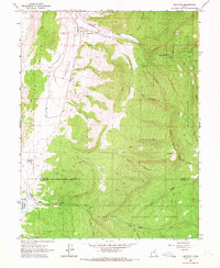 1965 Mayfield1967 Print · USGSMayfield and the Arapien Valley are captured in the mid-1960s as the town was sustained by the waters of Twelvemile Creek. Researchers can trace the Old Indian Treaty Boundary, find the Mayfield Cem, and locate Michaelson Springs near the edge of the White Hills.2 unique versions available
Showing maps 1-25 of 312
Top cities of Sanpete County
- Ephraim historical maps
- Manti historical maps
- Gunnison historical maps
- Mount Pleasant historical maps
- Moroni historical maps
- Fairview historical maps
See more
Frequently asked questions
- What are the different types of historical maps available for Sanpete County?
- What is the oldest map of Sanpete County?
- Where can I purchase historical maps of Sanpete County for my home or office?
- Where can I download high-res historical maps of Sanpete County?
- Are there historical topographic maps available for Sanpete County?
- Is there historical aerial imagery available for Sanpete County?
- Where are historical maps of Sanpete County sourced from?