2000-2009 Maps of Sanpete County, Utah
Explore 31 historic maps of Sanpete County from 2000-2009. These maps offer a rare glimpse into what life looked like during the 2000s — showing old roads, neighborhoods, homes, and landmarks that have changed or disappeared over time.
Whether you're researching your family's past, planning a metal detecting trip, or studying how Sanpete County's landscape evolved across the 2000s, these high-resolution maps are a powerful tool for exploring the history of this region.
- Focus on a specific era: All maps on this page are from the 2000s, giving you a focused view of this time period.
- See what’s changed: Compare century-old streets, trails, and buildings to today's modern landscape using overlays and satellite layers.
- Research with precision: Use these maps for genealogy, historical research, land use analysis, or educational projects.
- View, download, or print: Maps are fully viewable online in high resolution, and can be downloaded or printed for your own records.
Start exploring Sanpete County's history through authentic maps from the 2000s. This is your window into the past.
Sanpete County, UT maps
(31)- 2001 Map of Scipio Lake, 2003 Print
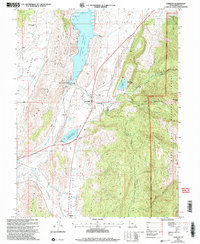
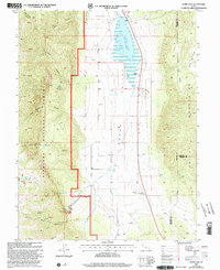 2001 Scipio Lake2003 Print · USGSMillard County at the start of the twenty-first century reveals a landscape of high-altitude canyons and vital water sources. Researchers can trace the drainage of Round Valley Creek into Scipio Lake or locate remote landmarks like Maple Grove and Dairy Knoll.
 - 2001 Map of Scipio South, 2003 Print
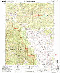
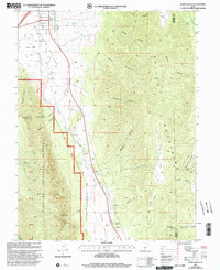 2001 Scipio South2003 Print · USGSThe outskirts of Scipio at the turn of the 21st century reveal a landscape of high-desert valleys and steep National Forest canyons. Researchers can locate family-named landmarks like Billys Canyon, find the town Cem, or trace the path of Round Valley Creek.
 - 2001 Map of Huntington Reservoir, 2004 Print
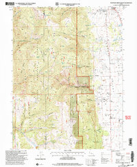
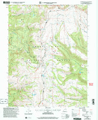
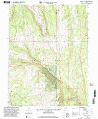
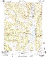
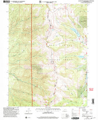 2001 Huntington Reservoir2004 Print · USGSThe high plateau of the Wasatch Range is captured here in the early 2000s, showcasing the water and power infrastructure of the Manti-La Sal National Forest. Researchers can trace the layout of the Lower Mt Pleasant Powerplant, the reaches of Huntington Reservoir, and the paths of Skyline Drive.
 - 2001 Map of Fairview, 2004 Print
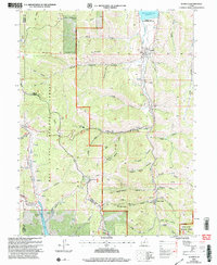
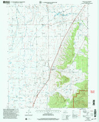
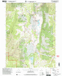
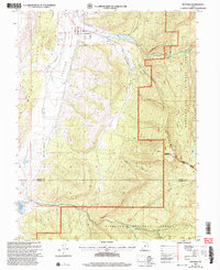
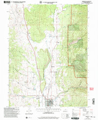 2001 Fairview2004 Print · USGSThe Sanpete Valley near the turn of the millennium shows a landscape defined by the San Pitch River and the rising slopes of the Cedar Hills. Genealogists and local historians can trace the town layouts of Fairview and Milburn, locate the Fairview Cem, or find rural landmarks like the Powerplant and Hill Top.
 - 2001 Map of Scofield, 2004 Print
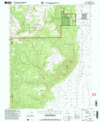
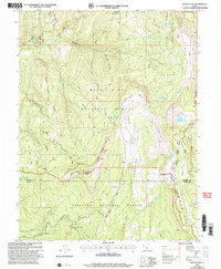
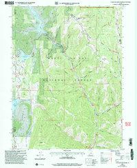
 2001 Scofield2004 Print · USGSScofield and the surrounding high-mountain mining districts are captured here at the dawn of the new millennium. Historians and genealogists can trace the footprint of the energy industry and local infrastructure through the Skyline Mine, the Scofield Cemetery, and Clear Creek.
 - 2001 Map of Fountain Green North, 2004 Print
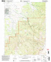
 2001 Fountain Green North2004 Print · USGSThe Sanpete Valley meets the mountains of the Uinta National Forest at the turn of the millennium. Genealogists can locate the town Cem and local landmarks like the Fish Hatchery and Big Springs.
 - 2001 Map of Fountain Green South, 2004 Print
 2001 Fountain Green South2004 Print · USGSThe Sanpete Valley remains a quiet agricultural landscape at the turn of the millennium, anchored by small settlements and high mountain ridges. Trace the routes of local families through Fountain Green, Freedom, and the nearby Cem.
 - 2001 Map of Flagstaff Peak, 2004 Print
 2001 Flagstaff Peak2004 Print · USGSHigh in the Wasatch Plateau during the early 2000s, this area shows the intersection of three Utah counties within the Manti-La Sal National Forest. Researchers can trace the water network from Wrigley Springs Reservoir to Blue Lake and locate the summit of Flagstaff Peak.
 - 2001 Map of Chester, 2004 Print
 2001 Chester2004 Print · USGSThe rural heart of Sanpete County is captured here at the turn of the millennium, showing a landscape defined by century-old irrigation and small valley settlements. You can trace the lineage of the land through the Pioneer Cem, the historic Chester PO, and the rail junction at Pigeon Hollow Junction.
 - 2001 Map of Sterling, 2004 Print
 2001 Sterling2004 Print · USGSSanpete County at the turn of the century shows a landscape of mountain-fed reservoirs and deep canyons. Genealogists and historians can trace the irrigation network from Gunnison Reservoir to Sterling, or locate the Morrison Mine and local cemetery.
 - 2001 Map of Heliotrope Mountain, 2004 Print
 2001 Heliotrope Mountain2004 Print · USGSThe high Wasatch Plateau of Sanpete County is captured here at the start of the millennium. Outdoor historians and researchers can trace the high-elevation Skyline Drive and locate remote water sources like Emerald Lake or Henningson Reservoir.
 - 2001 Map of Wales, 2004 Print
 2001 Wales2004 Print · USGSThe Sanpete Valley at the turn of the millennium remains a landscape of high-desert agriculture and forest wilderness. Genealogists and historians can trace the townsite of Wales, the local Cem, and the old resource roads through Coal Canyon and Axhandle Canyon.
 - 2001 Map of Danish Knoll, 2004 Print
 2001 Danish Knoll2004 Print · USGSSanpete County high country is mapped here at the turn of the twenty-first century, showcasing the complex water and research infrastructure of the national forest. Researchers can trace historic sites like the Great Basin Experiment Station and Seely Creek Guard Station alongside family-named landmarks such as Danish Knoll and Swedish Knoll.
 - 2001 Map of Woods Lake, 2004 Print
 2001 Woods Lake2004 Print · USGSHigh-country ridges and forest boundaries define the Sanpete-Sevier border at the turn of the millennium. Researchers can trace historic backcountry sites like Whitlock Cabin and follow high-altitude routes such as the Great Western Trail past Mollys Nipple.
 - 2001 Map of Chriss Canyon, 2004 Print
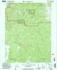 2001 Chriss Canyon2004 Print · USGSThe Sanpitch Mountains straddle the Juab and Sanpete county lines in the early 2000s, showing a landscape defined by forest management and deep drainages. Outdoor enthusiasts and local historians can trace rugged 4WD routes to Little Red Hill, the high summit of Big Baldy, and the waters of Chriss Creek.
 - 2001 Map of Ferron Reservoir, 2004 Print
 2001 Ferron Reservoir2004 Print · USGSThe high alpine country of the Sanpete County mountains is captured here at the turn of the millennium, showing a landscape defined by forest management and recreation. Researchers can trace the development of the Ferron Reservoir Summer Home Area and find specific forest sites like the Indian Cr Admin Site and Shoemaker Flat.
 - 2001 Map of Ferron Canyon, 2004 Print
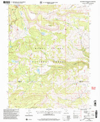
 2001 Ferron Canyon2004 Print · USGSSanpete County high country is shown here in the years following the turn of the millennium, documenting the working landscape of the Wasatch Plateau. Researchers can locate remote camps and early trails like Horn Mtn Cow Camp, the Dairy Trail, and Dairy Point.
 - 2001 Map of Fairview Lakes, 2004 Print
 2001 Fairview Lakes2004 Print · USGSHigh in the Sanpete mountains during the early 2000s, this forest survey captures the vital water infrastructure and trail networks of the Wasatch Plateau. Researchers can trace the path of Skyline Drive past Fairview Lakes and locate the historic Mammoth settlement site.
 - 2001 Map of Spencer Canyon, 2004 Print
 2001 Spencer Canyon2004 Print · USGSCentral Utah's high country is documented here at the turn of the century, showing where the boundaries of three counties converge. Researchers can trace the Summit Trail past Mount Baldy or locate remote waters like Madsen Lake and Blind Lake.
 - 2001 Map of Scofield Reservoir, 2004 Print
 2001 Scofield Reservoir2004 Print · USGSHigh-elevation canyons and the northern waters of Scofield Reservoir define this portion of the Wasatch Plateau at the turn of the millennium. Modern-day explorers can trace the Fish Creek National Recreation Trail or locate remote landmarks like Eternal Flat and The Backswitch.
 - 2001 Map of C Canyon, 2004 Print
 2001 C Canyon2004 Print · USGSThe high ridges of the Manti-La Sal National Forest are shown at the turn of the millennium along the border of Utah and Sanpete counties. Researchers can trace forest management history at the Iceberg Administrative Site, follow the Skyline Drive, and locate landmarks like Browns Peak.
 - 2001 Map of Candland Mountain, 2004 Print
 2001 Candland Mountain2004 Print · USGSThe high-elevation plateaus and canyons of the Manti-La Sal National Forest are shown here just after the turn of the millennium. Trace industrial and water history through features like Electric Lake, Monument Peak, and the small settlement at Stuart.
 - 2001 Map of Spring City, 2004 Print
 2001 Spring City2004 Print · USGSThe Sanpete Valley and the high ridges of the Manti-La Sal National Forest are shown in the early 2000s, centered on the historic grid of Spring City. Researchers can trace the extensive irrigation systems like the Oak Creek Canal and find family-named landmarks including Bill Allred Creek.
 - 2001 Map of Joes Valley Reservoir, 2004 Print
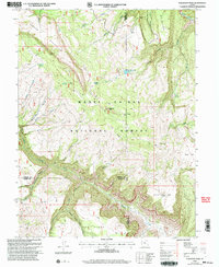
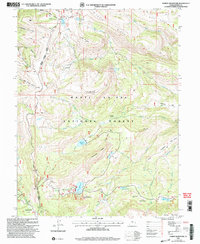
 2001 Joes Valley Reservoir2004 Print · USGSSanpete and Emery counties show a landscape of high-country water management and national forest life at the turn of the millennium. Researchers can trace land use through the Olsen Ranch, old grazing Corrals, and the extensive Reeder Trail network.
 - 2001 Map of Mayfield, 2004 Print
 2001 Mayfield2004 Print · USGSMayfield sat at the edge of the central Utah wilderness at the turn of the millennium, where valley farming met the high national forests. Researchers can locate the Mayfield Cem, trace the route of the South Canal, and find remote landmarks like Jacks Flat.
Showing maps 1-25 of 31
Top cities of Sanpete County
- Ephraim historical maps
- Manti historical maps
- Gunnison historical maps
- Mount Pleasant historical maps
- Moroni historical maps
- Fairview historical maps
See more
Frequently asked questions
- What are the different types of historical maps available for Sanpete County?
- What is the oldest map of Sanpete County?
- Where can I purchase historical maps of Sanpete County for my home or office?
- Where can I download high-res historical maps of Sanpete County?
- Are there historical topographic maps available for Sanpete County?
- Is there historical aerial imagery available for Sanpete County?
- Where are historical maps of Sanpete County sourced from?