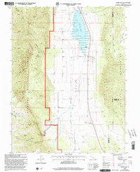
2001 Map of Scipio Lake
USGS Topo · Published 2003About this map
Scipio Lake dominates the upper reach of Round Valley, a prominent hydrological feature on the border of Millard, Sanpete, and Sevier counties. This landscape is defined by the sharp transition from the valley floor to the high ridges of the Fishlake National Forest, where steep drainages like Wild Goose Canyon and Hans Pumpernickle Canyon cut into the mountains. The presence of flowing wells and various springs, such as Libbs Spring and Cedar Spring, indicates a reliance on groundwater systems to support the arid environment.
Find a feature on this map
43 named features on this map. Tap any name to fly to it.
Don’t see what you’re looking for? This feature index may not catch every label — zoom into the map to look around manually.
Map Details
Editions of this 2001 Scipio Lake Map
This is the sole edition of this map. No revisions or reprints were ever made.
Other maps of this area

1885 · Manti
USGS Topo · 1:250,000

1885 · Beaver
USGS Topo · 1:250,000

1885 · Sevier Desert
USGS Topo · 1:250,000

1885 · Fish Lake
USGS Topo · 1:250,000

1895 · Manti
USGS Topo · 1:250,000

1896 · Fish Lake
USGS Topo · 1:250,000

1953 · Richfield
USGS Topo · 1:250,000

1953 · Delta
USGS Topo · 1:250,000

1956 · Salina
USGS Topo · 1:250,000

1956 · Price
USGS Topo · 1:250,000