1990s Maps of Ophir, Utah
Explore 3 historic maps of Ophir from the 1990s. These maps offer a rare glimpse into what life looked like during the 1990s — showing old roads, neighborhoods, homes, and landmarks that have changed or disappeared over time.
Whether you're researching your family's past, planning a metal detecting trip, or studying how Ophir's landscape evolved across the 1990s, these high-resolution maps are a powerful tool for exploring the history of this region.
- Focus on a specific era: All maps on this page are from the 1990s, giving you a focused view of this time period.
- See what’s changed: Compare century-old streets, trails, and buildings to today's modern landscape using overlays and satellite layers.
- Research with precision: Use these maps for genealogy, historical research, land use analysis, or educational projects.
- View, download, or print: Maps are fully viewable online in high resolution, and can be downloaded or printed for your own records.
Start exploring Ophir's history through authentic maps from the 1990s. This is your window into the past.
Ophir, UT maps
(3)- 1993 Map of Mercur
 1993 Mercur1993 Print · USGSThe Oquirrh Mountains in the 1990s show a landscape shaped by Utah's mining legacy. Genealogists and historians can trace the remnants of historic camps like Mercur (Site) and Sunshine (Site) alongside the massive Open Pit Mine.
 - 1993 Map of Ophir
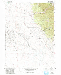 1993 Ophir1993 Print · USGSThe mining heights of the Oquirrh Mountains meet the broad Rush Valley in this 1990s record of Utah's industrial and military heritage. Researchers can trace the extensive mine works around Ophir, find the Cemetery, and locate the Tooele Army Depot (South Area).
 - 1997 Map of Mercur, 2002 Print
 1997 Mercur2002 Print · USGSThe Oquirrh Mountains in the late twentieth century reveal a landscape of deep mining history and forgotten town sites. Genealogists and historians can trace the foundations of Mercur, Manning, and Sunshine alongside an Old Railroad Grade.
End of results
Showing maps 1-3 of 3
Top cities near Ophir
- West Jordan historical maps
- South Jordan historical maps
- Eagle Mountain historical maps
- Herriman historical maps
- Tooele historical maps
- Grantsville historical maps
See more
Frequently asked questions
- What are the different types of historical maps available for Ophir?
- What is the oldest map of Ophir?
- Where can I purchase historical maps of Ophir for my home or office?
- Where can I download high-res historical maps of Ophir?
- Are there historical topographic maps available for Ophir?
- Is there historical aerial imagery available for Ophir?
- Where are historical maps of Ophir sourced from?