1960s Maps of Wasatch County, Utah
Explore 23 historic maps of Wasatch County from the 1960s. These maps offer a rare glimpse into what life looked like during the 1960s — showing old roads, neighborhoods, homes, and landmarks that have changed or disappeared over time.
Whether you're researching your family's past, planning a metal detecting trip, or studying how Wasatch County's landscape evolved across the 1960s, these high-resolution maps are a powerful tool for exploring the history of this region.
- Focus on a specific era: All maps on this page are from the 1960s, giving you a focused view of this time period.
- See what’s changed: Compare century-old streets, trails, and buildings to today's modern landscape using overlays and satellite layers.
- Research with precision: Use these maps for genealogy, historical research, land use analysis, or educational projects.
- View, download, or print: Maps are fully viewable online in high resolution, and can be downloaded or printed for your own records.
Start exploring Wasatch County's history through authentic maps from the 1960s. This is your window into the past.
Wasatch County, UT maps
(23)- 1960 Map of Salt Lake City
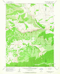
 1960 Salt Lake City1960 Print · USGSThe Wasatch Front and High Uintas are captured mid-century as the Salt Lake Valley underwent significant postwar expansion. Genealogists and historians can trace rail lines like the Union Pacific and locate established landmarks such as Fort Douglas, Camp Williams, and the Bingham Canyon Mine.
 - 1960 Map of Price
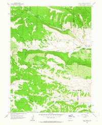
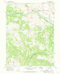
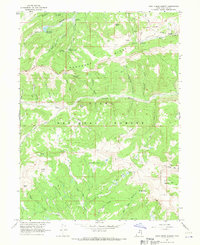
 1960 Price1960 Print · USGSCentral Utah in the late fifties was a landscape of coal-hauling railroads and high plateau settlements. Genealogists and local historians can trace the rail-to-river economy from Price to the mountain mining camps of Hiawatha, Dragerton, and Sunnyside.2 unique versions available
 - 1962 Map of Price
 1962 Price1962 Print · USGSCentral Utah during the early sixties shows a landscape balancing high-mountain forestry with valley agriculture and coal mining. Genealogists and historians can trace the Denver and Rio Grande Western rail lines through industrial hubs like Price or locate formerly active sites like Coal City (abandoned).
 - 1962 Map of Deep Creek Canyon, 1963 Print
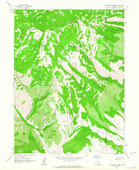
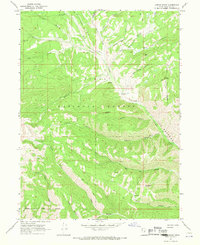
 1962 Deep Creek Canyon1963 Print · USGSThe Wasatch and Duchesne county line was a high-country wilderness of deep drainages and pack routes in the early sixties. Researchers can trace the paths of old Jeep Trails and a Telephone line through Deep Creek Canyon and Wildcat Canyon.3 unique versions available
 - 1962 Map of Wolf Creek, 1963 Print
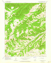
 1962 Wolf Creek1963 Print · USGSThe high Uinta Mountains were a wilderness of timber and water in the early sixties, split by the Wasatch and Duchesne county line. Trace the Old Indian Treaty Boundary or follow tracks to Tims Hole and Blue Lake.3 unique versions available
 - 1962 Map of Raspberry Knoll, 1964 Print
 1962 Raspberry Knoll1964 Print · USGSThe high-elevation boundary of Wasatch and Duchesne counties is captured in the early sixties, showing a landscape of forest preserves and emerging industry. Researchers can trace the Old Indian Treaty Boundary and locate a Mine and Oil Well near Bobby Duke Pass.2 unique versions available
 - 1962 Map of Strawberry Peak, 1964 Print
 1962 Strawberry Peak1964 Print · USGSThe Wasatch Range high country in the early sixties remains a wilderness of national forest lands and deep canyons. Researchers can trace the Old Indian Treaty Boundary and locate isolated landmarks like Twelve Hundred Dollar Ridge and the Oil Well near Jackson Hollow.
 - 1966 Map of Strawberry Reservoir NW, 1968 Print
 1966 Strawberry Reservoir NW1968 Print · USGSHigh in the Wasatch Range during the mid-sixties, this map documents the critical water infrastructure and early recreational camps of the Strawberry Valley. Researchers can trace the path of the Strawberry Tunnel and locate historical sites like Clarks Camp and the Bryants Fork Guard Station.2 unique versions available
 - 1966 Map of Strawberry Reservoir NE, 1968 Print
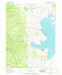
 1966 Strawberry Reservoir NE1968 Print · USGSThe High Uinta backcountry of Wasatch County comes into focus in the mid-1960s, documenting the early development of the regional water system. Researchers can locate remote landmarks like Stinking Springs, trace the primitive Jeep Road through Badger Hollow, and see the original shoreline of Strawberry Reservoir.2 unique versions available
 - 1966 Map of Strawberry Reservoir SW, 1969 Print
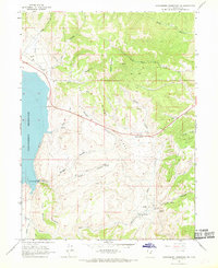
 1966 Strawberry Reservoir SW1969 Print · USGSThe high ridges of the Wasatch and Utah County border are captured in the mid-1960s, showing a landscape shaped by water and forest management. Researchers can trace remote routes like the Treaty Bdy Trail and locate the historic Willow Creek Guard Station.3 unique versions available
 - 1966 Map of Charleston, 1969 Print
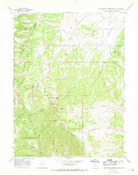
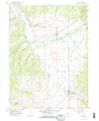
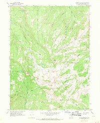
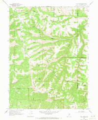
 1966 Charleston1969 Print · USGSThe Heber Valley of the mid-1960s is defined by its deep mountain canyons and its sophisticated irrigation systems. Genealogists and researchers can trace local families near Charleston, locate the Cem, or follow the Denver and Rio Grande Western rail lines.
 - 1967 Map of Francis, 1969 Print
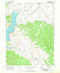
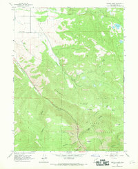
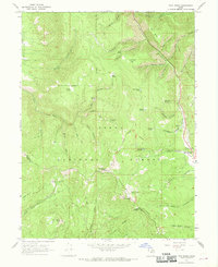
 1967 Francis1969 Print · USGSRhodes Valley and the West Hills are captured here during the late 1960s, showing the intersection of Summit and Wasatch counties. Genealogists and local historians can trace the early layout of Francis, locate the local Cemetery, and identify industrial markers like the Mine and Provo Canal.2 unique versions available
 - 1967 Map of Two Tom Hill, 1969 Print
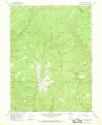 1967 Two Tom Hill1969 Print · USGSThe high backcountry of the Wasatch Range is captured here in the late sixties, highlighting the intersection of forest management and early recreation. Researchers can locate the Diamond Fork Guard Station, trace the INDIAN TREATY BOUNDARY, and find remote sites like Springville Crossings.2 unique versions available
 - 1967 Map of Kamas, 1969 Print
 1967 Kamas1969 Print · USGSThe rural communities of Rhodes Valley are captured in the late sixties, a period of established cattle ranching and high-mountain agriculture. Genealogists can locate family sites and local burials at Peoa Cem, Oakley Cem, and Marion Cem.2 unique versions available
 - 1967 Map of Center Creek, 1969 Print
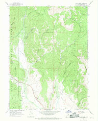
 1967 Center Creek1969 Print · USGSHeber Valley and the Uinta National Forest highlands are captured here in the late sixties during a period of transition between ranching and recreation. Local researchers can locate the Center Creek settlement and Cem, trace the Pack Trail into Daniels Canyon, or find family landmarks like Parker and Clegg Canyon.2 unique versions available
 - 1967 Map of Heber Mountain, 1969 Print
 1967 Heber Mountain1969 Print · USGSHigh in the Uinta mountains during the late sixties, this survey shows the rugged divide between the Provo and Duchesne watersheds. Researchers can trace the Indian Treaty Boundary and the Old Duchesne Road past Heber Mountain.2 unique versions available
 - 1967 Map of Co-Op Creek, 1969 Print
 1967 Co-Op Creek1969 Print · USGSHigh in the Wasatch range during the late sixties, this survey reveals a mountain landscape being reshaped by water engineering and forest management. Researchers can trace the Indian Treaty Boundary and locate remote outposts like the Hub Guard Station or the Currant Creek Feeder Canal.2 unique versions available
 - 1967 Map of Twin Peaks, 1969 Print
 1967 Twin Peaks1969 Print · USGSThe high ridges of the Wasatch Range come into focus in the late sixties, showing a landscape defined by forest boundaries and remote trails. Trace early land divisions and mountain landmarks like the Old Indian Treaty Boundary, Strawberry Peak, and Barrys Reservoir.2 unique versions available
 - 1967 Map of Strawberry Reservoir SE, 1969 Print
 1967 Strawberry Reservoir SE1969 Print · USGSWasatch County high country is captured here in the late sixties, where the boundaries of two national forests meet. Modern researchers can trace the Old Indian Treaty Bdy and follow historic routes through Broad Hollow and Buffalo Canyon.2 unique versions available
 - 1967 Map of Wallsburg Ridge, 1969 Print
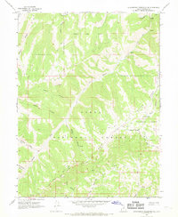
 1967 Wallsburg Ridge1969 Print · USGSWasatch and Utah County mountain lands are documented here in the late sixties, showing the rugged backcountry of the Uinta National Forest. Researchers can trace old mountain routes like the Sheep Canyon Trail and find family-named landmarks like Fullmer Hollow and Johns Hollow.
 - 1967 Map of Wolf Creek Summit, 1970 Print
 1967 Wolf Creek Summit1970 Print · USGSThe high Uinta country in the late sixties is mapped here at the height of its mid-century forest management and water resource development. Trace the path of the Old Indian Treaty Boundary or locate the Mill Hollow Guard Station and Yellow Lake.2 unique versions available
 - 1967 Map of Jimmies Point, 1970 Print
 1967 Jimmies Point1970 Print · USGSThe high backcountry of Wasatch County comes into focus in the late 1960s, showing a landscape of forest management and cattle grazing. Trace historic routes like the JEEP TRAIL or locate remote sites like the Currant Creek Guard Sta and Cow Camp.3 unique versions available
 - 1969 Map of Flat Ridge, 1971 Print
 1969 Flat Ridge1971 Print · USGSThe high ridges and deep hollows of the Wasatch-Duchesne border are shown in the late sixties as a network of forest boundaries and jeep trails. Researchers can locate remote high-country landmarks like the Indian Guard Station, the Old Indian Treaty Bdy, and Bown Corral Reservoir.
End of results
Showing maps 1-23 of 23
Top cities of Wasatch County
Frequently asked questions
- What are the different types of historical maps available for Wasatch County?
- What is the oldest map of Wasatch County?
- Where can I purchase historical maps of Wasatch County for my home or office?
- Where can I download high-res historical maps of Wasatch County?
- Are there historical topographic maps available for Wasatch County?
- Is there historical aerial imagery available for Wasatch County?
- Where are historical maps of Wasatch County sourced from?