Old Maps of Wasatch County, Utah for Genealogy
Trace your family roots with 262 historic maps of Wasatch County. These high-res maps reveal old neighborhoods, homesites, landmarks, and streets — helping you uncover where your ancestors lived and how the area evolved over time.
- Explore historic neighborhoods: Identify where your relatives may have lived in the 1800s or 1900s.
- Compare maps over time: Trace the changes in streets, buildings, and landmarks for multi-generational research.
- Perfect for genealogy & ancestry research: Used by family historians and researchers to map out lineage and migration.
These maps are an incredible resource for exploring your personal connection to Wasatch County's past.
Wasatch County, UT maps
(262)- 1885 Map of Salt Lake
 1885 Salt Lake1885 Print · USGSThe Wasatch Front and surrounding high valleys appear here in the mid-1880s during a period of rapid mining and rail expansion. Genealogists and historians can trace early town sites and mining camps including Alta, Silver City, and the military grounds of Fort Douglass.7 unique versions available
 - 1885 Map of Manti
 1885 Manti1885 Print · USGSCentral Utah during the mid-1880s reveals a growing network of agricultural towns and vital rail lines through the high desert. Researchers can trace early family settlements along the San Pete River and locate historic depots like Pleasant Valley Junction or the early township of Nephi.4 unique versions available
 - 1885 Map of Uinta
 1885 Uinta1885 Print · USGSThe high wilderness of northern Utah is documented during the early surveying era of the 1880s. Geologists and historians can trace the headwaters of the Duchesne River and locate landmarks like Gilbert Peak and Rhodes Plateau.6 unique versions available
 - 1886 Map of Price River
 1886 Price River1886 Print · USGSEmery County and the surrounding canyonlands are documented here just as the railroad arrived in the mid-1880s. Local researchers can trace the early path of the Denver and Rio Grande Western R. R. through Castle Gate, Price, and Sunny Side.4 unique versions available
 - 1895 Map of Manti, 1921 Print
 1895 Manti1921 Print · USGSSanpete County and the high plateaus of central Utah are captured in the late nineteenth century as irrigation and railroads transformed the valley floor. Genealogists and historians can trace the early layout of Manti, Ephraim, and Nephi, alongside smaller outposts like Fountain Green and Mayfield.
 - 1896 Map of Price River
 1896 Price River1896 Print · USGSEmery County was transitioning into a vital rail corridor during the late nineteenth century. Trace the early layout of Price and Castle Dale alongside the winding Denver and Rio Grande Western RR and the depths of Desolation Canyon.
 - 1900 Map of Coalville, 1955 Print
 1900 Coalville1955 Print · USGSThe high valleys of Summit and Wasatch counties are captured at the turn of the century as the silver and coal industries flourished. Researchers can trace early settlements like Rockport and Hailstone or locate the industrial Ontario Drain Tunnel near Park City.2 unique versions available
 - 1901 Map of Hayden Peak
 1901 Hayden Peak1901 Print · USGSThe high Uintas at the turn of the century appear here as a pristine wilderness of alpine peaks and glacial lakes. Genealogists and researchers can trace the headwaters of the Bear River and Provo River or locate early landmarks like Holiday Park and Grandaddy Lake.2 unique versions available
 - 1903 Map of Hayden Peak
 1903 Hayden Peak1903 Print · USGSThe high Uintas at the beginning of the twentieth century reveal a landscape split between the Uinta Forest Reserve and the Uinta Indian Reservation. Researchers can trace the original Utah-Wyoming Boundary Line and the headwaters of the Bear River and Duchesne River.6 unique versions available
 - 1903 Map of Coalville, 1921 Print
 1903 Coalville1921 Print · USGSUpper Utah at the turn of the century reveals a landscape defined by mining corridors and valley settlements. Genealogists and historians can trace the early path of the Union Pacific R. R. through Coalville or locate family-named sites like Rigby's Ranch and the Ontario Drain Tunnel.2 unique versions available
 - 1907 Map of Strawberry Valley, 1955 Print
 1907 Strawberry Valley1955 Print · USGSIn the early 1900s, this high-mountain territory was defined by the ranching and rail connections of the Uinta region. Researchers can trace family-named outposts like Averetts Ranch, the Diamond Battle Monument, and the early route of the D and R G RR.2 unique versions available
 - 1909 Map of Strawberry Valley
 1909 Strawberry Valley1909 Print · USGSWasatch County at the dawn of the twentieth century shows a landscape of mountain ranches and early settlements before the major dams. Genealogists and historians can trace family locations at Averetts Ranch, locate the Diamond Battle Monument, and follow the old D and R G RR line.2 unique versions available
 - 1925 Map of Ft. Douglas
 1925 Ft. Douglas1925 Print · USGSThe Wasatch Range in the mid-1920s shows a landscape of mining camps and early mountain tourism. Genealogists and researchers can trace the old paths of the Lincoln Highway and locate vanished stops like Gogorza, Kimballs, and the Pacific Mine.
 - 1928 Map of Ft. Douglas
 1928 Ft. Douglas1928 Print · USGSIn the mid-1920s, the high country east of Salt Lake was a hive of mining and early canyon tourism. Trace old claim sites like the Pacific Mine or visit early retreats such as Pinecrest Inn and the YWCA Camp during the mining era.2 unique versions available
 - 1939 Map of Soldier Summit, 1958 Print
 1939 Soldier Summit1958 Print · USGSCentral Utah’s mountain passes and railroad corridors are captured here during the 1920s and 30s. Genealogists and historians can trace the high-altitude tracks of the Denver and Rio Grande Western Railroad and locate remote sites like Pondtown Mine, Colton, and Soldier Summit.3 unique versions available
 - 1942 Map of Soldier Summit
 1942 Soldier Summit1942 Print · USGSHigh mountain passes and the rail-driven economy of the Wasatch Range come alive in this early 1940s survey. Genealogists and historians can trace the steep grades of the Denver and Rio Grande Western through old stations at Soldier Summit and Colton.2 unique versions available
 - 1948 Map of Orem, 1959 Print
 1948 Orem1959 Print · USGSThe Utah Valley at the end of the 1940s showcases a unique blend of heavy industry and high-mountain wilderness. Local historians can trace the development of Orem and Pleasant Grove or locate the Steel Plant and Lincoln Jr HS near Utah Lake.2 unique versions available
 - 1948 Map of Aspen Grove, 1960 Print
 1948 Aspen Grove1960 Print · USGSThe Wasatch Range and Heber Valley appear here in the late 1940s, highlighting the area's role in education and recreation. You can trace the shoreline of the Deer Creek Reservoir and locate historic sites like the Alpine Summer School (B. Y. U.) and the Girls M. I. A. Camp.3 unique versions available
 - 1948 Map of Bridal Veil Falls, 1960 Print
 1948 Bridal Veil Falls1960 Print · USGSThe Provo River canyon was a vital transportation corridor just after the war, where the Denver & Rio Grande Western RR wound past steep peaks. Trace early settlement sites and mountain landmarks like Bridal Veil Falls, Vivian Park, and Y Mountain.4 unique versions available
 - 1950 Map of Aspen Grove
 1950 Aspen Grove1950 Print · USGSThe high Wasatch Range at the mid-point of the century shows a landscape defined by mountain recreation and education. Genealogists and historians can trace the foundations of Aspen Grove, the Alpine Summer School (B. Y. U.), and the early rail route of the Rio Grande and Western.
 - 1950 Map of Bridal Veil Falls
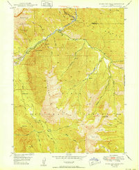 1950 Bridal Veil Falls1950 Print · USGSThe Provo River canyon was a bustling corridor for the Denver & Rio Grande Western and mountain travelers in the 1950s. Trace old settlements like Vivian Park, Springdell, and the landmark Bridal Veil Falls.
 - 1954 Map of Salt Lake City, 1964 Print
 1954 Salt Lake City1964 Print · USGSThe Wasatch Front and Uinta Mountains are captured here in the mid-fifties, showing the industrial heart of Utah and its high mountain wilderness. Researchers can locate vanished infrastructure and landmarks like the Geneva Steel Plant, Bingham Canyon Mine, and the Utah State Prison.4 unique versions available
 - 1955 Map of Heber, 1956 Print
 1955 Heber1956 Print · USGSHeber Valley and the surrounding mountains are captured here in the mid-fifties, just as the regional mining industry and agricultural settlements were finding a new equilibrium. Researchers can trace the original locations of Hailstone and Jordanelle or locate family sites near Wasatch High Sch and the Mayflower Mine.5 unique versions available
 - 1955 Map of Park City East, 1956 Print
 1955 Park City East1956 Print · USGSPark City and the surrounding mining districts are captured here in the mid-fifties, just as the local economy began pivoting from ore to outdoors. Researchers can trace historic industrial sites like the Queen Esther Shaft alongside early recreation at the Snow Park Ski Lifts.5 unique versions available
 - 1955 Map of Brighton, 1957 Print
 1955 Brighton1957 Print · USGSThe high Wasatch peaks are captured in the mid-1950s as a landscape defined by deep-shaft mining and emerging alpine recreation. Researchers can trace historic extraction sites like the Daly West Mine and Dutchman Mine alongside early camps such as Redman Forest Camp.4 unique versions available
Showing maps 1-25 of 262
Top cities of Wasatch County
Frequently asked questions
- What are the different types of historical maps available for Wasatch County?
- What is the oldest map of Wasatch County?
- Where can I purchase historical maps of Wasatch County for my home or office?
- Where can I download high-res historical maps of Wasatch County?
- Are there historical topographic maps available for Wasatch County?
- Is there historical aerial imagery available for Wasatch County?
- Where are historical maps of Wasatch County sourced from?