1990s Maps of Wasatch County, Utah
Explore 45 historic maps of Wasatch County from the 1990s. These maps offer a rare glimpse into what life looked like during the 1990s — showing old roads, neighborhoods, homes, and landmarks that have changed or disappeared over time.
Whether you're researching your family's past, planning a metal detecting trip, or studying how Wasatch County's landscape evolved across the 1990s, these high-resolution maps are a powerful tool for exploring the history of this region.
- Focus on a specific era: All maps on this page are from the 1990s, giving you a focused view of this time period.
- See what’s changed: Compare century-old streets, trails, and buildings to today's modern landscape using overlays and satellite layers.
- Research with precision: Use these maps for genealogy, historical research, land use analysis, or educational projects.
- View, download, or print: Maps are fully viewable online in high resolution, and can be downloaded or printed for your own records.
Start exploring Wasatch County's history through authentic maps from the 1990s. This is your window into the past.
Wasatch County, UT maps
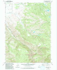
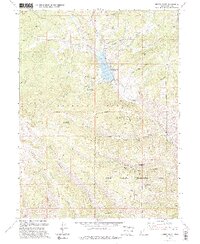
(45)- 1991 Map of Mirror Lake
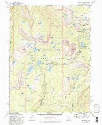 1991 Mirror Lake1991 Print · USGSThe high Uintas in the early 1970s reveal a landscape of alpine lakes and early forest service outposts. You can trace the historic Indian Treaty Boundary and locate backcountry landmarks like the Mirror Lake Guard Sta and Notch Mountain.
 - 1993 Map of Heber Mountain
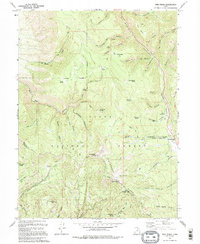
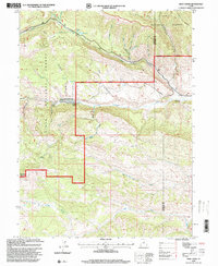
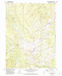 1993 Heber Mountain1993 Print · USGSHigh in the Wasatch Range in the early 1990s, this area shows a landscape defined by federal forests and tribal lands. Researchers can trace historic trails and boundaries between Heber Mountain, the Uinta and Ouray Reservation, and Timber Lakes.
 - 1993 Map of Charleston
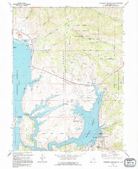
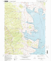
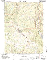
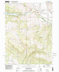
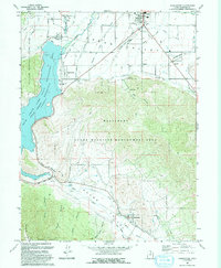 1993 Charleston1993 Print · USGSHeber Valley and Round Valley are shown in the early nineties as the region's agricultural roots met modern expansion. Genealogists and local historians can trace family-named sites like Billy Haws Canyon and landmarks including the Midway Hatchery and Cem.
 - 1993 Map of Wolf Creek Summit
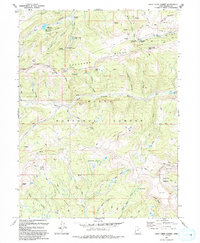 1993 Wolf Creek Summit1993 Print · USGSThe high Uinta country in the early nineties is revealed here through its mountain passes and river headwaters. Researchers can trace forest boundaries and remote geography from Wolf Creek Summit to the Mill Hollow Granite Sch Center and Heart Lake.
 - 1993 Map of Center Creek
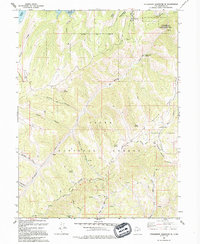
 1993 Center Creek1993 Print · USGSThe eastern edge of the Heber Valley in the early nineties shows the rise from rural farmsteads into mountain wilderness. Genealogists and historians can trace the Cem at Center Creek or explore the heights around Timber Lakes and Witts Lake.
 - 1993 Map of Co-Op Creek
 1993 Co-Op Creek1993 Print · USGSWasatch County’s high-country terrain is captured here in the early nineties, showing a landscape defined by the Uinta National Forest and the Strawberry River. Researchers can trace old mountain routes and water developments like the Sugar Mill, Bull Spring, and an Abandoned Canal.
 - 1993 Map of Wallsburg Ridge
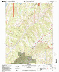
 1993 Wallsburg Ridge1993 Print · USGSThe northern reaches of the Uinta National Forest meet the pastures of Round Valley in the early nineties. Researchers can trace high-altitude Mines and old pack trails near Bear Canyon Pass and Bald Knoll.
 - 1993 Map of Two Tom Hill, 1994 Print
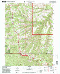
 1993 Two Tom Hill1994 Print · USGSThis high-country portion of the Wasatch and Utah county line shows the mountain landscape in the 1990s. Researchers can trace historic access routes via Pack Trails and locate remote landmarks like the Diamond Fork Guard Station and Mollies Nipple.
 - 1993 Map of Bridal Veil Falls, 1994 Print
 1993 Bridal Veil Falls1994 Print · USGSCanyon life in the Wasatch Range was defined by the river and the road during the early 1990s. Trace the development of mountain communities like Vivian Park and Upper Falls alongside recreational landmarks like Bridal Veil Falls and the Sundance Ski Area.
 - 1993 Map of Strawberry Reservoir SE, 1994 Print
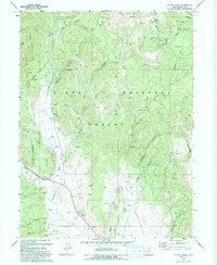
 1993 Strawberry Reservoir SE1994 Print · USGSThe high Wasatch backcountry and the eastern edge of the Strawberry Reservoir appear here in the early nineties. Researchers can trace remote Pack Trails, high-altitude campsites at Aspen Grove Campground, and family-named landmarks like Poulson Spring.
 - 1993 Map of Aspen Grove, 1994 Print
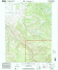
 1993 Aspen Grove1994 Print · USGSMount Timpanogos and the Provo Canyon corridor appear here in the early nineties, showcasing a landscape of high-altitude recreation and wilderness. Trace the development of the Sundance Ski Area, the Aspen Grove complex, and the Old Railroad Grade.2 unique versions available
 - 1994 Map of Strawberry Reservoir SW
 1994 Strawberry Reservoir SW1994 Print · USGSThe Wasatch and Utah county line area in the early nineties shows a landscape of high ridges and reservoir access. Researchers can locate the Willow Creek Guard Station, numerous mining Prospects, and the shoreline of Strawberry Reservoir.
 - 1994 Map of Strawberry Reservoir NE
 1994 Strawberry Reservoir NE1994 Print · USGSThe high-country waters of Wasatch County are captured here in the mid-nineties, showing the expansive shoreline of Strawberry Reservoir. Researchers can trace the engineering of the Soldier Creek Dam and find landmarks like Island Mountain and the West Portal.
 - 1994 Map of Twin Peaks
 1994 Twin Peaks1994 Print · USGSThe high ridges of Wasatch and Utah counties come into focus in the mid-1990s, revealing a landscape of alpine peaks and forest boundaries. Researchers can trace the Uintah and Indian Reservation Boundary and locate landmarks like Harrys Reservoir or the Lodgepole Campground.2 unique versions available
 - 1994 Map of Jimmies Point
 1994 Jimmies Point1994 Print · USGSHigh in the Uinta National Forest during the late twentieth century, this survey documents a rugged landscape of ridges and reservoirs. Researchers can trace remote sites like Cow Camp, the Currant Creek Work Center, and the steep terrain of The Narrows.
 - 1994 Map of Strawberry Reservoir NW
 1994 Strawberry Reservoir NW1994 Print · USGSThe Strawberry Valley area of the Uinta National Forest is captured here in the mid-1990s during a period of significant water infrastructure development. You can trace the Tunnel (Under Construction) near East Portal and explore the complex shoreline of Strawberry Reservoir from Jakes Bay to Rainbow Bay.
 - 1996 Map of Wolf Creek, 2000 Print
 1996 Wolf Creek2000 Print · USGSThe Wasatch and Duchesne county borderlands are shown in the late nineties as a rugged intersection of national forests and high-mountain drainages. Researchers can trace forest management boundaries and old livestock infrastructure like the Corral near Sand Creek and the remote Blue Lake.
 - 1996 Map of Iron Mine Mountain, 2000 Print
 1996 Iron Mine Mountain2000 Print · USGSThe high Uinta backcountry is captured here in the mid-1990s at the intersection of three national forests. Outdoor historians and researchers can trace the industrial legacy of the Iron Mine or locate early water projects like the Duchesne Tunnel and Spruce Springs Reservoir.
 - 1996 Map of Flat Ridge, 2000 Print
 1996 Flat Ridge2000 Print · USGSHigh-altitude forest lands in the western Uinta Mountains are captured in the late nineties as these national forests met across three county lines. Trace family landmarks and terrain features from Indian Head to Trail Reservoir and Cat Peak.
 - 1996 Map of Strawberry Peak, 2000 Print
 1996 Strawberry Peak2000 Print · USGSThe Wasatch and Duchesne county line passes through this high-forest wilderness in the mid-1990s. Researchers can trace the rugged topography of Strawberry Peak, explore named landmarks like Dollar Ridge, and locate remote water sources such as Big Beaver Springs.
 - 1996 Map of Strawberry Reservoir SE, 2000 Print
 1996 Strawberry Reservoir SE2000 Print · USGSThe Wasatch backcountry in the 1990s is documented here during a period of transition in national forest management and recreation. Researchers can trace remote livestock markers and water sources like the Paulson Spring, Willow Creek Road, and several corrals.
 - 1997 Map of Francis, 2001 Print
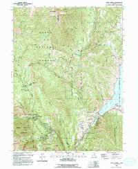
 1997 Francis2001 Print · USGSRhodes Valley and the upper Provo River region are captured here in the late nineties, showcasing a landscape shaped by water and high-mountain terrain. You can trace the development of Francis, locate the local Cem, and explore the shoreline of Jordanelle Reservoir.
 - 1998 Map of Two Tom Hill, 2000 Print
 1998 Two Tom Hill2000 Print · USGSThe high canyons and timbered ridges of the Utah and Wasatch county lines are captured here in the late nineties. Researchers can locate remote forestry outposts like Diamond Fork Guard Station and distinctive landmarks including Mollies Nipple and Two Tom Hill.
 - 1998 Map of Center Creek, 2000 Print
 1998 Center Creek2000 Print · USGSThe high Wasatch backcountry comes into focus in the late nineties as recreation and mountain ranching intersect. Researchers can trace land use through landmarks like Whiskey Spring, the Hogsback Exclosure, and the developing Timber Lakes area.
 - 1998 Map of Wallsburg Ridge, 2000 Print
 1998 Wallsburg Ridge2000 Print · USGSHigh in the Wasatch Range during the 1990s, this area showcases the intersection of forest service districts and mountain trails. Trace historical wilderness routes like the Upper Spanish Fork Trail and find landmarks such as Bald Knoll or Wing Flat.
Showing maps 1-25 of 45
Top cities of Wasatch County
Frequently asked questions
- What are the different types of historical maps available for Wasatch County?
- What is the oldest map of Wasatch County?
- Where can I purchase historical maps of Wasatch County for my home or office?
- Where can I download high-res historical maps of Wasatch County?
- Are there historical topographic maps available for Wasatch County?
- Is there historical aerial imagery available for Wasatch County?
- Where are historical maps of Wasatch County sourced from?