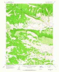
1962 Map of Wolf Creek
USGS Topo · Published 1963About this map
The high alpine country of the Ashley National Forest and Uinta National Forest dominates this 1962 survey, revealing a landscape defined by water and ridgelines. The West Fork Duchesne River cuts through the central terrain, fed by a complex network of tributaries including Buckboard Creek, Annie Mae Creek, and West Twin Creek. For researchers of historical land divisions, the map clearly traces the Old Indian Treaty Boundary as it traverses the county line between Wasatch and Duchesne counties.
Find a feature on this map
49 named features on this map. Tap any name to fly to it.
Don’t see what you’re looking for? This feature index may not catch every label — zoom into the map to look around manually.
Map Details
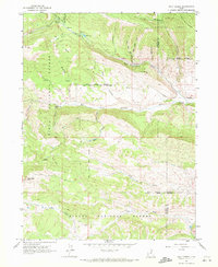
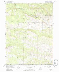
Editions of this 1962 Wolf Creek Map
3 editions found
Other maps of this area

1885 · Salt Lake
USGS Topo · 1:250,000

1885 · Uinta
USGS Topo · 1:250,000

1900 · Coalville
USGS Topo · 1:125,000

1901 · Hayden Peak
USGS Topo · 1:125,000

1903 · Hayden Peak
USGS Topo · 1:125,000

1903 · Coalville
USGS Topo · 1:125,000

1907 · Strawberry Valley
USGS Topo · 1:125,000

1909 · Strawberry Valley
USGS Topo · 1:125,000

1954 · Salt Lake City
USGS Topo · 1:250,000

1958 · Salt Lake City
USGS Topo · 1:250,000