1980s Maps of Wayne County, Utah
Explore 46 historic maps of Wayne County from the 1980s. These maps offer a rare glimpse into what life looked like during the 1980s — showing old roads, neighborhoods, homes, and landmarks that have changed or disappeared over time.
Whether you're researching your family's past, planning a metal detecting trip, or studying how Wayne County's landscape evolved across the 1980s, these high-resolution maps are a powerful tool for exploring the history of this region.
- Focus on a specific era: All maps on this page are from the 1980s, giving you a focused view of this time period.
- See what’s changed: Compare century-old streets, trails, and buildings to today's modern landscape using overlays and satellite layers.
- Research with precision: Use these maps for genealogy, historical research, land use analysis, or educational projects.
- View, download, or print: Maps are fully viewable online in high resolution, and can be downloaded or printed for your own records.
Start exploring Wayne County's history through authentic maps from the 1980s. This is your window into the past.
Wayne County, UT maps
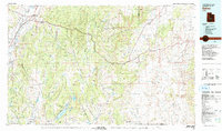
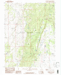
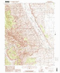
(46)- 1980 Map of Loa
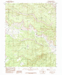
 1980 Loa1980 Print · USGSCentral Utah's high plateaus and the Fremont River corridor are captured here during the 1980s, showcasing a landscape of high-elevation reservoirs and remote ranching outposts. Genealogists can trace family names and early settlements from Loa and Teasdale to the orchards of Fruita.2 unique versions available
 - 1980 Map of Salina, 1981 Print
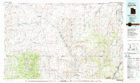
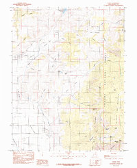
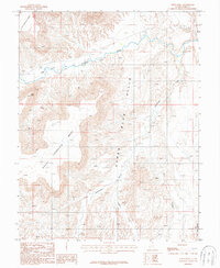
 1980 Salina1981 Print · USGSCentral Utah in the late twentieth century reveals a landscape of high plateaus and transit corridors. Trace the Denver and Rio Grande Western RR past Salina or locate remote sites like Browning Mine and Fish Lake.2 unique versions available
 - 1980 Map of Hanksville, 1987 Print
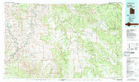
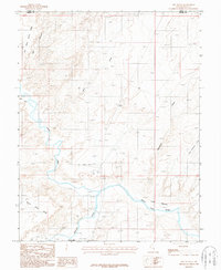
 1980 Hanksville1987 Print · USGSHanksville and the surrounding high desert are captured in the early 1980s, showcasing a landscape of dramatic topography and isolated outposts. Researchers can trace the rugged drainage of the Dirty Devil River and locate landmarks like the Factory Butte Mine and Robbers Roost Flats.2 unique versions available
 - 1982 Map of La Sal, 1983 Print
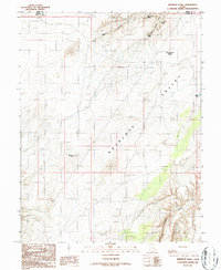
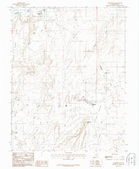
 1982 La Sal1983 Print · USGSThe high desert of southeastern Utah meets the Colorado border in the early eighties, showing a landscape defined by deep canyons and mining. Trace the industrial operations at Lisbon Mine or explore the early mapping of The Needles and Island in the Sky.2 unique versions available
 - 1985 Map of Cathedral Mountain
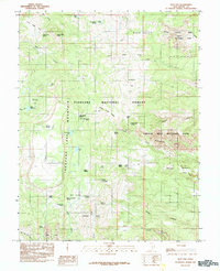
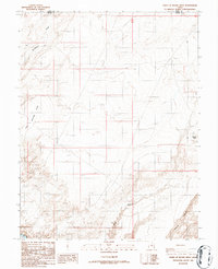
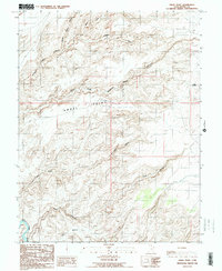
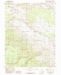 1985 Cathedral Mountain1985 Print · USGSWayne County was characterized by its geology and remote desert access in the mid-eighties, centered on the Waterpocket Fold. Researchers can trace old trails like the Hartnet and locate vital water sources including South Desert Spring and Ring Water Spring.
 - 1985 Map of Government Point
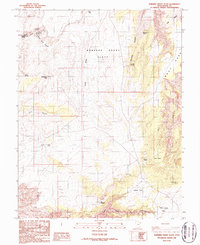
 1985 Government Point1985 Print · USGSHigh-altitude plateaus and alpine basins define this mid-1980s survey of the Wayne and Garfield county line. Researchers can trace remote water sources and landmarks like Pine Creek Reservoir, Government Point, and Peterson Grove.
 - 1985 Map of Flat Top
 1985 Flat Top1985 Print · USGSWayne County, Utah, is shown in the mid-1980s where the high forest meets the desert reefs. Researchers and collectors can trace the geological boundary of the Waterpocket Fold and locate remote landmarks like Wiffs Pasture and Point Lookout.
 - 1985 Map of Blind Lake
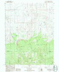
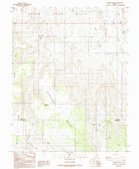
 1985 Blind Lake1985 Print · USGSHigh atop the plateaus of Wayne and Garfield counties in the mid-1980s, this area showcases a high-elevation backcountry of the Dixie National Forest. Researchers can trace the alpine water systems and grazing lands of Boulder Mountain, including Blind Lake, Hickman Pasture, and Donkey Meadows.
 - 1985 Map of Torrey
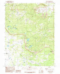
 1985 Torrey1985 Print · USGSTorrey and Teasdale sit at the center of this 1980s survey of the high plateau country in Wayne County. Researchers can trace the path of the Torrey Canal across Poverty Flat and explore landmarks like Chimney Rock Can and the Teasdale Bench.2 unique versions available
 - 1985 Map of Twin Rocks
 1985 Twin Rocks1985 Print · USGSWayne County canyon country is revealed in this 1980s survey as the modern infrastructure of Capitol Reef National Park takes shape. Researchers can trace the rugged corridor of the Fremont River and locate specific landmarks like Fruita, Twin Rocks, and the Waterpocket Fold.2 unique versions available
 - 1985 Map of Lyman
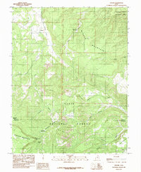
 1985 Lyman1985 Print · USGSWayne County settlements and high desert water systems are captured in the mid-eighties as ranchers managed the eastern edge of the plateau. Local historians can trace early water infrastructure like the Highline Ditch and family-named landmarks including Tidwell Spring and Burnt Springs.
 - 1985 Map of Grover
 1985 Grover1985 Print · USGSGrover and the surrounding Utah high country are captured in the mid-1980s, where ranching meadows meet the red rocks of the reef. Local historians can trace high-altitude landmarks like Boulder Mountain, Rock Creek Meadow, and the Wide Hollow Reservoir.2 unique versions available
 - 1985 Map of Bicknell
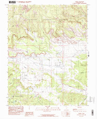
 1985 Bicknell1985 Print · USGSWayne County ranching and water management are front and center in the mid-1980s as the town of Bicknell sits surrounded by the Fremont River and its wetlands. Genealogists and locals can trace family-named landmarks like Dab Keele Spring, Petes Pond, and Bullard Spring.
 - 1986 Map of Point of Rocks West
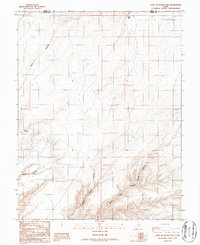
 1986 Point of Rocks West1986 Print · USGSSouthern Utah in the mid-eighties shows a landscape of remote drainages and high desert plateaus at the border of Emery and Wayne County. Trace the paths of the Dirty Devil River and the primitive 4WD tracks that reach Point of Rocks.2 unique versions available
 - 1986 Map of Angel Cove, 1987 Print
 1986 Angel Cove1987 Print · USGSThe Dirty Devil River winds through the high desert of Wayne County during the mid-1980s. Local history buffs and researchers can trace the intricate oxbows and dramatic elevation changes along the Dirty Devil River.2 unique versions available
 - 1986 Map of Dry Lakes Peak, 1987 Print
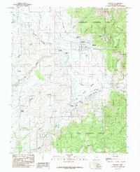
 1986 Dry Lakes Peak1987 Print · USGSThe high plateaus of Wayne and Garfield Counties are captured here in the mid-1980s, showcasing a landscape of remote basins and mountain passes. Trace the routes of early ranchers through Rock Corral, explore Jet Basin, or locate the waters at Sidehill Springs.
 - 1986 Map of Whitbeck Knoll, 1987 Print
 1986 Whitbeck Knoll1987 Print · USGSWayne County’s high desert comes into focus in the mid-1980s, revealing a landscape of remote ranching outposts and hidden springs. Researchers can trace 4WD trails leading to isolated landmarks like Whitbeck Knoll, Bluejohn Canyon, and the Little Saucer Basin.
 - 1986 Map of Angel Point, 1987 Print
 1986 Angel Point1987 Print · USGSWayne County’s high desert plateaus and labyrinthine canyon systems are preserved here in the mid-1980s. Trace the intricate reaches of South Fork Robbers Roost Canyon and the winding course of the Dirty Devil River near Bull Pasture.2 unique versions available
 - 1986 Map of Robbers Roost Flats, 1987 Print
 1986 Robbers Roost Flats1987 Print · USGSWayne County’s high-desert canyons and plateaus are captured here in the mid-1980s, documenting a landscape where water and geography dictated survival. You can trace 4WD tracks to isolated water sources like Bluejohn Spring or the remote Landing Strip near Twin Corral Box Canyon.
 - 1986 Map of Stevens Mesa, 1987 Print
 1986 Stevens Mesa1987 Print · USGSThe high desert boundary of Wayne and Garfield counties comes into focus in the mid-1980s. Local researchers can trace vital water sources and landforms like Indianwater Seep, Maidenwater Spring, and the massive Stevens Mesa.
 - 1986 Map of Point of Rocks East, 1987 Print
 1986 Point of Rocks East1987 Print · USGSWayne County canyon country in the mid-1980s reveals a landscape of isolated 4WD tracks and deep drainages. Researchers can trace the rugged topography around Point of Rocks and the winding paths of North Fork Robbers Roost Canyon.
 - 1987 Map of Fruita
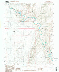
 1987 Fruita1987 Print · USGSThe settlement of Fruita is shown at the confluence of desert rivers during the late 1980s, surrounded by the towering cliffs of Capitol Reef. Researchers can trace the geologic uplift of the Waterpocket Fold and locate landmarks like Hickman Natural Bridge and Danish Hill.2 unique versions available
 - 1987 Map of Town Point
 1987 Town Point1987 Print · USGSWayne County in the late eighties remains a landscape defined by its striking geography and the Fremont River. Researchers can trace the drainages of Sweetwater Creek and Oak Creek as they flow between North Caineville Mesa and the heights of Town Point.
 - 1987 Map of The Notch
 1987 The Notch1987 Print · USGSHanksville in the late 1980s centers on the confluence where two rivers form the Dirty Devil. Genealogists and desert historians can trace the local Cem, the early Hanksville Airport, and topographic landmarks like The Notch and Wild Horse Mesa.
 - 1987 Map of Hanksville
 1987 Hanksville1987 Print · USGSHanksville in the early 1980s is captured here at the junction of the Fremont River and the desert plains. Researchers can trace the town's footprint, including the Trailer Park, and follow cattle-era landmarks like Beef Hollow Reservoir and Penitentiary Point.
Showing maps 1-25 of 46
Top cities of Wayne County
- Loa historical maps
- Bicknell historical maps
- Lyman historical maps
- Hanksville historical maps
- Torrey historical maps
Frequently asked questions
- What are the different types of historical maps available for Wayne County?
- What is the oldest map of Wayne County?
- Where can I purchase historical maps of Wayne County for my home or office?
- Where can I download high-res historical maps of Wayne County?
- Are there historical topographic maps available for Wayne County?
- Is there historical aerial imagery available for Wayne County?
- Where are historical maps of Wayne County sourced from?