1960s Maps of Wayne County, Utah
Explore 21 historic maps of Wayne County from the 1960s. These maps offer a rare glimpse into what life looked like during the 1960s — showing old roads, neighborhoods, homes, and landmarks that have changed or disappeared over time.
Whether you're researching your family's past, planning a metal detecting trip, or studying how Wayne County's landscape evolved across the 1960s, these high-resolution maps are a powerful tool for exploring the history of this region.
- Focus on a specific era: All maps on this page are from the 1960s, giving you a focused view of this time period.
- See what’s changed: Compare century-old streets, trails, and buildings to today's modern landscape using overlays and satellite layers.
- Research with precision: Use these maps for genealogy, historical research, land use analysis, or educational projects.
- View, download, or print: Maps are fully viewable online in high resolution, and can be downloaded or printed for your own records.
Start exploring Wayne County's history through authentic maps from the 1960s. This is your window into the past.
Wayne County, UT maps
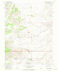
(21)- 1960 Map of Salina
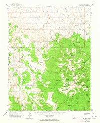
 1960 Salina1960 Print · USGSThe high plateaus and canyonlands of south-central Utah appear in the early sixties as a region of remote ranching towns and developing parklands. Researchers can trace historic settlements like Fruita and Loa or locate the uranium mines and the tracks of the Denver and Rio Grande Western RR.2 unique versions available
 - 1960 Map of Moab
 1960 Moab1960 Print · USGSThe canyonlands and high plateaus of the Utah-Colorado border are shown here during the mid-century uranium boom. Researchers can trace the river-and-rail corridors of the Colorado River and the Denver and Rio Grande Western near Moab and Uravan.3 unique versions available
 - 1962 Map of Moab
 1962 Moab1962 Print · USGSThe canyon country of southeastern Utah and western Colorado is captured here in the early sixties, showing the reach of the Denver and Rio Grande Western through the desert. Researchers can trace the layout of mining settlements like Uravan and old railroad stops at Cisco and Sagers Station.
 - 1962 Map of Salina
 1962 Salina1962 Print · USGSSevier County and the surrounding desert wilderness appear here in the early sixties as a network of isolated river valley towns and high-altitude forests. Researchers can locate remote landmarks like Fruita, trace the Denver & Rio Grande Western RR, and find backcountry sites like the Aquarius Ranger Station.
 - 1962 Map of Mt. Ellen, 1964 Print
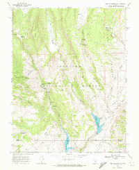
 1962 Mt. Ellen1964 Print · USGSGarfield County rangeland and the high Henry Mountains are captured here in the early sixties, showing a landscape of mining and ranching. Trace old mining operations at Bromide Mine or locate historic seasonal outposts like King Ranch and Rock Corral.2 unique versions available
 - 1963 Map of Robbers Roost Canyon, 1964 Print
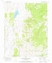
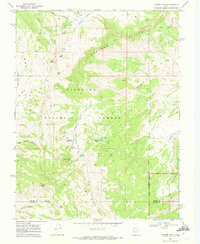
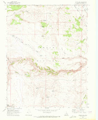
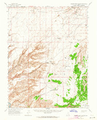 1963 Robbers Roost Canyon1964 Print · USGSIn the early 1960s, this Wayne County desert remained a vast expanse of ranching outposts and canyon hideouts. Researchers can trace remote routes like Angels Trail or locate isolated landmarks like Biddlecome Ranch and the eponymous Robbers Roost Spring.3 unique versions available
 - 1963 Map of Hanksville, 1965 Print
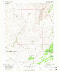
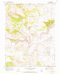
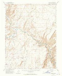 1963 Hanksville1965 Print · USGSHanksville and the surrounding high desert are documented here during the early 1960s as aviation and energy interests moved into the region. Local historians can trace the town's footprint near the Hanksville Cem and the confluence of the Fremont River and Muddy Creek.3 unique versions available
 - 1964 Map of Moab
 1964 Moab1964 Print · USGSThe canyonlands of eastern Utah and western Colorado are captured here in the mid-1960s, a time when uranium mining shaped the local economy. Researchers can trace the river-and-rail network through Sinbad Valley and locate mining outposts like Uravan and Vancorum.
 - 1965 Map of Moab
 1965 Moab1965 Print · USGSSoutheast Utah and Western Colorado are mapped here in the mid-sixties, showcasing a landscape of high plateaus and deep river canyons. Genealogists and historians can trace the mining-era towns of Uravan and Paradox or locate remote landmarks like Castleton and Dead Horse Point.
 - 1967 Map of Lyman, 1973 Print
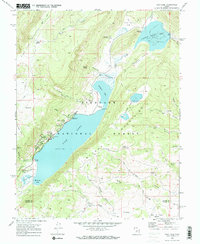
 1967 Lyman1973 Print · USGSThe high country of the Uinta and Summit County border is captured here in the late sixties as the Meeks Cabin Reservoir began to fill. Researchers can locate the Old Blacks Fork Commissary, the Youth Camp at Lyman Lake, and the remote East Fork Blacks Fork Guard Station.
 - 1968 Map of Solomons Temple, 1972 Print
 1968 Solomons Temple1972 Print · USGSThe high desert of south-central Utah is captured here in the late sixties at the junction of three counties. Geologists and local historians can trace isolated water sources like Birch Spring and Jeffery Reservoir alongside landmarks like Solomons Temple.2 unique versions available
 - 1968 Map of Fish Lake, 1972 Print
 1968 Fish Lake1972 Print · USGSThe high Utah plateau in the late sixties reveals a landscape of alpine lakes and national forest management. Researchers can trace the layout of Fish Lake Ranger Sta and remote sites like Tasha Spring and the Gravel Pit.2 unique versions available
 - 1968 Map of Burrville, 1972 Print
 1968 Burrville1972 Print · USGSGrass Valley and the high plateaus of central Utah are captured in the late sixties as agricultural and forest lands intersected. Researchers can locate the Burrville Cem and trace historic routes like the Old Bamberger Road and the Aqueduct.
 - 1968 Map of Forsyth Reservoir, 1972 Print
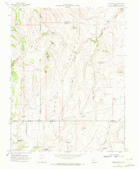
 1968 Forsyth Reservoir1972 Print · USGSThe high country of the Sevier and Wayne County line is captured in the late sixties as a hub for forest recreation and water management. Researchers can locate early forest service sites like Pah Ga Ne A Campground and trace trails through Tidwell Canyon.
 - 1968 Map of Geyser Peak, 1972 Print
 1968 Geyser Peak1972 Print · USGSThe high plateau country of Sevier and Wayne counties comes alive in this late 1960s survey of the Fishlake and Capitol Reef borderlands. Researchers can trace remote routes like the Jeep Trail through Solomon Basin or locate high-country landmarks like Geyser Peak.2 unique versions available
 - 1969 Map of Smooth Knoll, 1972 Print
 1969 Smooth Knoll1972 Print · USGSWayne and Garfield counties are mapped in the late sixties during a period of active high-country ranching and timber management. Researchers can trace land use through family-named landmarks and water systems like Mitts Reservoir, Blackburn Reservoir, and Logging Grove.
 - 1969 Map of Flossie Knoll, 1972 Print
 1969 Flossie Knoll1972 Print · USGSThe high plateau of the Dixie National Forest is captured here in the late sixties, showing a landscape defined by grazing and water management. Researchers can trace remote landmarks like Flossie Lake, the string of The Buttes, and Gripe Reservoir.2 unique versions available
 - 1969 Map of Jakes Knoll, 1972 Print
 1969 Jakes Knoll1972 Print · USGSThe high Awapa Plateau comes into focus in the late sixties, showing the complex ranching and water infrastructure of Wayne and Piute counties. Genealogists and historians can trace essential upland water sources like Cyclone Co-op Reservoir, Parker Lake, and the local jeep trails.2 unique versions available
 - 1969 Map of Moroni Peak, 1972 Print
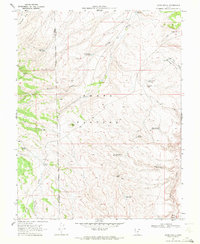
 1969 Moroni Peak1972 Print · USGSWayne County high country in the late 1960s reveals a land of high plateaus and remote range infrastructure. Researchers can trace the development of water resources across the Awapa Plateau, locating Moroni Reservoir and the distinctive landmark Elsies Nipple.
 - 1969 Map of Loa, 1973 Print
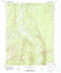
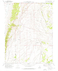
 1969 Loa1973 Print · USGSRabbit Valley and the high plateaus of Wayne County are captured here in the late sixties. Researchers can trace the water-management history of Loa through local features like the Fish Hatchery, Allred Ditch, and the community Rodeo Grounds.2 unique versions available
 - 1969 Map of Abes Knoll, 1976 Print
 1969 Abes Knoll1976 Print · USGSHigh-country ranching and water management define the Wayne County highlands during the late 1960s. Researchers can trace land use patterns and remote settlements like Cedar Grove alongside named landmarks like Abes Knoll and Eightmile Reservoir.
End of results
Showing maps 1-21 of 21
Top cities of Wayne County
- Loa historical maps
- Bicknell historical maps
- Lyman historical maps
- Hanksville historical maps
- Torrey historical maps
Frequently asked questions
- What are the different types of historical maps available for Wayne County?
- What is the oldest map of Wayne County?
- Where can I purchase historical maps of Wayne County for my home or office?
- Where can I download high-res historical maps of Wayne County?
- Are there historical topographic maps available for Wayne County?
- Is there historical aerial imagery available for Wayne County?
- Where are historical maps of Wayne County sourced from?