2000s (21st Century) Maps of Wayne County, Utah
Explore 283 historic maps of Wayne County from the 2000s (21st Century). These maps offer a rare glimpse into what life looked like during the 2000s — showing old roads, neighborhoods, homes, and landmarks that have changed or disappeared over time.
Whether you're researching your family's past, planning a metal detecting trip, or studying how Wayne County's landscape evolved across the 2000s, these high-resolution maps are a powerful tool for exploring the history of this region.
- Focus on a specific era: All maps on this page are from the 2000s, giving you a focused view of this time period.
- See what’s changed: Compare century-old streets, trails, and buildings to today's modern landscape using overlays and satellite layers.
- Research with precision: Use these maps for genealogy, historical research, land use analysis, or educational projects.
- View, download, or print: Maps are fully viewable online in high resolution, and can be downloaded or printed for your own records.
Start exploring Wayne County's history through authentic maps from the 2000s. This is your window into the past.
Wayne County, UT maps
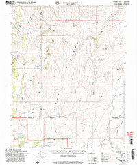
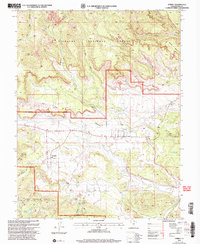
(283)- 2001 Map of Lyman, 2003 Print
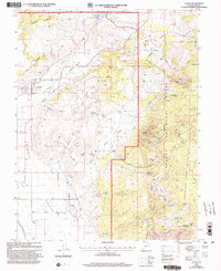 2001 Lyman2003 Print · USGSThe Fremont River valley and the eastern slopes of Thousand Lake Mountain are documented here at the turn of the millennium. Researchers can locate the local Cem, trace the HIGHLINE DITCH, and map high-altitude landmarks like Blind Lake.
 - 2001 Map of Twin Rocks, 2003 Print
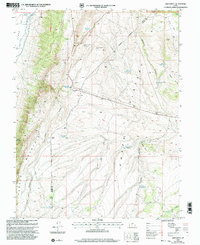
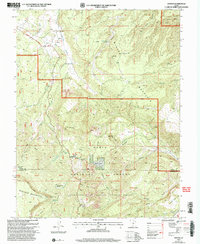
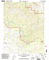
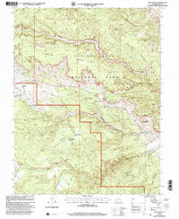 2001 Twin Rocks2003 Print · USGSWayne County was undergoing modern resource mapping at the turn of the millennium as federal agencies documented this iconic desert corridor. Researchers can trace the layout of Fruita and identify landmarks like Chimney Rock, The Castle, and the Goosenecks.
 - 2001 Map of Burrville, 2003 Print
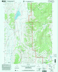 2001 Burrville2003 Print · USGSThe rural community of Burrville and the high country of the Fishlake National Forest are shown here at the start of the millennium. Researchers can trace the legacy of early settlers at Burrville Cem and locate historic water sources like Torgerson Spring or the Old Bamberger Road.
 - 2001 Map of Forsyth Reservoir, 2003 Print
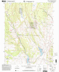 2001 Forsyth Reservoir2003 Print · USGSSevier and Wayne counties are captured at the turn of the millennium as a network of reservoirs and springs within the Fishlake National Forest. Researchers can trace water sources from Zedds Meadows down to Forsyth Reservoir and the Fremont River.
 - 2001 Map of Cathedral Mountain, 2003 Print
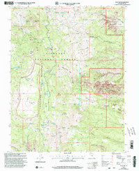
 2001 Cathedral Mountain2003 Print · USGSCapitol Reef National Park and the surrounding high desert are documented here during the early 2000s, showing the intersection of federal lands and geologic wonders. Researchers can trace the remote tracks of The Hartnet and locate vital water sources like South Desert Spring and Ring Water Spring.
 - 2001 Map of Flat Top, 2003 Print
 2001 Flat Top2003 Print · USGSHigh desert plateaus and alpine forests meet at the turn of the 21st century in this Wayne County study. Researchers can trace the transition from Elkhorn Campground across the summit of Flat Top to the geological wonder of the Waterpocket Fold.
 - 2001 Map of Loa, 2003 Print
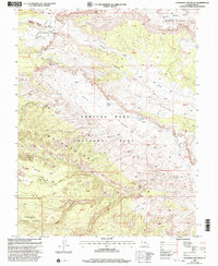
 2001 Loa2003 Print · USGSLoa and the verdant Rabbit Valley are shown at the turn of the twenty-first century, just as they sit between the high Awapa Plateau and the Fremont River. Local historians can trace the town's footprint including the Loa Cem, Rodeo Grounds, and the nearby Loa Fish Hatchery.
 - 2001 Map of Fish Lake, 2003 Print
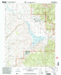
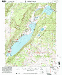 2001 Fish Lake2003 Print · USGSThe alpine basins and high plateaus of Sevier County are captured here at the turn of the millennium. Outdoor historians and researchers can trace established sites like Fish Lake Campground and remote landmarks such as Elias Wells or Mytoge Mountain.2 unique versions available
 - 2001 Map of Abes Knoll, 2003 Print
 2001 Abes Knoll2003 Print · USGSThe high plateau country of Piute and Wayne Counties is captured here at the turn of the millennium, revealing a landscape defined by water management and communication hubs. You can trace the remote settlement at Cedar Grove and locate vital backcountry landmarks like Abes Knoll and Eightmile Reservoir.
 - 2001 Map of Geyser Peak, 2003 Print
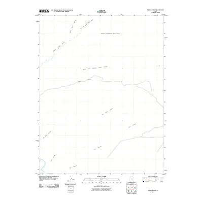
 2001 Geyser Peak2003 Print · USGSHigh-country plateaus and national forest lands meet at the turn of the century along the Sevier and Wayne county lines. Researchers can trace remote water sources and geologic landmarks like Floating Island Lake, Geyser Peak, and Hogan Pass.
 - 2002 Map of Smooth Knoll, 2005 Print
 2002 Smooth Knoll2005 Print · USGSHigh desert plateaus on the Wayne and Garfield County border come to life in this early 2000s survey of the Dixie National Forest. Trace a network of high-country water features from Mutts Reservoir to Blackburn Reservoir and the timbered heights of Smooth Knoll.
 - 2002 Map of Bicknell, 2005 Print
 2002 Bicknell2005 Print · USGSBicknell and the Rabbit Valley are mapped here at the start of the millennium, showing a landscape defined by the Fremont River and the Thousand Lake Mountain. Researchers can trace land use through the Bicknell Waterfowl Management Area, the local Cem, and the Wayne Wonderland Airport.
 - 2002 Map of Flossie Knoll, 2005 Print
 2002 Flossie Knoll2005 Print · USGSHigh-altitude Utah backcountry is mapped here during the early 2000s, showing the intersection of Wayne, Piute, and Garfield counties. Researchers can trace historic water sources and landmarks like Death Hollow Reservoir, The Buttes, and Tri Corner Pond.
 - 2002 Map of Grover, 2005 Print
 2002 Grover2005 Print · USGSHigh desert plateaus and deep canyons meet at the turn of the millennium near the Wayne and Garfield county line. Researchers can trace historic land use through several Mine Shaft locations and the remote outpost of Grover near the Dixie National Forest boundary.
 - 2002 Map of Government Point, 2005 Print
 2002 Government Point2005 Print · USGSHigh on the volcanic plateau of Wayne County in the early 2000s, this area shows a landscape of subalpine lakes and forest management. Researchers can trace the high-country paths of the Great Western Trail and locate family-named features like Peterson Grove or Giles Hollow.
 - 2002 Map of Golden Throne, 2005 Print
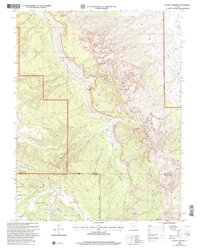 2002 Golden Throne2005 Print · USGSWayne and Garfield counties are mapped during the early 2000s, showcasing the intricate geological features and cultural landmarks of the Waterpocket Fold. Researchers can locate historic sites and landforms like the Pioneer Register, Petroglyphs, and the towering Eph Hanks Tower.
 - 2002 Map of Torrey, 2005 Print
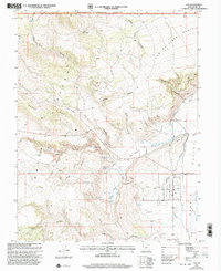
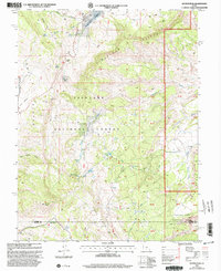
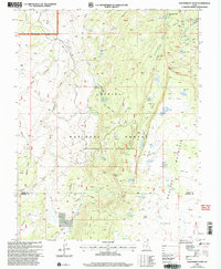
 2002 Torrey2005 Print · USGSTorrey and Teasdale sit at the edge of the canyonlands at the turn of the millennium, where high forest plateaus give way to irrigated ranching valleys. Trace the paths of the Great Western Trail and the lifelines of the Fremont River and Canal.
 - 2002 Map of Blind Lake, 2005 Print
 2002 Blind Lake2005 Print · USGSBoulder Mountain and the surrounding high plateau are documented in this early 2000s survey of federal forest lands. Researchers can trace alpine water systems and grazing history through landmarks like Blind Lake, Donkey Reservoir, and Hickman Pasture.
 - 2010 Map of Baking Skillet Knoll, 2010 Print
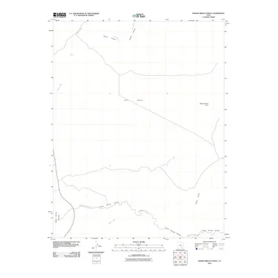 2010 Baking Skillet Knoll2010 Print · USGSCovers Wayne County, including Garfield County, United States, and other nearby areas
 - 2010 Map of Town Point, 2010 Print
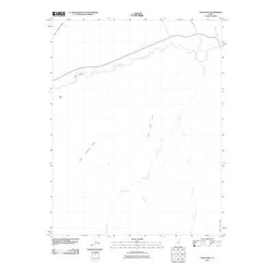 2010 Town Point2010 Print · USGSCovers Wayne County, including United States, Utah, and other nearby areas
 - 2010 Map of Angel Point, 2010 Print
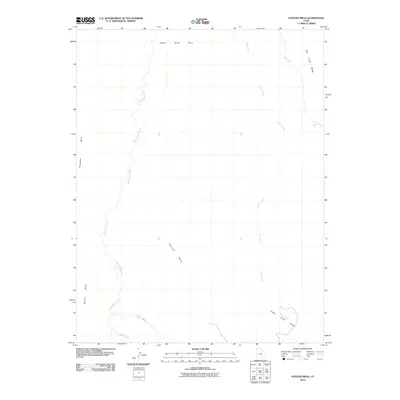
 2010 Angel Point2010 Print · USGSCovers Wayne County, including United States, Utah, and other nearby areas
 - 2010 Map of The Pinnacle, 2010 Print
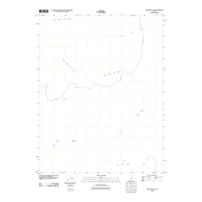 2010 The Pinnacle2010 Print · USGSCovers Wayne County, including Garfield County, United States, and other nearby areas
 - 2010 Map of Stevens Mesa, 2010 Print
 2010 Stevens Mesa2010 Print · USGSCovers Wayne County, including Garfield County, United States, and other nearby areas
 - 2010 Map of Robbers Roost Flats, 2010 Print
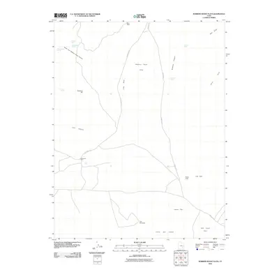 2010 Robbers Roost Flats2010 Print · USGSCovers Wayne County, including United States, Utah, and other nearby areas
 - 2010 Map of Angel Cove, 2010 Print
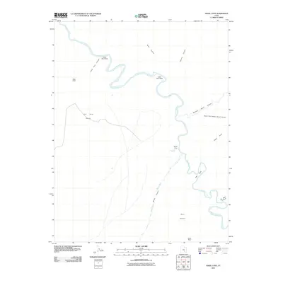 2010 Angel Cove2010 Print · USGSCovers Wayne County, including United States, Utah, and other nearby areas
Showing maps 1-25 of 283
Top cities of Wayne County
- Loa historical maps
- Bicknell historical maps
- Lyman historical maps
- Hanksville historical maps
- Torrey historical maps
Frequently asked questions
- What are the different types of historical maps available for Wayne County?
- What is the oldest map of Wayne County?
- Where can I purchase historical maps of Wayne County for my home or office?
- Where can I download high-res historical maps of Wayne County?
- Are there historical topographic maps available for Wayne County?
- Is there historical aerial imagery available for Wayne County?
- Where are historical maps of Wayne County sourced from?