1960s Maps of Weber County, Utah
Explore 13 historic maps of Weber County from the 1960s. These maps offer a rare glimpse into what life looked like during the 1960s — showing old roads, neighborhoods, homes, and landmarks that have changed or disappeared over time.
Whether you're researching your family's past, planning a metal detecting trip, or studying how Weber County's landscape evolved across the 1960s, these high-resolution maps are a powerful tool for exploring the history of this region.
- Focus on a specific era: All maps on this page are from the 1960s, giving you a focused view of this time period.
- See what’s changed: Compare century-old streets, trails, and buildings to today's modern landscape using overlays and satellite layers.
- Research with precision: Use these maps for genealogy, historical research, land use analysis, or educational projects.
- View, download, or print: Maps are fully viewable online in high resolution, and can be downloaded or printed for your own records.
Start exploring Weber County's history through authentic maps from the 1960s. This is your window into the past.
Weber County, UT maps
(13)- 1960 Map of Ogden
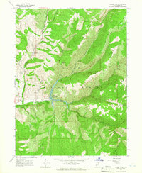
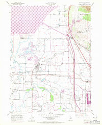
 1960 Ogden1960 Print · USGSIn the mid-1950s, this region of the American West balanced military expansion with frontier history along the Union Pacific RR. Genealogists and historians can trace old settlements like Fort Bridger, the residential growth of Washington Terrace, and industrial sites from the Hill AFB complex to the coal mines of Kemmerer.
 - 1961 Map of Morgan, 1963 Print
 1961 Morgan1963 Print · USGSThe Weber River valley in the early sixties was a critical junction of rail industry and mountain agriculture. Local historians can trace the industrial footprint of the Cement Plant near Devils Slide and find vanished rural landmarks like the Monastery and Como Springs.2 unique versions available
 - 1962 Map of Brigham City
 1962 Brigham City1962 Print · USGSNorthern Utah in the early sixties reveals a landscape of vast salt flats and growing towns along the Wasatch Front. Researchers can trace the Southern Pacific line past the Golden Spike Monument or locate landmarks like Indian Cave and Donner-Reed Pass.
 - 1964 Map of Lost Creek Dam
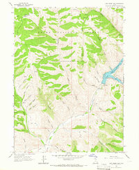 1964 Lost Creek Dam1964 Print · USGSThe mountains of Morgan County appear in the mid-sixties just as the Lost Creek Dam and Lost Creek Reservoir reshaped the high country. Historians can trace the Guilder Road or locate landmarks like Robinson Mine Hollow and Big Flat.2 unique versions available
 - 1964 Map of Monte Cristo PK, 1965 Print
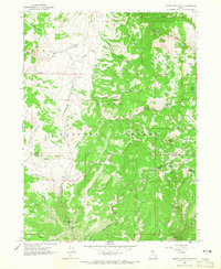 1964 Monte Cristo PK1965 Print · USGSThe northern Utah highlands and the Cache National Forest are shown here in the mid-1960s at a moment of intense topographic detail. Researchers can trace remote high-country water sources and landmarks like Monte Cristo Peak, Dry Bread Pond, and Bullpecker Spring.2 unique versions available
 - 1964 Map of Sharp Mountain, 1966 Print
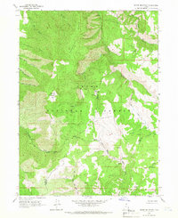 1964 Sharp Mountain1966 Print · USGSThe high ridge country of the Wasatch Range is captured here in the mid-1960s, showing the intersection of Cache and Weber counties. Local historians can locate the La Plata Mine and trace the headwaters of the Little Bear River and Cinnamon Creek.3 unique versions available
 - 1964 Map of Browns Hole, 1966 Print
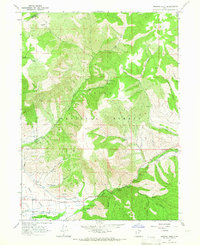 1964 Browns Hole1966 Print · USGSThe Ogden Valley hinterlands during the mid-sixties show a balance of irrigation agriculture and forest recreation near the Weber County line. You can trace early canyon access and recreation spots like Meadows Campground, Diversion Dam, and the winding Geertson Canyon.2 unique versions available
 - 1964 Map of Causey Dam, 1966 Print
 1964 Causey Dam1966 Print · USGSWeber County high country in the mid-1960s reveals a landscape centered on the recently completed Causey Dam. You can trace the rugged drainages of Skull Creek and Dry Bread Hollow or locate the holdings at Red Rock Ranch.3 unique versions available
 - 1968 Map of Horse Ridge, 1970 Print
 1968 Horse Ridge1970 Print · USGSThe high Wasatch backcountry of Weber and Rich counties comes into focus in this late 1960s survey. Researchers can trace historic access routes via Jeep Trails and Pack Trails across Horse Ridge and near the headwaters of the South Fork Ogden River.3 unique versions available
 - 1968 Map of Dairy Ridge, 1970 Print
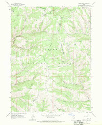
 1968 Dairy Ridge1970 Print · USGSThe high ridges of the Cache National Forest come into focus in the late sixties, showing a landscape managed for timber and range. Researchers can locate remote landmarks like the Monte Cristo Guard Sta, Woodruff Road, and dozens of named water sources like Neponset Spring.3 unique versions available
 - 1968 Map of Promontory Point, 1970 Print
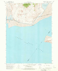 1968 Promontory Point1970 Print · USGSThe Southern Pacific railroad skirts the tip of the Great Salt Lake in the late 1960s, marking a vital industrial corridor through Box Elder County. Researchers can trace the Lucin Cutoff and find remote outposts like Saline and the specialized Elevated Flume.2 unique versions available
 - 1968 Map of Fremont Island SW, 1972 Print
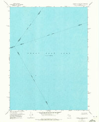 1968 Fremont Island SW1972 Print · USGSThe open waters of the Great Salt Lake are captured in the late sixties at a documented elevation of 4,193 feet. Researchers can trace the intersection of four counties along the Weber-Davis and Tooele-Davis indefinite boundaries.
 - 1969 Map of Plain City, 1971 Print
 1969 Plain City1971 Print · USGSNorth of Ogden in the late sixties, this landscape shows the complex water systems and rail corridors of the Weber River delta. Genealogists and local historians can trace the irrigation canals serving Plain City or locate the West Weber Cem and Utah Hot Springs.
End of results
Showing maps 1-13 of 13
Top cities of Weber County
- Ogden historical maps
- Roy historical maps
- North Ogden historical maps
- South Ogden historical maps
- Pleasant View historical maps
- Riverdale historical maps
See more
Frequently asked questions
- What are the different types of historical maps available for Weber County?
- What is the oldest map of Weber County?
- Where can I purchase historical maps of Weber County for my home or office?
- Where can I download high-res historical maps of Weber County?
- Are there historical topographic maps available for Weber County?
- Is there historical aerial imagery available for Weber County?
- Where are historical maps of Weber County sourced from?